
|
|
Mountain/Rock |
|---|---|
|
|
38.07389°N / 119.3128°W |
|
|
Mono |
|
|
Hiking, Scrambling |
|
|
Summer, Fall |
|
|
11033 ft / 3363 m |
|
|
Overview
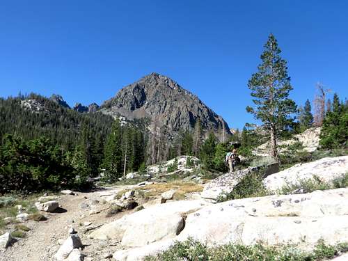
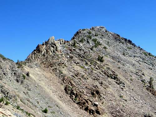
Gabbro Peak from the Green Creek Trail
Gabbro Peak is a stunning rocky peak that rises high above East Lake and Green Lake in Mono County. Gabbro Peak is located on the south side of Glimes Canyon en route to Virginia Pass, Gabbro Peak is often seen, but less often climbed due to its steep nature. It is steep on all sides - north, south, east, and west. Use trails climb up scree on its north side, and its south side. All final approaches are via a climb from a saddle below Gabbro up the west face.
With a prominence of approximately 400’, Gabbro is definitely its own peak, but it is a minor summit for the general area, with its higher neighbors Dunderberg Peak 12,376’ and Excelsior Mountain 12,446’ far more accessible. Indeed, Gabbro Peak, located near Green Lake and East Lake is far less visited than the very popular Virginia Lakes area to the south, which is accessed via a 6 mile paved road off 395 to nearly 10,000’, as opposed to the Green Creek Trailhead at just over 8,000’ and accessed via an 9 1/2 mile dirt road.
Nevertheless, Gabbro Peak is a nice little day hike/climb that presents a good challenge. It can be combined with Camiaca Peak 11,739’, but it is recommended that one climb Gabbro first due to the steep down-climb required to reach the saddle between it and Camiaca Peak.
Given it is located in the eastern extension of the Sierra Nevada range, hiking season generally begins in June and lasts through October. Snowfall varies significantly by year. A wet year might delay climbing season into July, while a dry year could enable mid-to-late May to start climbing. Camping is available at Green Creek Campground and sites are first come, first serve.
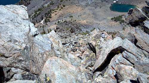
View from the summit down the south face
Getting There
From Bridgeport take Hwy. 395 south 5.5 miles and turn right. Take the improved dirt Green Creek Road (usually passable to all cars) 3.4 miles to a junction and take a sharp right. Continue another 6 miles to roads end (8,040').Route
There are a couple primary routes to the summit. The north side scree slope via Green Lake or the southeast side via East Lake. Both begin at the Green Creek Campground.For the north side, hike towards Green Lake on the trail to Virginia Pass. Once in Glimes Canyon find a trail heading up the scree slope. To do so, cross the creek and head up to the moraine. It will take you 900’ up to the saddle below Gabbro. All told it is over 5 1/4 miles from this route. This is also a descent route.
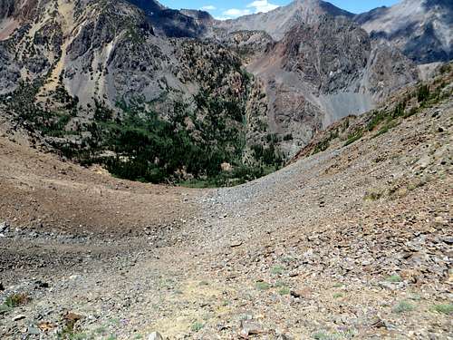
View down the north side scree slope
For the south side, head to East Lake and skirt the west side of the lake into a scree slope trail up to the saddle. This route is about 5 miles, but a little less steep.
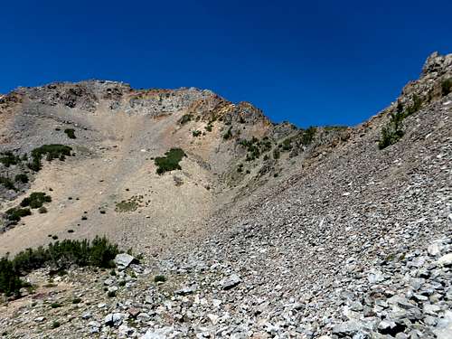
Looking towards the saddle
Final Class 2/3 stretch to the summit
From either side, there is an opportunity to do a loop which includes Camiaca Peak and a descent via Virginia Pass, returning through Glines Canyon for about a 14 mile loop.
Alternatively, Gabbro Peak can be hiked from the Virginia Lakes area to the south, albeit via a much longer route (>15 miles via a trail) using East Lake.