
|
|
Mountain/Rock |
|---|---|
|
|
48.08185°N / 121.20654°W |
|
|
Snohomish |
|
|
7262 ft / 2213 m |
|
|
Overview
The vast majority of parties scrambling Black Mountain finish the climb via a gully on the south side of the mountain, and that will be the route described here. Getting to this point can be accomplished by one of two approaches originating at the North Fork Sauk trailhead. In terms of overall difficulty, these approaches are just about equal. For this reason, I highly recommend making the full 20 mile loop (distance and elevation gain will vary, based on route and optional peaks), which has become known to local climbers as the 'Painted Traverse'. For parties in excellent condition, this traverse could probably be completed in a day. To truly appreciate this area for all it has to offer, a two or three day trip would be much more enjoyable.
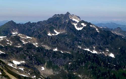
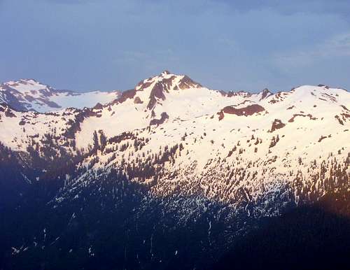
Black Mountain from Point 6844
Getting There
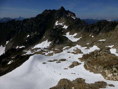
We had a couple of reasons for going this direction, but it is simply a matter of personal preference. Follow the North Fork Sauk Trail #649 for 8.2 miles, at which point it will intersect with the Pacific Crest Trail. The first 5.5 miles will be relatively easy, but the following two miles will be a workout. Do yourself a huge favor, and try to get through this section in the morning shade (i.e. leave the trailhead by 5 am). Turn left onto the Pacific Crest Trail, and follow it for 1.2 miles to Red Pass. On the way to Red Pass, one can turn uphill off the trail, and make a side trip to White Mountain, if desired. From Red Pass, follow a well defined climber's path to the summit of Portal Peak (class 2). From Portal Peak, follow the path up and over Point 6910', and then on to Skullcap Peak (mostly class 2, a few moves of class 3). The summit area of Skullcap Peak offers a nice tarn in late season, as well as potential camping. Continue on towards Point 6844 - at roughly 6600', you will encounter a rock step that can be bypassed on the left or right (we went right - steep heather). Pass just west of Point 6844, then descend into the basin just S/SE of Black Mountain's summit. We found great camping at N48 04.490 W121 12.290 Elev. 6450', with plentiful running water.

Our camp from Black Mountain summit
Approach 2 (clockwise):
Please see the Painted (Red) Mountain page for a detailed description to Painted Mountain's summit. From the summit, follow the gentle Northeast Ridge for 0.7 miles to a saddle located at 6000'. Please note that it is easier to turn right off the ridge just before the saddle, and descend into the creek basin at 5900' just south of the saddle - you will also find plentiful running water here. Good camping can be found in the vicinity of the saddle. There are numerous variations possible for the traverse from the saddle to the basin near Black Mountain, and I will not attempt to describe them in detail here. Unlike the approach from Red Pass, there is not a defined climber's path, so it is really a matter of personal preference. We chose to traverse on the south side of the ridge at roughly 6100' to 6200', following goat trails for a good portion of the route (class 2 and 3). It does appear that it may be possible to take a higher route near the ridge crest for at least part of the route, but we did not investigate this option. Please note that this traverse would be particularly tedious in wet conditions.
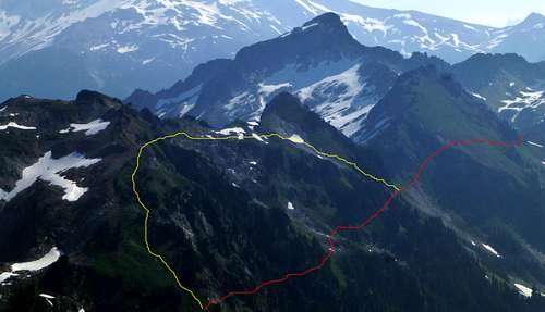
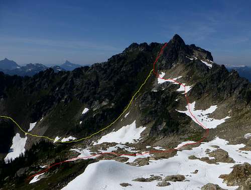
Black Mountain from Red Mountain. Red line shows our approximate route, yellow line shows a probable 'high route'.
Assuming you are beginning from the basin just S/SE of Black Mountain, make a counter clockwise traverse around the basin, with the goal of intersecting the south gully at 6700' to 6800'. This traverse is approximated by the red line in the photo below. If you are approaching from the west (from Painted Mountain), it is possible to follow the yellow line as an option, but expect plenty of steep, loose rock if you choose this route.
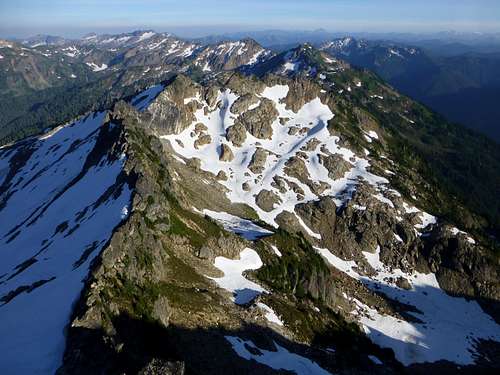
Black Mountain scramble routes from south
Upon entering the gully, you will find that the scrambling is mostly class 2 on steep heather and grass. There is very little loose rock in the upper portion of the gully, but anything kicked loose will pick up speed in a hurry.
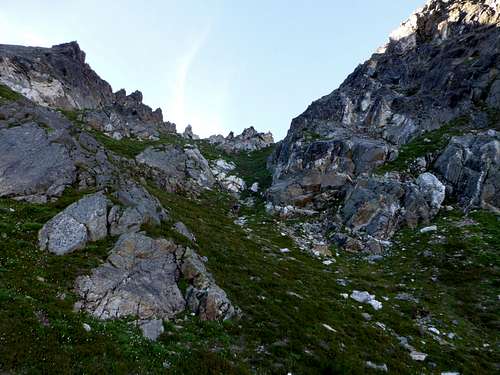
Black Mountain South Gully
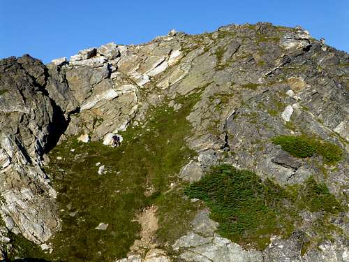
Black Mountain final scramble
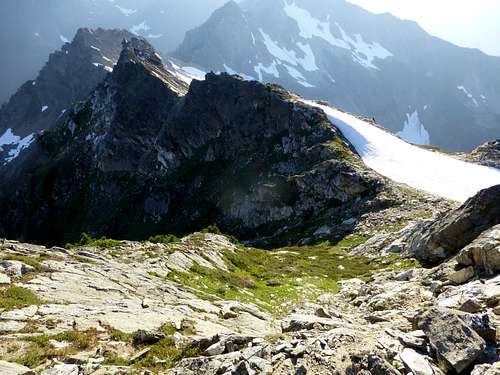
Looking down Black Mountain's South Gully from summit
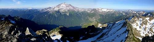
Black Mountain east pano
Black Mountain west pano
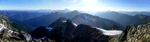
Looking SE from Black Mountain. White Mountain, Portal Peak, Point 6910, and Brown Peak can be seen in this photo. Our campsite is located at middle right on this photo.
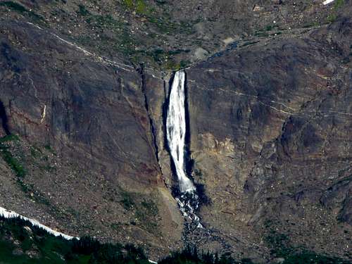
White Chuck River Falls from Black Mountain
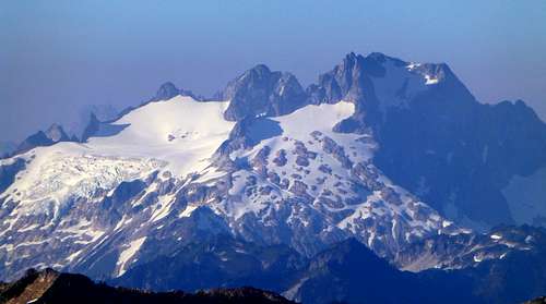
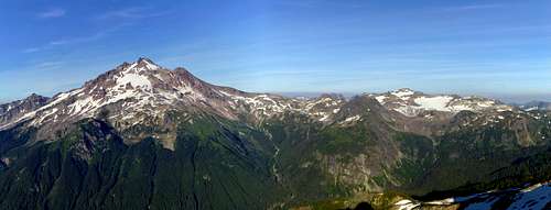
Glacier Peak summit from Black Mountain
The Cascade Alpine Guide describes a potential route from the Lake Byrne/Lost Creek Ridge area which utilizes the North Ridge. With the decommissioning of the last five miles of the White Chuck Road, this route is now less popular. I have no information on the difficulty of this route, but the photos below are included for the benefit of those considering this option.
Black Mountain North Ridge
Black Mountain from Lost Creek Ridge - June 2008. North Ridge on left side of photo.