
-
 6486 Hits
-
 85.36% Score
-
 20 Votes
|
|
Mountain/Rock |
|---|---|
|
|
42.75272°N / 109.21038°W |
|
|
Trad Climbing, Scrambling |
|
|
Summer |
|
|
11054 ft / 3369 m |
|
|
Overview
A minor summit just south of Warbonnet Peak, Sundance Pinnacle is impressive from nearly every position. While it lacks the prominence from the Sundance-Warbonnet saddle (only about 200' rise) to qualify as a ranked peak, it is still named on many maps and has its own entry in Joe Kelsey's indispensable Climbing and Hiking in the Wind River Mountains. At 15 miles RT and about 2000' of elevation gain from the trailhead, it's one of the few peaks in the Winds that's reasonable to climb as a day trip. However, it's more likely that one would make it one of several objectives during a multi-day trip to the Big Sandy Lake area and/or the Cirque of the Towers.
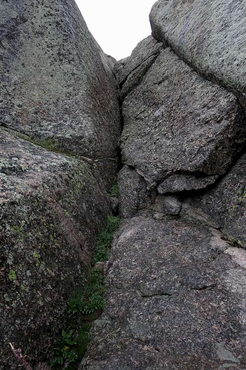
Sundance Pinnacle is a fairly quick side trip one can do on a day of climbing Warbonnet Peak and/or the Warriors via scrambling routes, but it also has at least 7 multi-pitch technical routes ranging from 5.2 to 5.11. The rock is a good, solid granite, though it turned out to make for a frighteningly slick Class 4 climb on a rainy afternoon.
If you are camped at or near Big Sandy Lake, you can do Sundance Pinnacle in 2-3 hours round-trip if you're in solid shape, so it's a nice objective for late in the day after you've made camp or if you did something bigger and longer earlier but have the energy for something else.
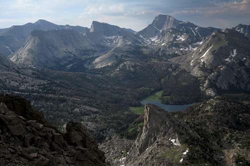
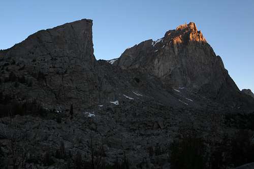
View from Warbonnet's south ridge-- Sundance Pinnacle in foreground
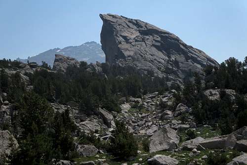
Sundance Pinnacle from the west
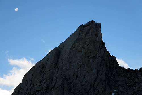
Sundance Pinnacle and the Setting Moon
Getting There
Much is said, and little of it positive, about the drive to Big Sandy.
It is not as bad as you might have heard or read. Yes, there are parts of the last few miles that are rocky or rutted, but I had no trouble getting there in a regular passenger car and did not have to slow to a crawl while doing so. And it's not as confusing to get there as you may have been led to believe; there is good signage along the way.
There was only one section that was pretty iffy for me: a muddy stream crossing just before the trailhead. If it looks like a no-go for your vehicle, you'll find ample parking space nearby and can cross on foot. This adds literally only a couple of minutes.
There are three main starting points for an approach to Big Sandy: Boulder (11 miles south of Pinedale), Farson, and South Pass. Because of this, I'm not going to go into detailed directions on this page.
Here are directions copied from the Forest Service website:
"From Pinedale, drive south on Hwy 191. At Boulder, turn left on Hwy 353 and drive 18 miles to the end of the pavement. Shorty after the pavement ends, go straight through the junction, and drive south crossing the Big Sandy River (Buckskin Crossing). At next junction, turn left (east) and drive 7 miles. Turn left at the following jct and follow the main road to the Big Sandy Campground and trailhead. This trailhead is remote, so be sure to have a full tank of gas."
Once you turn off the main trunk road, it is about 16 miles to the trailhead. Finding that first turnoff is critical, but there is a large sign indicating the junction. From Pinedale, it's between 50 and 60 miles to the trailhead.
From South Pass, directly across from Oregon Buttes Road, turn north onto the Lander Cutoff Road. This is a good unpaved road. Follow it until reaching the critical junction mentioned above.
From Farson, head east on WY 28 a short distance and turn north onto Farson-Little Sandy Road, which becomes Big Sandy-Elkhorn Road a bit after 5 miles. It pretty quickly becomes a good dirt road. Follow it to a junction with the Lander Cutoff Road. The turnoff to Big Sandy is nearby. Look for signs.
Expect 1.5-2 hours of driving from any of the principal access points. Note: there is no fuel at or near South Pass.
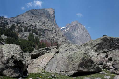
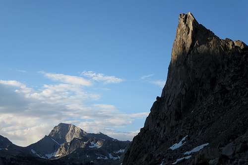
Sundance Pinnacle and Warbonnet Peak
Route
Reaching the Peak
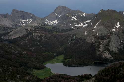
Hike an easy 5.5 miles to Big Sandy Lake; you only gain 600' of elevation during this. Trail signs say it's 6 miles to the lake, but most other sources call it 5.5. I think the 6 miles is the distance to the trail junction at the head of the lake, where one can head north for Jackass Pass and the Cirque or east to Black Joe Lake or to Clear and Deep Lakes (and beyond those lakes on an unmaintained route to Temple Lake and Temple Pass). This junction was unsigned in July 2014, but it was impossible to miss.
I recommend camping near Big Sandy Lake, but you can find some more sites as you climb from the lake to North Lake. The trail steepens considerably after the junction, though, so why not spare yourself hauling a heavy pack up it unless you plan to head over the pass?
From the junction, hike north toward Jackass Pass. Before you reach North Lake, the trail crosses the stream draining it. Just before the crossing, which is between half a mile and a mile from the junction, leave the trail and clamber your way up to the saddle on the south side of Sundance Pinnacle. You're at about 10,600' now, around 900' higher than Big Sandy Lake.
Sundance Pinnacle and Warbonnet Peak
Temple Peak and Sundance Pinnacle
Climbing Routes
For specific details about the routes, especially the technical ones, see Kelsey's guide. This book is available as a digital download from Google Books and from Amazon and likely some other sources as well, so it's a great idea to have it on your phone and take it with you when going out. It beats the hell out of carrying the book, copying pages, etc.
- West Face-- Class 4, not as enjoyable as the ridges, best as a descent
- South Ridge-- Class 4, a bit spicier and more exposed than the west face, fun ascent
- East Face Left-- 5.6
- East Face Center-- 5.9
- East Face-Klettershoe Chimney-- 5.9
- East Face, Right Crack-- 5.9
- Northeast Arete-- 5.10 b/c
- North Face-- 5.11 A1
- Northwest Ridge-- 5.0-5.2
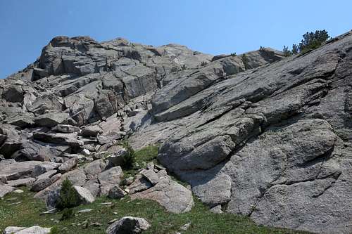 West Face | 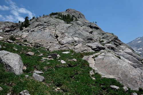 South Ridge |  Rocks near Summit |
On the West Face
Red Tape
Camp 100' from streams and 200' from lakes. You will probably see some lame people camped right beside the trail, but please don't follow suit.
Black bears have been a problem around Big Sandy Lake and Lonesome Lake. Proper food storage is mandatory. Bear canisters are recommended, but if you don't have one, hang your food and other scented items well. Some campsites by Big Sandy Lake have food lockers nearby.
If a black bear attacks you, fight back. When black bears attack, they attack to kill. Playing dead is what you're supposed to do when grizzlies attack. Grizzlies have come back to the southern Winds, and although it's highly unlikely that you will encounter one here, you have to be aware of the possibility.
When to Climb
Summer is best. You will not be able to drive all the way to the trailhead late fall through early spring because of snow. I do not know whether snowmobiling on the road is permitted.Camping
If you're doing this as a day climb, you can stay at Big Sandy Campground (fee) or use one of many dispersed sites near the trailhead. Big Sandy Lodge is close by and open in the summer, and it's nice but it isn't cheap.
For backcountry camping, staying around Big Sandy Lake is the best choice.
View East from Sundance Pinnacle