
-
 11311 Hits
-
 80.87% Score
-
 13 Votes
|
|
Mountain/Rock |
|---|---|
|
|
57.50736°N / 6.18451°W |
|
|
Hiking |
|
|
Summer |
|
|
2359 ft / 719 m |
|
|
Overview
The Storr is famous summit at the southern end of the Trotternish, on the Isle of Skye, Scottland. The beauty of the area and iconic stone formation "The Old Man of Storr" add to the popularity of the hike.Getting There
Public Transport: Bus number 57 - 4 times a day from Portree - get off near Storr car park.Car: Please see the map below. There is a parking lot at the trail head.

The Storr - Road Map
Route

The Storr - Route Map
Ascent:
- Hike from the parking lot, up through what appears to be a clear cut forest to the needles and the "Old Man of Storr".
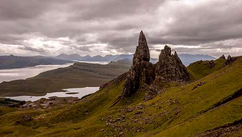
![Old Man of Storr]()
Old Man of Storr
- Head around to the north side; there is an impressive view of Loch Scamdal and the valley leading down to the Sound of Raasay.
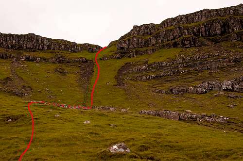
- The trail now traverses across the north face and towards Coire Scamdal. It is on this traverse that you can opt to climb the final 650 ft. up the north face direct (see dashed red line) at the expense of missing a view down Coire Scamdal; others in my party said the view was worth it, but I very much enjoyed the direct ascent up the face in the company of goats and flurries of hungry gnats.
![The Storr - North Face Route]()
The Storr - optional north face route
- Ascend to the summit, and enjoy the view!
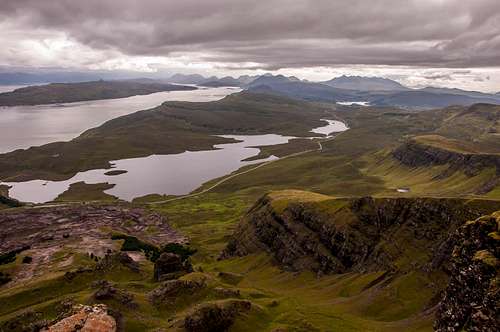
![The Storr - Looking South from the summit]()
The Storr - looking south from the summit
Descent:
Our descent was heavily reliant on a GPS with a topo map. If you don't have one, I can't recommend continuing on the loop as the route is not well traveled and you may take the wrong chute and end up on steep terrain or in a bog. It is not possible to specifically describe the descent as we were making it up much of the time, but we are certain we did take the correct chute as there was a use trail above and below it. The plain below the descent chute is boggy, be warned! Also, finding a way over the barbed wire fence at the road involved some bush whacking and muck surfing.
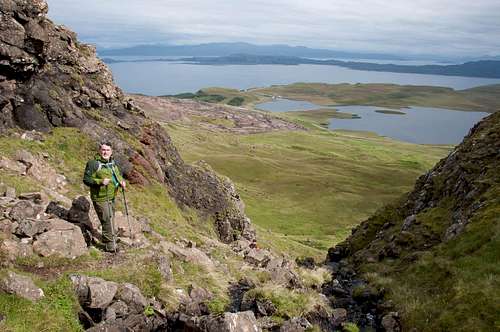
The Storr - descent chute