
|
|
Mountain/Rock |
|---|---|
|
|
42.11207°N / 14.13325°E |
|
|
Abruzzo |
|
|
Hiking, Mountaineering, Mixed, Scrambling |
|
|
Spring, Summer, Fall, Winter |
|
|
8517 ft / 2596 m |
|
|
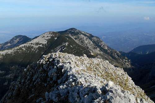
Cima delle Murelle
The entire Majella massif, with its deep ravines and its vast and desert-like high plains, is a very special place for long hikes in utter solitude. Although it has higher peaks to offer, for instance Monte Amaro (9,163 ft / 2,793 m) and Monte Acquaviva (8,980 ft / 2,737 m), the sight of this beautiful mountain is unmatched by the peaks surrounding it on either side. Also the valley 'Anfiteatro delle Murelle', at the base of the west face with its ragged buttresses and hidden natural arches is a truely fascinating place and worth a visit. It is also the true realm of the Apennine chamois.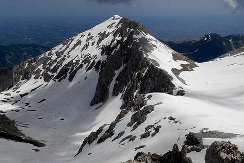 Cima delle Murelle (in June) | 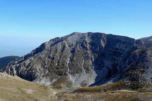 Cima delle Murelle (west face) | 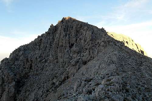 The summit (from the southeast ridge) |
The summit can be reached by anyone with a certain physical fitness. For a non-technical mountain, the actual difficulties lie, indeed, in the approach, which is long and requires a good stamina. The different regularly frequented routes are mainly using one of the three ridges which offer easy scrambles. However, this gem is not so often climbed, as many visitors of this mountain range are almost exclusively bound for the above mentioned peaks.
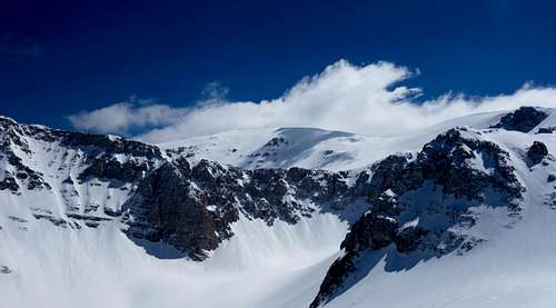
The notorious north face of the mountain, almost 700 metres high, is known to be one of the most demanding walls of the Apennines and has been climbed only a few times. The pathless approach is very long and the frangible rock of this wall, precarious belay points and often unpredictable snow conditions in winter should make these fifeteen or more pitches an arduous climbing experience. One route ("Oltre il Sogno", rated ED, IV+ / V with one passage VI+/VII-) has been opened a few years ago and was repeated twice.
The notorious north face of the mountain, almost 700 metres high, is known to be one of the most demanding walls of the Apennines and has been climbed only a few times. The pathless approach is very long and the frangible rock of this wall, precarious belay points and often unpredictable snow conditions in winter should make these fifeteen or more pitches an arduous climbing experience. One route ("Oltre il Sogno", rated ED, IV+ / V with one passage VI+/VII-) has been opened a few years ago and was repeated twice.
 Approach (north face)* |  North face (Cima delle Murelle)* | 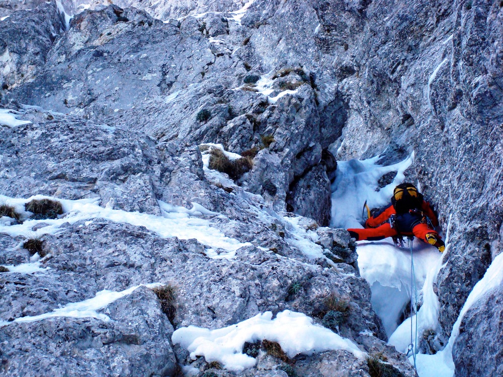 Climbing the north face* |
*North face images - source: masinoclimbing
Note: The term 'Cima' is another word for mountain (ital. monte) and usually indicates a more or less pyramid-shaped peak with distinct ridges.
Short after this scarcely marked peak you will have to descend to the col that connects Monte Focalone with the south-west ridge of Cima delle Murelle. Simply aim for the onset of the ridge or follow the path that zigzags towards it. From this col it is both possible to follow a narrow trail skirting the actual ridge line, or walk the ridge itself which offers great views on the vast valley of the 'Anfiteatro delle Murelle' and will take you in no time to the summit cross.
![Cima delle Murelle - North face (upper part)]()
Cima delle Murelle - North face (upper part)
A few landmarks and impressions
![Maiella massif (road map)]()
Maiella massif (road map)
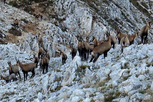
![Rupicapra pyrenaica]()
Chamois (Rupicapra pyrenaica)
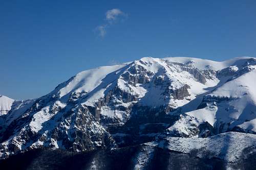
![Cima delle Murelle (left) and foresummit of Mt. Acquaviva]()
Cima delle Murelle (left) and foresummit of Monte Acquaviva (right)
Routes
1. South-west ridge
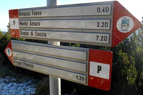
Trailhead for most ascents is the (closed) mountain hut Rifugio Bruno Pomilio (1,892 m / 6,207 ft), where it is possible to leave the car and take the normal route, signposted as trail P. An easy hiking path passes the minor peaks of Monte Blockhaus and Monte Cavallo before reaching the col 'Sella Acquaviva' (2,097 m / 6,879 ft). On the col it is possible to refill water supplies at the eponymous fountain.
Beyond the col, the trail traverses a large cluster of the low-growing Pinus mugo and keeps rising consistently. Approximately one hundred metres (in height) before reaching the small saddle where the path forks (left for the bivouac Fusco, right for Monte Pomilio etc.) you will encounter another small well.
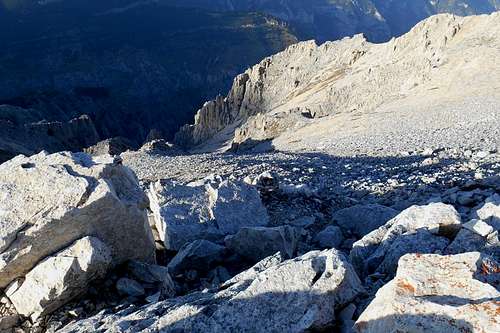
From the saddle the west face of the mountain can be observed in its entirety. In order to reach the south-west ridge, turn right and follow the hiking path which is now skirting a valley of glacial origins, the so-called 'Anfiteatre delle Murelle'. Once you have reached the plateau, the view opens towards the south and goes over the peaks of Monte Acquaviva (foresummit), Monte Sant'Angelo, Cima Pomilio, Monte Amaro and Monte Rotondo. Turn left (east) and follow the cliffs until you reach a heap of rocks that marks Monte Focalone.
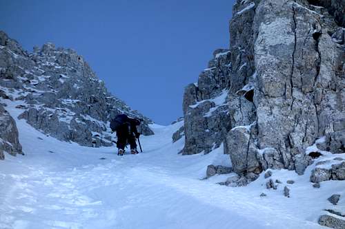
 Signposting (normal route) | 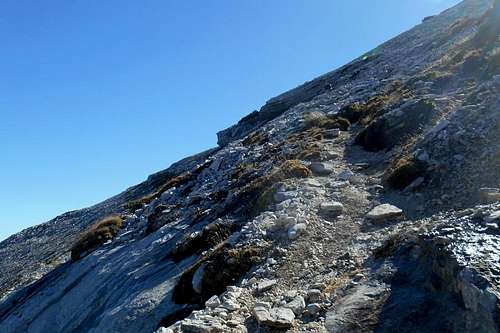 Approach on the normal route | 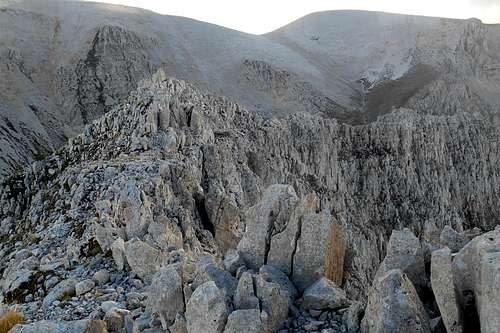 South-west ridge in October) |
2. Northwest ridge
A nice and somewhat more aerial alternative to the normal route is the north-west ridge of the mountain. In order to reach it you have at least two options: (1) Simply follow the hiking path to the col 'Sella Acquaviva' and turn left, following a hiking trail signposted as G7. This trail will take you directly to the valley at the base of the mountain. (2) From the col keep on following the normal route and turn for the bivouac hut Fusco. From there you will have to descend again and traverse the valley. This short traverse is noted as hiking path G9.
 Looking down the north ridge | 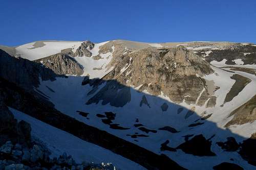 Anfiteatro delle Murelle (from the west face) |
As already mentioned above, the north-west ridge is somewhat more exposed, steeper and slightly longer. But it holds no technical difficulties either and offers some spectacular views on the almost vertical north face of the mountain and the valley bellow.
3. East ridge
Except for the long approach, the ascent on the east ridge is probably the easiest, surely the most varied route up to the top. You may leave the car at the picnic area located at the lowest point of the valley 'Valle di Palombaro'. After about two hundred meters the cement road turns hard right. At this point you may choose between two alternative routes. One is the wild and, apparently, not often frequented valley itself. This trail is (scarcely) signposted, sometimes in red and white (G5), sometimes in green and yellow (P1). The other is a forest track signposted as G4, which passes a well and, a few hundred meters further on, the first mountain hut, Rifugio Ugni. Both trails meet in proximity of the second mountain hut, Rifugio Martellese, situated only a few meters below the top of Mt. Ugni.
From this point on it is possible to circumvent Mt. Martellese, heavily vegetated with the Pinus mugo, on either side. The shorter and, arguably, nicer trail is the one which passes Mt. Martellese on its right flank (west). This trail allows views on the beautiful east face of Cima delle Murelle. It is noted as G4 or G7 and will take you to a col situated at the base of the east ridge.
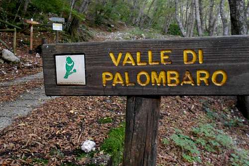 Trailhead for Valle di Palombaro |  Valle di Palombaro | 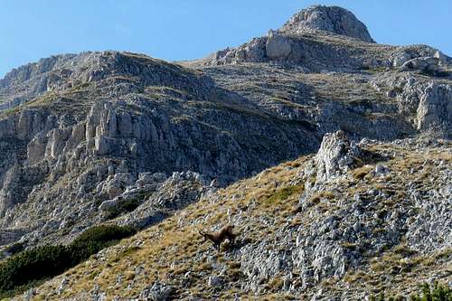 Onset of the east ridge |
From the col the look goes over the deep and ravine-like 'Valle del Forcone' and 'Valle dell'Inferno'. It also offers a look at the steep north walls of Mt. Acquaviva where some minor spots of crusted snow usually survive even the hot summer months.
 Monte Martellese & Cima Forcone (from the east ridge) | 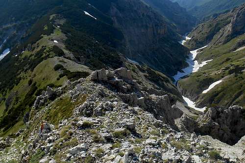 East ridge and Valle del Forcone |
From the col the hiking path can become sometimes unclear. However, following the ridge is not hard and it will take you almost directly to the summit. In case of doubt rather keep slightly to the left, as the rock quality is not very good and the right or north side of the ridge betimes fairly exposed.
4. West face / North face
With good snow conditions, usually between January and late April or even throughout the month of May, the mountain's west face holds some short but nice and very panoramic ascent routes. Especially the buttresses of the wall's southern sector host various mixed routes (with a difficulty between PD and AD+) that eventually meet with the south-east ridge. Although harder variants are also conceivable, it must be said that the rock quality of the steep buttresses is rather patchy, with some crumbly crags that can make placing a single protection become a challenging endeavour, let alone building a reliable belay stance. Like so often, patience can be the key. Once surmounted the gully exit, the summit lies up the south-west ridge of the mountain, which is a very panoramic ride with great views onto the "amphitheatre" (L'anfiteatro delle Murelle), the craggy north face of Monte Acquaviva and the Adriatic Sea. On the ridge expect to encounter some cornices.
The central couloir (about 300 m) promises a lot of fun as a fast and very direct descent route. In the summer months, however, the whole wall, almost from the top to its base, is rife with fine and hideous scree, making these routes impracticable, or a least very unpleasant. Therefore it should better be avoided during the snow-less months. Also the quality of the limestone rock on either side of the mountain is rather poor and will make it hard to find a spot for placing a reliable anchor.
 Cima delle Murelle - Via Cagnetta | 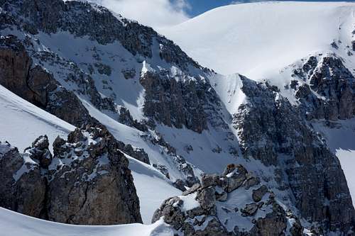 Cima delle Murelle - west face & Monte Acquaviva | 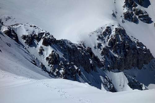 Cima delle Murelle - west face from the south ridge |
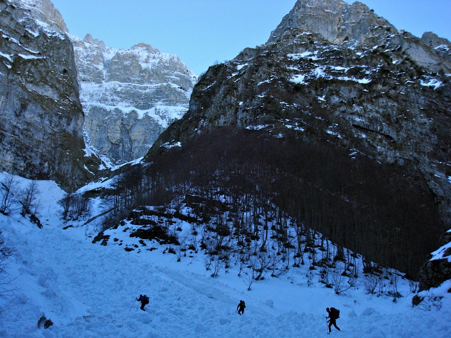
In case you should be looking for some really demanding mixed (or rock) climbing, you might also try the severe north face. An interesting route (15 pitches, ED, IV+ / V with one passage VI+/VII-) has been opened only a few years ago and was repeated no more than twice. The latest route on the north-west face of the mountain, Gran Diedro (700m, ED+; 50/70°, passages of 80°, M4+/3+ AI), was opened by Daniele Nardi, Cristiano Iurisci and Luca Mussavi on 26-27 February 2017. Some of the 12 tough pitches are extremely hard and almost impossible to protect with either removable pieces or pitons. The approach, and this applies for all possible routes up the steep northface, is very long and demanding itself, especially in winter, and exposed to major avalanches, rockfall and other objective hazards. Most of the conceivable routes are likely to require at least one uncomfortable bivouac. (For more details about the north wall and its routes: info)
Cima delle Murelle - North face (upper part)
A few landmarks and impressions
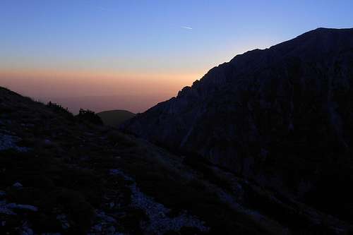 North ridge (just before sunrise) | 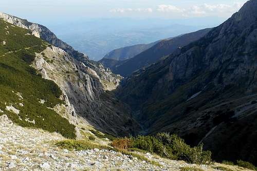 Valle del Forcone (from the east ridge) | 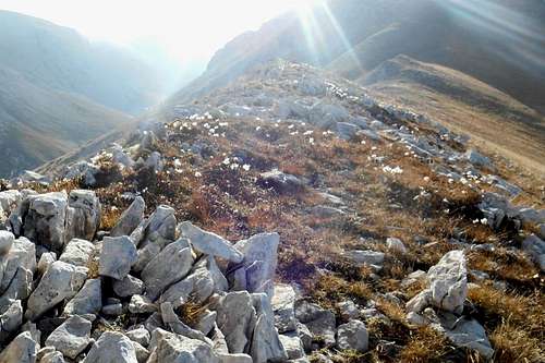 East ridge (just before sunset) |
Cima delle Murelle (in early June) | 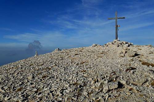 Summit cross (Cima delle Murelle) | 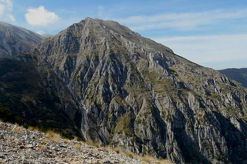 Cima delle Murelle (seen from the east) |
 Chance encounter |  Monte Acquaviva and the col (east ridge) | The summit (from the southwest ridge) |
Getting there
The closest international airport is Pescara (about 65 km). From Rome and its big international airports it is a considerably longer journey of 180-220 km (depending on the trailhead). Public transport (both bus and train) is limited and should be checked well before embarking on a journey to the Mailella massif.
Maiella massif (road map)
- from Pescara (airport): take the the state road SS5, then SS649 and later SS81 in direction of the country road SP214 for Fara San Martino; depending on your trailhead of choice, you may also take the country road SP214 already at Mandrone and follow indications for Pennapiedimonte or Pretoro
- from Ancona (highway E80/A14): take the Exit Pescara Ovest-Chieti and simply follow the road indicated above
- from Bari/Taranto (highway E80/A14): take the Exit 'Val del Sangro' in direction Casoli (state road SS652), at Piane d'Archi-Casoli take the state road SS154 and then SS84 in direction Casoli; from Casoli follow the indications for your trailhead of choice (Fara San Martino, Palombaro etc.)
- from Rome: take the highway E80/A24 and later E80/A25, at Pratola Peligna-Sulmona you may exit the highway for Sulmona and follow indications for Cansano and Campo di Giove
Red Tape
The entire Majella mountain range (or Maiella massif) is an integral part of the Maiella National Park, one of the three national parks of the Abruzzo region. The park was constituted in 1991. The same rules apply as for any other national park in Italy. Free camping is not allowed. There are no fees or permits required.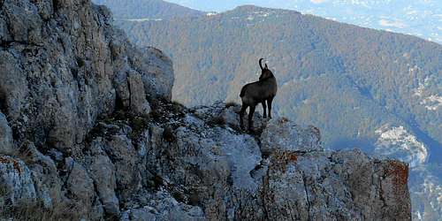
Chamois (Rupicapra pyrenaica)
The Majella National Park is home to an exceptional varied wild life. For instance, you will almost certainly spot several specimen of the generally shy Chamois (Rupicapra pyrenaica), prying human intruders from a save distance, or from behind a rock.
When to Climb
This mountain can be climbed all year round. Arguably the best months for hiking are June/July and September/October. August might be too hot. The small bivouacs can be quite crowded and, as there are no water resources to be found above 5,000ft, you will have to bring a considerable supply of water, which equals extra weight. Melting snow may be an option, though, as the Majella massif can hold snow accumulations well into midsummer. Because of its proximity to the Adriatic Sea and the overall altitude (between 8,000 and 9,000 ft) substantial snowfalls (several meters) are quite frequent from December to April and not uncommon during the month of May or even June.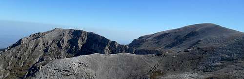
Cima delle Murelle (left) and foresummit of Monte Acquaviva (right)
A winter ascent can be a very rewarding experience. But keep in mind that this already taxing hike is likely to be complicated by often knee- or even waist-deep snow. An overnight stay at one of the bivouacs should be taken into consideration. Note also that the Majella is notorious for major avalanches. Situated close to the Adriatic Sea, it takes more snow than any other mountain range of the Apennines and its long and broad slopes almost invariably show inclinations at a critical angle.
![Rifugio Martellese (Majella massif)]()
Rifugio MartelleseShould you opt for the somewhat longer but also very rewarding ascent via the east ridge, you might stop and bivouac at one of the two small mountain huts of this area (Feudo d'Ungi). The huts are Rifugio Ugni (1,870m) and Rifugio Martellese (2,035m). Both are very similar in their structure and features. Each one is endowed with a proper fireplace and has room for about five guests. These huts should always be open.
![Bivouac Carlo Fusco (Majella)]()
Bivouac Carlo FuscoAnother great place to stay is the bivouac Carlo Fusco (2,455m), a yellow painted tin shed. It is passed by the route which ascends from 'La Maielletta' to the peaks of Monte Amaro, Monte Acquaviva etc. From the bivouac the view goes over the so-called "Anfiteatro delle Murelle", a valley of glacial origins, and the west face of the mountain.
![Route map - Cima delle Murelle]()
Route map - Cima delle MurelleGeneral ascent routes
Accommodation, mountain huts etc.
Accommodation can be found easily in one of the villages of the zone (Fara San Martino, Pennapiedimonte etc.) However, given the considerable height difference between some of the trailheads and the higher peaks of the Majella range, an overnight stay might become necessary. At the trailhead 'Maielletta' it is possible to find some rather expensive hotel rooms. These hostels are mostly frequented by visitors of the nearby ski resort. Here you may stay at the very nice mountain hut Rifugio Bruno Pomilio (1,895 m) re-opened in September 2015, after 8 years, and always open. The hut has room for 30 guests and warm showers.
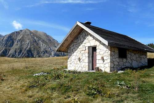
Rifugio Martellese
The first one can be reached by following the hiking trail G4 which winds up a forest track from the trailhead at the lower end of the valley. Water can be found at a well, only a few hundred meters from the hut. Also the latter is situated along the same hiking trail. However, it can be reached also by following the trail G5 which, basically, follows the very wild valley 'Valle di Palombaro'. From there you will enjoy a great view on the east face of the mountain.
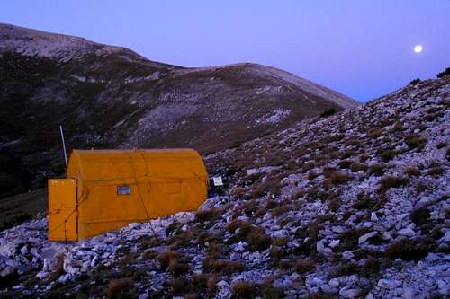
Bivouac Carlo Fusco
The neat little shed has room for six guests and is always open. There is no source of water near, though. In order to avoid a long and taxing descent, it is best to refill your supplies either at the fountain you can find on the col 'Sella Acquaviva' (close to Monte Cavallo) or, better, at another fountain ('Fonte Ghiacciata') which is also situated along the same trail, but only about one hundred below the bivouac.
Maps

Route map - Cima delle Murelle
- red - this is the north route from the 'La Maieletta' to the Bivouac Carlo Fusco, the trail is signposted (red and white) as P; it is part of the normal route for a number of other peaks, too
- yellow - this is the alternative route for the 'Anfiteatro' and the onset of the north ridge, the trail branches away from the above one at the col 'Sella Acquaviva' (in proximity of the fountain) and is generally signposted as G7
- blue - this is the direct way from the bivouac to the peak, via the north ridge, signposting is only a few (generally G7 or G9)
- purple - this is the most frequented route to the peak, from the bivouac the trail skirts the valley, passes the peak of Monte Focalone and descends to a col at the upper end of the valley 'Valle del Forcone' from where it follows the southwest ridge to the top
- green - this is one option for an ascent via the east ridge; it follows the valley 'Valle di Palombaro', passes the mountain hut Rifugio Martellese and skirts the slopes of the mountain of the same name before reaching the col and the actual ridge
There are several guidebooks and detailed maps available for the Majella mountain range. Most maps, however, are "hybrids" based on the original maps by the Military Geographic Istituto Italiano (IGMI - 1:25.000) and updated regarding to changes already conducted or planned (!) by the park authorities. Although the general geographical features are quite accurate, several charted hiking trails do exist only on these maps. Remnants of the old signposting system (yellow numbers on green background) can be found scattered all over the place and should not be confused with the new one (red and white).
- Parco Nazionale della Majella, Società Editrice Richerche 2008, map scale 1:25.000 (hiking atlas)
- Majella. Carta escursionistica, Edizioni Il Lupo, 2nd edition 1990, map scale 1:25.000 (hiking map)
- Guida all'alta via della Majella, CARSA 2002 (guidebook)
- Parco nazionale della Majella. 30 itinerari scelti nel cuore della Montagna madre, Edizioni Mediterranee 2007, map scale 1:50.000 (comprehensive guidebook with a selection of various itineraries, b/w images)