
|
|
Mountain/Rock |
|---|---|
|
|
48.42725°N / 118.5003°W |
|
|
Ferry |
|
|
Hiking |
|
|
Spring, Summer, Fall |
|
|
6397 ft / 1950 m |
|
|
Overview
Grizzly Mountain is a mid-elevation peak located in Ferry County, Washington. With at least 1757' of clean prominence, the peak is the most prominent mountain in the central region of the Kettle Range. With poor-conditioned access roads and a location in a remote part of the region, the peak gets few visitors.Most of the people who visit Grizzly Mountain are likely hunters and people interested in visiting lookout sites. The main access road stop just below the southern false summit, atop which is a fire lookout tower. Few people visit the northern true summit, which is located approximately 0.55 miles from the southern false summit. However, peakbaggers and prominence seekers hoping to claim a successful ascent of Grizzly Mountain need to visit the northern true summit... which is measured as 16' higher than than the southern false summit (6397' vs 6381').
Looking Towards True Summit From False Summit
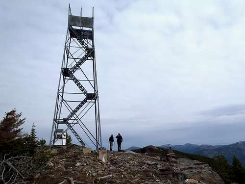
The peak is perhaps most notable for having a lookout site. The first lookout on the mountain was a 40' steel tower (with accompanying cabin living quarters) built during 1934 on the southern false summit. The tower and cabin were then replaced by a 33' all-steel MC-40 Aermotor tower during 1941. That Aermotor tower is still standing on the southern false summit today, although it no longer has a roof.
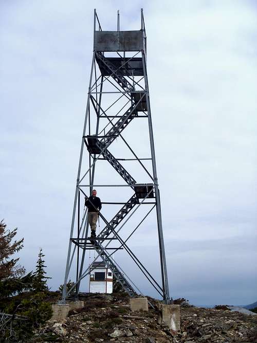
Lookout Tower
Getting There
FROM THE COMMUNITY OF INCHELIUM:1) Start at the intersection of County Road 3 & Bridge Creek Road/Twin Lakes Road/County Road 2: N 48.29725 W 118.19659
2) Head north along Hall Creek Road/County Road 1: N 48.30990 W 118.20324
3) Hall Creek Road/County Road 99 Turns Left/West: N 48.38531 W 118.29637
4) Turn left onto Sitdown Creek Road: N 48.41352 W 118.37662
5) North (Right) Turn in Area 33 (~2600 on map): N 48.40426 W 118.40687
ALTERNATE ACCESS ROADS (UNCONFIRMED):
North Turns in Area 2 (~3800 on map): N 48.39363 W 118.49541 or N 48.39067 W 118.49112
Or
North Turn in Area 5 (~4920 on map): N 48.39215 W 118.54639
6) Road ends below Grizzly Mountain Lookout (Southern False Summit): N 48.41944 W 118.49919
------------
IMPORTANT: Nearby slopes along the approach have encountered logging activities, which can change road access and driving routes without notice. Only a high-clearance 4WD vehicle is recommended.
Route
1) From the road-end, hike steeply up a short hill to visit the southern false summit of Grizzly Mountain.2) From atop the false summit, looking north will show the true summit approximately 0.55 miles away as well as a couple of slightly-lower rocky pinnacle hills in-between the false and true summits.
3) Hike back to the road and then into the forest, heading north.
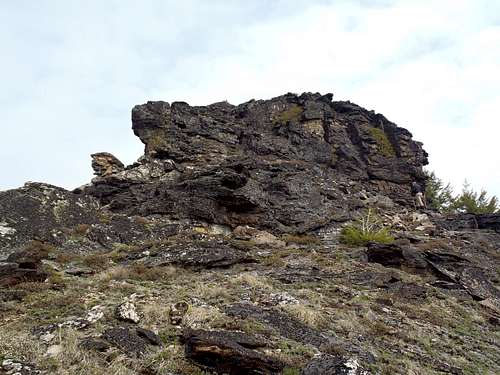
4) Follow the ridgetop/ridgeline the entire way, skirting around the central rocky pinnacles rather than over them (unless you want to!).
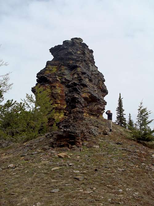
Walking Alongside A Central Rocky Pinnacle Hill
Near Another Central Rocky Pinnacle Hill
5) Ascend the final summit hill, which, unlike the other areas of the ridge, is one massive talus hill.
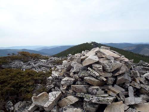
True Summit
Red Tape
There are no permits or fees for visiting Grizzly Mountain.In general, the Colville Indian Reservation requires a "Leave No Trace" policy for any recreational activities.
Considering this peak lies within Colville Indian Reservation, access and permissions might be revoked or changed for non-tribal members at any time. Please respect all rules and regulations.