
-
 10659 Hits
-
 77.48% Score
-
 8 Votes
|
|
Mountain/Rock |
|---|---|
|
|
48.77591°N / 113.59871°W |
|
|
Glacier |
|
|
Spring, Summer, Fall |
|
|
8404 ft / 2562 m |
|
|
Overview
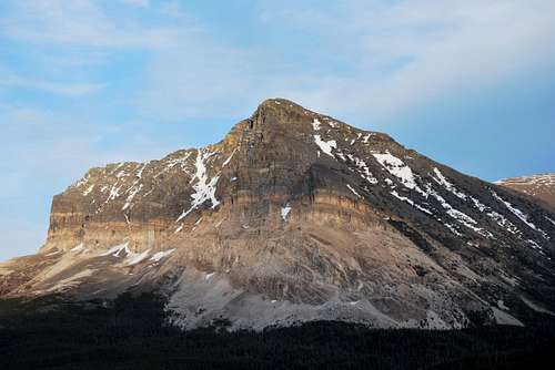
At first glance, many of the mountains of Glacier National Park appear virtually unscalable. Enormous cliffs look to be impossibly steep, with lofty summits surmountable only by the most skilled mountaineer. As one enters the Many Glacier area of the park via the windy, bumpy entrance road, visitors are greeted by a fantastic view of one of these precipitous peaks. Rising high above the waters of Sherburne Reservoir is the crumbled and broken north face of Wynn Mountain. From this vantage point, it is difficult to imagine that Wynn's summit can be obtained via a tiring, but straightforward class II slog. But herein lies one of the most magical wonders of the mountains of Glacier. Carved by glaciation and continually modified by notoriously fierce weather conditions, the vast majority of peaks can be ascended via class II and III routes if care is taken to exploit each mountain's path(s) of least resistance.Wynn Mountain is named after Dr. Frank B. Wynn, one-time president of the American Alpine Club. In 1922, he died near the summit of Mount Siyeh. His hiking companion noted that while climbing a challenging pitch, he suddenly hunched over and toppled a few hundred feet down a cliff. An 8,404 foot tall peak connected to Mount Siyeh via a long ridge, called Spot Mountain at the time of Wynn's death, was later renamed in his honor.
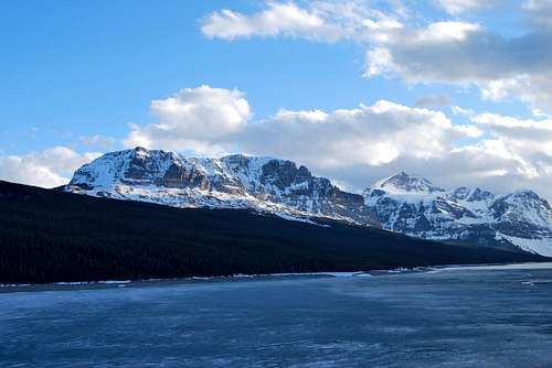
The north face of Wynn Mountain from the Many Glacier Entrance Road
Getting There
Welcome to Many Glacier! Wynn Mountain is on the left skyline.
Many Glacier can also be accessed via several well-maintained trails. The Highline Trail passes Granite Park Chalet, and detouring east over the Continental Divide on the Swiftcurrent Pass Trail will bring hikers to Many Glacier. The spectacular Piegan Pass Trail, which originates at Siyeh Bend east of Logan Pass on Going-to-the-Sun Road, ends along the shores of Swiftcurrent Lake right next to the Many Glacier Hotel. Hikers coming in from the Belly River Valley can also climb up the steep trail through Ptarmigan Tunnel, which terminates at the Swiftcurrent Motor Inn.
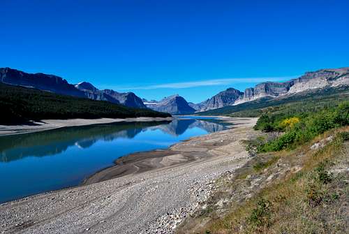
The most practical starting point for climbs of Wynn Mountain is the Cracker Lake Trailhead, located in the southeast corner of the large parking lot high above Many Glacier Hotel. It is also possible to summit Wynn Mountain via a long ridge walk from Mount Siyeh, but this requires starting from the Piegan/Siyeh Pass Trailhead on the Going-to-the-Sun Road. Gordon Edwards refers to this route as the "Skyline Experience" in his classic A Climber's Guide to Glacier National Park, although his route description beings at Many Glacier with a climb of Wynn Mountain before following the impressive ridge all the way to Siyeh.
![Cracker Lake Trail]()
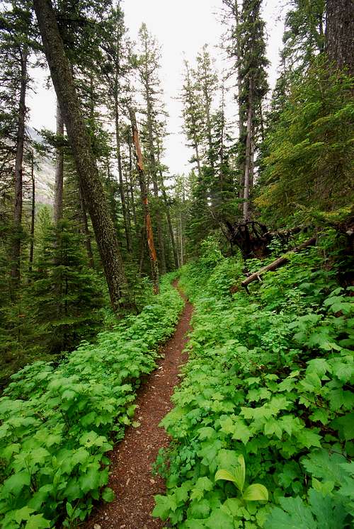
Cracker Lake TrailWynn Mountain is best accessed from the Cracker Lake Trail. One way distance is approximately 5 miles, with 3,500 feet of elevation gain. Many Glacier is renowned for its spectacular selection of trails. Extremely popular routes allow hikers of most abilities to visit Grinnell Glacier, Iceberg Lake and the beautiful chain of lakes up Swiftcurrent Valley. As such, the wonderful trail to Cracker Lake is comparatively less busy than the more famous treks the area has to offer. Cracker Lake is surely one of the most incredible trail destinations in the entire national park, but the trail is long (6+ miles one way) and spends more time below tree line than other area trails, which keeps foot traffic to a minimum. Another deterring factor that limits hiker traffic is the fact that the trail serves as the primary route for horseback tours in Many Glacier. The first two miles of trail are frequented by several horse parties per day, and as such this stretch tends to be a messy and frustrating mix of mud and horse manure. I would love to see the Park Service make a separate horse trail to remove these bothersome stressors from the hiking trail, but we'll save that discussion for another time...
Routes
![autumn night]() Wynn Mountain on a beautiful autumn night
Wynn Mountain on a beautiful autumn night
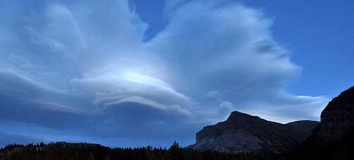 Wynn Mountain on a beautiful autumn night
Southwest Slope
Cracker Lake Trail
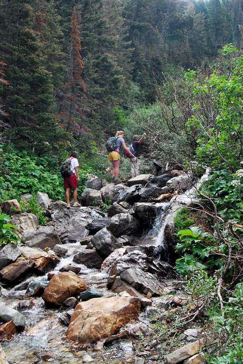
Clambering up the stream bed after leaving the Cracker Lake Trail
No more than a few paces after crossing the wooden bridge, a small use trail breaks through the foliage to the left. Follow this trail, which soon merges with a small creek. If conditions permit, clambering up the creek bed allows for a hasty ascent for several hundred feet. Some shrubs may need be negotiated, in additional to a few cascades and pools. When the terrain steepens and continuing on appears challenging, exit the creek bed to the east, where it is possible to locate sparse trails through the thick undergrowth. The foliage will eventually thin out and affords views of the surrounding area. Pick your way uphill through mixed talus slopes and krummholz. The goal is to aim for the southwest ridge, where game trails provide reasonable footing and a rather rapid ascent can be made to the summit. To descend, utilize the loose slopes in the great basin of loose rock immediately south of the southwest ridge. It is possible to locate a few good patches of scree running to make good time back towards tree line. There really are not any great routes through the thick forest above Canyon Creek, so it's best to retrace your steps through the creek bed used on the ascent until the rejoining the Cracker Lake Trail near the bridge crossing three miles from the trailhead.
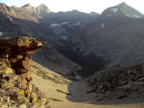
Southwest bowl, with the southwest ridge in shadow on the lower right. Photo by ManyGlacierMountaineer
Skyline Experience
Any discussion of Wynn Mountain needs to at least mention the remarkable ridge walk dubbed the "Skyline Experience" by Gordon Edwards. From Wynn's summit, an incredible 5 1/2 mile long ridge winds to the south/southwest all the way to the top of Mount Siyeh, Glacier's fifth tallest peak. The route crosses over a wind blown slope that often holds dangerous snow into late July before ascending class III pitches up to Point 9,190. From there, its on to Cracker Peak (9,833) before a quick loss/gain of several hundred feet en route to Siyeh's amazing summit. In recent years, I know of several parties who have completed this route in reverse from the Edwards description. By starting at the Piegan/Siyeh Pass Trailhead at Siyeh Bend on the Going-to-the-Sun Road, one can make the ascent of 4,000+ feet to Mount Siyeh in around 4 hours. From there, the route generally trends downhill to Wynn Mountain. For most parties, this will prove to be a slightly easier variation of this very long, very tiring, very scenic Glacier National Park classic. I encourage you to visit my Summitpost page on the Skyline Experience for more information.
Skyline Experience
Summit Views
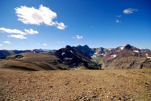
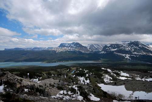
Allen Mountain and Mount Siyeh obstruct much of the view to the southwest. Beautiful Cracker Lake, perched at the head of the Canyon Creek drainage nearly 4,000 feet beneath the summit of Mount Siyeh, is truly a majestic sight. Much of Many Glacier is visible, with Mount Merritt and Old Sun Glacier towering far behind the Ptarmigan Wall to the west. The large hulks of Apikuni Mountain and Yellow Mountain dominate the scenery to the north. The view south is quite expansive for being atop a relatively short peak, and it's always a treat to gaze west at the start of the Great Plains and the obscure Sweet Grass Hills that rise 100 miles to the east.When to Climb
Due to extreme winters along the Continental Divide, problematic snow can linger on trails and mountain slopes well into July and August. Hence, the prime climbing season in Glacier is rather short, often beginning in June and lasting into late September/early October. However, some lower peaks and south facing slopes can be safely attempted much earlier in the season. Your best best is to inquire locally about snowpack and weather conditions. I use the NOAA for detailed weather forecasts and snowpack information of the greater Glacier area; check out their website for more information: NOAA.gov.
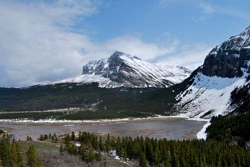
Wynn Mountain, spring
Where to Stay
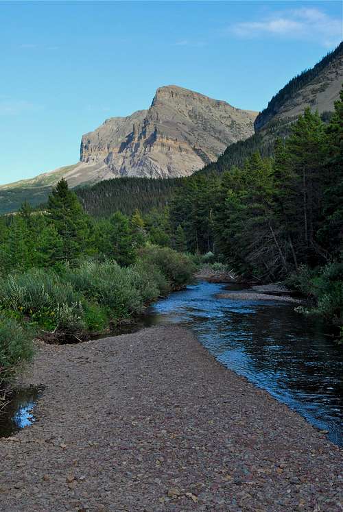
Wynn Mountain and Swiftcurrent Creek
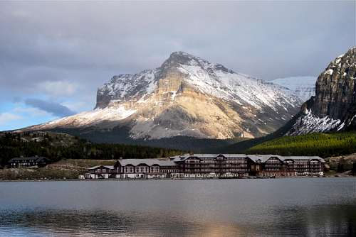
Wynn Mountain behind Many Glacier Hotel
Many Glacier Hotel offers 215 rustic rooms in a spectacular setting on the eastern shore of Swiftcurrent Lake. The hotel turned 100 in 2015, and does not have many modern amenities. It is extremely busy during the summer, and the concessioner recommends booking several months in advance. Rates range from approximately $150 to nearly $300 per night, with the majority of rooms in the $200 range. Visit Xanterra’s website for more information. There are also numerous local lodging opportunities (campgrounds, motels, cabins) just outside the park in and around the small towns of Babb and St. Mary.
Red Tape, Safety, Wildlife, etc.
Entrance Fees
A fee is required for all persons entering Glacier National Park. As of November 2016, single vehicle rates are $30 for a seven day pass, or $45 for an annual park pass (increasing to $50 in January 2017). A lower fee is charged for hikers and bikers; please visit the NPS fees webpage for a full explanation of the entrance fees.
Seasonal Closures
Glacier is subject to extreme winter weather conditions, and as such, much of the park is virtually inaccessible for the majority of the year. The Going-to-the-Sun Road is typically open in its entirety from mid-June to mid-September, and many of the developed areas of the park (including the historic lodges and most of the campgrounds) operate for a short window as well. Information on the operational status of front country campgrounds and park roads can be found by clicking on the hyperlinks.
Glacier Rock Grading
Due to the sedimentary nature of the rock in Glacier National Park, unique rock grading systems have been established by both Gordon Edwards and the Glacier Mountaineering Society. Please refer to the Glacier National Park Rock & Grading Systems Summitpost page (authored by Fred Spicker and Saintgrizzly) or the website of the Glacier Mountaineering Society for detailed information. If you are new to climbing in Glacier, I highly recommend checking out this info before attempting any climbs in the park. Oh, and don't forget to wear your climbing helmet!
A Climber's Guide to Glacier National Park
Pick up a copy of Gordon Edwards' classic A Climber's Guide to Glacier National Park. It's an absolute must for anyone who wants to safely venture to one of the park's many accessible mountain summits. Edwards spent many years as a seasonal ranger in Glacier, where he developed a deep passion for exploring the park's mountains and sharing its splendors with others. The book provides a fantastic history of climbing in Glacier, and his detailed and colorful route descriptions are a fantastic introduction to off-trail hiking and climbing in the park.
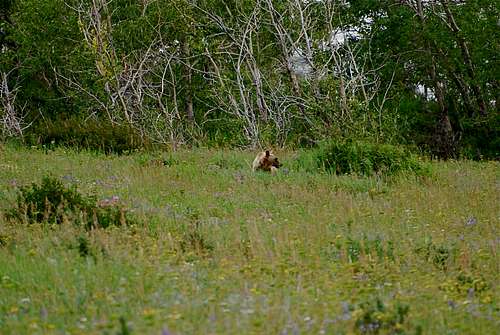
Hey bear!!!
The park is home to lots of potentially dangerous wildlife, including moose, black bear, grizzly bear, and mountain lion. Hike loud, carry bear deterrent spray (and know how to use it!), check local trail postings (for area warnings/closures) and let someone know your intinerary before heading out into the park. Also, note that special precautions are in place in all front and back country campgrounds to limit human-bear encounters. Regulations are posted everywhere (picnic tables, ranger stations, bathrooms) and it is every visitor's responsibility to take them seriously. Remember, a FED BEAR IS A DEAD BEAR! Please visit the NPS camping webpage for more detailed information.
Special Thanks
A special thanks to Sean Doyle (ManyGlacierMountaineer), a dear friend and trusted climbing partner of mine who contributed photos to this page.
Parting Shots
Wynn Mountain across Sherburne Reservoir
The southwest slope runs down and out of frame to the right