
|
|
Mountain/Rock |
|---|---|
|
|
48.36960°N / 121.73185°W |
|
|
Snohomish |
|
|
4700 ft / 1433 m |
|
|
Overview
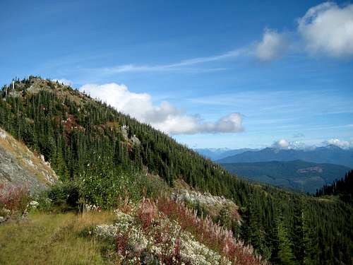
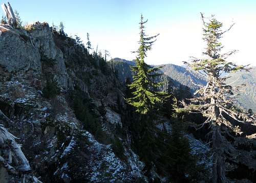
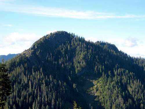
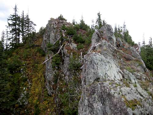
Branches Mountain southeast summit from the west
Branches Mountain has two distinct summits, separated by two-thirds of a mile, which are both enclosed by a 4680' contour. For simplicity's sake, I will refer to them as the northwest and southeast summits. Truthfully, the northwest summit (probably the true summit) is not that interesting - having never been logged, the views are somewhat disappointing. The southeast summit, on the other hand, has been completely logged off, and probably has the best 'near drive-up' views of any peak on 'Logger's Island' (that area contained by the Skagit, Sauk, and North Fork Stilliguamish Rivers).
Getting There
Begin downhill on FR28, which will cross the North Fork Stilliguamish River after 1.8 miles. FR28 will then closely follow the river's west bank for another 1.8 miles to an intersection. Take the right fork, and continue up FR28 (ignoring minor spurs) to a major five-way intersection in 10.8 miles (Yes, it is a lot of gravel road, but how often do you get to drive to the top of a mountain?). At the five-way intersection, stay left, and continue to an obvious, 3900' saddle in 0.6 miles. If you really like your car, park here. If you are a little braver, continue another 0.4 miles to another saddle at 4280'.
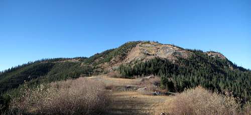
Branches Mountain southeast summit from south. This photo is taken from the 4280' saddle just below the quarry.
If you don't really care that much about your car, continue yet another 0.2 miles to the aforementioned gravel quarry at 4400'.
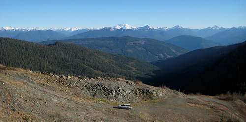
Quarry parking area for Branches Mountain
Optional routing (good for those combining this peak with North Mountain): From Darrington, follow SR530 north for one mile, and turn left on North Mountain Road/FR2810 (look for sign pointing to Whitehorse Park). Follow North Mountain Road/FR2810 for 6.6 miles to an intersection. Ignore the right switchback, which leads to the North Mountain lookout, and continue straight ahead. You will now be on FR2811 - follow it north for 2.6 miles to the aforementioned intersection with FR28.
Route
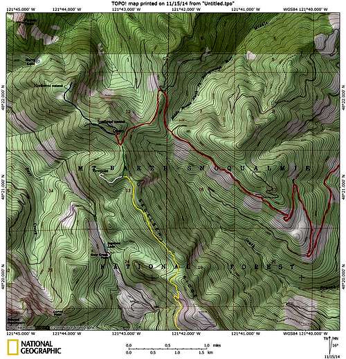
Branches Mountain route map. Red line shows the driving route up FR28, blue line shows scramble routes. Yellow line shows the Segelsen Ridge road, green line shows a potential (untested) connector route. White line shows a side trip to the Segelsen Ridge viewpoint.
Branches Mountain southeast summit from the east
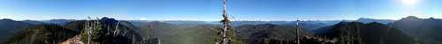
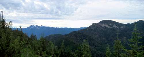
The summit area will provide pleasing, 360 degree views, with a particularly nice North Cascades panorama.
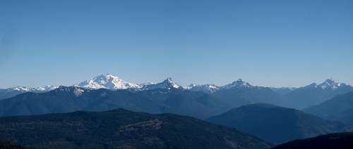
Branches Mountain northeast pano. Too many peaks to list, but Teebone Ridge is on the left, Eldorado just right of center, Forbidden, and many others.
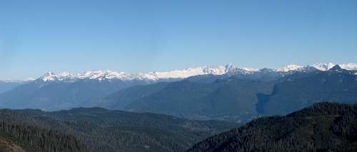
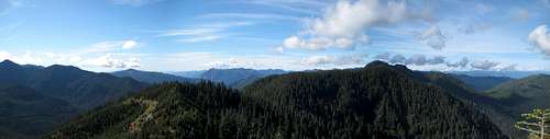
Branches Mountain summit pano
Branches Mountain northwest summit from southeast summit. Finney Peak can be seen just behind the northwest summit.
There are very few views to be had on the northwest summit, but there are a couple of nice meadows (pretty accurately shown on the USGS map) at about 4500'. There is a small summit register, which is completely waterlogged.
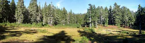
Meadows near Branches Mountain northwest summit
Finney Peak from Branches Mountain northwest summit
For those who would like to do a little less driving, at the cost of a little more scrambling, there is a potential third approach to Branches Mountain from the Segelsen Ridge road. I have not personally tested this route, but it looks reasonable. From the Whitehorse Store (five miles west of Darrington on SR530), turn north onto Swede Heaven Road. Follow it for 1.5 miles, then turn right onto FR18. Follow FR18 for 10.6 miles, then turn right on the Segelsen Ridge road. The road (not suitable for low-clearance vehicles) will become too rough for passenger vehicles at about four miles, which is almost the end of the road, anyway. From this point, it appears that one-half mile of straightforward scrambling will bring one to the 4280' saddle just south of Branches Mountain. For those who are interested in a side trip, there is a short path originating at the very end of the Segelsen Ridge road. This path leads up to a rocky promontory, which has nice south through northeast views.
Segelsen Ridge viewpoint
South view from Segelsen Ridge viewpoint. Whitehorse and Three Fingers on the left, Round Mountain on the right.

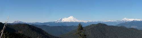
Branches Mountain from Segelsen Ridge viewpoint. Finney Peak on far left, Mount Baker between the northwest and southeast summit, Sauk Mountain on right.