
|
|
Mountain/Rock |
|---|---|
|
|
37.09489°N / 121.43456°W |
|
|
Download GPX » View Route on Map |
|
|
Santa Clara |
|
|
Hiking |
|
|
Spring, Summer, Fall, Winter |
|
|
2651 ft / 808 m |
|
|
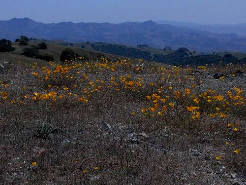
Overview
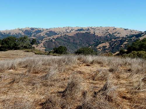
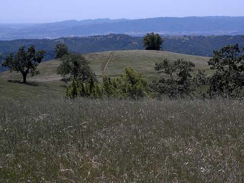
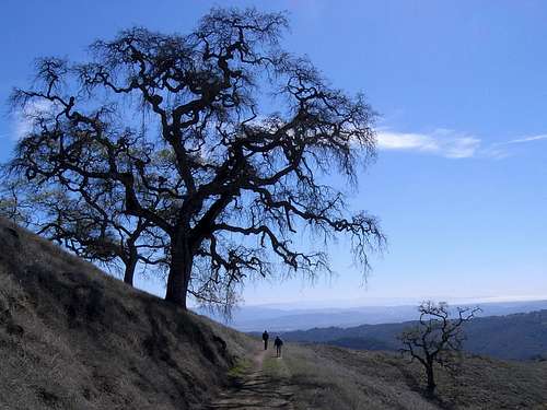
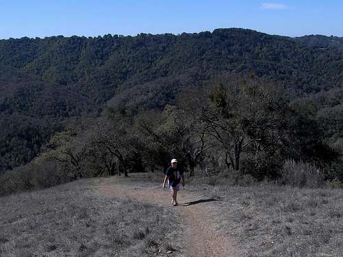
Steer Ridge from Bills Hill
Rising 1900 feet above Hunting Hollow and more than 2600 feet above sea level, Willson Peak is the highest officially named peak in southern Henry W. Coe State Park.
Wait a second... Willson?
Before I continue, maybe I should address the unusual spelling of the name lest one thinks that maybe I forgot to run 'spellcheck' on my report. Some maps, including the USGS topographic map of the Gilroy Hot Springs quad, show the name, “Wilson” spelled with one “l”. Official park maps, brochures, trail signs and the Coe website, however, show the correct spelling with 2 “l”s. Try as I may, I have not yet found the origin of this name and its unusual spelling. Perhaps it's named for a ranch hand who worked for the Redfern family or the Silacci family. They are the ranchers who once owned this interesting section of the Diablo Range. I even read one online suggestion that it is a deliberate mis-spelling of former California Governor Pete Wilson's name. He was a Republican who was not known for his pro-wilderness policies. Be that as it may, a peak by any other name...
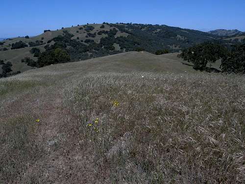
Steer Ridge From Vasquez Peak
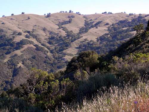
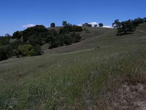
Willson Peak is the high point of a 6 mile long crescent shaped ridge that divides Hunting Hollow and Coon Hunter's Gulch to the south, from Grizzly Gulch to the north. The name of this ridge is not shown on any map that I've seen, but the road / trail that follows the crest is called Steer Ridge Road, so I'm going to use this name when referring to the ridge. There are numerous lesser ridges that extend both north and south from Steer Ridge that are divided from each other by several deep gulches and / or ravines. Many of these ridges are followed by steep trails and old ranch roads. It's very easy to create hiking loops with all the different trails found in the area. Be forewarned, though, that most of these trails can be relentlessly steep and would be quite arduous on a hot day in the summer.
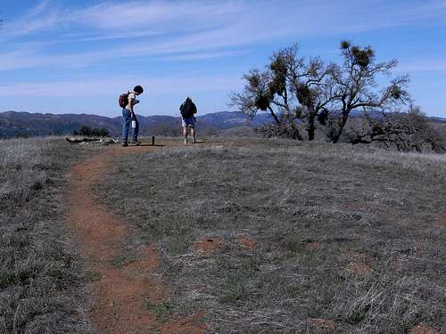 Matt and Nora on Willson Peak Summit | 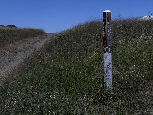 Willson Peak Summit Trail Sign |
In spite of the fact that Willson Peak is the highpoint, it doesn't rise that much higher than the rest of Steer Ridge. Indeed, if it wasn't for a sign pointing the way from the main trail, most hikers would probably pass it by without realizing where the highpoint was. The actual summit is broad, flat, and dotted with oaks and fir trees. One won't quite have a 360 degree view while standing on the very top, but a little wandering around the summit area will open up different views in nearly every direction. The good news is that if one arrives on a hot day, the shade and breezes can be most welcome!
 West from Willson Peak | 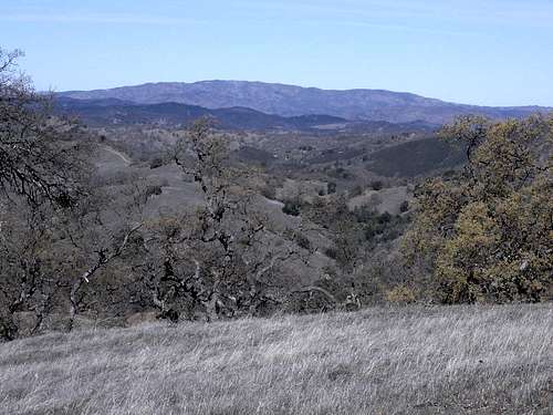 Mount Stakes from Willson Peak |
Perhaps the best views can be had from any of several points along Steer Ridge rather than from the peak itself. On clear days the high peaks of Ventana Wilderness are visible far to the south. To the southwest, one can see the afternoon sun reflecting off Monterey Bay 25 or 30 miles away. Sweeping from west to northwest, are the Santa Cruz Mountains extending north along the San Francisco Peninsula. To the north, Mount Hamilton and the white buildings of Lick Observatory are easy to pick out. Closer in are the classic features of the original part of Henry Coe park: Pine Ridge, Middle Ridge and Blue Ridge- each crowned with their signature Ponderosa pines. Views to the east are a bit more challenging due to the denser stands of trees on that side of the ridge. Looking between the them, one can get glimpses of Burra Burra Peak, Gulnac Peak and, further down to the southeast, the peaks south of Pacheco Pass and Hwy 152. If it's very clear, the white snows of the Sierra Nevada form the distant horizon to the east.
Willson Peak has a prominence of nearly 600 feet and is ranked at number 3061 in California according to Lists of John.
Getting There
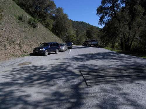
The best starting point for hiking up Willson Peak is the Hunting Hollow trailhead. There are trails up the peak from the Coyote Creek entrance, but you will still need to park at Hunting Hollow since parking is not allowed at the Coyote Creek gate.
To get to the Hunting Hollow entrance, take the Leavesley Road exit from US 101 and go east. After about 2.2 miles turn left (north) on New Avenue. This is follow for about 0.6 miles to the junction with Roop Road. Turn right on Roop Road and follow it east as it leaves a residential area and starts to wind its way up into the hills. Eventually, as it passes a couple of entrances to Coyote Lake County Park, the name of the road changes to Gilroy Hot Springs Road. Simply stay on the road as it drops into Coyote Creek Canyon and winds its way to the well signed Hunting Hollow entrance. The overall distance from US 101 to the Hunting Hollow parking lot is slightly less than 10 miles.
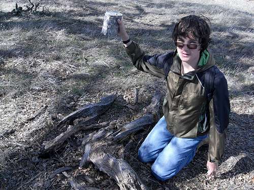
Matt and Geocache near Willson Peak summit
Route
As mentioned above, there are many trails and old ranch roads on the slopes of this peak that can be mixed and matched for a variety of routes and loops (see map below).
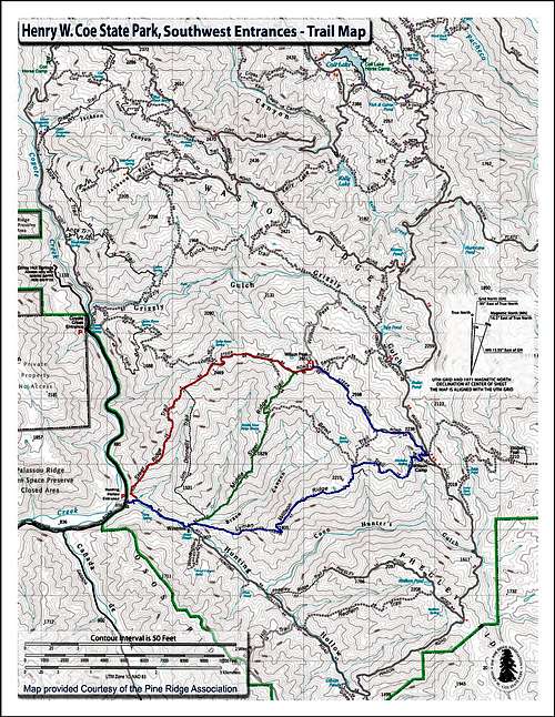
Willson Peak Route Map
From Hunting Hollow:
Steer Ridge Trail / Road: At 3.2 miles one way, this is probably the shortest route up the mountain. There is about 1800 feet of climbing not including some significant undulations in the trail that will likely increase the gain by at least 150 feet. Note that most of the climbing occurs along the first 1.25 miles of the trail and it often gets very steep. As a reward for your efforts, there are some excellent views along the way- especially during the last 2 miles before the peak.
Matt and Nora on Upper Steer Ridge Trail
Immediately beyond the Hunting Hollow parking lot gate, make a left turn to the north, cross the creek and start climbing. Feel the burn.
Lyman-Willson Trail / Steer Ridge Road: This 4.5 mile one way route is not the shortest way to the top of Willson Peak, but it does feature what is perhaps the easiest route to the crest of Steer Ridge. Most of the climbing is spread out over a longer distance resulting in a much pleasanter grade. The views are quite nice as well and I highly recommend this route.
 Willson Peak From Lyman-Willson Trail |  Bills Hill (Center Distance) From The Bowl Trail |
Follow Hunting Hollow Road for about 0.7 miles to an open area with a windmill rising in the midst of a grove of trees. A trail junction will be found just beyond a small stream crossing. Head east along the trail and take the right fork a short distance later. Climb this trail to the junction with Steer Ridge Road and turn left (northwest). Follow Steer Ridge Road to Willson Peak. Note that there are many variations to this route that may lengthen or shorten it. A side trip to Willson Camp can be made if not for viewing the interesting old ranching structures, but for the new and clean restroom that has been built there.
Fork in the Trail. Lyman-Willson to the right; Middle Steer Ridge to the left.
Middle Steer Ridge Trail: This route is about 3.7 miles one way and is a nice compromise between the short, steep and arduous Steer Ridge Trail / Road route and the somewhat longer Lyman-Willson Trail. This is a steep route, but the grade is spread out over a longer distance than the Steer Ridge Trail / Road route. The views along this route are also quite nice.
 Nora on Middle Steer Ridge | 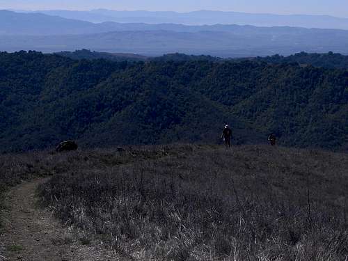 Matt and Nora on upper Middle Steer Ridge Trail |
Follow the directions for the Lyman-Willson / Steer Ridge Road route above until you reach the fork just east of Hunting Hollow Road. Take the left fork marked, “Willson Peak”.
From Coyote Creek Entrance:
The most direct route to the top from the Coyote Creek entrance appears to be the Spike Jones Trail. A nice looking loop can be made by combining the Spike Jones Trail along with Steer Ridge Road, the Willson Peak Trail and the Grizzly Gulch Trail. I have hikes planned for these routes later in the year and will update this page after completion.
Note that parking is not allowed at the Coyote Creek Entrance. You must park at Hunting Hollow and hike up the road from there. One can also drive up the 2.25 mile road to drop off companions and gear. Better yet is the method I've used: Park at Hunting Hollow and ride a bike up the road to the Coyote Creek gate. The grade is pretty easy and there are plenty of fences and trees where one can lock a bike.
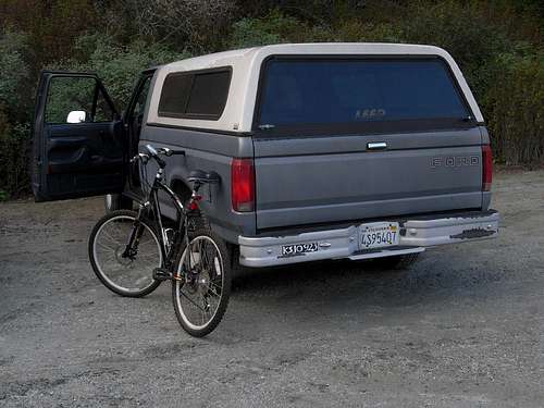
Truck and bike at the Hunting Hollow parking lot.
Red Tape
- Trailhead parking at Hunting Hollow is $6.00 per vehicle. Self payment envelopes are available at the kiosk in the middle of the Hunting Hollow parking lot.
- Car camping is not allowed.
- Dogs are not allowed on any of the trails.
- Drinking water is not available at either trailhead. Bring plenty of water for your hike.
- The Hunting Hollow Trail crosses the creek several times as it goes up the canyon from the trailhead. During times of high water these crossings can be very difficult and dangerous.
- The Hunting Hollow and the Coyote Creek entrances are open 24 hours a day, seven days a week all year making it nice for those who like to get an early start for their hikes.
- Important: Parking at the Coyote Creek Entrance is not allowed! Different online sources seem to have conflicting information regarding this issue, but the official park website states this in at least 3 different places.
Illegally Parked? Note that there are no "No Parking" signs at the Coyote Creek Entrance.
More information about the Hunting Hollow entrance can be found here:
In formation about Henry W. Coe State Park in general can be found here:
When to Climb
Willson Peak can be hiked at anytime of the year, but winter and spring are usually preferred due to the lower temperatures and the abundance of spring wildflowers. The downside is that stream crossings can become very difficult during wet seasons and bridges are extremely rare in Henry Coe Park. Remember also that it's not unusual for the higher elevations, such as Willson Peak, to receive snow during the winter months.
Near Willson Peak summit looking south. Henrietta Peak (left) and Santa Ana Peak (right).
The summer months can be oppressively hot with temperatures reaching well into the 100's. Bringing plenty of water is obligatory. Don't forget that the trailhead at Hunting Hollow is open 24 hours a day year round. One can start well before sunrise and be off the peak long before the heat sets in. A moonlight hike in Henry Coe is an amazing experience that one won't soon forget.
 Willson Peak from the west along Steer Ridge Road | 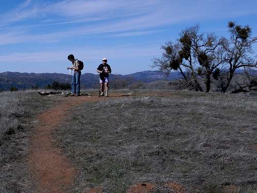 Matt and Nora on Willson Peak summit |
No matter what time of year you hike, keep an eye on the weather reports for extreme conditions. Being well prepared will make the difference between an excellent hike and a miserable ordeal.
Camping
Car Camping:
The nearest car camping sites are at Coyote Lake County Park. Car camping is not allowed in this part of Henry Coe Park.
Backpacking:
Backpacking is pretty unrestricted in this part of Henry W. Coe State Park. A permit can be self-issued at the Hunting Hollow kiosk. Regulations are the usual common sense rules that exist throughout much of the wilderness world for the purpose of minimizing damage and preserving the wilderness experience for others to enjoy.
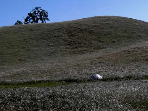
Backpacker's Camp on Lyman-Willson Trail
More information about backpacking in this part of Henry W. Coe County Park can be found here:
csister7still@yahoo.com - May 19, 2020 8:48 pm - Voted 10/10
Why was it Named Willsons peakI am a descendant of the Willsons( two "L"'s as my grandmother would say) The Willson brothers settled in Gilroy California in the late 1800's Masons by trade they also farmed and raised cattle . They Owned at least ten thousand acres of land between the brothers .. one of which was Horace Willson who's 2X great granddaughter sold the property to the state parks system aka Henry Co. to assure the land would be conserved ...Back in the day the family went up to hunting hollow to of course to hunt Lyman is one of Horace's sons ( Lyman trail ) he was bucked off a horse named outlaw coming down with a half a dear on his horse as he was heading down to Willson's hunting cabin toward the hunting hallow . Lyman passed away with head injuries from the accident .The whole area was owned by the Willson family ... contact me if you would like more information on the Willson family .. Horace had the first brick house in Santa Clara county made from a kiln right on his property out on Pacheco pass
boyblue - May 26, 2020 8:49 pm - Hasn't voted
Re: Why was it Named Willsons peakThank you for taking the time to comment on my page. Wow! This is all so interesting. What a history! I wish I had your contact information 5 or 6 years ago when I was first inspired to write about this beautiful region. I found it very difficult to find anything relevant even after hours of online searching. I've been meaning to update the page when I could, but it's been hard to find the time. Now you've given me new inspiration to work on this. I'm sure I'll have some questions about your family, so thank you for your kind offer. Regards, Gordon