
|
|
Mountain/Rock |
|---|---|
|
|
46.75890°N / 120.48055°W |
|
|
Kittitas |
|
|
Hiking |
|
|
3208 ft / 978 m |
|
|
Overview
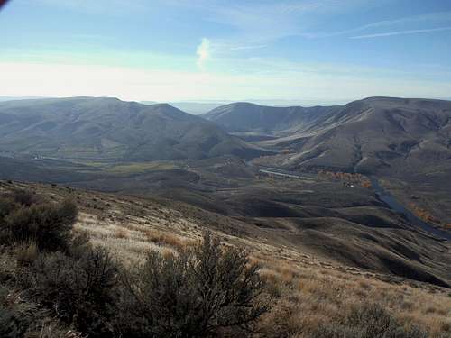
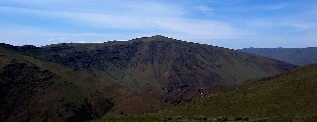
Gracie Point to the right is one of the premier summits of the Yakima Canyon Area
Gracie Point located just north of the city of Yakima is one of premier summit in the Yakima Canyon area. This 3208 foot summit is home to excellent views of Yakima Canyon, neighboring summits and of both Mount Adams and Mount Rainier in the distance. At 965 feet of prominence this peak is quiet prominent in the region despite its short elevation. In terms of popularity this mountain has a moderate amount of popularity. The most popular route up to the summit of Gracie Point is from the south via Yakima Skyline Trail with some off trail work needed at the end. This hike is almost ten miles long but it is very scenic from the start of the trail to the finish. This is due to the fact that Gracie Point is almost completely clear of trees. The dry climate of the Yakima Canyon Region in Central Washington most of the time offers good weather when the weather in western Washington tends to be not very good. There are some exceptions to this as Josh Lewis, Zarnez and I found out on December 7th, 2014 but most of the time this a great time to escape the bad weather of western Washington.
Gracie Point
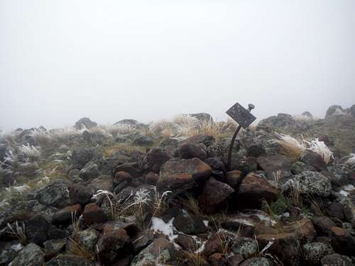 Icy Sign which is only is couple yards from the absolute summit | 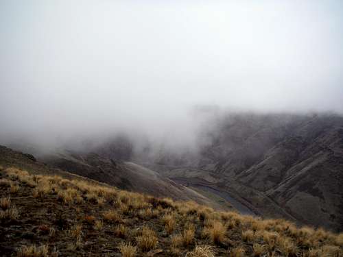 Yakima Canyon |
Getting There
From exit 26 off of I-82: Head west off of exit 26 for 0.2 miles. Make a left on Harrison Road and go 1.9 miles to the end of the road. Make a right onto Weneas. At 2.9 miles make a right onto Gibson Road. In about 0.3 miles make a right on Buffalo Road. which turns to dirt in 0.5 miles and heads right. Drive another 1.6 miles and then cross a cattle guard/drive through a gate on your left. If your vehicle can handle a rough road then drive another .75 miles to the hairpin turn. The trail will be on the left and has a marking.Route
From the trailhead head up the Yakima Skyline Trail up has it slowly rise up the ridge. This trail will alternate from moderate to steeper grade but there is nothing on this trail that is especially steep. The trail itself will continue to rise until it hits a sub-summit which has an elevation of around 2700 feet. If it is clear day stunning views should be seen by this first sub-summit. Unfortunately for us we were not so lucky. This summit is marked by a hitching post for horses. From there the trail meanders down roughly 300 feet to the saddle. After going up and down a couple more bump this trail is then intersected by another trail. From there the trail goes back up again. At about 2600 feet the there is a boot-path to the left that rise up the ridge or a trail that heads down from here you could go either way. The trail will continue to travel to the eastern base of Gracie Point where one can find a boot-path that goes all of the way to the summit. We went up the the boot path in the beginning due to limited visibility and then did an off trail route all the way to the summit. My friends GPS was used quiet extensively due to low visibility. You will know that you are on the summit by the special summit cairn (not exactly on the summit)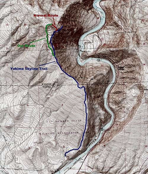 Map of the Route Up Gracie Point | 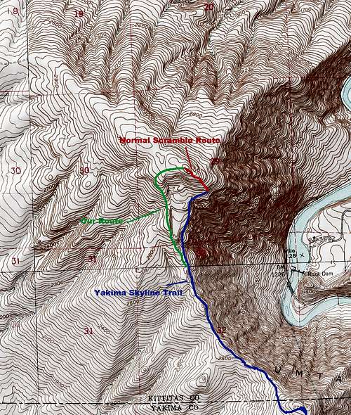 Close Up of the Route Up Gracie Point |
Red Tape
The trailhead requires a Discovery Pass. Unlike some more popular trailhead there is no place at the trailhead to buy a day pass.When to Climb
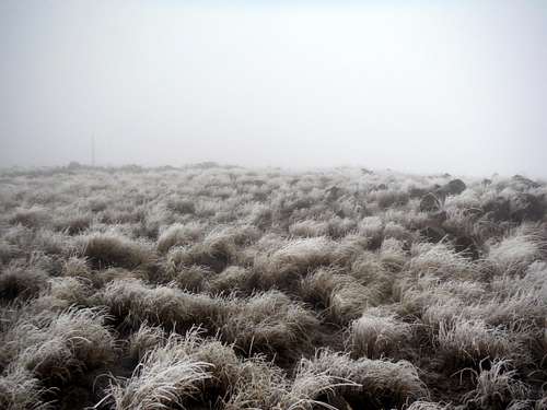
Icy surprise
This mountain can be climbed at any time of the year but there are definite warning flags of when to go. It should be noted this is the eastern part of Washington meaning that it is normally dry here. In the summer that means that this area gets very hot and very dry. Therefore it is recommended that this peak be climbed at other times of the year if it is a hot summer. Also there area has a moderate to high population of rattlesnakes which season goes from March to October. In winter this peak is a decent peak to hike provided there is not temperature inversion going on. Though the peak is doable even during a temperature inversion, the clouds on the summit don't usually lift and you will be on the summit in 30 degree temperatures and heavy fog. The fog also makes the normally dry trail very muddy and not much fun. This is what happened to me and my party on our December trip.
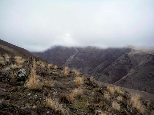 Fog on the peaks | 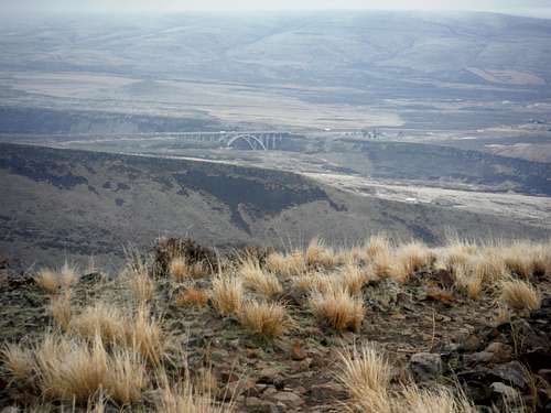 No water for a long time. This can be brutal in summer |