
-
 6575 Hits
-
 79.04% Score
-
 10 Votes
|
|
Mountain/Rock |
|---|---|
|
|
46.44033°N / 22.68953°E |
|
|
Bihor |
|
|
Skiing |
|
|
Spring, Summer, Fall, Winter |
|
|
6066 ft / 1849 m |
|
|
Topographic isolation: 110 km
Nearest higher peak: Negovanu (1936 m)
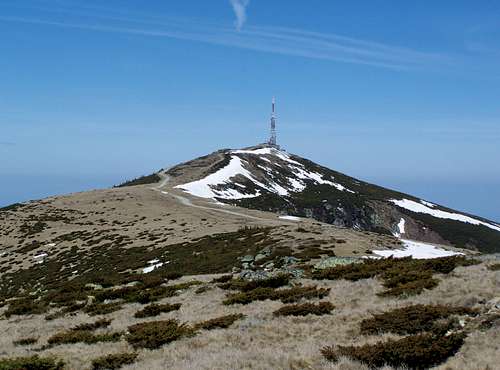
Prominence: 1478 m![CurcubÄta Mare / Nagy-Bihar]()
Curcubăta Mare / Nagy-BiharRomanian name: Vârful Curcubăta Mare, Cucurbeta Mare or Vârful Bihor
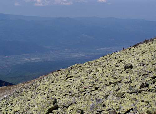
![Scree on the western slope of CurcubÄta Mare]()
Scree on the western slope of the peakHungarian name: Nagy-Bihar
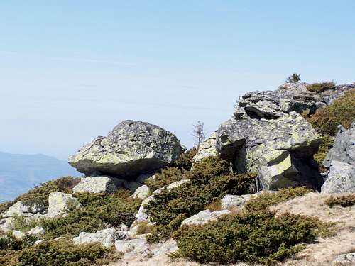
![Schist rocks with juniper]()
Schist rocks with juniperIn the following text I give both the Romanian and the Hungarian versions of the geographical names. Why? The mountain is in Romania, but it was part of Hungary or the Hungarian Principality of Transylvania during 1000 years. And it is a favorite hiking destination for tourist who live in eastern Hungary and in Budapest
This peak is among the most important peaks of Romania:
• It is the highest peak of the Western Transylvanian Mountains, with 1849 m height
• It is the 3rd most isolated peak of Romania, with 110 km radius of isolation
• It is the 5th most prominent peak of Romania, with 1478 m prominence
• It is highpoint of Bihor County. Before 1920 the area belonged to Hungary, and in those times the peak was the highpoint of Bihar County and also the highpoint of Torda-Aranyos County.
The north-south ridge of Curcubăta Mare/Nagy-Bihar is part of the drainage divide between the drainage basins of the rivers Mureș/Maros and Criș/Körös. Criș/Körös river is formed by the conflence of Crișul Negru/Fekete-Körös, Crișul Alb/Fehér-Körös and Crișul Repede/Sebes-Körös. Crișul Negru/Fekete-Körös has its source on the western slope of Curcubăta Mare/Nagy-Bihar. There is another important source on the southern slope of the mountain: the source of Arieșul Mic/Kis-Aranyos. This river belongs to the drainage system of Mureș/Maros. A water drop starting its journey in this source will travel 480 kilometer when it can meet its fellow water drop starting its journey in the source of Crișul Negru/Fekete-Körös. Their “meeting point” is in Szeged, in Hungary.
Curcubăta Mare/Nagy-Bihar is the culmination point of 3 ridges. The western ridge has a sub-peak called Vf. Tăul Mare/Zanoga-csúcs (1543 m). There is a nice lake near this peak: Tăul Mare/Nagy-tó. There is a sub-peak also on the south-eastern ridge: Vârful Curcubăta Mică (1769 m). The long ridge to the north connects Curcubăta Mare/Nagy-Bihar with Piatra Grăitoare/Zengő (1658 m). These two mountains are separated with the saddle called Tarniţa Bihorului/Bihar-nyereg (1510 m). Between this saddle and our peak there are two insignificant sub-peaks: Biharia (1597 m) and Culmea Chicera.
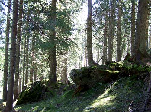
The huge mass of Curcubăta Mare/Nagy-Bihar is built from schist. There are a few rocky outcrops where this rock can be seen well, and there is also a nice scree slope near the summit. But most of the top of the mountain is covered by meadows of mountain-horses. Horses don’t like junipers, and so junipers are widespread up here, too. On the lower slopes of the mountains the typical vegetation is spruce and fir.
![This dirtroad is an alternative way to approach to CÄÅ£eilor]()
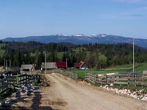
Land of Moți - with the view of Curcubăta Mare![ArieÈeni - a typical settlement of the MoÈi]()
Arieșeni - a typical settlement of the MoțiThe land east from our mountain is the famous ethnogeographical region Țara Moților/Mócvidék. The inhabitants of this land are known as "Moți". They are a special group of Romanian people, living in scattered hamlets on mountain highlands in archaic living conditions. West to the mountain there is the valley of Crișul Negru/Fekete-Körös. Today this valley is mostly populated by Romanians. But before the 16th century Hungarians were the majority here yet. Now Hungarians represent only a small minority.![The summit. 1849 meter]()
The summit. 1849 meter![View from the peak]()
View from the peak in northern direction![View in southern direction from CurcubÄta MicÄ]()
View in southern direction
![Culmea Chicera has a nearly perfect shape]()
The red trail accross Culmea Chicera![Stream Cepelor]()
The blue trails follows Stream Cepelor![End of April. There is snow yet on CurcubÄta Mare]()
End of April: there is a lot of snow yetThere are two usual routes to the peak. One of them is from north, from Şaua Vârtop/Bihar-hágó: the red trail. The other is from east, from Arieșeni/Lepus: the blue trail.
Road no.75 connects Lunca/Biharlonka with Turda/Torda. From any of the directions you can get to the mentioned two trailheads.
The red trail is much more popular. It is longer (9 km) and the elevation gain is 880 meter from![Junipers everywhere, making a nice pattern]()
Juniper "field" beside the red trailhere. This route is more beautiful.
The blue trail is shorter (6.5 km), with elevation gain of 970 meter. For a few kilometers the blue trail follows the service road of the station on the peak, and then the trail leaves the road to the right. But from there it is not well marked, and you would have a good chance to loose the way. If you don’t have good orientation skills, it’s better to follow the service road up to the peak.![Beautiful forest of CurcubÄta Mare]()
Good place for bearNo restricted area except for the fenced area on the summit with TV transmission station
Potential hazards
Sometimes bears.
Mountain rescue service is provided by Salvamont Bihor, for details see their website: www.salvamontbihor.ro
Nearest higher peak: Negovanu (1936 m)
Prominence: 1478 m
Overview
Curcubăta Mare / Nagy-Bihar
Scree on the western slope of the peak
Schist rocks with juniper
This peak is among the most important peaks of Romania:
• It is the highest peak of the Western Transylvanian Mountains, with 1849 m height
• It is the 3rd most isolated peak of Romania, with 110 km radius of isolation
• It is the 5th most prominent peak of Romania, with 1478 m prominence
• It is highpoint of Bihor County. Before 1920 the area belonged to Hungary, and in those times the peak was the highpoint of Bihar County and also the highpoint of Torda-Aranyos County.
The north-south ridge of Curcubăta Mare/Nagy-Bihar is part of the drainage divide between the drainage basins of the rivers Mureș/Maros and Criș/Körös. Criș/Körös river is formed by the conflence of Crișul Negru/Fekete-Körös, Crișul Alb/Fehér-Körös and Crișul Repede/Sebes-Körös. Crișul Negru/Fekete-Körös has its source on the western slope of Curcubăta Mare/Nagy-Bihar. There is another important source on the southern slope of the mountain: the source of Arieșul Mic/Kis-Aranyos. This river belongs to the drainage system of Mureș/Maros. A water drop starting its journey in this source will travel 480 kilometer when it can meet its fellow water drop starting its journey in the source of Crișul Negru/Fekete-Körös. Their “meeting point” is in Szeged, in Hungary.
Curcubăta Mare/Nagy-Bihar is the culmination point of 3 ridges. The western ridge has a sub-peak called Vf. Tăul Mare/Zanoga-csúcs (1543 m). There is a nice lake near this peak: Tăul Mare/Nagy-tó. There is a sub-peak also on the south-eastern ridge: Vârful Curcubăta Mică (1769 m). The long ridge to the north connects Curcubăta Mare/Nagy-Bihar with Piatra Grăitoare/Zengő (1658 m). These two mountains are separated with the saddle called Tarniţa Bihorului/Bihar-nyereg (1510 m). Between this saddle and our peak there are two insignificant sub-peaks: Biharia (1597 m) and Culmea Chicera.
The huge mass of Curcubăta Mare/Nagy-Bihar is built from schist. There are a few rocky outcrops where this rock can be seen well, and there is also a nice scree slope near the summit. But most of the top of the mountain is covered by meadows of mountain-horses. Horses don’t like junipers, and so junipers are widespread up here, too. On the lower slopes of the mountains the typical vegetation is spruce and fir.
People
Land of Moți - with the view of Curcubăta Mare
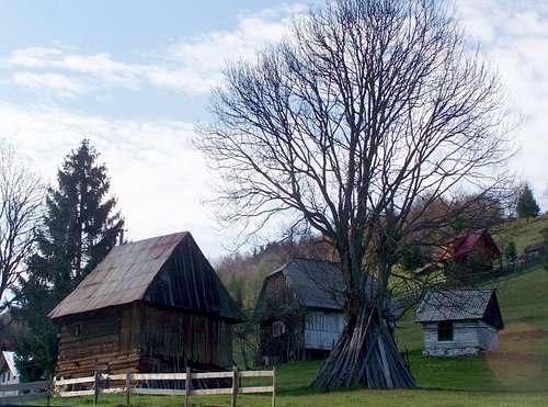
Arieșeni - a typical settlement of the Moți
On the peak
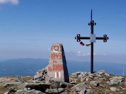
The summit. 1849 meter
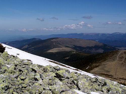
View from the peak in northern direction
We can say good and bad words about the peak. First of all let’s be happy that the area is not closed. In the 1950’s and 1960’s it was a prohibited area due to the nearby Uranium mines (on the western slopes).
Now there is a huge and very ugly building on the top of the mountain, with a 63 meter high TV transmission station. Luckily the highpoint of the mountain is outside of the fences of the station. From here and from the opposite side of the station there is fantastic panoramic view. This is not a surprise: this mountain has an isolation of 110 km and a prominence of 1478 meter. What peaks can be seen from here?
• N: Piatra Grăitoare/Zengő (1658 m) and Vlădeasa/Vigyázó (1836 m)
• NE: Silha (1670 m)
• E: Muntele Mare/Öreghavas (1826 m) and Vf. Poienița/Poienica-csúcs (1437 m)
• SE: Parângul Mare/Nagy-Páring (2519 m)
• S: Găina/Gajna (1486 m) and Păpușa/Papusa (2508 m)
• W: Pleșu/Szár-tető (1112 m)
It’s also interesting to look down into the valley of Crișul Negru/Fekete-Körös. There is a really huge altitude difference between the valley and the top of the mountain: 1550 meter!
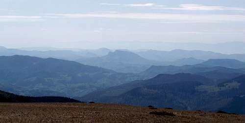
View in southern direction
How to Get There
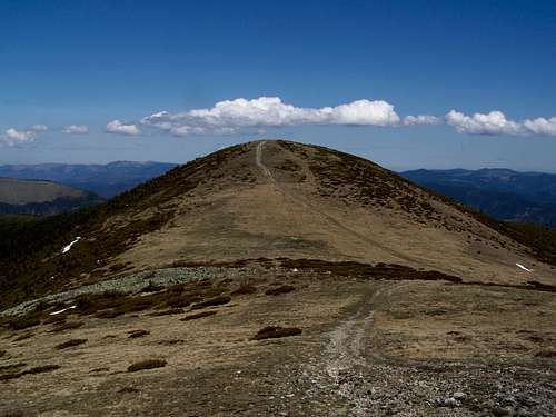
The red trail accross Culmea Chicera
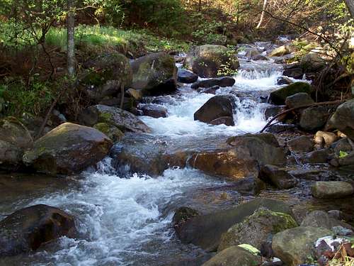
The blue trails follows Stream Cepelor
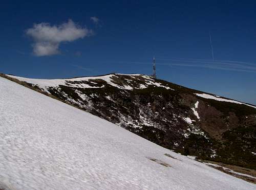
End of April: there is a lot of snow yet
Road no.75 connects Lunca/Biharlonka with Turda/Torda. From any of the directions you can get to the mentioned two trailheads.
The red trail is much more popular. It is longer (9 km) and the elevation gain is 880 meter from
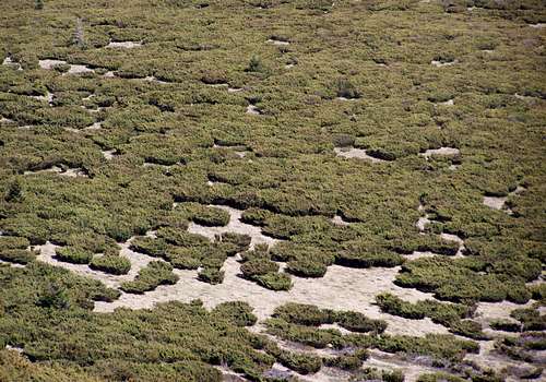
Juniper "field" beside the red trail
The blue trail is shorter (6.5 km), with elevation gain of 970 meter. For a few kilometers the blue trail follows the service road of the station on the peak, and then the trail leaves the road to the right. But from there it is not well marked, and you would have a good chance to loose the way. If you don’t have good orientation skills, it’s better to follow the service road up to the peak.
There is also a route from western direction. I didn't read any tour description from this direction yet. Apart from a 110 years old georgaphy book. In those times this was the most popular access to the mountain.
In wintertime and in early spring the peak can be reached only with ski.
Red tape
Good place for bear
Potential hazards
Sometimes bears.
Mountain rescue service is provided by Salvamont Bihor, for details see their website: www.salvamontbihor.ro
Tourist Huts
There is no tourist hut on the mountain. But you can find several lodgings either at Şaua Vârtop/Bihar-hágó or in Arieșeni/Lepus.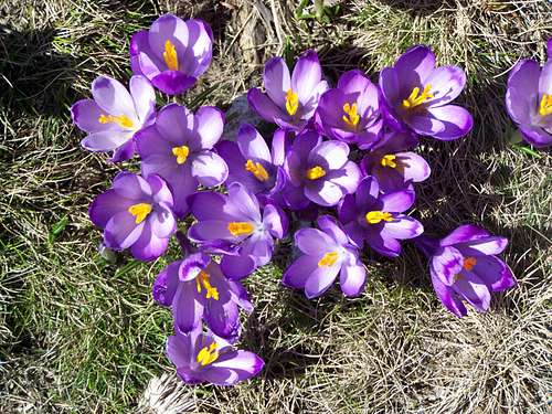 Crocus vernus Crocus vernus | 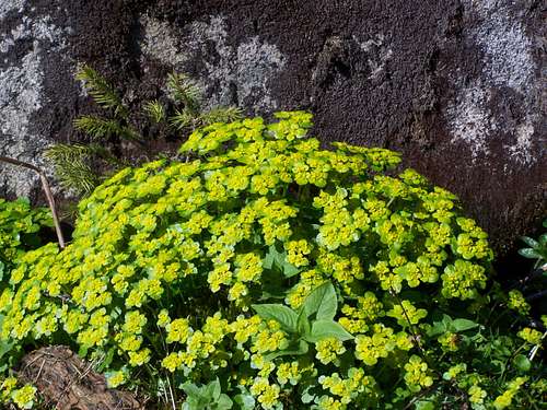 Golden Saxifrage Golden Saxifrage | 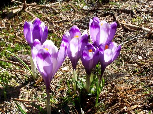 Crocus vernus Crocus vernus |
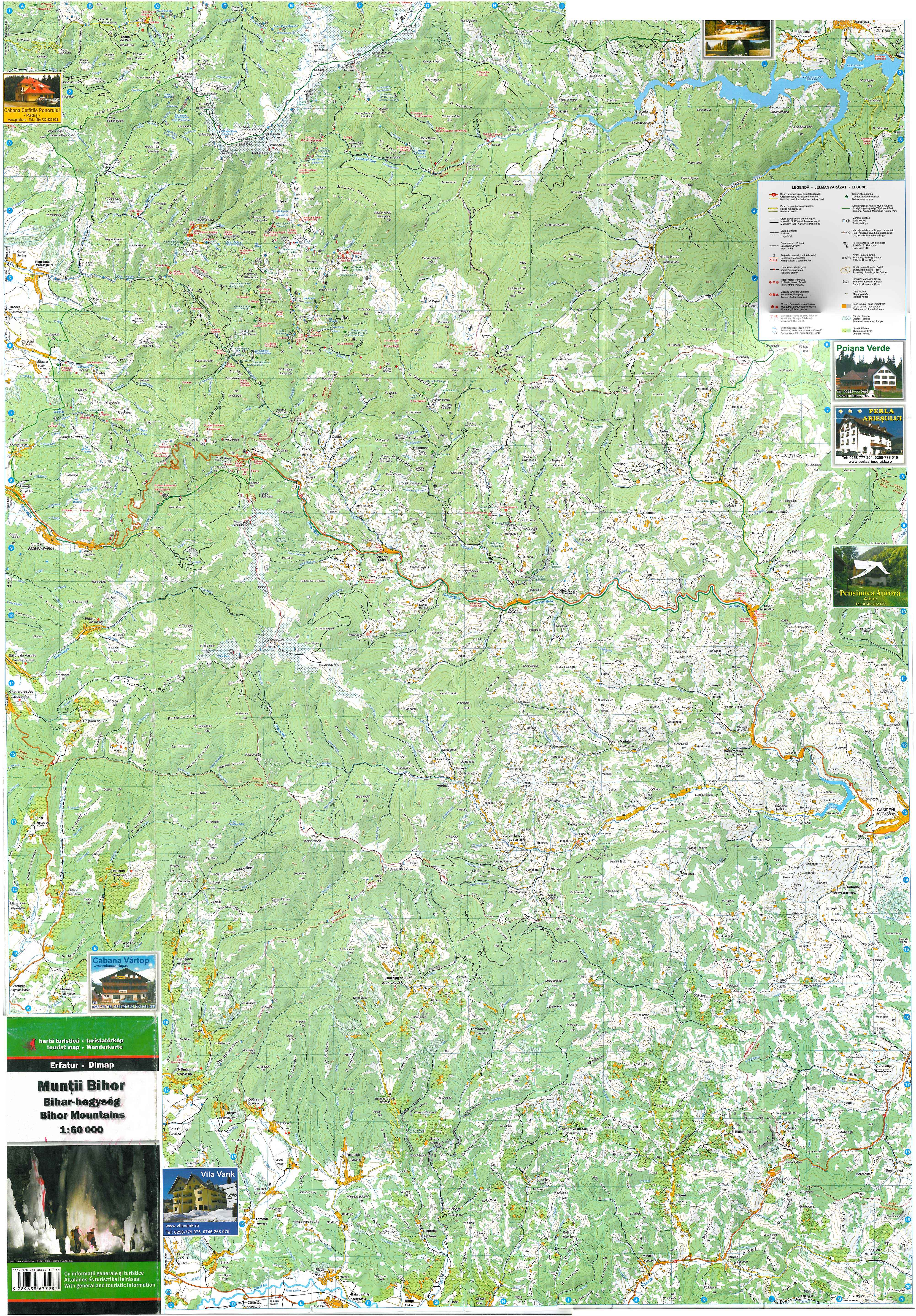
Map
Online map: www.bihariturak.hu/sites/default/files/bihar-hegyseg_terkep_2008.jpg