
|
|
Mountain/Rock |
|---|---|
|
|
33.55351°N / 111.99232°W |
|
|
Download GPX » View Route on Map |
|
|
Maricopa |
|
|
Hiking |
|
|
2429 ft / 740 m |
|
|
Overview
This peak is the highest point in the Paradise Valley city limits (Credit: surgent) and is kind of a little sister to Piestewa Peak in the Phoenix Mountain Preserve. It's name has been referred to as Dixie Peak for the Phoenix 7 Summits Challenge, but is labeled 'TwoBit Peak' by a signpost where the trail starts to ascend steeply to the summit. It's a short hike with a very easy first 2/3 and a quite steep final 1/3. The views from the top to Camelback as well as the rest of the preserve make this a rewarding experience.
![Final Pitch to the Summit]()
Final Pitch to the Summit
![Dixie Summit]()
Looking over @ the summit seen up close on the pic to the left
Final Pitch to the Summit
Looking over @ the summit seen up close on the pic to the left
Getting There
40th Street Trailhead, which is south of Shea Blvd and 40th Street. Drive south on 40th Street from Shea until you end up in the parking lot.
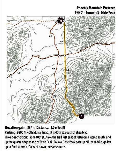
Dixie Peak Map
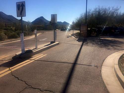
Trailhead Entrance
Route
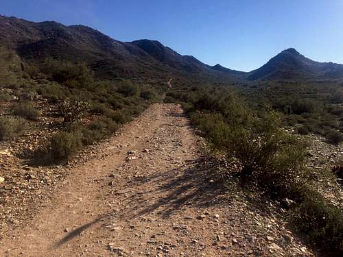
The hike starts off from the very good sized 40th Street trailhead that includes decent restrooms. You start off heading due south down a path that is inline with 40th Street that comes out of the east side of the trailhead. The trail starts off as a what was once likely a jeep road or two track.
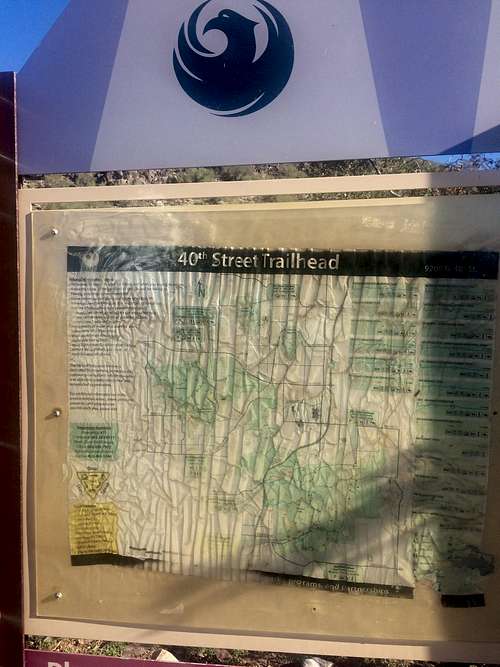
Map Sign at the trailhead
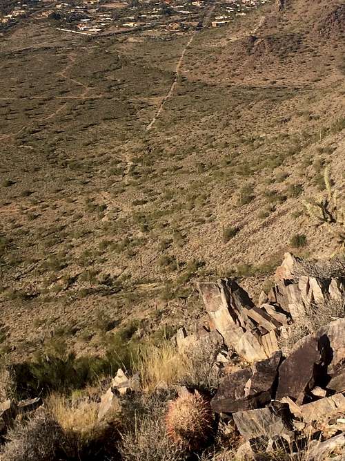
On your right is wide open and relatively flat land that extends over to the Squaw Peak conglomerate. At 0.35 miles in you cross paths with Trail 100 where it squeezes through the mountains to Tatum.
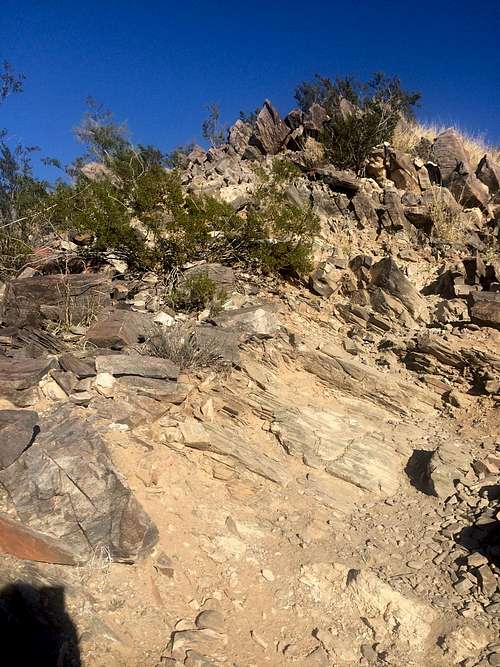
The hike continues easy going to 0.5 miles where you finally start up a slight grade. It's barely noticed though and won't have much effect on you. At 0.85 miles in things change. Here is where the 'TWOBIT PEAK' sign-post is and you're eased into a grade more reminiscent of Squaw for the final 0.4 mile push to the top. This peak has it's own characteristic in that it's progressively steeper as you go.
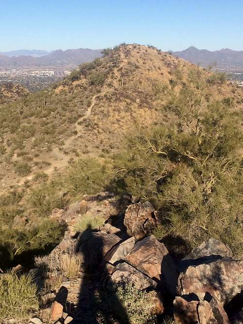
The peak itself is immediately up to your left when you reach the saddle/ridge. The sub peak or the second bit of Two-Bit is off to the right. The views are as good as Squaw or Camelback as far as city viewing goes.
Looking back down the trail to the trailhead
Start of the trail from the East side of the parking lot
Red Tape
None known as this is part of the Phoenix Mountain Preserves
When to Climb
October to April is best to avoid the heat, but anytime if you're prepared.
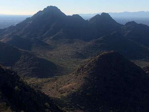
Piestewa Peak from Dixie Summit
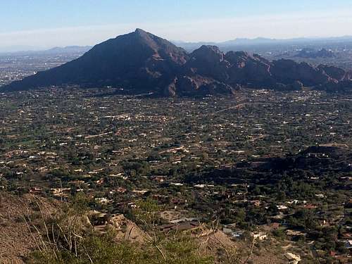
View of Camelback from Dixie Summit
Camping
None close as it's in the middle of the 6th biggest city in America.
External Links
Desription information gleaned from here: http://hikearizona.com/decoder.php?ZTN=562
hgrapid - Jan 16, 2015 11:18 pm - Voted 9/10
LongitudeUsing 111.99232°E, but needs to be -111.99232. Nearest mountain page now is in Shaanxi, China, Asia
runbyu1 - Jan 16, 2015 11:45 pm - Hasn't voted
OopsWoops good catch!
Nanuls - Jan 18, 2015 5:13 pm - Voted 8/10
FormattingHi there, not sure what screen resolution you used to write the page but there's some weird formatting going on re your photos when I view it on my laptop, which is set at 1366x768. I would suggest making the photos smaller and/or putting them in tables. Putting them in tables is especially useful as it means they don't get pushed around by other page elements. For instance on my screen the table of contents is pushing one of your photos out of line. Hope that helps. Dan
surgent - Jan 19, 2015 3:12 pm - Hasn't voted
Elevation & nameI was on the trail on 1-1-15 and the metal post did have "Dixie Peak" painted on it. Also, the elevation is 2,429 feet, per the topographical map. An interesting side note: This peak is the highest point inside Paradise Valley city limits.
runbyu1 - Jan 19, 2015 3:56 pm - Hasn't voted
Re: Elevation & nameGood stuff, thanks! Interesting that just a couple weeks later, the post says TWOBIT PEAK on it. Keep me posted if you see it change. I asked some hikers coming down and they said they thought it was called Twobit peak as well. Odd stuff.
surgent - Jan 19, 2015 8:51 pm - Hasn't voted
Re: Elevation & nameThe peak has no official name, and it appears that people are taking advantage of that post to rename it as they see fit. I only knew it as "Peak 2429" until recently; the Phoenix Mountain Preserve refers to it as Dixie Peak in some websites, and I have no idea the origin of that name. I live close by and probably will rehike it just for the exercise... I wonder what it will be called next time...