|
|
Mountain/Rock |
|---|---|
|
|
53.14733°N / 3.94717°W |
|
|
Conwy |
|
|
Hiking |
|
|
Spring, Summer, Fall, Winter |
|
|
2733 ft / 833 m |
|
|
Overview
|
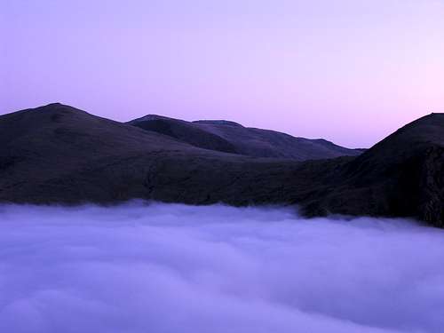
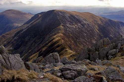
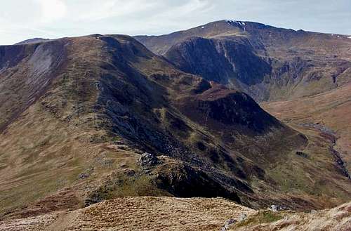
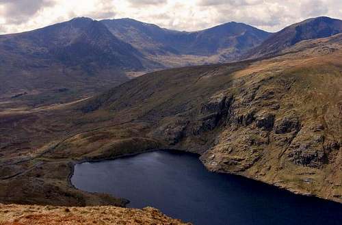
The Carneddau are home to some of the best named mountains in Snowdonia, with the highest taking the names of the princes and princesses of Wales and Gwynedd. The best names however are reserved for the range’s smaller, eastern tops, with Pen yr Helgi Du being among them; a name which literally means Head of the Black Hound. With a height of 833m, Pen yr Helgi Du is one of the Carneddau’s smaller summits, though it is enough to grant it a place on two of Britain’s mountain lists – the Hewitts and the Nuttalls. It sits between Carnedd Llewelyn in the west and Pen Llithrig y Wrach in the east, separated from the former by Bwlch Eryl Farchog and the latter by Bwlch y Tri Marchog. While Pen Llithrig y Wrach is probably the best named mountain in Wales, meaning Slippery Head of the Witch, the other features hint at the area’s feudal past. Carnedd Llewelyn is named after either Llywelyn ap Gruffudd, the last king of Wales, or Llywelyn the Great, an earlier prince of Gwynedd, while Bwlch Eryl Farchog and Bwlch y Tri Marchog mean Gap of the Hunting Knights and Gap of the Three Knights respectively. Before getting carried away with the romanticism of this nomenclature, it should be recognised that names are more often than not fluid entities and so a great deal of ambiguity exists around their etymology. W.P. Haskett-Smith in his Climbing in the British Isles Vol. 2 (1895) claims that the Ordnance Survey map of the time calls the mountain Pen yr Helyg Du, Helyg being the word for ‘willow’. While naming a mountain after a lowland tree would seem unusual, Helyg is also the name of the nearby Climbers’ Club hut, which sits in the southern shadow of the mountain. The hut and the name predate the Climbers’ Club, in fact in Wild Wales (1862) George Borrow describes an encounter with a family who lived there, describing it as “a wretched hovel. Later, in the first proper climbing guide to North Wales, George and Ashley Abraham (1906) give the name Pen yr Helig Du. In Welsh phonetics ‘i’ and ‘y’ often have the same ‘ee’ sound and therefore it’s easy to see how this spelling mistake and a later change to Helgi could occur. |
| There is some evidence therefore to support a theory that the mountain’s name should be Pen yr Helyg Du, as mountains are occasionally named after lowland features. Lowland features, being the first to be encountered by people moving into an area, are usually the first to be named and therefore it is feasible that name Helyg has some very old origins. Of course, the possibility that the Ordnance Survey map Haskett-Smith referred to was in fact incorrect cannot be discounted either. The cartographers of the time were almost without exception English speakers with no knowledge of Welsh and it is fair to say that their record in correctly interpreting and spelling Welsh words has not been a good one. Consequently, the etymological landscape of Wales is riddled with intriguing puzzles and ambiguities for us to try and decipher. |
Routes
|
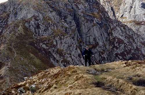
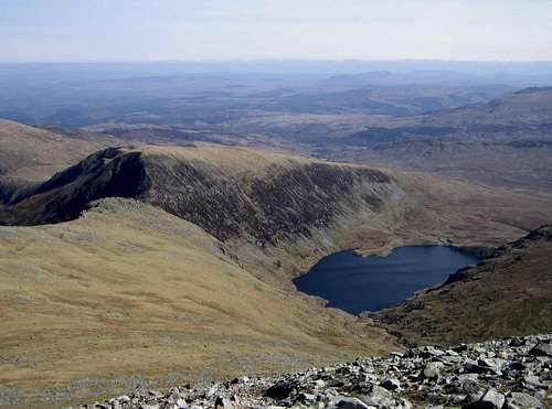
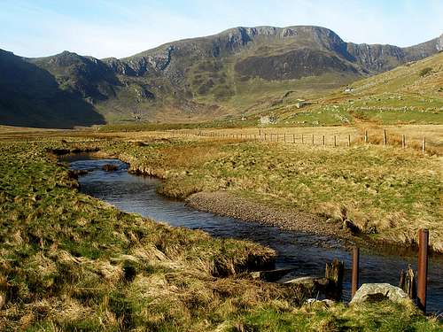
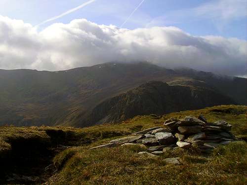
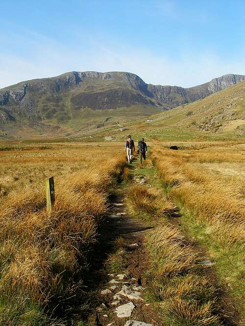
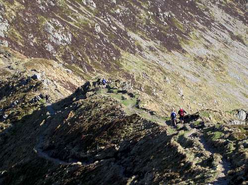
Pen yr Helgi Du (SH 698 630) is essentially a hiking mountain as it lacks the large rockfaces, such as Craig yr Ysfa (SH 693 637), that can be found on its larger neighbours and while Bwlch Eryl Farchog (SH 694 633) does have rocky sections that can be scrambled, they are not long enough to form a cohesive rock orientated route. There are a variety of walks that will take you to the mountain’s summit, with starts located in Cwm Ogwen in the south and Cwm Eigiau (SH 731 633) in the north. Most will choose to do Pen yr Helgi Du while visiting the Carneddau’s other summits, although direct ascents can be made if you’re just after a quick tick. If you start in Cwm Ogwen a horseshoe that includes Pen yr Ole Wen (SH 655 619)), Carnedd Dafydd (SH 663 630), Carnedd Llewelyn (SH 683 643) and Pen Lithrig y Wrach (SH 716 623) makes a great day out. Starting in Cwm Eigiau can also give an excellent horseshoe type route, visiting Carnedd Gwenllian (formerly Carnedd Uchaf) (SH687669), Foel Grach (SH688658) and Carnedd Llewelyn (SH 683 643) and Pen Lithrig y Wrach (SH 716 623). Further summits such as Foel Fras (SH 696 681) and Yr Elen (SH 673 651) may also be added to either route via short doglegs. The shortest route to Pen yr Helgi Du’s summit starts on the Cwm Ogwen side of the mountain. Parking is available at the Gwern Gof Isaf campsite (SH 685 603), which is located just off the main A5 road and therefore is easy to reach from places like Capel Curig and Bethesda. There is a small fee for this privilege, which is paid at the farmhouse on the site itself. From the campsite, turn right and walk down the main road in an easterly direction. After some 300m you will come to the access track for the Ffynnon Llugwy Reservoir, which joins the A5 on its northern side (SH 687 602). If you have not done so already, cross the road and take track, which rises in a more or less continual and straight line up the hillside. After about 2.5km, the track ends and a smaller path heads of north around the eastern side of the reservoir (SH 695 623). Take this path, which rises gradually at first, later steepening significantly, before joining the other paths on Bwlch Eryl Farchog (SH 694 633). Turn right and follow the ridge from Bwlch Eryl Farchog in a south-westerly direction; the summit is less than 500m away. |
Mountain Conditions
This section displays the mountain conditions for Snowdonia, of which Pen yr Helgi Du is a part. Click on the widget for maps and further information. |
|
This Snowdonia weather forecast is generated |
|
When to Climb and Essential Gear
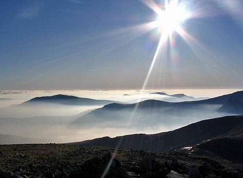
Pen yr Helgi Du can be climbed at anytime of the year, however in poor conditions the mountain may be best avoided. April to September offer the most reliable conditions and one will need all the equipment one usually carries for a day in the mountains, which in Wales means full waterproofs and sturdy boots as a minimum. If you’re lucky enough to climb the mountain in winter conditions then an ice axe and crampons would be very useful. |
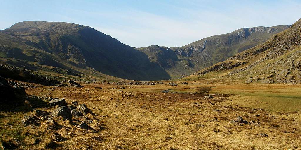 |
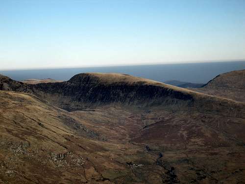
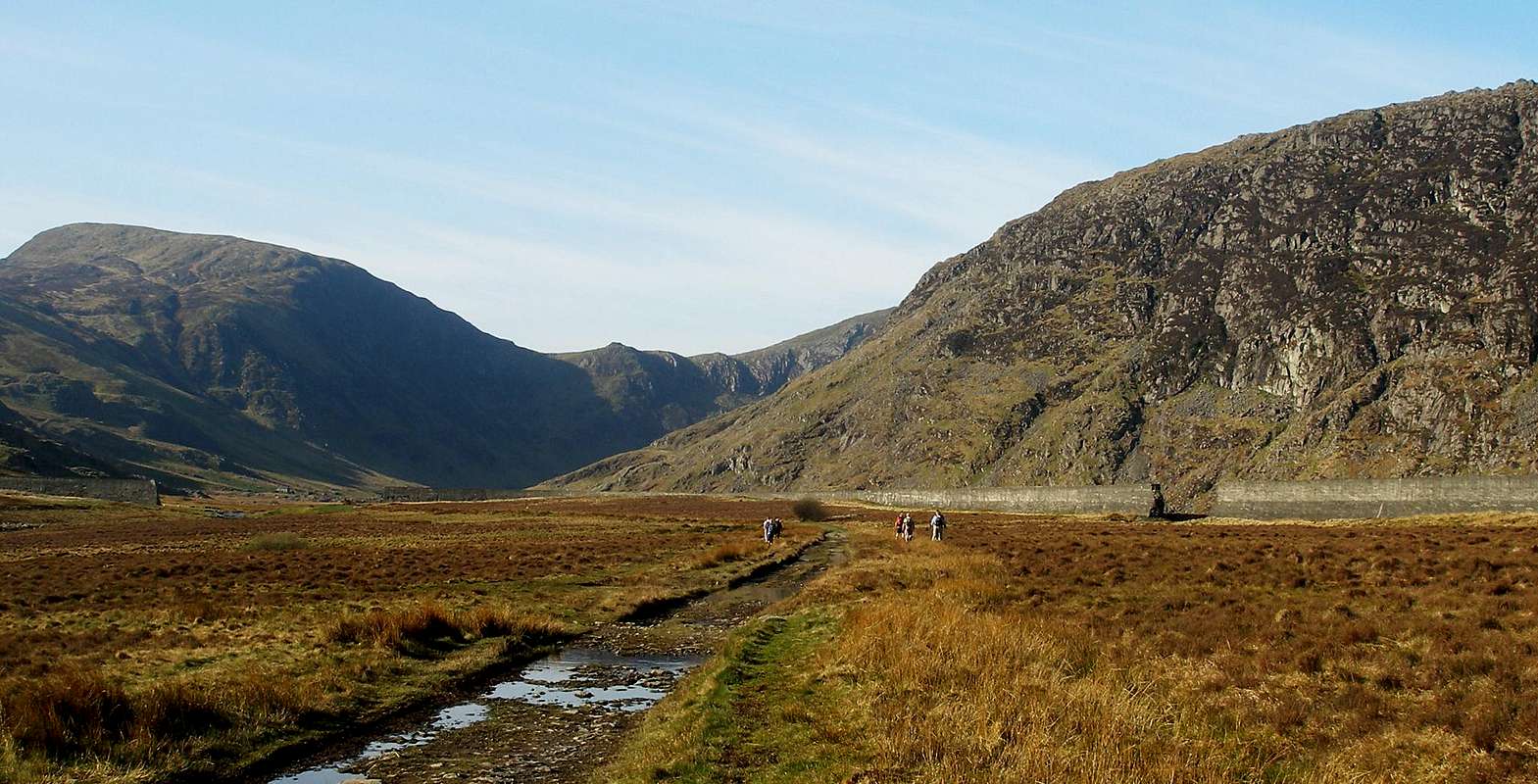
| Cwm Eigiau (Photo by Nanuls) |
Getting There
|
Pen yr Helgi Du (SH 698 630) is located in the eastern Carneddau in-between Carnedd Llewelyn (SH 683 643) in the west and Pen Llithrig y Wrach (SH 716 623) in the east. It can be approached from a number of locations but most will choose to do it while visiting some of the range's other summits. If starting in Cwm Ogwen then parking may be found along the A5. Parking at the Gwern Gof Isaf campsite (SH 685 603) will provide the shortest route up the mountain, though it will limit your options in terms of other summits. There is a small fee to pay for this privilege, which is done at the farmhouse on the site itself. Another good option would be to park at Idwal Cottage (SH 649 603), where the National Park Authority has a visitors centre. A day's parking costs around £4 here, although it is free if you park on the roadside opposite the cottage. This start provides the best access to Pen yr Ole Wen (SH 655 619)) and the main spine of the Carneddau and provides a great horseshoe style route An alternative to the busy Cwm Ogwen would be to park at the end of a minor road in Cwm Eigiau (SH 731 633). This road is accessed via the County road of the B5106 in Tal-y-Bont. This start is the quickest choice if you are traveling to Snowdonia via the A55.From here the summit may be approached along the bottom of Cwm Eigiau or as part of a horseshoe route of its surrounding uplands.
|
Red Tape and Access
No red tape or access issues here! For climbers, hill walkers and mountaineers, the British Mountaineering Council (BMC) runs a Regional Access Database, which holds mountain/crag specific information on matters of conservation and access, including issues such as nesting restrictions, nature designations and preferred parking: If you are in any doubt about any particular access arrangement, or need to report an incident, you should contact your local BMC Access Representative or the BMC Access Officers for Wales: Elfyn Jones. |
 |
| Cwm Eigiau and the Llyn Eigiau Dam (Photo by Nanuls) |
Camping and Accommodation
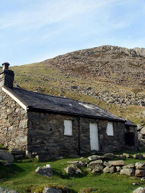
Youth Hostel Association in Wales Those looking for something a bit more local will find a couple of superb little campsites at Gwern Gof Isaf and Gwern Gof Uchaf, which are both in Cwm Ogwen. For those who do not want to spend a night under canvas, there is also a YHA Youth Hostel at Idwal Cottage, which is next to the National Park visitors centre at the foot of Cwm Idwal. Those who are members of BMC affiliated clubs may also book accommodation at the Climbers' Club's hut at Helyg, which is in Cwm Ogwen, or Rugby Mountaineering Club's Eigiau Cottage, which is in Cwm Eigiau. If you’re looking for a proper mountain experience then the Mountain Bothy Association maintain the Dulyn Bothy (SH 705 664), which is located in near the Llyn Dulyn Reservoir in the northern Carneddau. It is free to stay there, although you will need to follow the perfectly reasonable Bothy Code if you do. In addition to this, at Dulyn you are requested to keep dogs on a lead at all times and not to burn stove fuel within the bothy itself; cooking therefore should take place outside. |
Maps
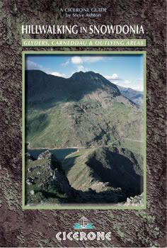
Guidebooks
|
|


External Links
Snowdonia National Park Authority Association of National Park Authorities Royal Commission on Ancient & Historical Monuments in Wales Hiking, Climbing and Mountaineering Organisations and Companies British Mountaineering Council Plas y Brenin National Mountain Centre Weather Tourist Information North Wales Tourism Partnership Local Information from Gwynedd.com Local Information from Snowdonia Wales Net Travel Welsh Public Transport Information Accommodation Youth Hostel Association in Wales Maps and Guidebooks Cordee Travel and Adventure Sports Bookshop Wildlife and Conservation |