
|
|
Mountain/Rock |
|---|---|
|
|
39.91730°N / 16.21930°E |
|
|
Terranova di Pollino |
|
|
Hiking, Mountaineering, Mixed, Scrambling, Skiing |
|
|
Spring, Summer, Fall, Winter |
|
|
6988 ft / 2130 m |
|
|
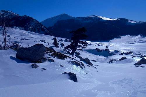
Serra delle Ciavole
With 2,130 metres Serra delle Ciavole its ranked fourth among the highest independent peaks of the Pollino massif and, thus, of the Southern Apennines (Appennino Meridionale). It is, arguably, the most beautiful peak of the central Pollino massif, too. Depending on the side from which the approach is made both its aspects and the difficulties in climbing it will differ considerably. The mountain offers easy and varied hiking trails as well as some of the most challenging winter climbing routes of the entire range. Approach routes are medium to (very) long. Especially long and taxing is the pathless approach of the base of the mountain's impressive east face and all of the more interesting mixed climbing routes it has to offer.
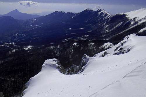
The unmatched view from the mountain's main peak include the entire southern chain of the Pollino massif, from Serra del Prete to Timpa del Principe - the so-called 'Traverse of the Infinite' (west), Serra di Crispo (north), La Falconara, a close view on the impressive rock face of Timpa di San Lorenzo (east), the Mediterranean - Golfo di Corigliano (south) and, further north, almost all the major peaks of the Lucanian Apennines (the Sirino massif with Monte del Papa, Monte Alpi etc.).
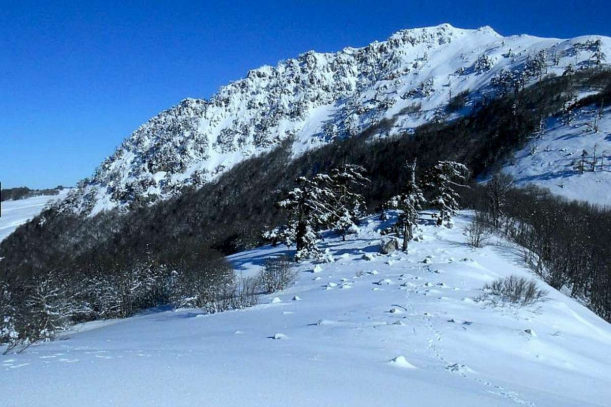 Serra delle Ciavole (from south-west) | 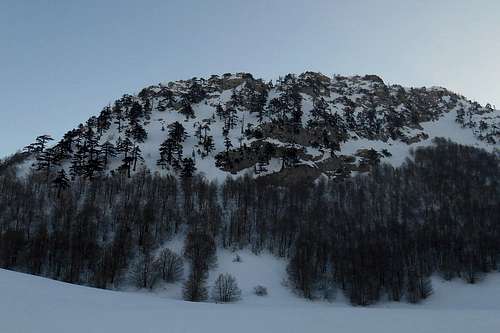 West face (Serra delle Ciavole) | 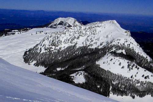 Serra delle Ciavole (from Serra Dolcedorme) |
During the winter months the mountain's west slopes and the near high plains are also a quite popular destination with folks interested in alpine skiing and snowshoeing.
Note: The term 'Serra' is another word for mountain (ital. monte) and usually indicates mountains with either a prolonged summit ridge or a main peak with a number of subsidiary summits (or non-independent peaks). It finds a use especially in the southern parts of the Apennine mountains.
1. Serra delle Ciavole from 'Colle d'Impiso' - hiking
![Ascending the west slopes]()
Ascending the west slopes![Serra di Crispo and the north ridge]()
Serra di Crispo and the north ridgeThis hiking route is perhaps the easiest to the summit. Trailhead is 'Colle d'Impiso' (see Pollino massif page for details). Setting off from Colle d’Impiso, turn hard left and take the most evident forest track that winds down to the plains called 'Piani di Vacquarro'. Once reached the plains, follow this track for another 100 meters until you reach a fork where you may find one of the few remaining signposts of the whole area. From here, turn left and follow the arroyo of the torrent Frido, always keeping it on your left. Immediately after crossing a small rivulet, turn left again. After entering the beech forest, keep direction until you reach a point where the forest track, now to your right, steadily begins to gain height, and is winding its way up to an extensive clearance called 'Radura di Rummo'.
Keep following the forest track that after a while begins to steepen noticably before it flattens out again. A few more meters ahead, the forest suddenly opens wide into the first of the three central high plains of the Pollino massif: Piano Toscano. From a loose heap of bigger rocks on a small elevation, once marked by another signpost (Update: New signposting has been set up in 2014!), you can catch a view on almost all of the major peaks: Monte Pollino and the ‘Great Slip’ – to the south-east, Serra delle Ciavole (2,130m) and the almost pyramidal summit of Serra Dolcedorme (2,267m) – to the south-west.
2. Serra delle Ciavole from 'Madonna di Pollino' (or Fosso Iannace) - hiking
![Fosso Iannace]()
Fosso IannaceAnother easy route, though some parts require a minimum of route finding skills (or a good map), especially with high snow and at some junctions. (Strange enough, where the path is most easily discernible it is almost over-signposted.) As the first part of this hiking path coincides with on of the normal routes to the summit of Serra di Crispo and the col 'Grande Porta del Pollino', it might help to follow these destination panels for a while.
![Serra di Crispo (north)]()
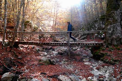
Serra di Crispo (north)Both trailheads can be reached from the village San Severino Lucana and are usually accessible, except after copious snow falls. From 'Madonna di Pollino', a santuary, the trail is somewhat easier and almost entirely under very old and impressive beeches. From 'Fosso Iannace', instead, the path is much shorter, and steeper, as it follows the narrow gorge of the Iannace torrent which will have to be crosses several times on wooden bridges. Some of them are in bad shape. Especially in late spring, with the torrent coming to life, expect some problems with crossing it.
The trails will meet at one point. From here on the terrain gets steeper and leads up to a spacious and beautiful glade, called 'Piano Iannace', situated just beneath the west face of Serra di Crispo.
Signposting is still good, and it should be easy to follow the broad forest track, even with high snow. Keep to it, because the forest is riddled with nasty digges, often full of mud or old an wet snow.
Later on, the forest is opening more and more, you should come across a small well. Keep direction (south-east) and follow the escarpment of Serra di Crispo until you reach the col, 'Grande Porta del Pollino'. Taking a little detour it is also possible to pay a visit to the so-called "Garden of the Gods" (ital. "Giardino degli Dei") and the "Dancing trees", both located below the onset of the south ridge of Serra di Crispo, and only about a kilometre or so from the col-
From the co it is possible to follow the ridge directly, and scramble up to the summit, or find a trail that ascends the gentle west slopes of the mountain, thus passing also the 'Cemetry of the Bosnian Pines', a large cluster of dead tree giants (same route options as 3.).
3. Serra delle Ciavole from 'Lago Duglia' - hiking
![Pietra Castello]()
Pietra CastelloThis is a good alternative for anyone who would like to approach the mountain from the north (or north-west). The trailhead can be reached form the small village of Terranova di Pollino. The asphalt road, though, is usually in rather bad conditions and becomes regularly impassable both after abundant snowfall (all winter) and heavy rains (rest of the year).
![Trail from 'Lago Duglia']()
Trail from 'Lago Duglia'The hiking path is mostly well signposted, with the usual red and white on tree trunks and large rocks, and should not pose major orientation problems. It first passes a small wellspring, then a shallow pond ('Lago Fondo') and later a quite distinctive rock formation, known as 'Pietra Castello'.
From a second, larger glade, called 'Piano dei Moranesi', the hiking path gains in steepness, though not in difficulty, and leads up to a col, 'Grande Porta del Pollino', which is situated between Serra di Crispo (right) and the onset of the north ridge of Serra delle Ciavole (left).
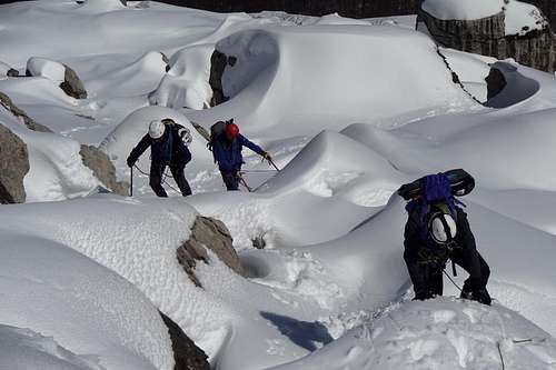
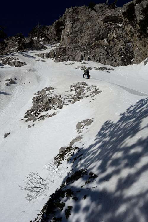
4. Full traverse ("Traversata delle Ciavole") - hiking/scrambling
The col can be reached by traversing the high plains in a southern direction. Hold somewhat to the left of the summit pyramid of Serra Dolcedorme and look for an accumulation of erratic boulders. On entering the forest the trail can become somewhat unclear. In case of doubt aim for the lowest point on the horizon. From the col the trail keeps more or less direction as it descends towards 'Piano di Acquafredda', a glade situated in a natural depression of glacial origin. There is also a natural (not perennial) well nearby.
At the other side of the glade the trail dips down again. Instead of following it, however, turn left and climb to the shoulder of the mountain. Keep climbing in an north-eastern direction until you come upon the actual ridge. There are several possibilities, but neither a trail nor any signposting. Some parts of the ridge are quite steep. In winter they can hold hard and iced snow. Although initially step kicking might seem an option, the situation can change drastically further up the ridge. It is highly advisable to look over your shoulder, once in a while, and examine the slope angle, and, also important, what lies at its lower end. (Note: A winter ascent will almost certainly require crampons and ice axe.)
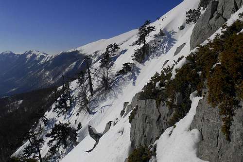
5. West face ("La diretta") - scrambling/ mixed climbing
Note: Due to its exposure (west) the snow cover should remain quite stable during the day, but especially in the morning, and there is plenty of good rock. Anyway, crampons and ice axe will surely become handy at some point. - Also without snow the west face is well negotiable and an easy to moderate scramble. Be careful, though, not to harm the delicate vegetation, and, of course, double-check the rocks before using them as hand or foothold. You might also come upon extensive juniper shrubs and tufts of wet grass. They are of a rather unforgiving nature.
6. East face (some considerations) - mixed climbing
![East face - Serra delle Ciavole - Via dei Moranesi]()
East face - Serra delle Ciavole - Via dei Moranesi
On location, carefully check snow conditions, examine potential run-out zones for debris before choosing a route and look out for conspicuous glide cracks in the steeper parts of the gullies. In case of doubt it might be tempting to turn to the limestone rock buttresses. But it is better not to rely too much on them. Generally much steeper than the gullies, they may provide fallback options for critical passages but, as mentioned above, the rock quality is mostly poor and placing protection can become a serious issue.
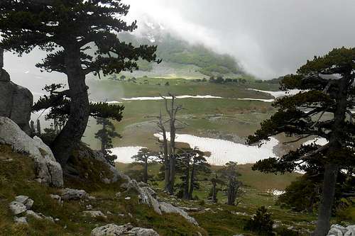
A few landmarks & impressions
Getting there
The nearest airports are Naples (about 230km), Bari and Brindisi (also about 220-230km). From Rome and its big international airports it is a considerably long journey of almost 450km. There is limited public transport in this region. The actual mountain roads are largely in bad conditions, especially the high passes might become impassable after snowfalls as road patrol service is scarcely to be seen around. If you should consider to visit the Pollino Massif between late October through early May, don't forget to bring snow chains or allow extra time for the approach way.
![Road conditions (good) - Colle d'Impiso]()
Road conditions (unusually good) - Colle d'Impiso
Red Tape
The Pollino massif, and hence Serra delle Ciavole, is an integral part of the 'Pollino National Park'. With a total area of 1,960 square kilometres it is the most extensive national park in Italy. The park was officially founded in 1993. The same rules and regulations apply as for any other national park in Italy.
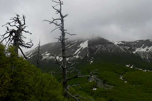
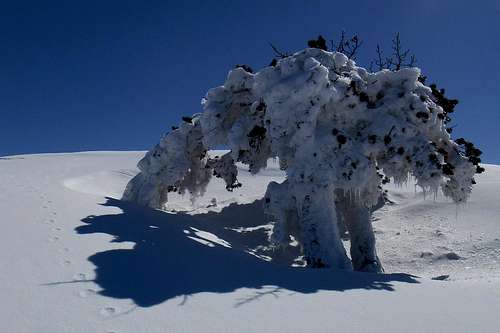
![Dead Bosnian Pine]()
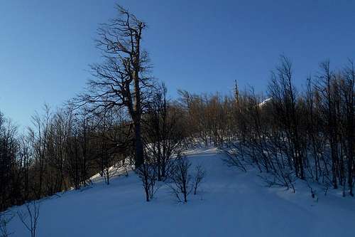
Dead Bosnian PineWhen to Climb
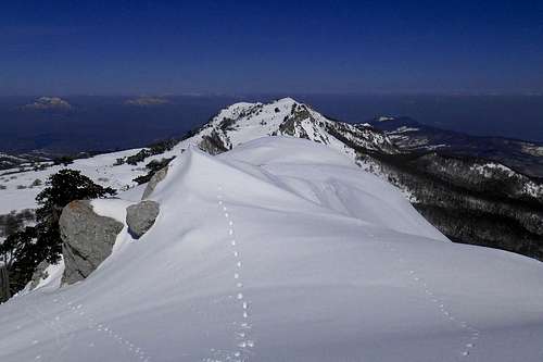
![Serra delle Ciavole (summit ridge)]()
Summit ridge (February)![On the summit ridge (may)]()
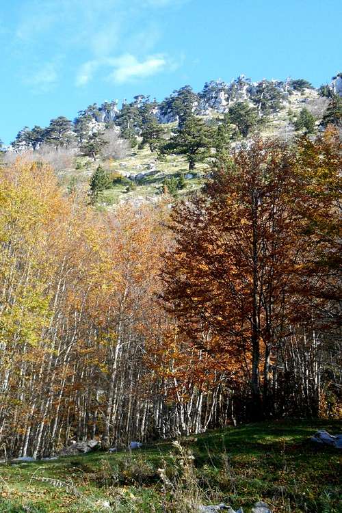
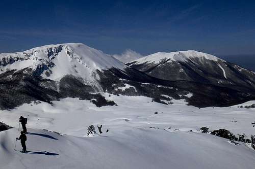
On the summit ridge (may)Serra delle Ciavole can (and should be) climbed and experienced all year round. Late spring through late autumn is the best time for hikers who want enjoy the magnificent flora of the gentle west slopes and the high plain 'Piana di Pollino' that leads to the summit and foresummit, or (literally) explore the vast (and mostly pathless) beech forest that stretches right beneath the east face.
A full traverse of the mountain is possible both in summer and winter. However, depending on the meteorological conditions during the winter month, a pair of crampons should be in your bag, as the entire summit area may be covered by almost impenetrable green (or blue) blank ice slabs.
Accommodation, mountain huts etc.
Most of the existing mountain huts in the area are currently closed and/or in poor conditions. As an exception can be seen the two mountain huts located on the high plain Piano Ruggio, south side of the mountain: Rifugio de Gasperi and Rifugio Fasanelli. A number of Bed & Breakfasts etc. can be found in the town centres of San Severino Lucano, Terranova di Pollino (to the north) or Castrovillari, Rotonda and Morano Calabro (to the south).

Rifugio Fasanelli
Maps
Maps in a scale of 1:25,000 are available for purchase directly from the IGMI - Istituto Geografico Militare Italiano (search term/key word:Terranova di Pollino). For full information about available literature (maps, guide books etc.) you may have a look at the respective section for the Pollino massif and the Pollino National Park.
![Routes - Serra delle Ciavole]()
Routes - Serra delle Ciavole
Small map with basic indications for the main trails:
1. green (normal route: Colle d'Impiso - Piani di Vacquarro - Piano Toscano - Piana di Pollino - Grande Porta del Pollino - Serra delle Ciavole)
2. red (normal route: Madonna di Pollino - Fosso Iannace - Piano di Iannace - Grande Porta del Pollino - Serra delle Ciavole)
3. blue (variation west face, direct route from Piano di Pollino)
4. yellow (variation full traverse: Piano di Pollino - Sella delle Ciavole and Piano di Acquafredda)
-
Routes
1. Serra delle Ciavole from 'Colle d'Impiso' - hiking
Ascending the west slopes
Serra di Crispo and the north ridge
Keep following the forest track that after a while begins to steepen noticably before it flattens out again. A few more meters ahead, the forest suddenly opens wide into the first of the three central high plains of the Pollino massif: Piano Toscano. From a loose heap of bigger rocks on a small elevation, once marked by another signpost (Update: New signposting has been set up in 2014!), you can catch a view on almost all of the major peaks: Monte Pollino and the ‘Great Slip’ – to the south-east, Serra delle Ciavole (2,130m) and the almost pyramidal summit of Serra Dolcedorme (2,267m) – to the south-west.
Follow the trail in an eastern direction as it ascends gentle slopes towards the high plain 'Piana di Pollino' and the col 'Grande Porta del Pollino'. Before reaching the col, the actual hiking is changing direction. But it is also possible to scale the north ridge of Serra delle Ciavole and scramble all the way up to the summit. In winter the cliffs often hold considerable snow cornices.
Therefore it can become hard to estimate the actual position of the ridge, and it might be advisable to stay a good deal away from the drop.
2. Serra delle Ciavole from 'Madonna di Pollino' (or Fosso Iannace) - hiking
Fosso Iannace
Serra di Crispo (north)
The trails will meet at one point. From here on the terrain gets steeper and leads up to a spacious and beautiful glade, called 'Piano Iannace', situated just beneath the west face of Serra di Crispo.
Signposting is still good, and it should be easy to follow the broad forest track, even with high snow. Keep to it, because the forest is riddled with nasty digges, often full of mud or old an wet snow.
Later on, the forest is opening more and more, you should come across a small well. Keep direction (south-east) and follow the escarpment of Serra di Crispo until you reach the col, 'Grande Porta del Pollino'. Taking a little detour it is also possible to pay a visit to the so-called "Garden of the Gods" (ital. "Giardino degli Dei") and the "Dancing trees", both located below the onset of the south ridge of Serra di Crispo, and only about a kilometre or so from the col-
From the co it is possible to follow the ridge directly, and scramble up to the summit, or find a trail that ascends the gentle west slopes of the mountain, thus passing also the 'Cemetry of the Bosnian Pines', a large cluster of dead tree giants (same route options as 3.).
3. Serra delle Ciavole from 'Lago Duglia' - hiking
Pietra Castello
Trail from 'Lago Duglia'
From a second, larger glade, called 'Piano dei Moranesi', the hiking path gains in steepness, though not in difficulty, and leads up to a col, 'Grande Porta del Pollino', which is situated between Serra di Crispo (right) and the onset of the north ridge of Serra delle Ciavole (left).
From the col it is possible to follow the ridge directly, and scramble up to the summit, or find a trail that ascends the gentle west slopes of the mountain, thus passing also the 'Cemetery of the Bosnian Pines', a large cluster of dead tree giants.
For the descent you may choose the same way, or return to the col and scale also the near summit of Serretta della Porticella (2,000 m) and Serra di Crispo (2,053 m). From there it is possible to complete a traverse, using the north ridge of the latter. At the base an alternative route branches to the right (east) which will take you back to the trailhead 'Lago Duglia'.
4. Full traverse ("Traversata delle Ciavole") - hiking/scrambling
Very rewarding and one of the true high points of a visit to this mountain range. Of course, a traverse is possible both in a south-north and a north-south direction. However, the "classic" traverse starts at the foot of the south ridge, i.e. from the glade (or high plain) 'Piano di Acquafredda'. The fastest way to this high plain is from 'Colle d'Impiso', via the central high plains (see above, 1.) and the mountain pass 'Sella delle Ciavole' (see images below), situated right between the north ridge of Serra Dolcedorme and south ridge of Serra delle Ciavole.
 Sella delle Ciavole (March) | 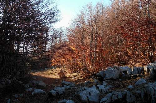 Sella delle Ciavole (October) |
At the other side of the glade the trail dips down again. Instead of following it, however, turn left and climb to the shoulder of the mountain. Keep climbing in an north-eastern direction until you come upon the actual ridge. There are several possibilities, but neither a trail nor any signposting. Some parts of the ridge are quite steep. In winter they can hold hard and iced snow. Although initially step kicking might seem an option, the situation can change drastically further up the ridge. It is highly advisable to look over your shoulder, once in a while, and examine the slope angle, and, also important, what lies at its lower end. (Note: A winter ascent will almost certainly require crampons and ice axe.)
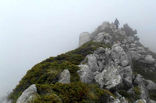
The ridge terminates a few metres beneath the foresummit (2,127 m). From this point turn right (east), approach the cliff and keep following it a northern direction. The actual summit is already within reach and will reward you with some exceptional views.
 South ridge and gully exit | 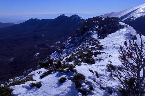 On the south-ridge (Serra delle Ciavole) |
In order to complete the traverse you will have to keep to the ridge also descending. Without snow it is an easy and diverting scramble on boulders and large rocks. In winter the cliff is usually topped by overhanging snow cornices. Pay close attention, as these cornices are hard to spot when facing north!
From the col ('Grande Porta del Pollino') it is possible to follow a trail which, in a western direction, descends further towards the central high plains and the forest track that will take you back to your trailhead. Especially in winter, and with foul weather, the descend should not be underestimated. The slope angle does not pose any problem, but on the vast moraine-like landscape it it easy to lose direction and descend one of the side valleys. In case of doubt keep rather a south-western direction. Once you reach the bottom of the high plains it will be easier to determine your precise position and take up the trail.
5. West face ("La diretta") - scrambling/ mixed climbing
Another interesting route, and a quite straight forward choice, is a direct ascent of the mountain's very beautiful and rather steep west face. From the trailhead 'Colle d'Impiso' simply follow the same hiking path mentioned above (1.) and the signposting for 'Piano di Toscano' or 'Piani del Pollino'. From 'Piano di Toscano', the first of the central high plains, head straight and aim for the distinctive summit pyramid of Serra Dolcedorme (south). After traversing the first plain and the moraines that divide it from the second high plain ('Piano di Pollino'), head directly for the west face (left), cross the second plain and look for a number of large erratic boulders.
From this point you will have to cut the beech forest. Where the beeches give way to the Bosnian Pines the terrain steepens considerably and you may choose either to stick to the south-west ridge or find an individual route up the west face. Any of these routes eventually lead to the foresummit (2,127 m). In order to reach the summit (2,130 m) continue in an eastern direction and follow the cliffs north (left). All the way up you can enjoy a nice view on the col and prolonged north ridge of Serra Dolcedorme.
 North ridge of Serra Dolcedorme | 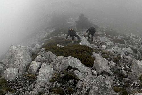 Scrambling on the west face |
6. East face (some considerations) - mixed climbing
Beheld from a distance, and a certain angle, the impressive east face of Serra delle Ciavole may look almost perpendicular. However, its inclination rarely exceeds 60 degrees. The wall features several broad rock buttresses and offers a great number of gullies of various length and difficulty, often broken by horizontal (snow covered) ledges. It is one of the more challenging destinations for anyone looking for individual mixed climbing routes in the Southern Apennines. Various routes have been climbed and named already. For detailed information about the routes see Sud verticale (in Italian language only).
 East face (Serra delle Ciavole) - second pitch | 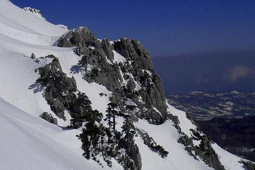 East face (Serra delle Ciavole) - 3/4 up | 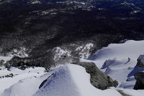 East face (Serra delle Ciavole) - gully exit |
Because of its remoteness, and the relative inaccessibility that comes with it, it is climbed rather infrequently. Any conceivable approach is long and tiresome, mostly on pathless terrain and, in the winter months, often through knee-deep snow. An early start is mandatory; given its particular exposure (east), the wall is often discharging small rocks and pieces of ice already half an hour or so after sunrise. The approach through the forest should be made well before that time, and bringing a climbing helmet is a certainly a good idea.
East face - Serra delle Ciavole - Via dei Moranesi
One of the major hazards are spontaneous or man-triggered slab avalanches; expect an elevated risk especially on cloudless days (sun exposure) and shortly after sudden temperature rises, and cosult the Avalanche Radar (for the Southern Apennines) beforehand. Any late ascent (afternoon) should be prepared cautiously and not attempted under unfavourable conditions. Also a solo ascent is well within the realms of possibility. For a climping party of two, or more, a rope may provide additional safety. Keep in mind that on certain routes some pitches may require more than the usual 60 metres. A 60 m single rope, however, is the minimum you will need on most routes in order to get from one (halfway safe) stance to the next. The rock quality is mostely precarious, to say the least, and useful cracks to be found won't take more than small nuts or hexes. At least a couple of short snow anchors and a selection of old fashioned pitons are a good alternative, or addition, as they may fit into the type of small, narrow holes and cracks most prevalently encountered. And don't forget to bring plenty of slings and accessory cord.
Here a few impressions from one of the routes of the East face: Via Piccolo Dente del Gigante, 400 m, AD / 65° / II+ / AI
 Via Piccolo Dente del Gigante, the first pitch | 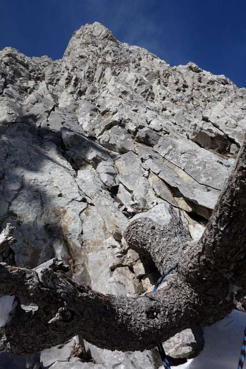 Via Piccolo Dente del Gigante, stance | 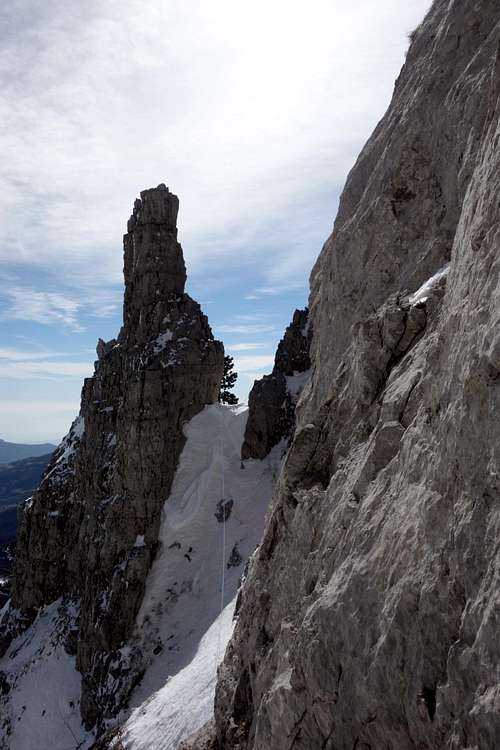 Piccolo Dente del Gigante, the "tooth" | 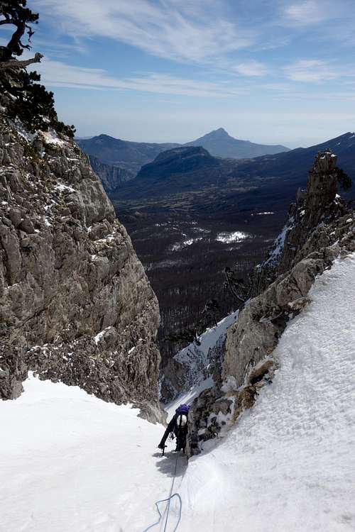 Via Piccolo Dente del Gigante, the last pitch |
On location, carefully check snow conditions, examine potential run-out zones for debris before choosing a route and look out for conspicuous glide cracks in the steeper parts of the gullies. In case of doubt it might be tempting to turn to the limestone rock buttresses. But it is better not to rely too much on them. Generally much steeper than the gullies, they may provide fallback options for critical passages but, as mentioned above, the rock quality is mostly poor and placing protection can become a serious issue.
A few landmarks & impressions
 Monte Pollino and Serra del Prete (from the summit) | 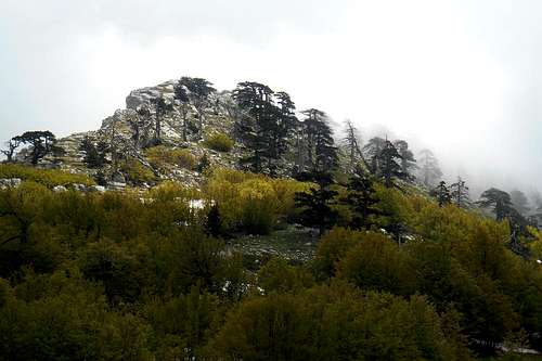 Onset of the north ridge | 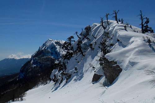 Serretta della Porticella and Serra delle Ciavole |
 Bosnian Pine (in winter coat) | 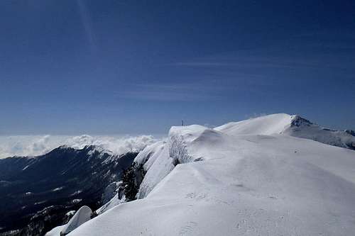 Serra delle Ciavole (the summit) | 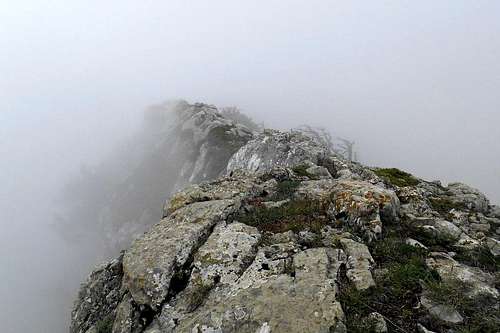 On the summit ridge (with low clouds) |
 Descending to Piano Toscano | 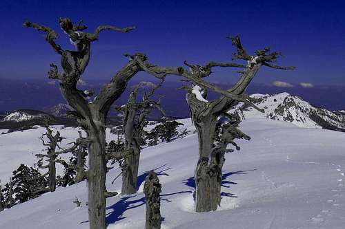 Serra di Crispo (from the north ridge) | 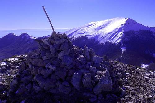 Serra Dolcedorme (seen from the foresummit) |
Getting there
The nearest airports are Naples (about 230km), Bari and Brindisi (also about 220-230km). From Rome and its big international airports it is a considerably long journey of almost 450km. There is limited public transport in this region. The actual mountain roads are largely in bad conditions, especially the high passes might become impassable after snowfalls as road patrol service is scarcely to be seen around. If you should consider to visit the Pollino Massif between late October through early May, don't forget to bring snow chains or allow extra time for the approach way.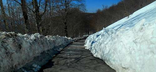
Road conditions (unusually good) - Colle d'Impiso
from Naples: Take the A3/E45 in direction Reggio Calabria, Salerno (about 195 km). Take the Exit (Uscita) Lauria Sud and follow thestate the State Road SS19. At Castellucio Inferiore turn left and follow the indications for Viggianello or San Severino Lucano. From the latter not always practicable mountain roads lead to the trailheads Madonna di Pollino and Colle d'Impiso or to the village of Terranova di Pollino.
from Bari/Brindisi: Take the State Road SS100 (or the highway A14/E843) for Taranto. Turn left (indications for Jonica/Palagiano/Matera/Reggio Calabria) and take the coastal road E90. After passing Policoro pay attention, as the Exit can easily be missed, and turn left, taking the State Road SS653 (indications for "Sinnica". Take the Exit „Val Sarmento“, and follow indications for Terranova di Pollino, or „Valle Frida“ and follow indications for San Severino Lucano.
Red Tape
The Pollino massif, and hence Serra delle Ciavole, is an integral part of the 'Pollino National Park'. With a total area of 1,960 square kilometres it is the most extensive national park in Italy. The park was officially founded in 1993. The same rules and regulations apply as for any other national park in Italy.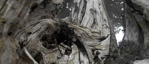
Dead Bosnian Pine
Free camping is generally not encouraged (in other terms: it is not allowed). However, it might be tolerated from dusk until dawn and as emergency bivouac. No open fire etc. will be tolerated, though. There are no fees or permits required.
When to Climb
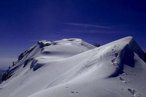
Summit ridge (February)
On the summit ridge (may)
A full traverse of the mountain is possible both in summer and winter. However, depending on the meteorological conditions during the winter month, a pair of crampons should be in your bag, as the entire summit area may be covered by almost impenetrable green (or blue) blank ice slabs.
In winter the east face is a fantastic playground for climbers seeking individual and challenging mixed routes that can be found between towering rock buttresses. The only drawback might be the very long approach routes. Getting up extremely early in the morning is mandatory; given the exposure (east), the gullies are already starting to discharge small rocks and pieces of ice only an hour or so after sunrise.
Depending on sun exposure (cloudless days) and the actual day temperature, an ascent later in the day and during the late hours of the afternoon might be possible as well, but expect elevated avalanche risk on almost all possible passages. Carefully check snow conditions, examine potential run-out zones for debris before choosing a route and look out for conspicuous glide cracks in the steeper parts of the gullies.
Accommodation, mountain huts etc.
Most of the existing mountain huts in the area are currently closed and/or in poor conditions. As an exception can be seen the two mountain huts located on the high plain Piano Ruggio, south side of the mountain: Rifugio de Gasperi and Rifugio Fasanelli. A number of Bed & Breakfasts etc. can be found in the town centres of San Severino Lucano, Terranova di Pollino (to the north) or Castrovillari, Rotonda and Morano Calabro (to the south).Rifugio Fasanelli
Situated right on the col between Serra del Prete and Monte Pollino is the always open bivouac Rifugio Gaudolino. For additional information regarding accommodation in the vicinity you may also have a look at the respective section on the Pollino massif main page.
Maps
Maps in a scale of 1:25,000 are available for purchase directly from the IGMI - Istituto Geografico Militare Italiano (search term/key word:Terranova di Pollino). For full information about available literature (maps, guide books etc.) you may have a look at the respective section for the Pollino massif and the Pollino National Park.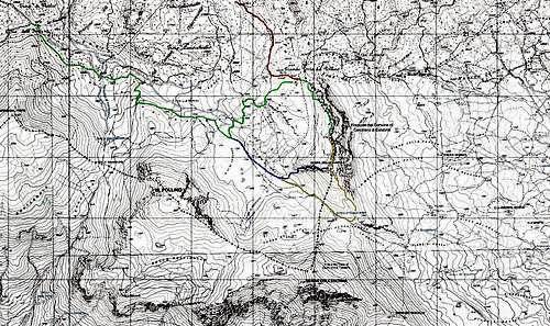
Routes - Serra delle Ciavole
Small map with basic indications for the main trails:
1. green (normal route: Colle d'Impiso - Piani di Vacquarro - Piano Toscano - Piana di Pollino - Grande Porta del Pollino - Serra delle Ciavole)
2. red (normal route: Madonna di Pollino - Fosso Iannace - Piano di Iannace - Grande Porta del Pollino - Serra delle Ciavole)
3. blue (variation west face, direct route from Piano di Pollino)
4. yellow (variation full traverse: Piano di Pollino - Sella delle Ciavole and Piano di Acquafredda)
-