
|
|
Mountain/Rock |
|---|---|
|
|
33.50239°N / 111.54463°W |
|
|
Maricopa |
|
|
Hiking |
|
|
Spring, Fall, Winter |
|
|
3381 ft / 1031 m |
|
|
Overview
Dome Mountain is the highest point of the Goldfield Mountains, which are known for their abundant cliffs and rock outcroppings. The range is located in eastern Maricopa County, just north of the city of Apache Junction, hemmed in on the south by Apache Junction and Mesa, on the west by Usery Pass Road, on the north by the Salt River, and the east by State Route AZ-87. The Goldfield Mountains are essentially a foothill range to the bigger Superstition Mountains immediately to the east. However, peaks in this range are challenging and quite interesting. Most Phoenix-area hikers are familiar with Wind Cave and Pass Mountain, the westernmost peak in the range. Dome Mountain rises about three miles east. The ghost town of Goldfield is located not far off AZ-87, and is open to the public. On the one hand, it features actors in period dress, mock gun fights, and ice cream. However, it's a real actual old town, and apparently haunted, being featured on ghost-oriented television shows.
Dome Mountain's summit rises to 3,381 feet, with slightly over 1,200 feet of prominence. The summit is notable for its saddle shape, the northern lobe being highest. Relatively few hikers bother to visit the top, given its proximity to the metro Phoenix area. The summit is reached via a road, then wide trail, then lighter trail, then a steep use trail, then a final steep section for the last 200' or so. All accomplished in a little over three miles from the starting point. The views are excellent.
Dome Mountain has a south peak about 1/2 mile away, at 3,269', which may be referred to as South Dome Mountain. Both can be done in a day, but the safest way is hike up Dome Mountain first, then up to South Dome Mountain, and then probably up and over Dome Mountain again. Hiking cross-country below Dome Mountain is pretty gnarly. Dome Mountain can also be combined with East Dome Mountain 3,134', which is an easier combination.
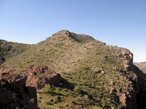
South Dome Mountain is the big rock en route on the left in the first photo below.
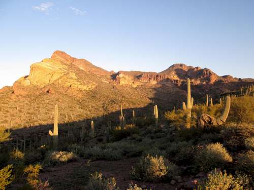 Dome Mountain as seen on the hike in Dome Mountain as seen on the hike in |
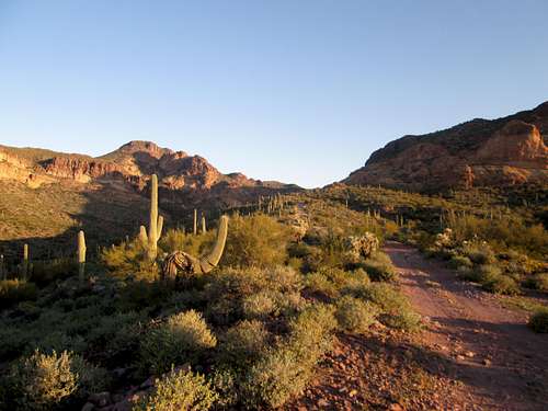 Slightly different angle, with some of the road. Slightly different angle, with some of the road. |
Getting There
In Apache Junction, about 35 miles east of Phoenix, exit US-60 at Idaho Road. Here is a more detailed set of directions, courtesy of mstender:
- Take exit 196 for AZ-88 E/Idaho Rd
- Turn left onto S Idaho Rd go 4.5 mi
- Turn right onto E McKellips Blvd go 0.5 mi
- Turn left onto N Wolverine Pass Rd go 0.9 mi
- Turn right onto E Tonto St go 0.2 mi
- Take the 2nd left onto N Cactus Rd go 0.1 mi
- N Cactus Rd turns right and becomes E McDowell Blvd
- E McDowell Blvd turns left and becomes N Cactus Rd
The last road will bend left and cross the Tonto National Forest boundary, coming to a large gate and parking area. If you have a permit, you can drive beyond the gate. Otherwise, park here. Elevation here is about 2,050 feet.
Route
Past the gate, hike north on Tonto Road 10. When it starts to bend west, look for FR-1356, which continues north. Take it for a third of a mile and turn right. Continue north for a mile and a quarter. Turn right again. A map is helpful; particularly a satellite image. Trail hiking apps, like All Trails, can be good guides as well for this route.
Continue for about three-quarters of a mile up this road/trail. You will reach an overlook point. This is over two and a quarter miles at this point in the hike. There is a use trail on the right. Take it and follow as best you can. After about a half a mile, there is a trail junction. Take the trail on the left, which leads up to Dome Mountain. The trail is fairly easy to follow. The last bit to the summit requires some scrambling.
It is over three miles to the summit and over 1,400’. If adding South Dome Mountain, it is another 750’ total gain, to go up to South Dome Mountain and back up and over Dome Mountain, adding another 1.5 miles round trip.
Wear long pants, sleeves, hat, gloves and good shoes. You will get scratched, but thankfully, there isn't that much cholla on this hike.
Red Tape
If you are planning to hike the roads, no permits are necessary. If you plan to drive the roads north past the gate, you'll need a permit from the Tonto Ranger Station in Mesa. Here is their contact information:
Mesa Ranger District 5140 E. Ingram St. Mesa, Arizona 85205 (480) 610-3300
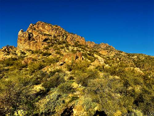
 North summit (the highest point) North summit (the highest point) |
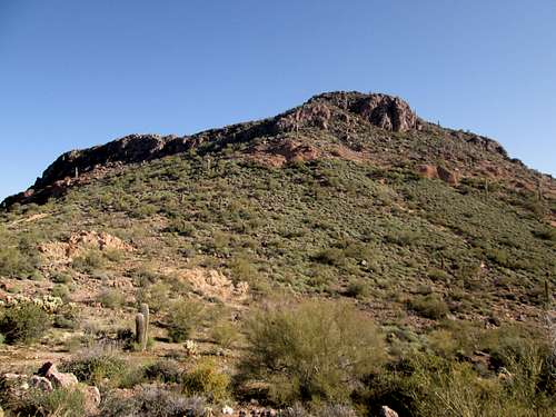
 South summit South summit |
When to Climb
The cooler months, November through March, are best. It's a brushy hike, and doing this in the heat of summer would be very unpleasant.
Camping
If coming from the south, there is no camping. However, you may be able to find an out-of-the-way road somewhere north or east of the range to car-camp for the night. You'll be close to civilization. It may be best to get a cheap hotel nearby if you have nowhere to stay.
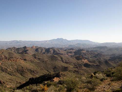 Four Peaks Four Peaks |
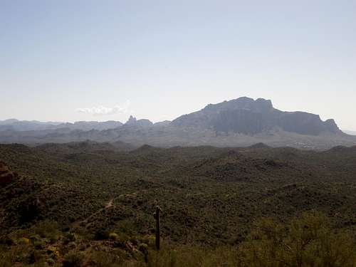 Weaver's Needle and the Superstition Mountains Weaver's Needle and the Superstition Mountains |
External Links
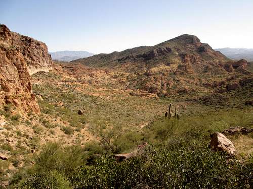
Peak 3134 as seen from the slopes below Dome Mountain.