
|
|
Mountain/Rock |
|---|---|
|
|
48.96750°N / 121.961°W |
|
|
Whatcom |
|
|
5481 ft / 1671 m |
|
|
Overview
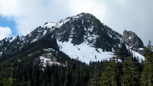
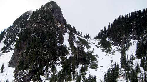
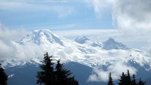
Bald Mountain from FR3140
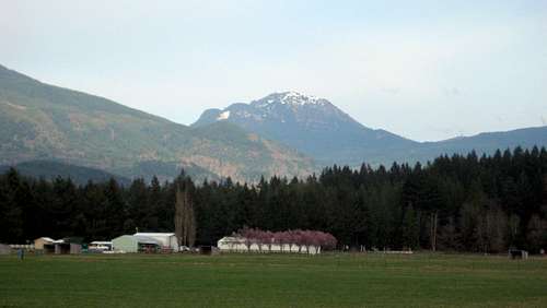
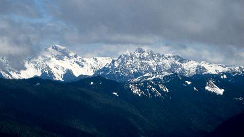
Bald Mountain from Kendall area
Note: Bald Mountain is normally a fairly quick and easy scramble, but this assumes one can access FR3140 from the Canyon Creek Road (FR31). At the time of this writing (3-27-15), FR3140 is closed at the 0.5 mile point due to a washout. Please contact the Forest Service beforehand to check road conditions, or be prepared for a long hike/bike ride.
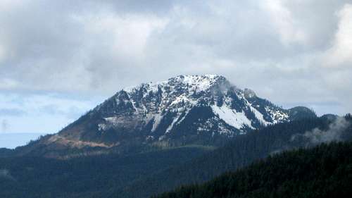
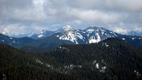
Bald Mountain from the east
Getting There
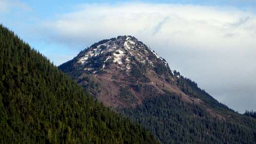
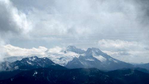
Bald Mountain from Canyon Creek Road
Assuming FR3140 is open, follow it for 5.7 miles, at which point you will arrive at a three-way intersection (shown as 4219T on USGS maps). Normal passenger vehicles will want to stop here, as the road deteriorates beyond this point.
If FR3140 is closed, hike or bike the road for 4.7 miles, at which point you will arrive at the creek draining from Bald Lake (3840'). FR3140 has a fairly gentle overall grade, so a mountain bike is recommended.
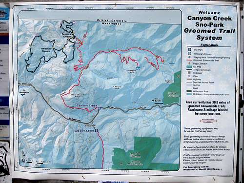
Note: There is a sign at the beginning of FR3140 that suggests this area is used as a Snow Park in the winter. I have no information regarding what months Snow Park regulations are in effect - again, this might be a good question for the Forest Service.
Sign at beginning of FR3140 on Bald Mountain
If, for some crazy reason, you would like to access Bald Mountain on logging roads from the west, the Sierra Pacific road starts at Hwy 542, 2.3 miles east of Maple Falls. Using this 'trailhead' would involve substantial elevation gain and distance relative to the FR3140 route. I will leave it to you and Google Earth to sort out a route if you decide to come this way. The only possible benefit I can see from using this road is combining with Black Mountain for a '2fer'.
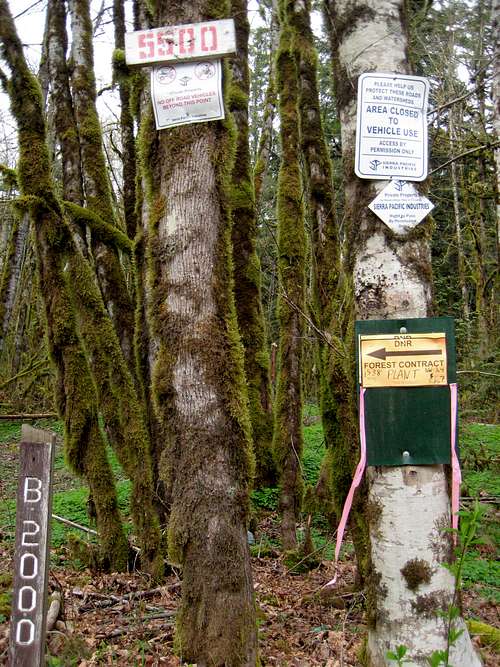
Sign on optional Sierra Pacific approach road. Located at N48 55.675 W122 02.032 Elev. 630'.
Route
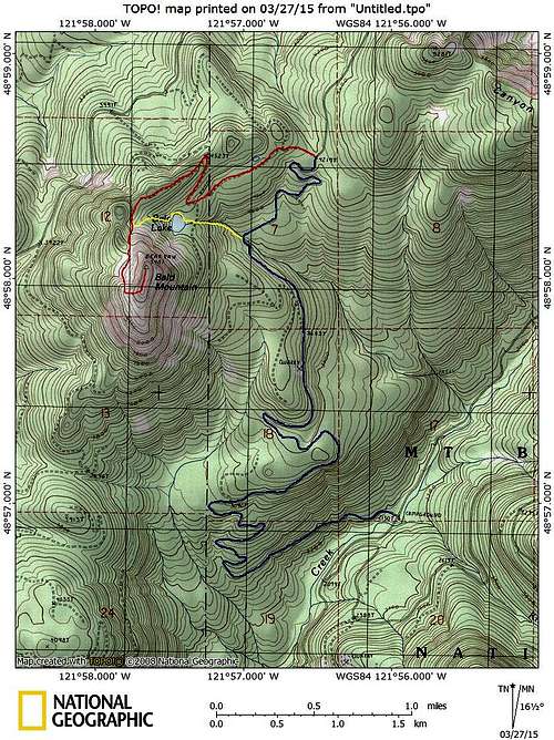
Bald Mountain route map. Blue line shows normal driving route up FR3140. Red line shows normal 'no snow' route, yellow line shows an early season alternative.
From the intersection at 4219', take the left fork to its end in 0.6 miles. From the end of the road, make a slightly rising traverse through second growth to the southwest - after about 500', you will intersect the logging road that passes just to the east of Bald Lake. From this point, you have two options - option 1 is easier with no snow cover, option 2 is easier with snow cover:
1. Turn right, and follow the road to its end in 0.7 miles (don't miss the turn at 4523T). From the road end, traverse about 600' south, at which point you will be in a fairly open basin at 4700' (just to the west of Bald Lake).
2. Turn left, and follow the road a short distance to Bald Lake. From here, you can join the optional 'yellow routing' as shown on the route map. Traverse around the north side of Bald Lake (slightly easier than the south side), then continue uphill to the aforementioned basin at 4700'.
A third option (best if FR3140 is closed) is to follow Bald Lake's outlet creek from FR3140 to the lake. This option is shown in yellow on the route map.
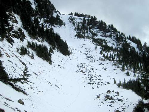
From the basin, make a steep, 300' ascent to a 5000' saddle just northwest of Bald Mountain's summit. This slope should be avoided if avalanche conditions exist.
First slope from 4700' on Bald Mountain

Looking down the first slope from 5000' on Bald Mountain. Bald Lake is out of view beyond the right edge of the photo.
From the saddle, drop slightly, and make a south traverse to another steep slope. Ascend this slope for 300', until arriving on a shoulder at 5300' just southwest of Bald Mountain's summit. This slope also needs to be avoided in avalanche conditions - please note that it is possible to ascend in the trees to the right of the gully.
Looking up the second slope from 5000' on Bald Mountain
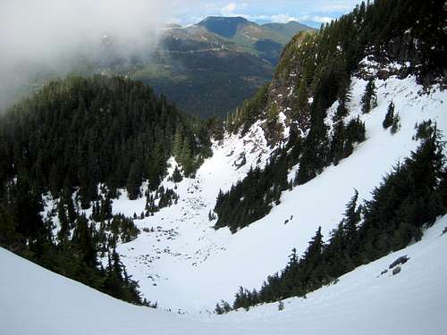
Looking down the second slope from 5300' on Bald Mountain. The saddle at 5000' can be seen in center of photo.
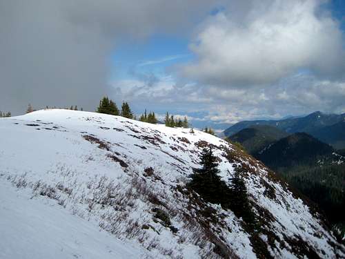
From the shoulder at 5300', make the short climb east on open slopes to Bald Mountain's massive, flat summit. The true summit is on the north end, and is marked by a rock cairn. On the USGS map, it is marked as 'Bearpaw'. Since Bearpaw Mountain is located five miles to the E/SE, I am assuming this was labeled in error. There are a few online maps that refer to this summit as Kaisoots Mountain (caltopo, for example). I am not sure where this name originates from, and I was not able to find an online reference for it.
Bald Mountain summit
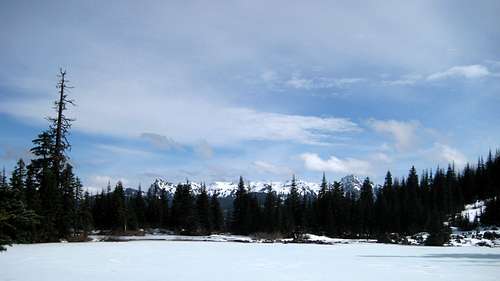
Based on its position and prominence, Bald Mountain should have fantastic views. Unfortunately for me, the summit clouded in, stealing much of the view I was hoping for. If anyone has better Bald Mountain summit panos, please feel free to contribute to the cause.
Liumchen Mountain (BC) from Bald Mountain. Mount McGuire (BC) in background.
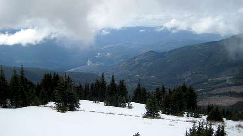
North Fork Nooksack Valley from Bald Mountain

Bald Mountain east pano. Canyon Creek valley in center of photo.
metasyn11 - Jul 6, 2021 6:20 pm - Hasn't voted
2021 update on road conditionsRoad 3140 is freshly graded from Canyon Creek Road all the way to the end, suitable for driving in all passenger vehicles. The last 1/2 mile on spur road 250 is very rough and should probably be walked for most vehicles.
ShinyPlanter - Mar 3, 2023 8:03 am - Hasn't voted
Sierra Pacific Road ?Does anyone know whether the road referred to as the "Sierra Pacific" road is actually gated at the intersection with Hwy 542? I've seen this road labeled as U.S. Forest Service Road 3678 on another map and am wondering if the signage indicating that vehicle access is by permission only is enforced/enforceable if the road is not gated.