
|
|
Mountain/Rock |
|---|---|
|
|
38.69383°N / 119.58761°W |
|
|
Alpine |
|
|
Hiking, Scrambling |
|
|
Spring, Summer, Fall, Winter |
|
|
8315 ft / 2534 m |
|
|
Overview
 Dome 2 from south summit ridge
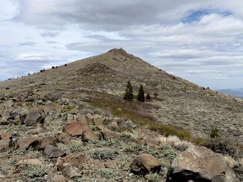
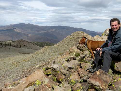
Dome 2 (sometimes called Dome Two or Dome 2 Benchmark) is a rocky-topped summit located near Monitor Pass. It is easily accessed via Big Springs Road, the first major dirt road once reaching the Monitor Pass area from the winding road below if coming from the east. Dome 2 has a prominence of 375 feet, making it one of three prominent summits directly accessible from the pass. There is no Dome 1. Dome 2 is a unique little summit in its own right. Rocky topped, there is a massive cairn on the summit. The views aren’t as all-encompassing as nearby Leviathan Peak, but the views to the east are outstanding.
 View northeast to the Pine Nut Mountains
Dome 2 is an excellent add-on hike to Leviathan Peak or South Monitor Pass Peak. It can be hiked all year round depending on whether or not the pass road is open during winter months. It is not advisable to hike during the hottest days of summer.
Getting There
From the west: From the junction of Hwy. 4 with Hwy. 89 5 miles south of Markleeville continue east on Hwy. 89 for about 8 miles to Monitor Pass. Continue then past Leviathan and for a little under 2 miles to Big Springs Road. From the east: From the junction with Hwy. 395 south of Topaz Lake, enter California from the north and drive a few miles to the sign for Hwy 89 west. Take this for about 8 miles as it winds up towards Monitor. Big Springs Road is the first road on the right if coming from the east. You can park at the beginning of the road or drive down a little ways to cut off some distance. From the Reno/Carson City area, one can approach Monitor Pass via Highway 88 through Markleeville or via 395. Both are equidistant.Route
The route information is described from the top of Big Springs Road adjacent to Highway 89. From the parking area, take a dirt road as it descends slightly towards Dome 2. There are a couple options. There is an access road about 0.35 miles down Big Springs Road, that heads up towards Dome 2 from the south, or you can continue down Big Springs Road for another 0.8 miles to an access road that approaches Dome 2 from the north. This can also be done as a loop.
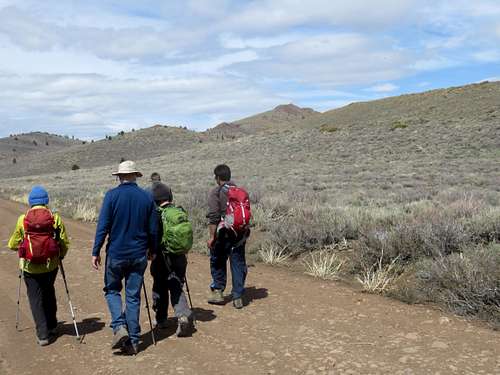 Group starting out on Big Springs Road with Dome 2 rising on the right
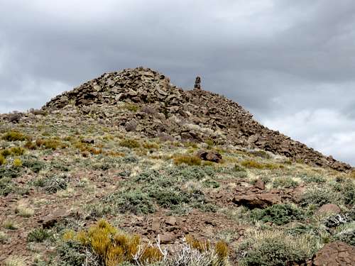 Approaching the summit block from the south
The north side approach is longer, but more of it is on road. If doing a loop, it is better to approach this way, and descend back to the south. It is about 1.7 miles from the north approach to the summit, gaining about 440’ and about 1.25 miles from the south gaining about 435’. The loop is therefore almost 3 miles. The summit block requires Class 2 scrambling from either direction climbing at least 50’.