Monte Sant'Angelo
The Maiella massif has many interesting facets and holds some of the highest peaks of the entire Central Apennine. Although being one of them,
Monte Sant'Angelo (2,669 m / 8756 ft) is perhaps one of the loneliest peaks of this range. Rarely climbed by those heading straight for
Monte Amaro, or turning earlier for
Monte Acquaviva, its lofty mountainside fortress is seldom given the time of a day and remains mostly undisturbed even through the main hiking season. From the normal route to
Monte Amaro it is actually just a short detour to its summit. Still, there is no actual hiking path and in order to climb the last few meters to the top it is inevitable to use both hands.
This mountain might be lacking the sublime beauty of the pyramidal shaped
Cima delle Murelle or the stimulus of being "the" highest peak. The fascinating moonscape surrounding it and the exceptional views it offers are very well worth the small extra effort it takes to reach this peak. Indeed, weather conditions permitting, from the rocky towers of
Monte Sant'Angelo it is possible to enjoy a 360° view on at least twelve major summits of the Maiella massif. But also the broad valleys that flank its base to the north and the south ('Valle delle Mandrelle' and 'Valle Cannella') are an absorbing sight.
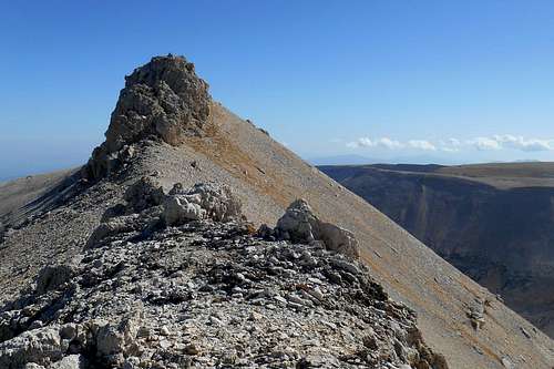
![Monte Sant'Angelo (Maiella massif)]() Monte Sant'Angelo (the summit)
Monte Sant'Angelo (the summit)
| ![Monte Sant'Angelo (Maiella massif)]() Monte Sant'Angelo (from the south)
Monte Sant'Angelo (from the south)
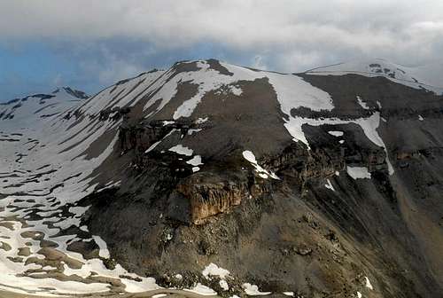
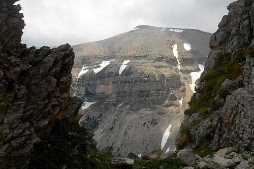
| ![Monte Sant'Angelo (north-east face)]() Monte Sant'Angelo (from its east shoulder)
Monte Sant'Angelo (from its east shoulder) |
During springtime and in late autumn the steep slopes and broad shoulders of this mountain are the favourite playgrounds of the Chamois (
Rupicapra pyrenaica). Even lonelier are the prolonged east ridge and the talus covered east shoulder. A full traverse (from east to west) is, arguably, among the most interesting routes of the central part of the Maiella massif. From late spring through late fall it is an easy but very enjoyable scramble. In the winter moths it becomes a quite challenging route for the more experienced and requires full mountaineering gear.
Routes
As already pointed out before, and unless you are a truly hardboiled scree slope enthusiast, there are only two conceivable routes to the summit. One via the normal route to
Monte Amaro and the short and quite easy west ridge, the other via the valley 'Valle di Santo Spirito', the high plains 'Valle di Macchia Lunga' and 'Piano della Casa', the summit of
Cima Sala del Monoco (2,214 m) and the prolonged east ridge. The second option is, without any doubt, the more varied and scenic route. It is much longer, too, generally equals a
full traverse of the mountain and requires some rudimentary climbing skills.
1. West ridge (via the normal route to Monte Amaro, from Maielletta) - hiking
In order to reach the summit via the west ridge of the mountain it is best to leave your car at the (closed) mountain hut Rifugio Bruno Pomilio and take the quite evident and well signposted hiking trail "
P" for
Monte Amaro. At a small chapel you might choose to bypass
Monte Blockhaus (2,142 m / 7,027 ft) on either side. Both trails will eventually meet and take you in direction of
Monte Cavallo (2,171 m / 7,122 ft). Once this peak is passed the trail descends towards a col. Right on the col is a copious wellspring where it is possible to get water supply for the ascent.
From now on the path gets steeper and starts meandering through the impervious pine thicket. Where the forest opens the path turns sharp left while it keeps rising. After a few hundred meters in this direction you should come upon another small wellspring. Unless you find snow to melt, this is the last opportunity to refill your water supplies. After another few hundred meters the trail turns right again and catches up with the north ridge of
Monte Focalone ( 2,676 m / 8,779 ft). To your left you will see the west face of
Cima delle Murelle, to your right, if you're lucky, the dark silhouette of the far-off Grand Sasso range.
![Fountain (on hiking trail 'P'), Majella]() Fountain (on hiking trail 'P')
Fountain (on hiking trail 'P') | ![Panorama (hiking trail 'P'), Majella]() Panorama (hiking trail 'P')
Panorama (hiking trail 'P') |
Once reached the summit of
Monte Focalone simply keep direction and descend towards the col between this summit and the summit of
Cima Pomilio (2,656 m / 8,713 ft).
Monte Sant'Angelo is already in sight (left). And so are
Monte Rotondo,
Monte Pescofalcone (both to the right) and
Monte Amaro (straight). Short after reaching the summit of
Cima Pomilio you will have to leave the trail and turn left (south). There is no signposting for your destination, so just keep altitude and direction (south-southeast).
In order to reach the col, situated right beneath the summit some easy rocks will have to be negotiated. On the other side of the col you may choose between scrambling up to the summit or bypass the rocky fortress on either side and use one of the small gullies to reach the top. The easiest way is to bypass it on the right side and climb a very short passage that comes out right under the small heap of rocks that marks the summit.
![Monte Sant'Angelo (from Cima Pomilio)]() Monte Sant'Angelo (from Cima Pomilio)
Monte Sant'Angelo (from Cima Pomilio) | ![Easy scrambling to the summit]() Easy scrambling to the summit (Monte Sant'Angelo)
Easy scrambling to the summit (Monte Sant'Angelo) |
Return is usually via the same route which can be combined with a visit to one or more of the following summits:
Monte Rotondo,
Cima dei Tre Portoni,
Monte Pescofalcone,
Monte Amaro,
Monte Acquaviva or
Cima delle Murelle. Best bivouac opportunities are Bivacco Fusco (along the hinking trail 'P') and Bivacco Pelino (on the summit of
Monte Amaro).
2. East ridge (from Fara San Martino, via Piano della Casa) - hiking/scrambling/mixed climbing
A great alternative route to the summit of
Monte Sant'Angelo partially coincides with the longest normal route in the entire Apennines: the east route from the village Fara San Martino to the summit of
Monte Amaro, signposted as
H1. The trailhead, a very small gorge at the mouth of the deep Valle di Santo Spirito, is situated at only 500 m / 1,640ft. The first part of the trail is quite evident and well signposted (
H1, red and white). Even with a heavy bag it shouldn't take you more than 2 hours to the first junction, Bocca dei Valloni (1,055 m / 3,461 ft).
From this point the valley gradually opens, and the trail, from now on only marked with small cairns and occasional waymarks (green and yellow), gets slightly steeper as it enters a vast beech forest. Before reaching the wellspring 'Fonte Milazzo' you will have to cross two glades. The wellspring, situated at 1,596 m / 5,236 ft, to the right of the trail and at the feet of a high escarpment, is fed by a number of small cataracts. (
Note: During the winter months these rivulets might be frozen. With ice covering the entire escarment the wellspring is usually inaccessible.)
![Bocca dei Valloni (in winter)]() Bocca dei Valloni (in winter)
Bocca dei Valloni (in winter) | ![Rock face (Valle di Macchia Lunga)]() Rock face (Valle di Macchia Lunga)
Rock face (Valle di Macchia Lunga) | ![The escarpment (in winter)]() The escarpment (in winter)
The escarpment (in winter) |
After refreshing your water supplies (or taking a shower?) simply follow the escarpment and climb the steep scree ramp on its uphill side. Hidden under an overhanging rock you will surely notice a small emergency bivouac. At the upper end of the slope turn sharp right and follow the narrow trail that runs along the declivity. After crossing a number of rivulets you will find yourself beneath another, much more comfortable bivouac, known as 'Grotta dei Porci' (1,793 m /5,882 ft). From the bivouac keep close to the rocks and look for a steep and narrow trail (
F4a) that enters the forest to your left. Only a few hundred meters further on this trail you should pass by the last wellspring on this route. Where the forest opens and the trail peters out you have reached the high plain 'Piano della Casa'.
![Valle Macchia Lunga and escarpment]() Valle di Macchia Lunga and escarpment
Valle di Macchia Lunga and escarpment | ![Fonte Milazzo]() Fonte Milazzo
Fonte Milazzo | ![Trail in the vicinity of 'Grotta dei Porci']() Trail in the vicinity of 'Grotta dei Porci'
Trail in the vicinity of 'Grotta dei Porci' |
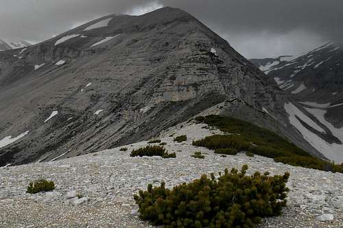
Cross the plain in a direct line and climb up to the ridge. The view from up there is already fabulous:
Cima dell'Altare,
Monte Pizzone,
Monte Acquaviva,
Cima Sala del Monaco and, in an eastern direction, the deep blue of the lake Lago Sant'Angelo. Keep to the ridge and head for the pine trees on the east slope of
Cima Sala del Monaco. There is some signposting in form of simple yellow spots, stripes or arrows that will help to avoid the nasty pine thicket. Further up the ridge this kind of signposting will also show the easiest scrambling route and, finally, accompany you to the summit of
Monte Sant'Angelo. (
Note: During spring and summer month, try not to step on the low-growing juniper shrubs, as they are home to the venomous "Vipera ursinii".)
From where the pine thicket opens up again the terrain flattens out and it is only a short walk over the summit plateau to the heap of stones marking the summit of
Cima Sala del Monaco (2,214m / 7,263 ft). Now the trail descends towards the col that connects this peak and the onset of the actual ridge of
Monte Sant'Angelo.
![Piano della Casa & Cima Sala del Monaco]() Piano della Casa & Cima Sala del Monaco
Piano della Casa & Cima Sala del Monaco | ![Cima Sala del Monaco (the summit)]() Cima Sala del Monaco (the summit)
Cima Sala del Monaco (the summit) | ![Onset of the east ridge]() Onset of the east ridge (Monte Sant'Angelo)
Onset of the east ridge (Monte Sant'Angelo) |
The steepest part of the ridge consists of two escarpments which are connected by a ramp rife with scree and talus. The easiest scrambling route is signposted by yellow dots and arrows painted on large rocks. There are several fairly easy climbing passages (UIAA II) and a narrow and somewhat exposed ledge. Harder and more interesting variations are conceivable, too. From top of the second escarpment the ridge keeps rising towards a false summit. Continue in this direction for a few hundred meters and the pinnacles of the true summit will come within sight.
As the actual summit ridge is broken up by a number of deep incisions it is advisable to bypass it on either side and use one of the short gullies in order to scramble up the last few meters to the small heap of rocks which marks the highest point of the crest, the summit of
Monte Sant'Angelo (2,669 m / 8756 ft). Enjoy the great view!
![The ledge]() The ledge (Monte Sant'Angelo)
The ledge (Monte Sant'Angelo) | ![Interlude]() Interlude (east ridge)
Interlude (east ridge)
| ![Cima Sala del Monaco (from the ridge)]() Cima Sala del Monaco (from the east ridge)
Cima Sala del Monaco (from the east ridge) |
To complete a full traverse of
Monte Sant'Angelo take the short gully that descends directly from the summit, turn right and follow the short west ridge of the mountain that gradually broadens. On the high plateau at the end of it you will come upon signposting for
Monte Amaro and the
Monte Focalone. The hiking trail which connects these two peaks passes close by the no longer marked summit of
Cima Pomilio. Turn left for
Monte Amaro and the bivouac Pelino (about 1 ½ hours) or right for the
Cima delle Murelle and bivouac Fusco (about 1 hour).
A few impressions and landmarks
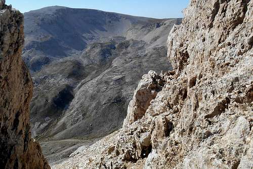
![East ridge (Monte Sant'Angelo)]() The east ridge
The east ridge | ![Valle Cannella & Monte Amaro]() Valle Cannella & Monte Amaro (from the summit)
Valle Cannella & Monte Amaro (from the summit) | ![West ridge (Monte Sant'Angelo)]() The west ridge
The west ridge |
![Monte Sant'Angelo & Monte Acquaviva]() Monte Sant'Angelo (from Monte Amaro)
Monte Sant'Angelo (from Monte Amaro) | ![The summit]() The summit
The summit
| ![Monte Sant'Angelo (from the east)]() Monte Sant'Angelo (from the east)
Monte Sant'Angelo (from the east) |
![Monte Pescofalcone & Monte Rotondo]() Mt. Pescofalcone & Mt. Rotondo (from summit)
Mt. Pescofalcone & Mt. Rotondo (from summit)
| ![Cima dell'Altare]() Cima dell'Altare (from the east ridge)
Cima dell'Altare (from the east ridge)
| ![Monte Amaro (from the Monte Sant'Angelo)]() Monte Amaro (from Monte Sant'Angelo)
Monte Amaro (from Monte Sant'Angelo) |
Getting there
The closest international airport is
Pescara (about 65 km). From
Rome and its big international airports it is a considerably longer journey of 180-220 km (depending on the trailhead). Public transport (both bus and train) is limited and should be checked well before embarking on a journey to the Mailella massif.
![Maiella massif (road map)]() Maiella massif (road map)
Maiella massif (road map)- from Pescara (airport): take the the state road SS5, then SS649 and later SS81 in direction of the country road SP214 for Fara San Martino; depending on your trailhead of choice, you may also take the country road SP214 already at Mandrone and follow indications for Pennapiedimonte or Pretoro
- from Ancona (highway E80/A14): take the Exit Pescara Ovest-Chieti and simply follow the road indicated above
- from Bari/Taranto (highway E80/A14): take the Exit 'Val del Sangro' in direction Casoli (state road SS652), at Piane d'Archi-Casoli take the state road SS154 and then SS84 in direction Casoli; from Casoli follow the indications for your trailhead of choice (Fara San Martino, Palombaro etc.)
- from Rome: take the highway E80/A24 and later E80/A25, at Pratola Peligna-Sulmona you may exit the highway for Sulmona and follow indications for Cansano and Campo di Giove
Red Tape
The entire Majella mountain range (or Maiella massif) is an integral part of the
Maiella National Park, one of the three national parks of the Abruzzo region. The park was constituted in 1991. The same rules apply as for any other national park in Italy. Free camping is not allowed.
There are no fees or permits required.
![Vipera ursinii]() Vipera ursinii
Vipera ursinii
The Majella National Park is home to an exceptional varied wild life. For instance, you will almost certainly spot several specimen of the generally shy Chamois (
Rupicapra pyrenaica), prying human intruders from a save distance, or from behind a rock.
When to Climb
The best season for climbing
Monte Sant'Angelo is late spring, i.e. late May through the first half of June. Most of the thick snow layer that covers the ridges during the winter months has already melted away, and there is no longer the risk of spontaneous avalanches. The copious wellsprings in the surrounding valleys are overflowing and the mountainside itself is riddled with colorful flowers.
Also
autumn is a very rewarding season, for the color of the autumn foliage, the spectacular cloud formations and the milder daytime temperatures. Late September through early November is a very recommendable period.
During the hot
summer months, from late June to mid-September, the temperature in the valleys can easily pass the 35°C mark. Because of the long approach and the considerable altitude difference to negotiate (e.g. the altitude gain from Fara San Martino is more than 2,100 m / 6,900 ft) an ascent can get pretty much exhausting. Keep also in mind that above 1,700 m there is absolutely no water source to be found, and there might be no snow for melting in the pot. This means extra weight for your bag. However, it is always possibile to approach the mountain on the normal route to
Monte Amaro which is much shorter.
![Avalanche prone slope]() Avalanche prone slope
Avalanche prone slope | ![Result of an avalanche]() Result of an avalanche (2015)
Result of an avalanche (2015)
|
Also a
winter ascent is not impossible and can be a fantastic experience. But you will need to be well prepared and start extremely early in the morning in order to reach the summit before sundown. An overnightstay might be inevitable. Snow can be found well below the 1,000 m mark. Some steep slopes hold a vast amount of unstable snow, too. Due to their particular exposure (south, south-east) the snow pack is usually getting wet early in the day and violent slab avalanches are rather frequent. Indeed, the avalanche risk is never to be underestimated. Snow masses may break away well out of sight and hit you where you would least expect it, even in the forests that cover the valley floor.
It is imperative to check the avalanche radar and plan your tour accordingly. Especially the east ridge, usually an easy scramble (UIAA II), will become a quite serious undertaking (PD+) and should better not be tried without proper mountaineering gear. Even with some experience in evaluating objective mountain hazards and after checking the actual snow conditions on location a substantial risk will remain.
Accommodation, mountain huts etc.
Accommodation can be found easily in one of the villages of the zone (Fara San Martino, Pennapiedimonte etc.) However, given the considerable height difference between some of the trailheads and the higher peaks of the Majella range, an overnight stay might become necessary. At the trailhead 'Maielletta' it is possible to find some rather expensive hotel rooms. These hostels are mostly frequented by visitors of the nearby ski resort. Unfortunately, the very nice mountain hut
Rifugio Bruno Pomilio (1,895 m) is still closed and no re-opening date has been announced.
On the route from Fara San Martino there are a least two emergency bivouacs, both of them natural caves closed by dry stone walls.
Grotta dei Porci is located at about 1,700m, below the high plain Piano della Casa. It is actually a natural cave transformed into a simple shepherds hut - always open, unguarded, with a simple fireplace, for 3 to 4 guests. Water supply can be refilled on a fountain (Fonte Milazzo) a few hundred meters before reaching the cave or another small fountain further up - trail
"
F4a"
. The second place is truly an emergency choice. Much smaller than the above it can be found in the vicinity of Fonte Milazzo. Simply keep close to the escarment and follow it in a western direction, i.e. uphill. The bivouac hut is somewhat hidden under overhanging rocks. It is very small and without any comfort.
![Grotta Milazzo]() Grotta Milazzo (emergency bivouac)
Grotta Milazzo (emergency bivouac) | ![Grotta dei Porci]() Grotta dei Porci
Grotta dei Porci | ![Bivacco Carlo Fusco]() Bivacco Carlo Fusco
Bivacco Carlo Fusco |
The best choice, however, is the bivouac
Carlo Fusco (2,455m), a yellow painted tin shed. It is passed by the route which ascends from 'La Maielletta' to the peaks of
Monte Amaro,
Monte Acquaviva etc. From the bivouac the view goes over the so-called "
Anfiteatro delle Murelle", a valley of glacial origins, and the west face of the beautiful
Cima delle Murelle.
The neat little shed has room for six guests and is always open. There is no source of water near, though. In order to avoid a long and taxing descent, it is best to refill your supplies either at the fountain you can find on the col 'Sella Acquaviva' (close to Monte Cavallo) or, better, at another fountain ('Fonte Ghiacciata') which is also situated along the same trail, but only about one hundred below the bivouac.
Maps
 | There are several guidebooks and detailed maps available for the Majella mountain range. Most maps, however, are "hybrids" based on the original maps by the Istituto Geografico Militare Italiano (IGMI - 1:25.000) and updated regarding to changes already conducted or planned (!) by the park authorities. Although the general geographical features are quite accurate, several charted hiking trails do exist only on these maps. Remnants of the old signposting system (yellow numbers on green background) can be found scattered all over the place and should not be confused with the new one (red and white).- Parco Nazionale della Majella, Società Editrice Richerche 2008, map scale 1:25.000 (hiking atlas)
- Majella. Carta escursionistica, Edizioni Il Lupo, 2nd edition 1990, map scale 1:25.000 (hiking map)
- Guida all'alta via della Majella, CARSA 2002 (guidebook)
- Parco nazionale della Majella. 30 itinerari scelti nel cuore della Montagna madre, Edizioni Mediterranee 2007, map scale 1:50.000 (comprehensive guidebook with a selection of various itineraries, b/w images)
|
![Monte Sant'Angelo (IGMI 1 : 15,000)]() Monte Sant'Angelo (IGMI 1 : 15,000)
Monte Sant'Angelo (IGMI 1 : 15,000)- red (east ridge / full traverse; Fara San Martino - Bocca dei Valloni - Valle di Macchia Lunga - Piano della Casa - Cima Sala del Monaco - Monte Sant'Angelo - Cima Pomilio - Monte Focalone - Bivacco Fusco) - ca. 10 hours
- green (normal route "P" to Monte Amaro; Rifugio Bruno Pomilio - Monte Blockhaus - Monte Cavallo - Bivacco Fusco - Monte Focalone - Cima Pomilio - Monte Sant'Angelo)
- yellow (trail "P" from Cima Pomilio to Monte Amaro and Bivacco Pelino) - ca. 1 ½ hours
- blue (descent route; Tre portoni - Rifuggio Manzini - Valle Canella - Sala del Monaco - Valle di Macchia Lunga)

 Monte Sant'Angelo (the summit)
 Monte Sant'Angelo (from the south)
 Monte Sant'Angelo (from its east shoulder)
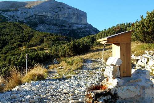 Fountain (on hiking trail 'P')
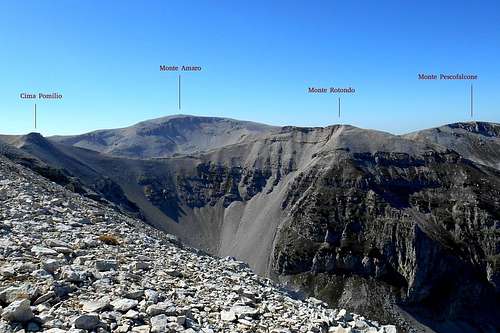 Panorama (hiking trail 'P')
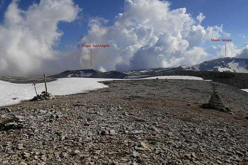 Monte Sant'Angelo (from Cima Pomilio)
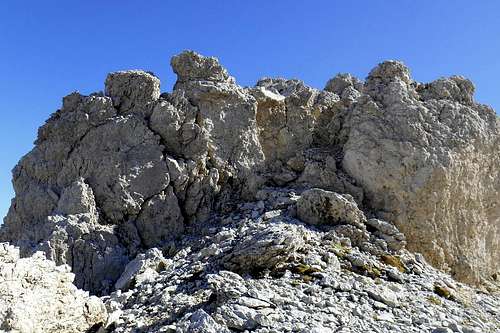 Easy scrambling to the summit (Monte Sant'Angelo)
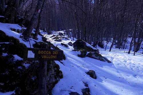 Bocca dei Valloni (in winter)
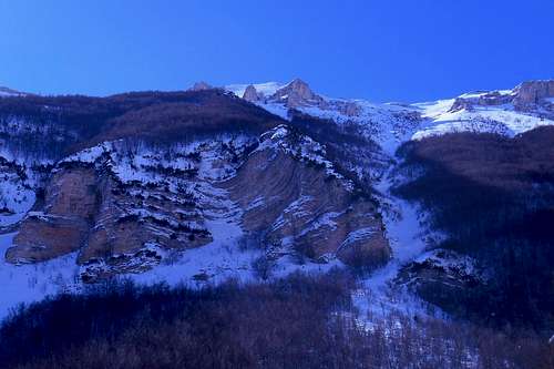 Rock face (Valle di Macchia Lunga)
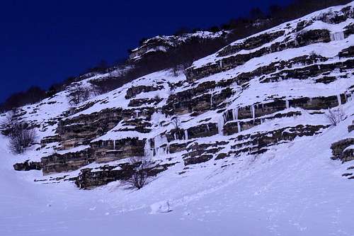 The escarpment (in winter)
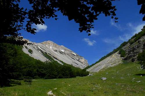 Valle di Macchia Lunga and escarpment
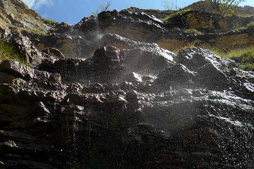 Fonte Milazzo
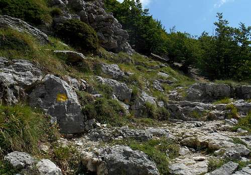 Trail in the vicinity of 'Grotta dei Porci'
 Piano della Casa & Cima Sala del Monaco
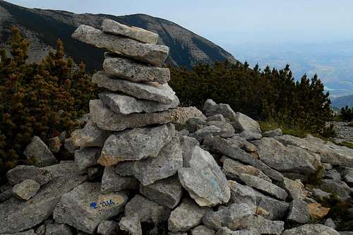 Cima Sala del Monaco (the summit)
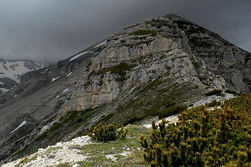 Onset of the east ridge (Monte Sant'Angelo)
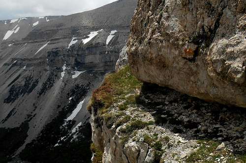 The ledge (Monte Sant'Angelo)
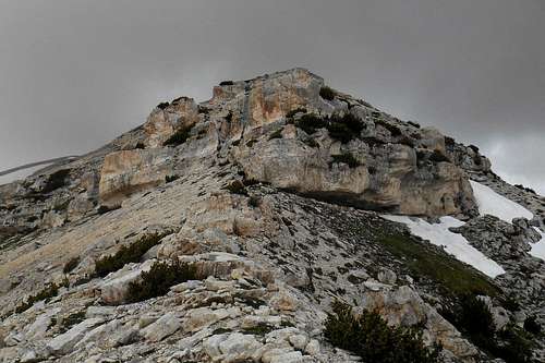 Interlude (east ridge)
 Cima Sala del Monaco (from the east ridge)
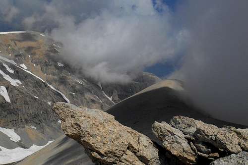 The east ridge
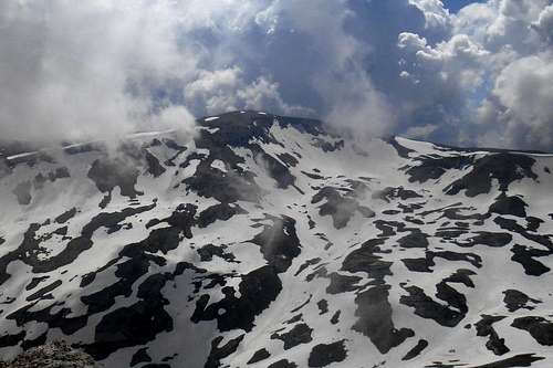 Valle Cannella & Monte Amaro (from the summit)
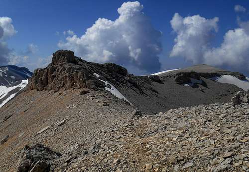 The west ridge
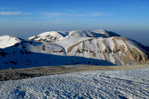 Monte Sant'Angelo (from Monte Amaro)
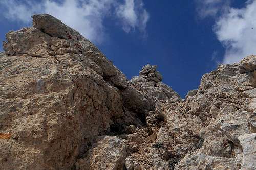 The summit
 Monte Sant'Angelo (from the east)
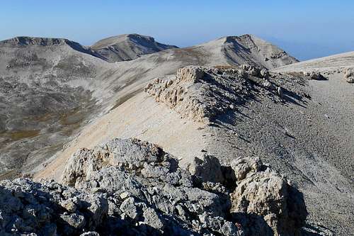 Mt. Pescofalcone & Mt. Rotondo (from summit)
 Cima dell'Altare (from the east ridge)
 Monte Amaro (from Monte Sant'Angelo)
 Maiella massif (road map)
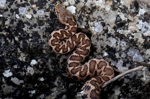 Vipera ursinii
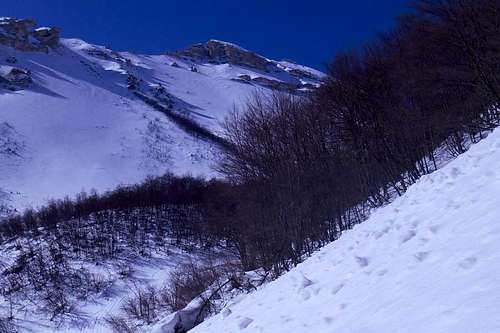 Avalanche prone slope
 Result of an avalanche (2015)
 Grotta Milazzo (emergency bivouac)
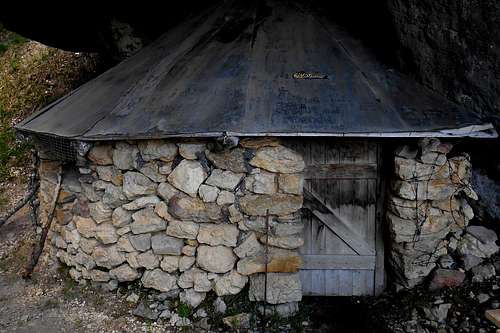 Grotta dei Porci
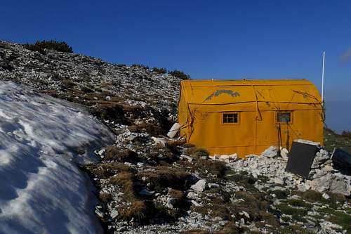 Bivacco Carlo Fusco
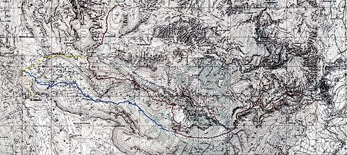 Monte Sant'Angelo (IGMI 1 : 15,000)