

-
 17188 Hits
-
 82.88% Score
-
 16 Votes
|
|
Mountain/Rock |
|---|---|
|
|
11.48170°N / 85.60307°W |
|
|
Hiking |
|
|
Spring, Summer, Fall, Winter |
|
|
5282 ft / 1610 m |
|
|
Overview
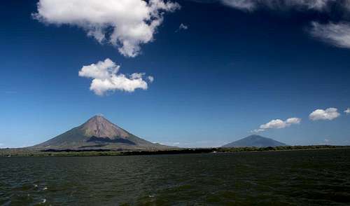
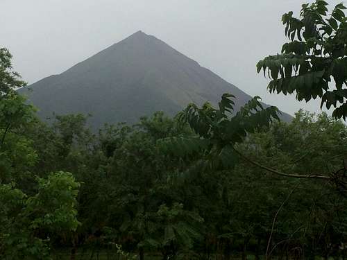
Ometepe's two iconic volcanoes, Concepción and Maderas.
On a clear day, hiking to the summit offers rewarding views of the island and the crater. When overcast, don't expect to see much of anything. The hike starts on a defined trail through the jungle, which leads to a steep climb through mud and over roots to the treeline. From there, the trail climbs steadily upward to the summit across loose volcanic rock. As you approach the summit, the smell of sulfur will get stronger and the heat emitting from the rock will increase.
Getting There
From Managua, take a bus from Roberto Huembe Terminal to San Jorge (approx. 2.5 hours). Once you arrive in San Jorge, take the ferry for $3 across Lake Nicaragua to the port town of Moyogalpa on the island of Ometepe. As you approach the island on the ferry, you will see Volcán Concepción and the smaller Volcán Maderas towering over Lake Nicaragua.You can also bring a vehicle over to Ometepe, and it doesn't cost much to do so. For those arriving by private or rented vehicle, the main challenge is making sure you have space on the ferry. As of 2017 there was no on-line system for reserving a spot, and telephone communication with the ferry lines is difficult. It seems to be a good idea to phone for reservations a week or more in advance. That being said, if you failed to do so, there are fixers in San Jorge who can try to squeeze you in.
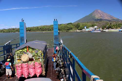
The ferry
A number of hotels and hostels exist in Moyogalpa for hikers to rest up before the morning ascent. You have to start early, both because afternoon weather tends to be bad and because the rangers/guide services will turn you away if you come too late.
Routes
 Howler Monkeys
La Concha: The most common route as of 2017 is the La Concha trail. Take the road ("route 64" on some maps) north from Moyagalpa about 3 kilometers. Just past the village of La Concepción is a well-signposted turn to the right, which leads to a parking area and ranger station. This is a well-organized operation and you will be assigned to a guide for the ascent at a fixed rate that, recently, was US $20 per person. You can't go without a guide, but you won't mind--the guides mostly seem to be personable teenagers and young men from the nearby villages.
The trail starts gradually through open dry forest and ranchland. After warming up on this for a couple of kilometers, it becomes a path in dense, pretty jungle, where you're likely to see and hear howler monkeys. At 900 meters/3000 feet you emerge onto a beautiful grass balcony. Quite a few hikers call it a day here, but those with summit fever will continue another 2000 feet up much steeper volcanic debris to the top, where it is almost always extremely windy and quite cold (except around the fumarole vents--don't burn yourself!). This part of the route has poor footing, and if you're not comfortable on steep scree and gravel, bring trekking poles.
A view from the La Concha route, about 500 feet below the summit
La Flor: The La Flor route also leaves from the Moyogalpa area. For this trail, you can find a guide in Moyogalpa to assist with transport to the trailhead (a few miles from town).
Approaching the trailhead
The initial miles of easily navigable jungle trail become much less defined as you rise above the treeline and climb across loose volcanic rocks to the summit. The trail gets steeper and hikers often experience gusty winds and cloudy conditions.
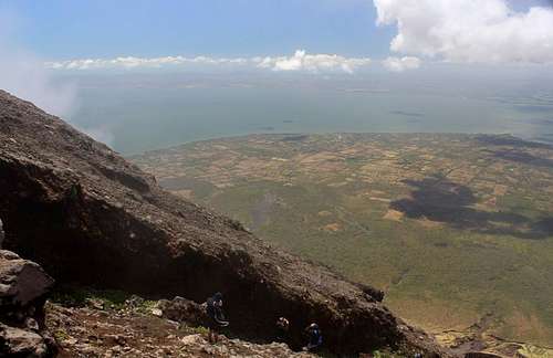
On a clear day, you can see across Lake Nicaragua and into the billowing crater, but fog and clouds often limit the incredible views. When we ascended in mid-June rain and clouds eliminated any chance of a view from the summit. On the descent, the clouds briefly dissipated to reveal the expansive island below before we dipped back into the jungle.
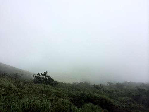
Minimal visibility on the descent
Average roundtrip treks to the summit and back to the trailhead take approximately 7-10 hours by either route. We completed the out and back on the La Flor route in just over 6 hours. When we returned to the trailhead, the rain stopped and the clouds cleared to reveal the perfectly symmetrical volcano.
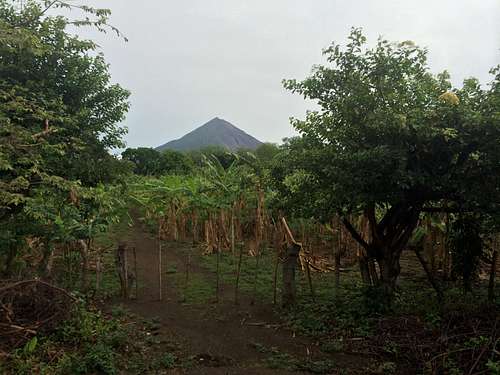
Volcan Concepción after the clouds cleared
Red Tape
$20-$25 per person for a guide and permission to climb the volcano.
Hazards
The main hazard on this mountain is the rocks that may be kicked down by others in your group or in other groups as they make their way up the last fissured slopes along the crater rim. Those who wear contacts will also have problems with the virtually perpetual sandstorm that the summit winds whip up (the wind on the rim is so strong that it is frequently difficult to stand).
When to Climb
You can climb Volcán Concepción year-round, but the dry season lasts from December to February or March. You will have a better chance of a clear view during this time period (though not guaranteed). The wettest months occur from September through November.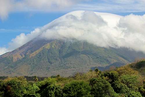
Even in the dry season, the high winds sweeping Ometepe often sock the mountain in with a lenticular cap.
Camping
Plenty of hostels and hotels in Moyogalpa.External Links
Fuego y Agua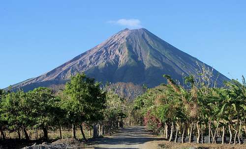
The objective