
-
 11435 Hits
-
 87.2% Score
-
 24 Votes
|
|
Mountain/Rock |
|---|---|
|
|
48.20713°N / 120.97208°W |
|
|
Snohomish |
|
|
Hiking |
|
|
Summer, Fall |
|
|
7870 ft / 2399 m |
|
|
Overview
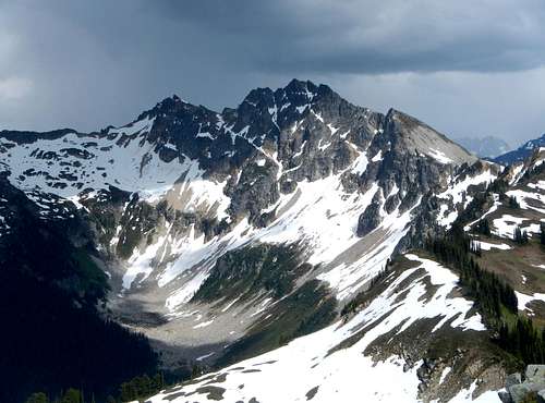
Plummer Mountain North Face
At 7870 feet, Plummer Mountain is the high point of Miners Ridge and is located 10 miles northeast of Glacier Peak. The western portion of Miners Ridge extends out to Image Lake and several less prominent high points, one of which houses the Miners Ridge lookout. The south slopes angle moderately down to Miners Creek at the southern flanks. A small unnamed lake is located just east of the summit at 6800 feet. The north face is precipitous and drops 2000 feet down to the south fork headwaters of Canyon Creek. The northeast ridge extends to Sitting Bull Mountain, a seldom climbed Cascade peak.
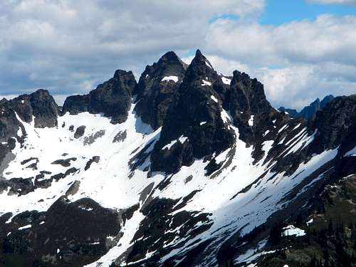
Sitting Bull Mountain
The southern slopes of Plummer Mountain feature numerous mining claims. This area was heavily prospected between the early 1900’s and the 1950’s. In 1966 Kennecot Copper Corporation, the largest producer of copper in the country, announced their intentions of building a road to access these claims and to create a pit mine on Plummer Mountain. Their plan was to extract 12 to 15 thousand tons of copper, worth over 350 million dollars at the time. By today’s market value, that same ore which is still present has a net worth of 77 billion dollars!
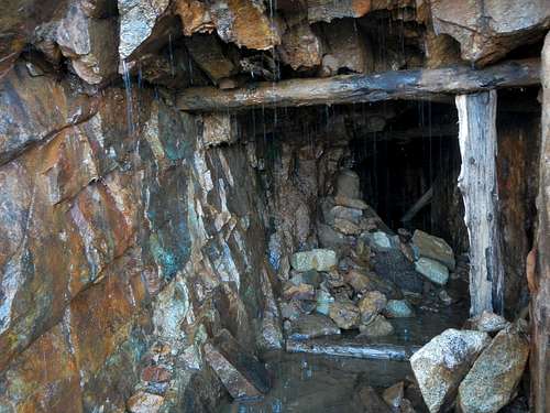
Abandoned Copper Mine
Thankfully, the Glacier Peak Wilderness was designated in 1960 and the Kennecot Corporation was a day late and a dollar short. They met huge opposition from the public, the Forest Service and public officials. Their plans for a massive pit mine operation were completely abandoned. Collapsed miners quarters are still present on the mountain as well as unearthed bits of copper ore and blue rock around the prospects. You will find such remains if you search for them.
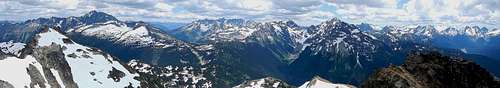
Summit Panorama East
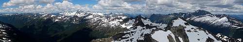
Summit Panorama North
Getting There / Approach Options
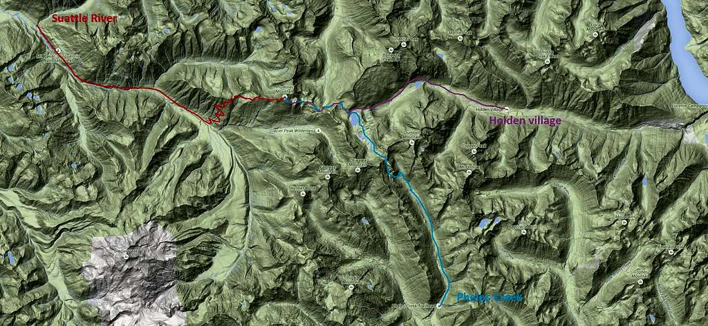
Approach Options
The key word for Plummer Mountain is ISOLATION. This is also true for a number of its close neighbors, especially Bannock Mountain. Plummer Mountain is not technically difficult, but it is buried deep in the Glacier Peak Wilderness, near the exact center. Only the heartiest hikers will bag it, or those with backpacking experience. There are 3 main approach options. The shortest route is 25 miles round-trip from Holden village.
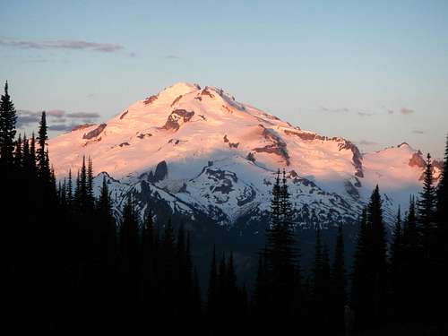
Glacier Peak View
Two alternate approaches are both 29 miles round-trip. The standard route ascends the west ridge and can be accessed from the Suattle River trail and Miners Ridge trail. But the southeast ridge can be accessed from Suattle Pass and Cloudy Pass, coming from Lyman Lakes, Spider Gap, and Phelps Creek. This last option is by far the most scenic, but also the most challenging for elevation gain and loss.
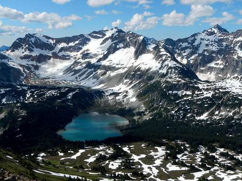
Lyman Lakes Below Chiwawa and Fortress
If you have not seen Lyman Lakes or Spider Gap in person, it’s worth the extra effort, for this is a Washington classic hike. But make sure you go in late season or bring gear appropriate for snow travel.
Summit Scramble Route
Whether coming from the east or west, to reach the summit of Plummer Mountain will require several miles of off-trail travel and a short scramble over some loose rock with minor exposure.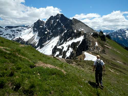
Plummer West Ridge
The west ridge above Image Lake makes for nice travel. Stay on or near the crest until Point 7440+ and then make a slightly ascending traverse on the open south slopes until reaching the upper southeast ridge. Follow the upper southeast ridge or final southern slopes up to the false summit.
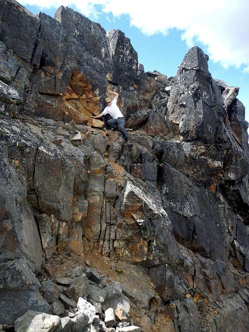
On The Hidden Ledge
From the false summit it appears as though a deep notch will impair further progress. However there is a hidden slanted ledge which descends from the west side of the false summit, down to the notch (class 3). Be careful of loose rock along the ledge. From the notch scramble a narrow ridge 75 yards north to the true summit. This final narrow ridge has good features for the feet along the west side and is not as difficult as it appears.
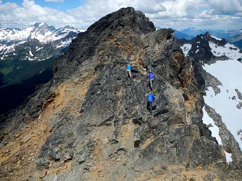
3 Guys Wearing Blue Scramble To The Summit
To approach from the east it is possible to access the unnamed lake off-trail from Suattle Pass and then the southeast ridge. I know one person who has gone that way, but I won’t describe the route in detail since I have not done it.
Camping
Image Lake
There are numerous camping options no matter which approach route you choose. The best spots are located near Image Lake but there are also some very fine meadows just below Suattle Pass on the south side. Leave no trace!