
-
 10245 Hits
-
 85.87% Score
-
 21 Votes
|
|
Mountain/Rock |
|---|---|
|
|
29.79616°N / 9.03533°W |
|
|
Anti-Atlas |
|
|
Hiking |
|
|
Spring, Fall |
|
|
7740 ft / 2359 m |
|
|
Overview
Jebel el Kest (Afa-n-Tmezgadiwine) 2359 m
Afa-n-Tmezgadiwine 2359 m is the highest point of the mighty ridge - overcoming 2000 meters above sea level - which starts from Tizim Waylim Pass 1745 m to the West and ends on Tarakatine Pass 1655 m to the East, running for about 35 kilometers in length. This charming summit is generally known by the simpler name of Jebel el Kest and belongs to the homonymous massive mountain range lying in the Eastern end of the Moroccan Anti-Atlas region, a wide and semi-desert land situated SE of the Atlantic coast. This extensive mountain range overlooks to the North the wide Oued Sous Valley, separating it by the higher High Atlas. To the South Jebel el Kest creates the Northern bank of the amazing Ameln Valley with its traditional ancient Berber villages. There are different routes getting the summit of Jebel el Kest, the more frequented are the Anergui route or Western route and the Tagdicht Route or Eastern route, joining each other in the highest part of the itinerary.
The easier route is the second one, starting from the village of Tagdicht and involving approximately 1000 metrs of height gain in over 4 km. It's a long hike on rough ground, but it doesn't involves any climbing and experienced walkers can make the ascent unguided. Anyhow be aware that the itinerary is not always easy to find and there are no rescue services in the region.
Getting There
The closest town to stay is Tafraout, a nice town lying about 400 Km south to Marrakech and 170 km South-East to Agadir, providing a wide range of facilities. Tafraout is located to the South of Jebel el Kest in a wonderful setting.

The starting point to climb Jebel el Kest Normal route is Tagdicht, one of the highest villages on the eascarpment, located at about 1400 m above sea level, just beneath the summit of Jebel el Kest and approached by a very impressive mountain road. To take it easy, overnights can be arranged in Tagdicht, alternatively you can climb Jebel el Kest in one day climb directly from Tafroute by a dawn starting.


The amazing oasis of Tafraoute can be reached from Marrakech or Agadir, both provided by several international flights. Once at the airport the best choice is hire a car (in the Airports there are many Car Hire Agencies).


- From Agadir the travel is shorter (you can drive to Tafraoute in 2 hours on a good 170 kms long road), but the flights’ choice is more restricted.
- From Marrakech the road to Tafraoute involves a trip of 400 Kms and takes nowadays about 5 hours via the new Motorway connecting Marrakech to Agadir, then following a busy road via Inezgane (close to Agadir), Biougra and Ait Baha; alternatively if you are provided with a good availability of time you can follow the longer road via Asni, through the High Atlas range, a scenic trip along a narrow mountain road inside a charming and high mountain landscape, and descending then to Taroudant (it takes at least 7-8 hours).

Road approach to Tagdicht
From Tafraout drive to the main Ameln valley. At the junction turn to left (West) and carry on along the road for about 3 km. after the junction, reaching a road starting on the right and leaving the main one (signposts). Take this road rising by some hairpins and then entering the valley of Tagdicht, reaching the secluded village of Tagdicht by an impressive trip.
Jebel el Kest Normal route from Tagdicht (Eastern route)
Jebel el Kest Normal route from Tagdicht (Eastern route)
Summit altitude: m. 2359
Difficulty: Walk
Vertical gain: 1000 m
Exposure: East
Starting point: village of Tagdicht

")

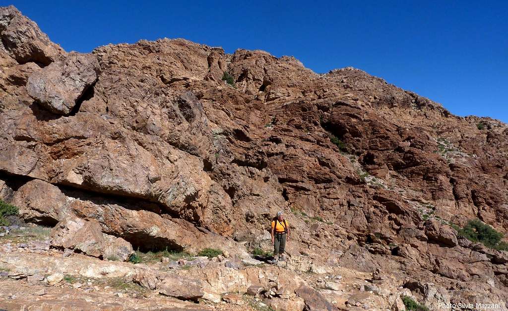
Route report - The route is clear enough to follow and sufficiently marked with cairns, however be careful in Tagdicht because the starting is not signposted and it's not easy to find. After parking the car, cross the village to the left (West) walking along a narrow road through the houses. Once reaching the western end of the village cross a valley and walk up the opposite slope following a winding path, then continue slanting left. Cross a characteristic narrow rocky saddle and then climb long on good track.


After a small saddle, walk along a hill, getting the junction with the trail coming from Anergui (West). Head to the right, taking a path on a slight slope marked by cairns passing near a characteristic shepherds cave and getting a wooded valley at the base of the summit rocky escarpment. Steeply up along the narrow vegetated valley, exiting onto an open ground and continue until you reach the base of an easy rocky ramp.


")
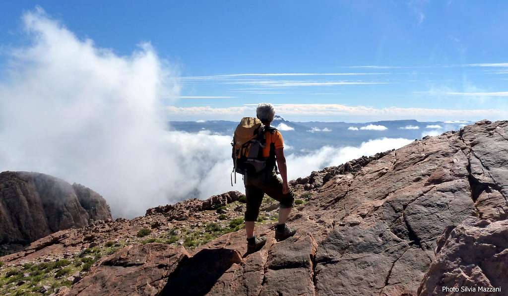
Climb easily the rocky slope that doesn't involve climbing to reach the extensive summit of the mountain with the summit signal and some characteristic stone shelters. Everything is wonderful and unique and the view is extraordinarily extended: to the South appears Ameln valley with Berber villages and the second highest mountain of the Jebel el Kest range, Adrar Mgourn. On the summit you will find some surprising ancient shelters, home to a local religious hermit, who chose to spend the rest of his days here!
Descent: reversing the same route. Be aware that on the descent the route is most difficult to follow, particularly in its lower part


Other routes

The other Normal route to climb Jebel el Kest starts from the village of Anergui.
Red Tape
No fees no permits required
Flora and fauna


The landscape is marked by the shape of the Argan, an endemic tree producing plenty of berries, which precious oil finds a large use in cooking and beauty culture, and by the palms in the oasis. We can find some other spiky vegetation as prickly pears, the common "cactus"-like plant that is often seen in the area and the rounded and beautiful but unpleasant Euphorbia everywhere along the approach trails and on many climbing routes; the Euphorbia is growing mainly on the slopes and on the steep walls facing South and it must be carefully avoided because of its irritant white milk, released when the plant is disturbed.


The area counts many species of mammals, like gazelles, antelopes, wild boars , the native grey squirrels named "sib-sib", and many kind of birds. Various kind of poisonous snakes and scorpions have been reported, but it’s rare to meet them during late fall and winter months.
Accomodation
The town of Tafraoute provides different accomodation in hotels and an equipped campsite.
The Hotel Les Amandiers is located on a hill dominating the town HOTEL LES AMANDIERS
Other options in Tafraoute: Argana Guesthouse www.argana-tafraout.com, Hotel Salama, Auberge Les Amis and Hotel Tete du Lion
When to climb

The best seasons to climb are fall (from the end of october) and spring, till april, when the weather is mainly fine and the temperature is pleasant. Late in the spring and in summer the temperature rises up dramaticaly, and climbing is virtually impossibile. Winter (december to february) is traditionally the wet season and rain, cold and even snow, on the highest peaks, sometimes may be a problem. Nevertheless, you can find often pleasant temperature also in winter during the day, though the evening and the night can be quite chilly.Add External Links text here.
Guidebooks and maps
"Tafraout - Rock Climbing in Morocco's Anti-Atlas" Vol I - The South Side of Jebel El Kest and the Ameln Valley by Steve Broadbent, Oxford Alpine Club 2013
“Climbing in the Moroccan Anti Atlas – Tafraoute and Jebel El Kest” by Claude Davies, Cicerone 2004