
-
 15268 Hits
-
 87.21% Score
-
 24 Votes
|
|
Mountain/Rock |
|---|---|
|
|
44.60924°N / 109.768°W |
|
|
Mountaineering, Scrambling |
|
|
Summer |
|
|
11922 ft / 3634 m |
|
|
Overview
Deep inside the wildest mountain range of the Lower 48 yet not so deep as to require several days to get to and from it, Sunlight Peak is one of the best mountaineering objectives in Greater Yellowstone for several reasons:
- Climbing it is neither very hard nor very easy.
- It is a beautiful mountain when viewed from any direction.
- From the summit, there are no views of towns or paved roads. There is an ocean of mountains.
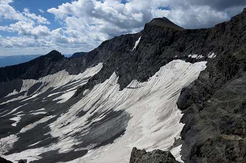
- There is a [dying] glacier at its base, and many approaches will involve crossing that glacier.
- A Class 4/5 traverse to Stinkingwater Peak is possible.
- Since there was no register or cairn up top as of July 25, 2015, you might have the chance to be the first (or the latest) to mar this summit with your sign. Spray away!
- At the right (or wrong) time of summer, a climber may find himself or herself among so many grizzlies that it may seem as if life has become a National Geographic special.
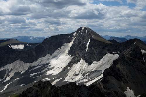
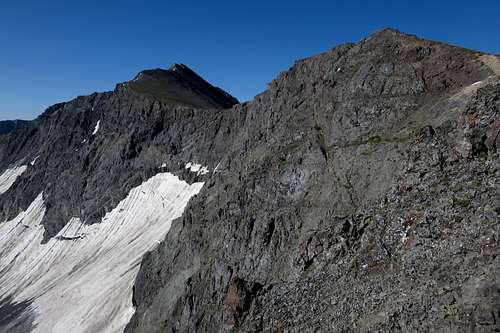
Sunlight Peak from Stinkingwater Peak
The Absaroka Range has just one 13er but many 12,000+ peaks both named and unnamed, which means that Sunlight Peak, less than 100' under that magic mark, might not make it onto a lot of to-do lists (not a bad thing at all), but seeing its distinctive profile and its position is going to make serious mountaineers want to climb it.
Fun fact: the view from Sunlight Peak does not take in Sunlight Basin proper; Stinkingwater Peak does offer a view into the higher parts of the basin.
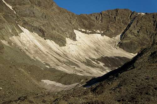
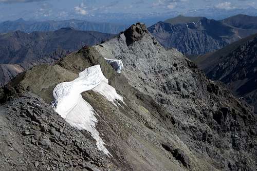
Sulphur Glacier, Dawn
Warning: If you have any issues whatsoever about bears, avoid this peak. Grizzlies are abundant in this mountain range, and they may have a liking for this section in particular. On the day my friend and I climbed this peak, we counted 20 different grizzlies on the slopes, and some, including a huge male, were quite close. We had happened to pick a day when the bears were scouring the talus slopes for nesting moths, and they were so busy eating that all but a few completely ignored us, but it was nonetheless disconcerting to be surrounded by 10,000 pounds or so of possibly grisly death that day (pun intended). For two people used to seeing grizzlies and comfortable going out into their dominion, we still were worried about all that could have gone so badly wrong, so anyone who would really rather not include close encounters with grizzly bears among his or her Greater Yellowstone experiences should probably stay away from here.
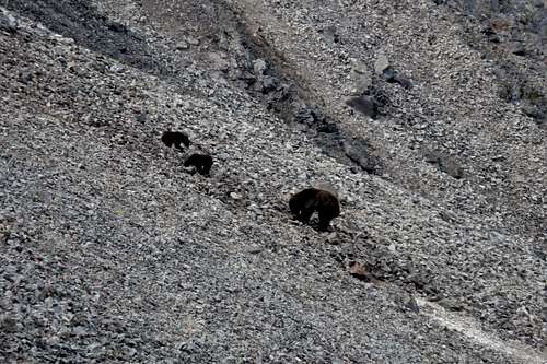 Mama Grizzly and Cubs on Sunlight Peak | 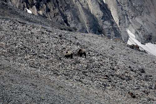 Grizzlies |
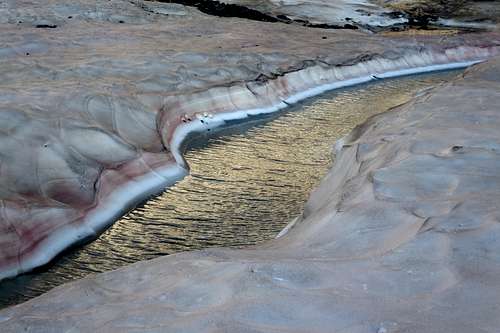
Open Channel in the Sulphur Glacier with Dawn's Reflected Light
Getting There
If you're solid on exposed, unprotected Class 3/4 rock in the mountains, then the crux might be the approach.From WY 296 turn onto the signed road following Sunlight Creek into Sunlight Basin. This road is between Dead Indian Pass and Sunlight Bridge and is actually just before Sunlight Bridge if one is approaching from Dead Indian Pass, and just after it if one is approaching from the Beartooth Highway.
Drive about 20 miles, past where state maintenance ends and the road gets narrower and rougher, to an unbridged crossing of Sunlight Creek. Shortly before this spot, there is a turnoff on the left side.
Drive about 20 miles, past where state maintenance ends and the road gets narrower and rougher, to an unbridged crossing of Sunlight Creek. Shortly before this spot, there is a turnoff on the left side.
If the water is low enough and if you have high clearance, drive down, cross the water, and go as far as you can and then park without blocking the road.
If the water is not low or if you do not have high clearance, park in an obvious turnout area just up the road.
Now, if you have real 4wd and high clearance and are up for some rugged driving, cross the creek and keep heading up the main road as far as you dare. It really is not too bad, but up high, it gets very narrow, steep, and rocky, with few options for turning around or pulling off easily. But if you and your vehicle are up to it, you can drive to within just yards of the logical place to camp, a meadow beneath the steep slopes leading up the the basin below Sunlight Peak. An added bonus is that you can store food in the car; the closest trees are a hassle to get to.
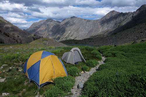
A Great Campsite
Driving the road can save up to 5 miles and 2000' of elevation gain.
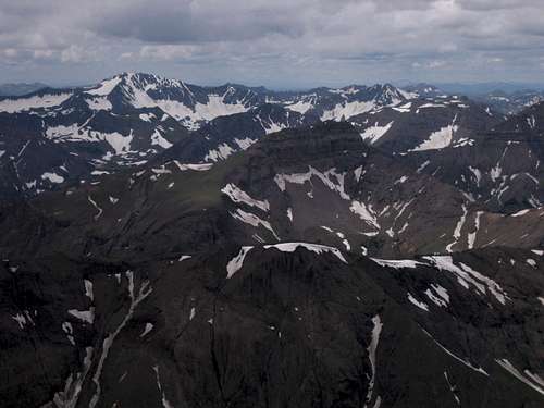
Dead Indian Peak-- Summit View-- Sunlight and Stinkingwater Peaks
Route
This assumes you have hiked or driven to the aforementioned camping location. One-way distance from this point is about 3 miles, with an elevation gain of about 2600'.
Head up steep slopes to a moraine and then to what is left of the Sulphur Glacier. Head north along or beside the glacier (this is low-angle terrain and more snow than ice; crampons will usually be overkill) in a northerly direction to ugly-looking scree slopes leading up to a notch. This notch is not the saddle marking the lowest point on the ridge between Sunlight Peak and Stinkingwater Peak; it is the next notch south of it, or left of it as you face it from here.
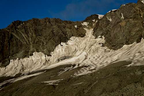 Sunlight Peak and Sulphur Glacier, Dawn | 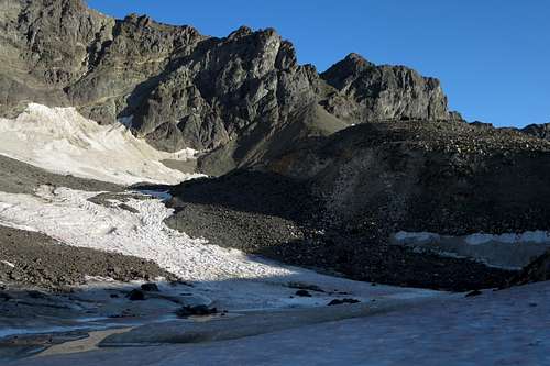 Route to Notch |
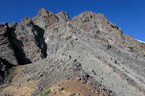
Suffer up the scree. Actually, you can get on a rock rib some way up and climb reasonably good (by Absaroka standards) Class 3 and 4 terrain almost all the way to the notch. This is more challenging technically but far less physically exhausting for someone like me who hates slogs up sand-like scree above almost all other things.
Sunlight Peak and Sulphur Glacier
From the notch, work south and actually descend a hundred feet or so. When you see a system of chutes and broken ledges leading up to the ridge again, take it. This can be kept Class 3 without too much effort.
Back on the ridge, you soon reach an exposed chockstone that is not really that difficult to surmount but is probably the mental crux of the route. There is a workaround below and to the right, but it is more difficult even though it is less exposed.
 NE Ridge Route 1 | 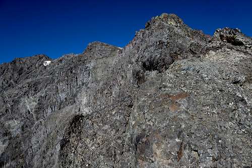 NE Ridge Route 2 |
 NE Ridge Route 3 | 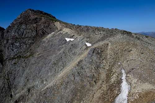 NE Ridge Route 4 |
After that, there is a little more scrambling before the route becomes a ridge walk over some false summits until you reach the true one. It is too bad that the last false summit is not the real one; it is smaller, more aesthetically pleasing, and challenging to reach than the true summit is.
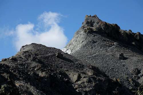
False Summit
False Summit from True Summit
Red Tape
It's prime grizzly country. Make noise, carry pepper spray and have it accessible at all times, and know how to behave around the bears.Sunlight Peak is on the border of the North Absaroka Wilderness, but in case you cross over for some reason, the following acts are prohibited in the North Absaroka Wilderness:
- Camping within (50) feet of any trail.
- Grazing livestock at sites posted as closed to livestock grazing.
- Using a campsite or other area with a group exceeding (20) persons and or a combined number of pack and saddle stock exceeding (30) animals.
- Possessing, storing, or transporting food for livestock except for pelletized feed or processed grain (rolled). Cubed hay is authorized only if certified weed seed free by an authorized Federal, State, or County Officer.
- Camping or otherwise occupying a single location for a period exceeding (16) consecutive days.
- Leaving camping equipment unattended for a period greater than 48 hours.