Overview
Finding a small amount of solitude in Sedona can be tough, especially on shorter hikes. On busy weekends, finding a parking space is a challenge of itself! For those looking for a shorter hike that is a little less crowded, Mescal Mountain fits the bill. Thanks to an unmarked, unofficial climbers trail, Mescal Mountain is easily accessible but infrequently climbed, and some short class III runs weed out even more casual hikers. Unlike many of the smaller buttes around Sedona, Mescal has a tree-less, sandstone highpoint, offering impressive views for a low summit. Additionally, the hike passes some old Native American ruins tucked into a sandstone cave on the ridgeline.
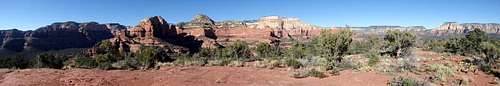
![Mescal Mountain Summit]() Summit Panorama
Summit PanoramaGetting There
From 89A in Sedona, turn onto Dry Creek Road, heading to the northwest. Follow this for two miles, after which the road becomes Boynton Pass Road. Continue another mile to a T-intersection and three- way stop. Turn right onto Long Canyon Road and drive 0.6 miles to the Long Canyon trailhead with limited parking. Alternate parking can be found closer down the road at the Mescal Trail parking lot, which connects with the Long Canyon trail.
Route
Round Trip Mileage: 3.0
Elevation Gain: 750′
Class III
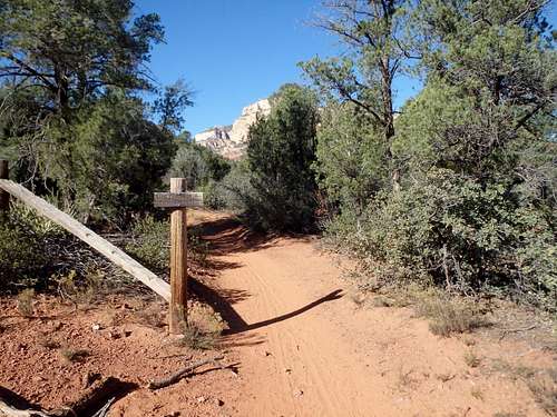
![Unnamed Image]() The turnoff
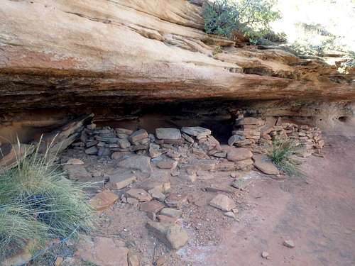
The turnoff![Grandma's Cave]() Grandma's Cave
Grandma's CaveFrom the Long Canyon Trailhead, follow the wide, sandy road through Juniper with a small creek to the right. Continue on this for 0.6 miles until you reach an old barbed wire fence. Take a use trail heading to the left through the trees, heading directly toward a shallow saddle on Mescal Mountain's North Ridge. There are a few branch points from use trails heading towards small sandstone caves, but keep on the main trail, more or less heading directly towards the lowpoint on the ridgeline. The use trail quickly switchbacks up to some small ruins in a sandstone cave just below the saddle. This is known locally as "Grandma's Cave." Scramble up the remaining sandstone benches to the ridgeline. Once on the ridge, the route-finding becomes a bit more challenging. There's a decent use trail along the left side of the ridge, heading towards the summit cliffs. Traverse along the base of the cliffs for roughly a quarter mile until reaching a short, class III crack that climbs back up to the right. That will bring you through the lower cliff bands. Above the crack, continue following a use trail to the east, past several shallow sandstone caves to a breach in the higher sandstone benches to the summit plateau. From there, the high point is a short walk to the southwest for unobstructed views.
Red Tape
None. The Red Rocks Pass is not required for parking at this trailhead.
When to Climb
Can be hiked year round. Early starts are recommended in the summer, both due to the heat and afternoon thunderstorms. Winter could bring snow and ice to the summit, but typically only right after a storm.
Camping
There are numerous lodging options throughout Sedona. The best developed camping can be found in Oak Creek Canyon to the North, although this highway can get very congested in the summer. At large camping is a bit more difficult around Sedona than other places, but I've heard there are some spots along Schnebly Hill Road to the east.