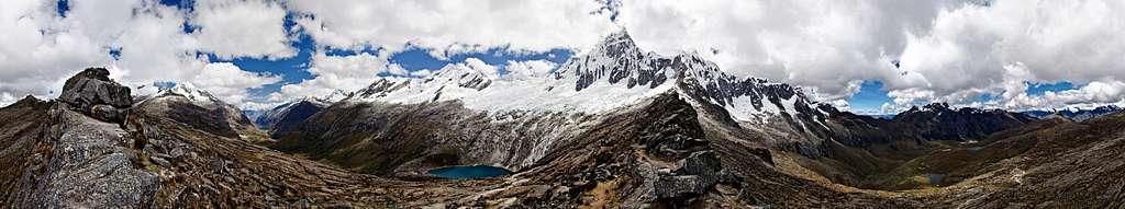
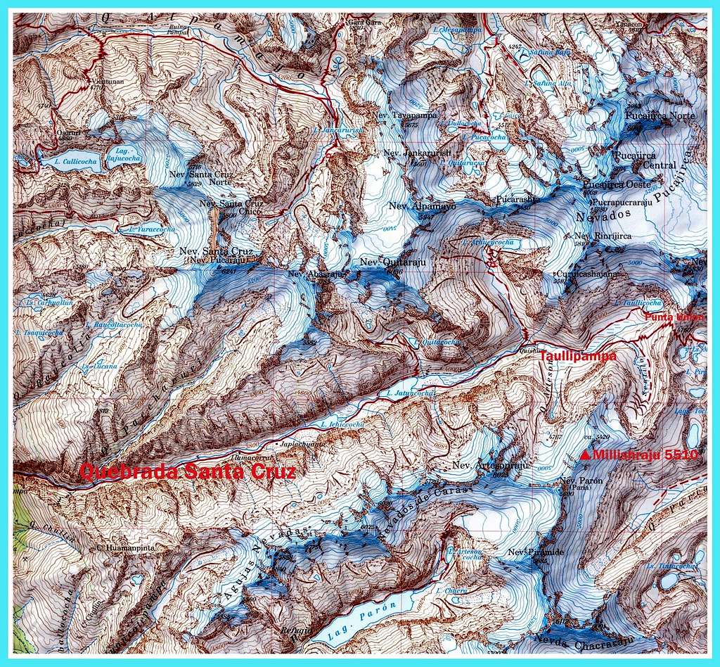
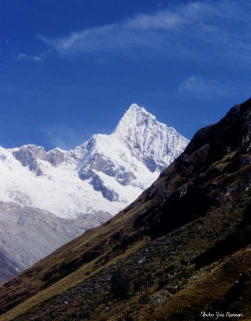
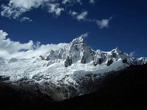
Millishraju I and Millishraju II are a couple of twins snow capped “nevados” belonging to the extensive Huandoy Massif in the Cordillera Blanca, Ancash region. The peaks are located between Nevado Paròn to the South and the small Sentillo to the North in a short side valley starting on the right (left orographic) of Taullipampa. Taullipampa is an extensive grassy plateau located at 4250 meters at the foot of Nevado Taulliraju, at the head of Quebrada Santa Cruz, one of the longest valleys in the Cordillera Blanca, the same one leading to Alpamayo/Quitarajo BC. The trail going up Quebrada Santa Cruz is probably one of the most frequented of the Cordillera Blanca, so expect lots of people, but less then in Llanganuco or Quebrada Ishinca. Millishraju I and Millishraju II are far, not well known and even less frequented peaks opposing minor technical difficulties and offer a complete view over the Northern sector of Cordillera Blanca. The twin Millishraju involve a quite long approach and therefore their ascent is useful as acclimatization climb in view of more challenging ascents located in the same Quebrada Santa Cruz, as Quitaraju or Alpamayo.
View from Punta Union (head of Quebrada Santa Cruz) - ph. nattfood
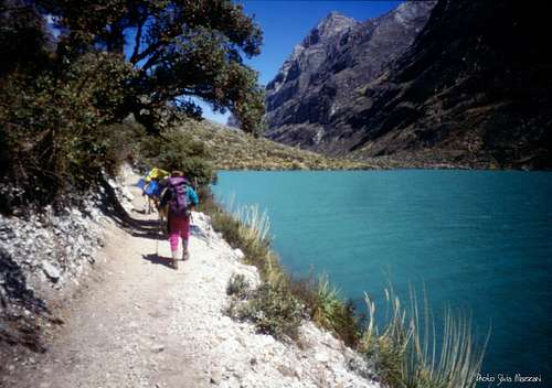
Otherwise to climb Millishraju may be a profitable completion of the famous trek Cashapampa – Vaquería, a plus by means of achieving a profitable summit. This trail is considered as one of the most interesting round trip in Cordillera Blanca in reason of its exceptional beauty and easy access, crossing extraordinary landscapes. Here we can contemplate long wonderful "lagunas" sparkle in the sun and spectacular snow-capped mountains such as Alpamayo, Quitaraju andArtesonraju.
Paron Grande & Twins Millishraju from campsite PariaTwins Millishraju and Paron seen from Artesonraju moraine camp
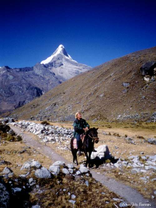
At the head of the "quebrada" the jagged Taulliraju soars skyward like a snow-covered rocky castle Once at the pass of Punta Union 4,750 m, it appears a fantastic variety of scenery, endless Andean valleys and glacial lakes.
History
Twins Millishraju and Paròn from Alpamayo Morraine Camp
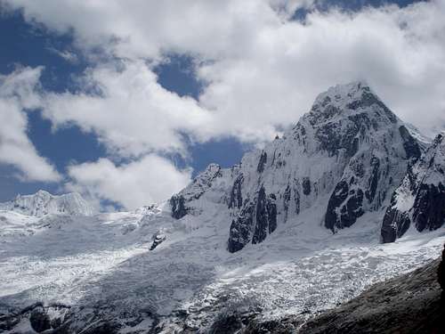
East of Artesonraju there is a glacier-filled basin, surrounded by Artesonraju itself on the right, the Nevado Parón at the head and a ridge of ice-covered summits (Millishraju) on the left, all about 18,200 feet, heading north-northeast from the Nevado Parón towards Taulliraju. These peaks were climbed for the first time by a German team from Monaco of Bavaria composed by H. Huber, A. Koch, H. Schmidt on august 16th 1955, who climbed along NE and North ridges, then six years later by an italian party from Torino in 1961. See more info here: German Expedition 1955 Afterwards, a Swiss team which climbed these peaks in the year 1965, proposed to call them Millishraju (Twins), as two of them are nearly identical. The first summit starting from the south, Millishraju I (18,078 feet), was climbed on July 30 by Emilio Angeles, Boiler, Comtesse and the Spoerrys along its south ridge. The second summit from the south, Millishraju II (18,045 feet), was climbed on July 29 along a new route on its West face directly to the summit by Georg Hartmann and Ruedi Schatz, Swiss Alpine Club. It was on moderately steep ice.
Getting There
Getting to Lima
There are different flights getting to the Aeropuerto Internacional "Jorge Chavez" in Lima, both from Europe and North America, obviously many more from South America. The airport is situated in Callao (about 12 km West to downtown).
Getting to Huaraz
Huaraz, the capital of the Ancash region and Cordillera Blanca, is a lively and bustling city located about 3000 meters above sea level, which offers several opportunities for accommodation and food, and also easily the possibility to arrange on-site transportation and trekking for people who haven't previously booked any service. Sometimes there are flights joining Lima and Huaraz, but nor regularly. The best way to reach Huaraz is at moment a 6-8 hours trip by bus or private minibus (if you're travelling with a group or an organized expedition). Currently comfortable coaches provide a good transportation from Lima to Huaraz. There are six different bus companies; the best ones are Cruz del Sur, Movil Tours and Ancash Express.
Alpenvereinskarte 03/a Cordillera Blanca Nord
Getting to Cashapampa
The starting point of the trail to Quebrada Santa Cruz is situated in Cashapampa 2900 m, a little "pueblo" located in the Northern Cordillera Blanca, some km N to Caraz. In Huaràz you can take a "colectivo" (public transport) to Caràz and another one from Caràz to Cashapampa. Otherwise in Huaràz you can also arrange with a small truck owner to bring you straigth to Cashapampa. This is surely the quickest way and the most convenient option if you share the transport with other passengers. The best choice is to arrange previously for "burros" (donkeys), anyhow if you haven't provide for in Huaraz, in Cashapampa you can hire arrieros (muleteers) with the traditional burros (donkeys) to help you to carry your gear along the trail. Be aware that if you didn't pre-arranged burros in Huaraz and you arrive late in Cashapampa, you may end up staying overnight there.
Quebrada Santa Cruz trail description
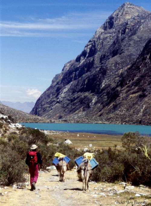
Cashapampa 2900 m - Llama Corral 3800 m
At first the path rises quite steep along the valley, inside a narrow canyon between high rocky walls. In the first half we gain in altitude, in the second half in the distance. After the rocky gorges, the valley widens and the trail becomes less steep to arrive after about 2,30-3 hours at Llamacorral, where it's convenient to arrange the first camp.
Quebrada Santa Cruz
Artesonraju
Alpamayo seen from Q. Santa Cruz
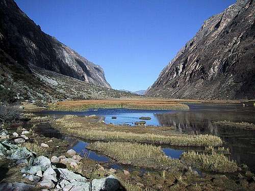
Llamacorral 3800 m - Taullipampa 4200 m The trail continues up the valley coasting in succession two wonderful and extensive lagoons, at first the smaller Ichiccocha with a particular habitat of birds and aquatic flora, then the larger one, Jatuncocha, meaning "large lagoon". During the walk we will observe the Caraz, Quitaraju, Alpamayo and Artesonraju.
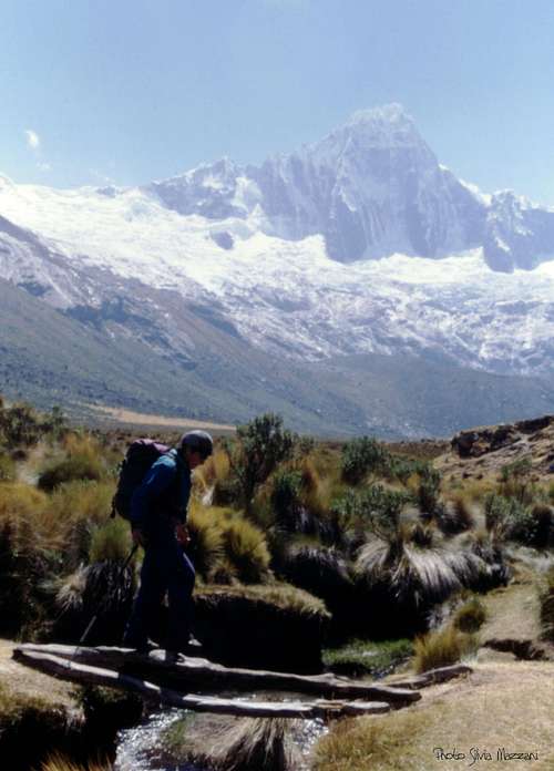
Approach in Q. Santa Cruz
Ichiccocha lagoon
To Taullipampa, Millishraju in background
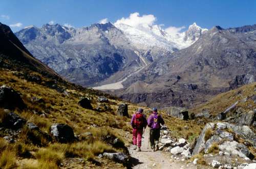
Successively we cross a dry floodplain with views over Artesonraju, getting to a signpost indicating the beginning of the Quebrada Arhuaycocha, leading to Alpamayo and Quitaraju BC. Continue to the right up the main valley without entering the forest, getting the plain called Taullipampa at 4200 meters, just below Taulliraju breathtaking rocky castle.
Taulliraju at sunset from BC above Taullipampa
From Taullipampa we rise again to arrange the camp on a plan a bit above, just in front of the side valley that will lead us to Millishraju. 4 hours from Llamacorral.
Millishraju NE route report
North-East Ridge Normal Route
Summit altitude: 5510 m
Difficulty: Alpine PD-, 30°- 40°
Difference in level: 1250 m. from Base Camp above Taullipampa, 900 m. from Moraine Camp
Exposure: NE
First ascent: H. Huber, A. Koch, H. Schmidt 1955, August 16th
Starting point: Taullipampa in Quebrada Santa Cruz m. 4200
Twins Millishraju from campsite PariaSummit view over Taulliraju
It's the itinerary climbed by the first summiters, a German team, an interesting and worthwhile route with low difficulties, on rock in the first section and then on ice. Summiting directly from Taullipampa is a rather long day, requiring good acclimatization. It's possible to arrange a further camp on the meadows at the head of the side valley below a steep rocky wall, cutting the altitude gain of about 350 meters. Otherwise, if you are well acclimatized, you can start directly from the Base Camp.
Crossing a foot-bridge in Q. Sentillo
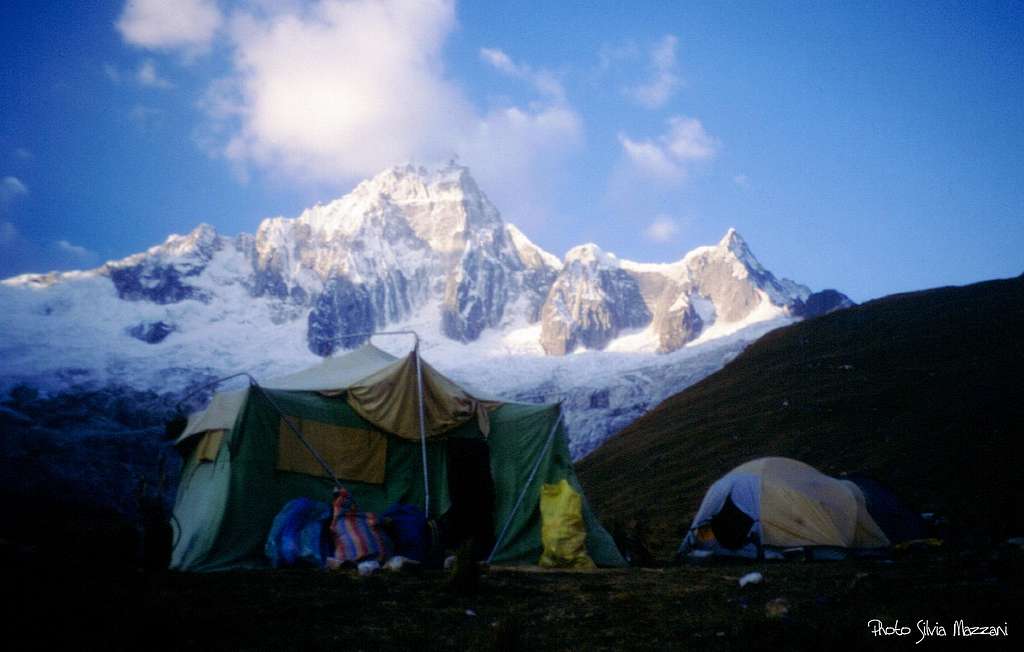
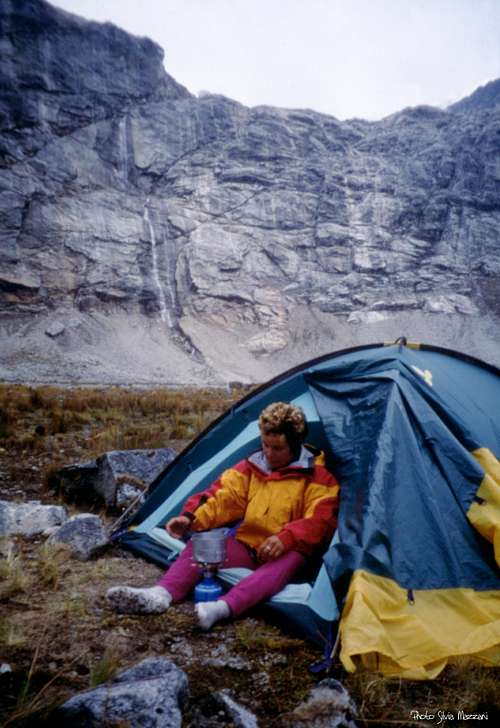
Millishraju campsite
Rocky rampart below Millishraju
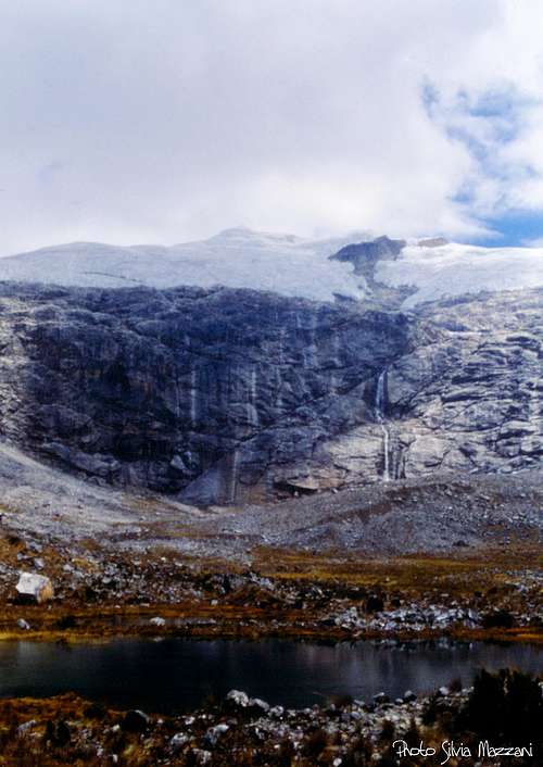
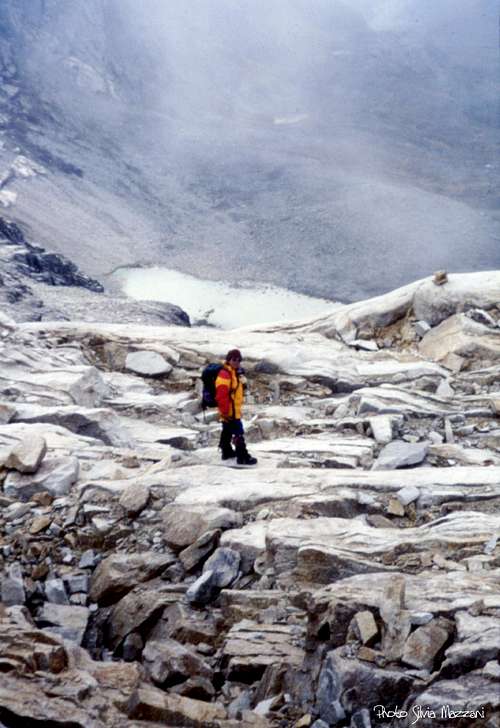
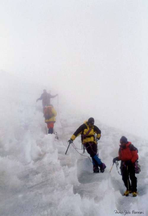
From the BC above Taullipampa head to right (South) entering the Sentillo Valley, a Quebrada Santa Cruz side valley, rather swampy at beginning. Later the trail climbs between boulders and tufts of grass to reach a small lake, then on debris and stones reaches a small grassy plain near the river, just at the base of an imposing rocky ramparts. Here eventually it's possible to put the tent and stay overnight. From the plain reach the rocky wall closing the head of the valley. The wall really seems more difficult than it is! In fact a smart route on easy rocky ground and some ledges, aided by several cairns, allows to climb the rocky rampart getting to a col from which the upper section of the climb, on ice, is quite obvious. Here it starts the glacier. We enrope and start to climb this second section of the route on a steep ice slope, cut by several crevasses.
Above the rocky rampart
"Penitentes"
Crossing crevasses and "penitentes"
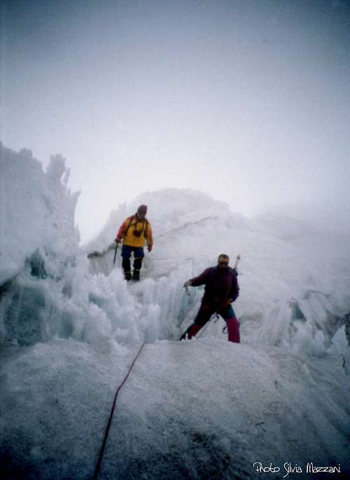
Further the crevassed stretch ends and it begins a large snowy ridge ahead of the summit snow cap. After having climbed the ridge, we do a long crossing to the right that leads just below the bergschrund, often rather wide. Cross the bergschrund and after a steep slope a horizontal field leads to another deep crevasse. Further we find a new bergschrund, the last hurdle to overcome to gain the distinctive summit hood. Descent: reversing the same route
Essential gear
Rope, crampons, long axe, eventually some pickets and 1-2 ice-screws
Red Tape
Nevados Millishraju and the whole Cordillera Blanca are located within Parque Nacional Huascaràn, one of most spectacular high mountain area in Perù, established in 1975 and acknowledged as an Unesco World Natural Heritage in 1985. Unesco Link here: Unesco info
Taulliraju
Taulliraju, other perspective
The Huascaràn National Park is administered by the Instituto Nacional de Recursos Naturales (INRENA). An entrance fee is due. In 2011, the fee for the Huascaran National Park was 65 Soles for 7 days.
Club mosses (Lycopodiopsida) in Quebrada Sentillo, Cordillera Blanca
Since 2011, officially nobody is allowed to climb without a Mountain Guide, except for the persons who are members of a Mountaineering Association. In this case, the permit can be obtained at the National Park Office in Huaraz, showing the Alpine Club card. Always be respectful of this fragile landscape. Carry-out everything you bring in and any litter that you carry-in or that you find on the routes and help to conserve the beautiful landscape! Take care of nature as usual in the natural sites and particularly within the boundaries of all the natural parks.
When to Climb
The dry season in Cordillera Blanca goes from middle May to the early September, coinciding with the local winter, being the Cordillera Blanca situated in the southern hemisphere. Anyhow, still there is usually too much snow dust in May and June for the ascents, the months of July and August are more indicated. Usually the rainy season starts in early September.
Climate and conditions
The Quebrada de Santa Cruz
The climate of the Cordillera Blanca is influenced by both the dry air coming from the Western deserts and the wet air coming from the Eastern amazonicos forests. From May to early September, Cordillera Blanca has some periods of clear weather, expecially in June and July, generally with an alternation of few days of bad weather. During these days the mountains can get some amounts of snowfall. Sometimes August may be a month of change, expecially in the second half, with possible afternoon storms. Being the "Blanca" located in the Southern hemisphere, North and East faces get good conditions first. Cordillera Blanca is suffering because of global warming, with its "tropical" glaciers melting at a rate even higher than the global average.
Accomodation
There is a wide choice of options for accomodation and meal in Huaraz.
Parents refers to a larger category under which an object falls. For example, theAconcagua mountain page has the 'Aconcagua Group' and the 'Seven Summits' asparents and is a parent itself to many routes, photos, and Trip Reports.

 4566 Hits
 84.82% Score
 19 Votes


 in Quebrada Sentillo, Cordillera Blanca")


