
-
 12932 Hits
-
 81.18% Score
-
 13 Votes
|
|
Mountain/Rock |
|---|---|
|
|
34.26110°N / 114.82768°W |
|
|
Download GPX » View Route on Map |
|
|
San Bernardino |
|
|
Hiking |
|
|
Winter |
|
|
4298 ft / 1310 m |
|
|
Overview
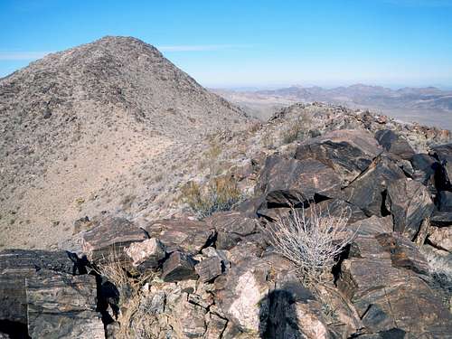
Turtle Mountains Summit
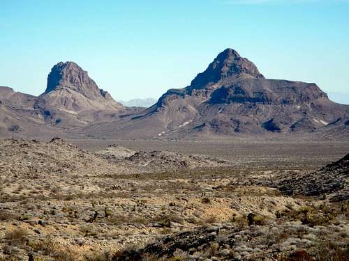
Mopah Point and Umpah Peak
Located in the Mojave Desert, the Turtle Mountains were incorporated into the Turtle Mountains Wilderness in 1994, an area of 177,209 acres. There is a high concentration of desert tortoise in the range, especially the northern segment. It is likely that these mountains were named for this abundance of desert tortoise. At that time, the difference between a turtle and a tortoise was not widely understood. But tortoises are not the only animal present. Bighorn sheep, coyote, jackrabbits, kangaroo rats, quail, roadrunners, golden eagles, falcons, rattlesnakes, and several species of lizards also make their home in the Turtle Mountains.
![Tortoise Shell]()
Tortoise Shell

Tortoise Shell
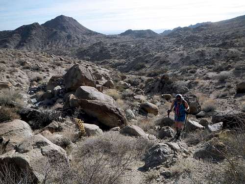
There is no trail to the summit of the Turtle Mountains, however it is a relatively easy class 2 desert hike, compared to the more technical peaks like Umpah and Mopah. Vegetation is somewhat sparse and navigation is not a serious challenge. In fact, the most difficult thing about reaching the high point of the range is likely the drive in, which can be confusing in one spot where it crosses a wash.
![Cactus]()
Summit Views
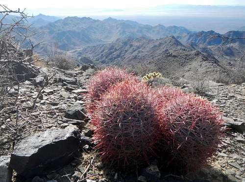
Summit Views
The standard southeast used to be a half day ordeal but the designation of the wilderness has prohibited motorized travel on the final stretch of road and just about doubled the hiking distance. Watch for crescent shaped tortoise burrows in the washes and keep in mind that these animals spend most of their time inactive and typically only range within a single square mile during their lifetime.
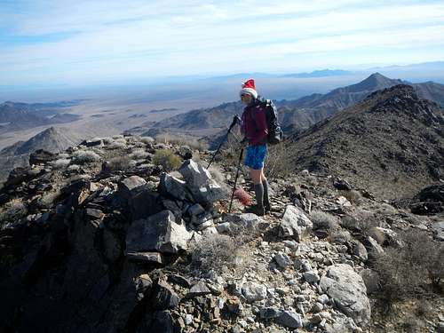
On The Summit
Interactive Route Map
Standard Route
The Pass
Near The Main Divide
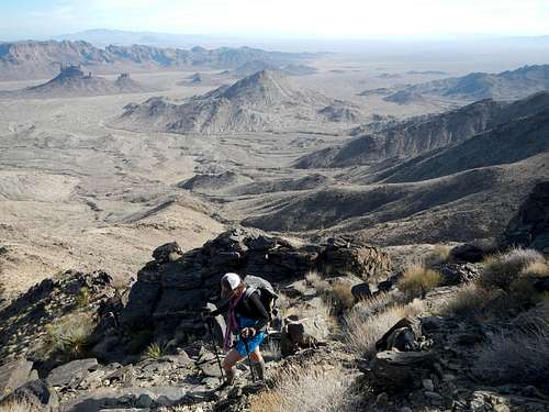
From the pass traverse west by northwest crossing several hidden washes. Choose one of the minor ridges on the east face of the main divide and follow that up to the south ridge crest. These eastern ridges are the steepest part of the route and might contain some loose rock. Follow the main divide north to the summit where a register can be found in a large cairn.
Driving Directions
This approach drive is not one of the grip-your-steering-wheel and hope you don't get stuck in the sand types, but it is somewhat confusing even from the start. For that reason it is strongly suggested that you don't attempt it in the dark. Also four wheel drive and high clearance are required.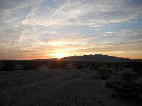
Turtle Mountains At Sunrise
The turnoff for this approach is located on Highway 62, 8 miles southwest of Vidal Junction or 32.7 miles east of the junction with highway 177 (Rice Road). Starting from highway 62, cross the aqueduct and then follow the unsigned Vidal Wash road west. After crossing the aqueduct there are several junctions. Take the one which heads down into a sandy wash and then back up the west side heading away from the aqueduct. 1.9 miles west of the highway turn northwest on the unsigned Horn Spring Road, always following the main road, shortly thereafter crossing a four-way junction.
![Castle, Mopah, Umpah]()
Castle Rock, Mopah Point and Umpah Peak
Continue another 4.8 miles (6.7 total) northwest to a sharp junction (34.188523, -114.751343) and turn southeast. This is where things get interesting (34.186386, -114.748740). Enter the wash and follow the road to the far side (34.186694, -114.747189) and out of the wash and then turn north. The road may not be visibly detectable inside the wash.
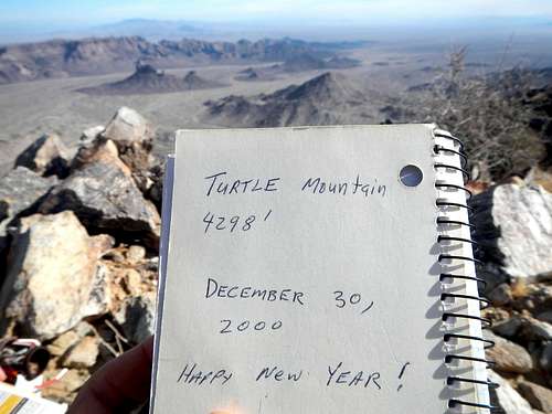
![Turtle Register]()
Summit Register
After the wash continue north on the main road for another 2 miles to the obvious parking area at the edge of the wilderness boundary.
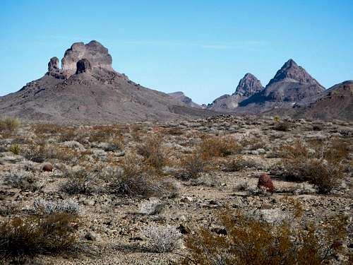
Castle Rock, Mopah Point and Umpah Peak
Continue another 4.8 miles (6.7 total) northwest to a sharp junction (34.188523, -114.751343) and turn southeast. This is where things get interesting (34.186386, -114.748740). Enter the wash and follow the road to the far side (34.186694, -114.747189) and out of the wash and then turn north. The road may not be visibly detectable inside the wash.
Summit Register
After the wash continue north on the main road for another 2 miles to the obvious parking area at the edge of the wilderness boundary.