
-
 10584 Hits
-
 80.49% Score
-
 12 Votes
|
|
Mountain/Rock |
|---|---|
|
|
37.95930°N / 107.76361°W |
|
|
Ouray & San Miguel |
|
|
Hiking, Mountaineering |
|
|
Spring, Summer, Fall, Winter |
|
|
13436 ft / 4095 m |
|
|
Overview
 T 5 summit
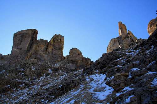 Virginius Pass
T 5 combines well with an unranked Mendota Peak. It is worth to hike to the summit of Mendota and get great views down into Telluride.
The Guide to the Colorado Mountains with Robert Ormes (sort of a bible of Colorado Mountains) only briefly mentions T 5 in reference of peaks accessed from Imogene Pass Road. "...when you pick out a very obscure trail which ascends east to a shallow dip on Mendota Peak's south ridge. The unmaintained trail drops briefly into the extreme upper portion of Marshall Basin, where a maze of old mine roads all descend ultimately to Imogene Pass Road. The trail ascends northwest obscurely, then disappears into the scree just below a pass connecting with the Governor Basin side, only to rise to a surprisingly inviting portal on the divide crest. From this seldom visited pass, T 5 (13,436') is a short 0.5 mile climb east."
Don Scarmuzzi in Telluride Trails describes the route from Telluride side - from Tomboy Road.
The famous Hardrock 100 mile race runs through Virginius Pass (just 0.5 mile below the summit of T5).
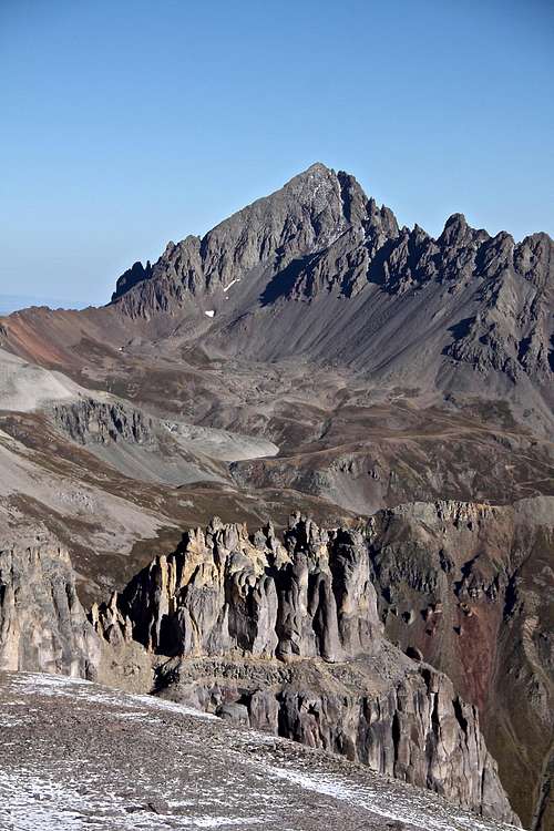
What's up with the name? There are many summits that have unofficial names that have sprung up because of local usage or traditional agreement in the climbing community. Examples of these are some of the "T", "S", or "V" designation summits in the San Juans.![T 5 - summit view]() T 5 - summit view: Mount Sneffels in the center, Gilpin to the left and Cirque Mountain to the right.
T 5 - summit view: Mount Sneffels in the center, Gilpin to the left and Cirque Mountain to the right.
Colorado Rank: 293
Saddle elevation: 13,020
Line Parent: 13,510 feet
Proximate Parent: Mount Emma
Nearby Peaks:
- Mendota Peak 0.82 miles
- "Tomboy Peak" 1.06 miles
- Saint Sophia Ridge 1.29 miles
- United States Mountain 1.34 miles
- Chicago Peak 1.55 miles
- Mount Emma 1.80 miles
- Potosi Peak 2.24 miles
- Gilpin Peak 2.48 miles
- "Coffeepot" 2.57 miles
- T 7 2.80 miles
- Telluride Peak 2.82 miles
- Teakettle Mountain 2.85 miles
- T 8 2.86 miles
- Mount Sneffels 3.43 miles
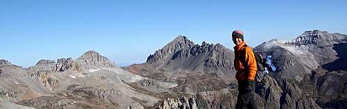 T 5 - summit view: Mount Sneffels in the center, Gilpin to the left and Cirque Mountain to the right.
 Getting There
From Ouray (also nick named Switzerland of America) drive south on US 550. Pass the first switchback, watch for the turn off for the Camp Bird Road (well marked county road 361). Cross the gorge over Uncompahgre River (this is the location of Ouray Ice Park in the winter time). Continue driving up the road - it is a well kept dirt road, easily passable for passenger vehicles. At about 4 miles you reach Senator Gulch, this is a winter closure site. Continue higher up the road, it has some spectacular shelf sections, pass the intersection for Imogene Pass Road. At 6.7 miles you reach another intersection where the road for Governor Basin turns off - well marked. If driving passenger car, consider parking anywhere along this road. If driving 4WD car, continue up the dirt road into Governor Basin (the road was in a great condition in September 2016 - probably passable even for 2 WD cars). I parked about half way up into Governor Basin, but could have easily driven higher. You can park your vehicle near the Virginius Mine remains. Otherwise walk up the road. The views along this section of the road are spectacular.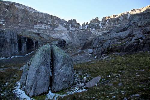
Route Finding: easy (you can see a faint trail)
Length: depending where you start on Government Basin Road, 3.5 miles one way if hiking the road; 1.5 miles one way is starting at Virginius Mine.
I chose to hike the mountain from Government Basin because it is closer to my house than Imogene Pass Road + I also I ran the Imogene Pass Run 4 days ago and was kind of sick of that road. The description below will be from Government Basin.
Hike, or drive up Government Basin Road. This road is spectacular and the views are amazing. It is an exposed and narrow shelf road, but not technically hard. You will reach in intersection where a road splits with left fork going into Sidney Basin and right fork going to Governor Basin. It is signed - take the right fork for Government Basin. You will find several places for car camping here. Eventually you reach a nice flat area about 1/4 mile away from Virginius Mine. Park here if you were driving.
Do not go go Virginius Mine, but instead take the road going left and making switchbacks above the Virginius Mine. The road ends, but you will find a faint path leading up a scree gully to a more open area, then another steeper scree gully, which will eventually take you to Virginius Mine. There are cairns along this section and the trail was pretty obvious. The views are spectacular! especially over Mount Emma, Gilpin Peak, Mount Sneffels and peaks east of Mount Sneffels.
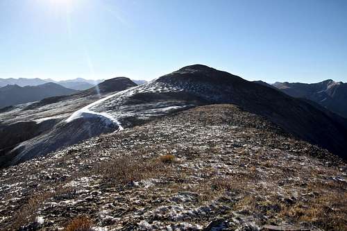
Virginius Pass is small, but obviously touched by human hands with build in shelter. The trail to the left (east) ascends to Point 13,337. The ridge becomes wide and from the summit of Point 13,337 you can see the actual summit of T 5. The summit was marked with a small cairn and a glass register.
On your return you may consider walking the narrow, but easy ridge to the summit of Mendota Peak. The views from Mendota are impressive - there is a huge vertical drop down to Telluride.
Governor Basin is popular in the summer for wildflower viewing. I have hiked mid September and found a slight blanket of snow.
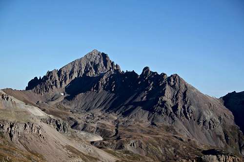
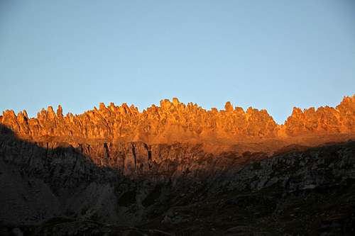 Saint Sophia Ridge - early morning light Saint Sophia Ridge - early morning light | 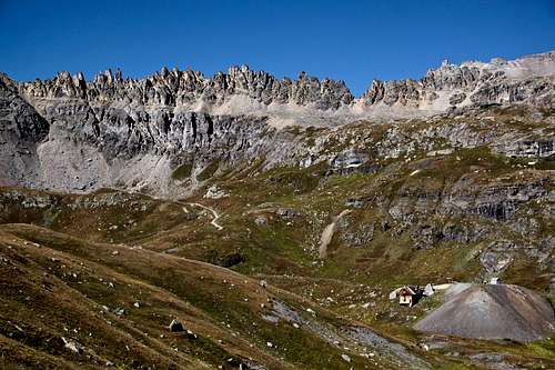 Saint Sophia Ridge - day light Saint Sophia Ridge - day light |
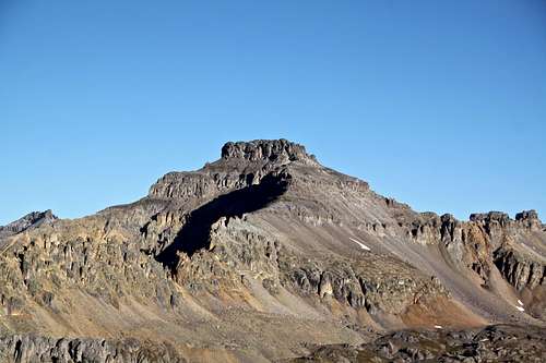
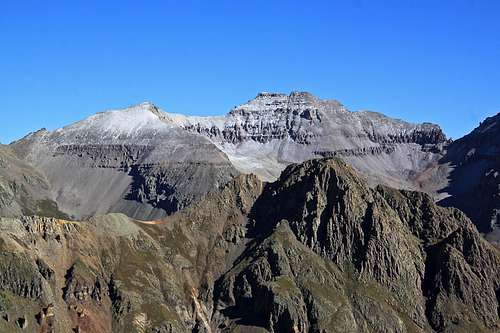
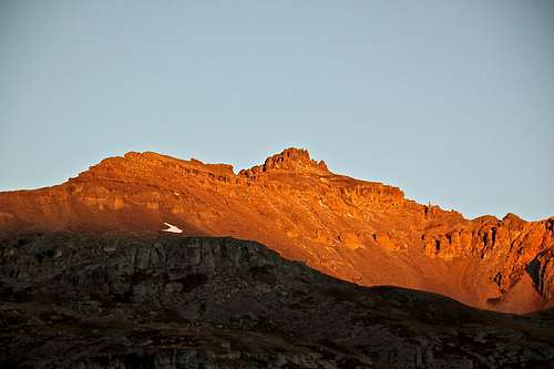 Mount Emma - early morning light from Governor Basin Road Mount Emma - early morning light from Governor Basin Road | 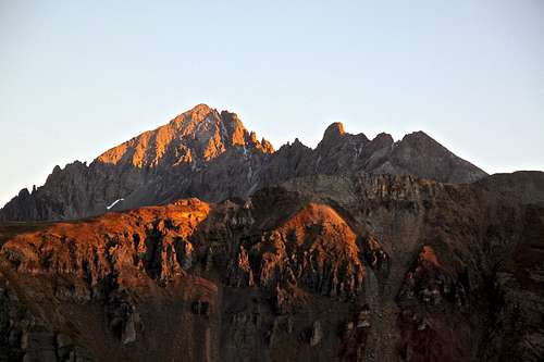 Mount Sneffels - from Governor Basin Mount Sneffels - from Governor Basin |
 Mount Emma - from the trail up Virginius Pass Mount Emma - from the trail up Virginius Pass | 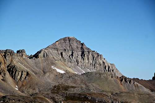 Gilpin Peak Gilpin Peak |
 Mount Sneffles Mount Sneffles | 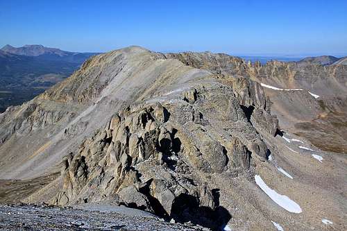 Mendota Peak Mendota Peak |
 Cirque Mountain Cirque Mountain | 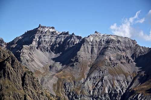 Teakettle Mountain Teakettle Mountain |
Red Tape
Driving into Governor Basin is free. There are some mines in the area and Virginius Mine and Mountain Top Mine are on private land (you cannot drive there).Hiking and camping are free.
When to Climb
Summer is the easiest - great access if you have 4 WD vehicle. Winter provides more challenge. The Camp Bird Rd. gets closed at Senator Gulch area (cca 4 miles from Ouray) and you have to travel on a very exposed shelf road, most likely covered with snow through an avalanche terrain.Camping
There are 2 developed campgrounds along the road to Yankee Boy Basin:- The Angel Creek Campground: no reservations, first come, first serve camping, 10$ per night, 8 designated camp sites with tent pads and fire rings.
- Thistledown Campground: no reservations, first come, first serve camping, 10$ per night, opens in late May, vault toilet.
Higher up there are several places in Governor Basin great for primitive camping. Just drive up and look for several pull outs along the road. The views from these sites are incredible - just across from Potosi Peak and Stony Mountain.