
|
|
Mountain/Rock |
|---|---|
|
|
33.59890°N / 114.02185°W |
|
|
La Paz |
|
|
Hiking, Scrambling |
|
|
Spring, Fall, Winter |
|
|
3639 ft / 1109 m |
|
|
Overview
This Black Mesa lies about 10 miles east of Quartzsite, AZ, just a few miles south of Interstate 10; since there are at least another 6 mountains named "Black Mesa" in Arizona I used the Plomosa Mts. annotation. Black Mesa is the highpoint of the Plomosa Mountains and has 1659 feet of prominence coming in a #116 on the AZ prominence list. It is also the highpoint of the New Water Mountain Wilderness even though the actual New Water Mountain range lies further east. Black Mesa seems to be a little bit out of place in this area because most of the surrounding mountains are much more rocky and craggy whereas this is a perfectly flat mesa that looks very black due to the dark basalt lava rocks all over the mountain, hence its name. Black Mesa can easily be seen from I-10 as it dominates the area and it also affords very nice views from the summit of Signal, Cunningham and Harquahala Peaks. When searching for information on this peak not much came up except an older trip report from 1995; this peak does not seem to see many visitors though we did not find a summit register at the rock pile marking highpoint. There is second area on the mesa within a 3600 contour on the topo map, however that area seems to be lower by 5-10 feet based on sight leveling we did from the summit, so we did not bother visiting it.
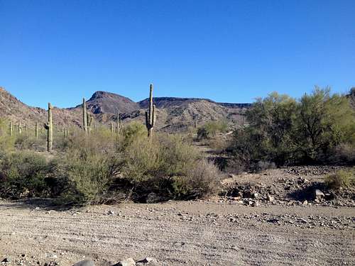
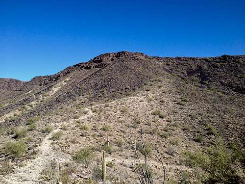
View at Black Mesa showing the gully we took on our ascent
Getting There
Take exit 26 off Interstate 10 about 10 miles east of Quartzsite, AZ, and turn south onto Gold Nugget Road. Follow Gold Nugget Road for about 2 miles as it parallels I-10 passing Guadalupe Peak (the prominent peak with the towers on top). This road is paved, however there is a pretty gnarly wash crossing where the pavement has been washed away which requires some clearance and a strong vehicle with 4WD comes in handy; a low clearance vehicle will not make it through the wash. After 2 miles you come to the intersection with BLM Road 0059 (Road 59) which is marked. Turn right (south) onto Road 59; Gold Nugget Road actually ends shortly after the intersection. Road 59 is pretty rough and there was a steep incline that was very eroded and rocky which requires a high clearance 4WD vehicle. We drove in about 2 miles on road 59 as we came to a very steep and eroded 100 foot drop into a wash at which point we decided to park on walk from here. This section would probably require a strong vehicle with higher clearance and beefier tires. If you could get past this section you would end up in Poormans Wash where the road becomes much better (just sandy or gravely but essentially flat) as it follows the wash. Our parking elevation was 1840 feet.
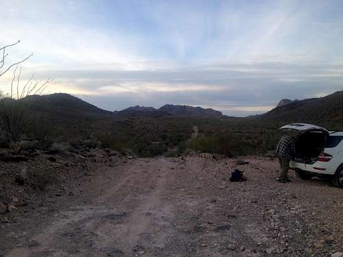
View down Road 59 from our parking spot
Route
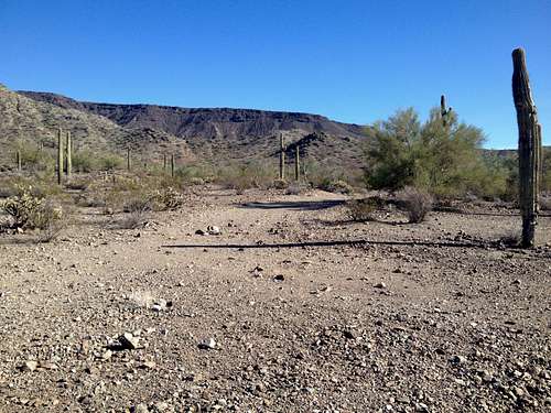
We took a different route on the descent than we did on the ascent essentially making the hike a lollipop loop. Continue to walk on Road 59 from the parking spot dropping into Poormans Wash where the road follows the wash. There are several intersection with minor roads marked with 59A, 59B etc. but always stay on the obvious main road. After 2 miles you will come to the Apache Chief Mine with a stone shack right at the side of the road. Right at the mine the road splits and you want to take the left (going east) branch; the right branch will go to the actual mine. The road now follows the Apache Wash and at the that point you are at the western edge of the New Water Mountain Wilderness indicated by sign posts. After another 2 miles past the mine you come to a faint mining track turning off left and going east towards a prominent hill marked as Peak 2927 on maps. This track is marked on maps.
Turn on to the mining track here; it is marked by a cairn.
Follow this track for about a mile with some ups and downs on the way as it eventually ends at a mining shaft at about 2850 feet below a gully that cuts into the mesa. The actual summit is on the right side of the gully which provides a break in the otherwise vertical cliffs of the mesa. The gully itself is not too steep but very brushy in parts. After about 500 vertical feet you reach the top of the gully where you need to turn right up the now gentle slopes towards the highpoint.
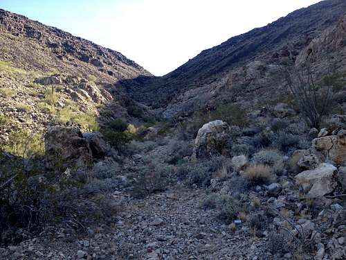
View up the gully
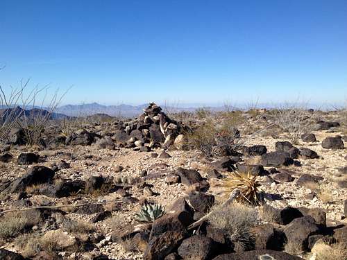
The top of the mesa has the densest ocotillo forest I have ever encountered. The summit is marked by a large rock pile and the benchmark is affixed a nearby rock; we did not find a summit register. For our descent we aimed at a saddle between Black Mesa and nearby Dripping Springs Peak to the southwest of the highpoint where you can pick up Road 59 again. After about a mile and dropping 400 feet in elevation you come to western rim of the mesa where we found a weakness in the cliffs that allowed us to drop towards the aforementioned saddle. We descended the steep bowl and eventually picked up a mining trail on a ramp that led us to the saddle and back onto Road 59.
View up the ramp with the mining track which we descended.
Turn right and walk back about 5 miles to the parking spot.
Our roundtrip distance was 13 miles with about 2000 feet of total elevation game. Our ascent route was shorter but requires climbing up a steep and brushy gully. The descent route was longer by a mile but also easier. The map below shows our route:
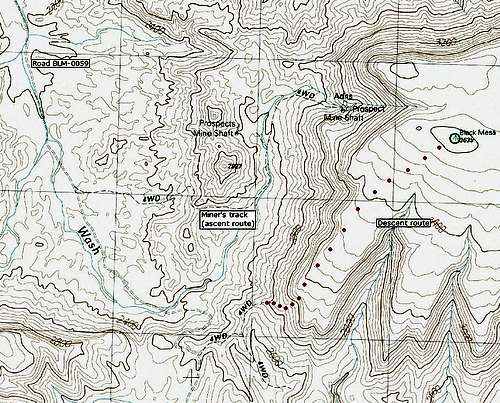
Map with our routes - courtesy of Scott Surgent
Red Tape
No Red Tape other than the rules of the New Water Wilderness; see link below. There are some private mines in the area that were clearly signed when we visited the peak.
When to Climb
The best time to climb this peak would be in winter. This area gets way too hot in summer as temperature above 110F are not uncommon here. The best time would probably be November through March which should generally provide pleasant temperature. On our hike in mid December the high reached low 70s with a crisp but pleasant morning.
Camping
Right at the Gold Nugget Road exit (exit 26) just south of I-10 is a large BLM sign and camping is allowed there. The area is about 10 miles away from Quartzsite which has some lodging as well as camping options.
Update: I contacted the BLM office regarding camping in the wilderness area and here is the answer I received. "Yes, you may camp within the New Water Mountains Wilderness Area. Mechanized travel is NOTallowed. You may not CUT wood; you would need to pack in your own or pickup dead, down, and detached pieces."
External Links
New Water Mountains Wilderness webpage.
View from the mesa rim towards Dripping Springs Peak; you can see Road 59 in the valley.
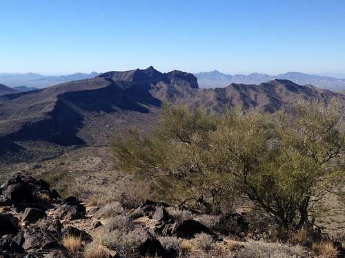
The summit with Cunningham Peak in the background