
-
 8820 Hits
-
 77.48% Score
-
 8 Votes
|
|
Mountain/Rock |
|---|---|
|
|
33.45481°N / 115.1682°W |
|
|
Download GPX » View Route on Map |
|
|
Riverside |
|
|
Hiking |
|
|
Winter |
|
|
3446 ft / 1050 m |
|
|
Overview
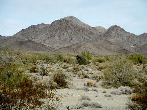
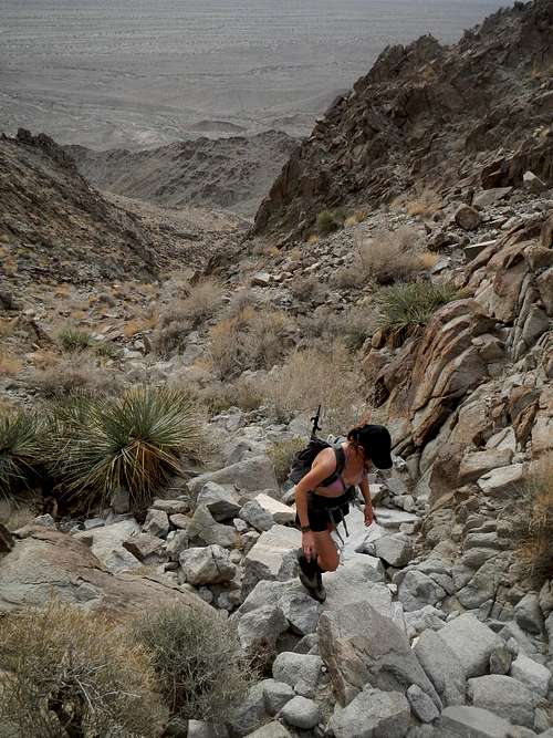
Chuckwalla South Face
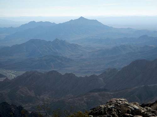
Black Butte Seen From Chuckwalla Summit
Along with Black Butte, the range highpoint, Chuckwalla Mountain is included on the Sierra Club’s Desert Peak Section List. If not for that fact, the peak would seldom be visited at all. Since both peaks are short easy hikes, most peakbaggers visiting the area opt to climb them in the same day. Just make sure you get an early start.
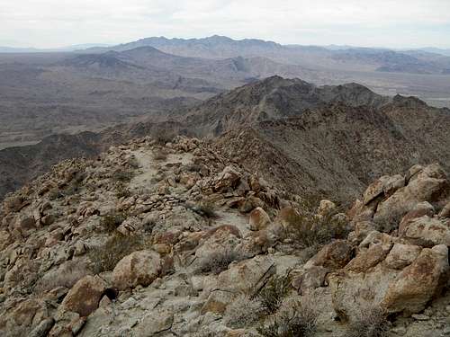
Chuckwalla Mountain Seen From Black Butte Summit
In general this range is extremely arid and scarcely supports any flora aside from cactus, ocotillo, and creosote. Most of the ground here is bare rock. Animal species that frequent the area include the desert tortoise, chuckwallas (a large lizard), sidewinders, bighorn sheep, coyotes, kangaroo rats, and raptors.
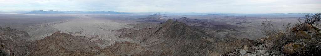
Summit Panorama East
Chuckwalla Mountain is located between two wilderness areas but not included inside either of them. Guidebook author Andy Zdon claimed that this peak is the highpoint of the Little Chuckwalla range which is a protected wilderness, but that is incorrect because the Little Chuckwalla Range only begins east of Graham Pass.
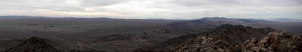
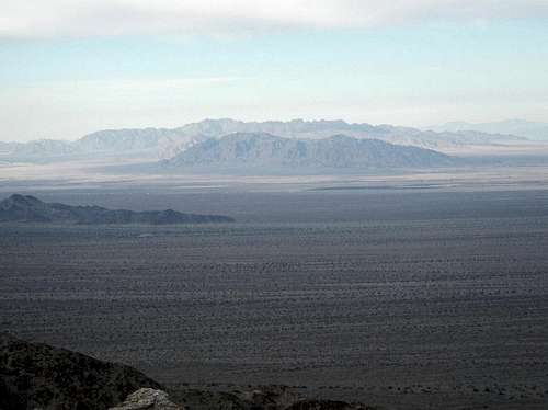
Summit Panorama West
The valleys surrounding these ranges are very sandy. As of December 2016, the main access road was in good shape, however visiting this area in a normal car is not recommended. High clearance is suggested and 4-wheel or all-wheel drive is an absolute must! Always keep lots of extra water in your vehicle as well as emergency supplies when travelling in the desert.
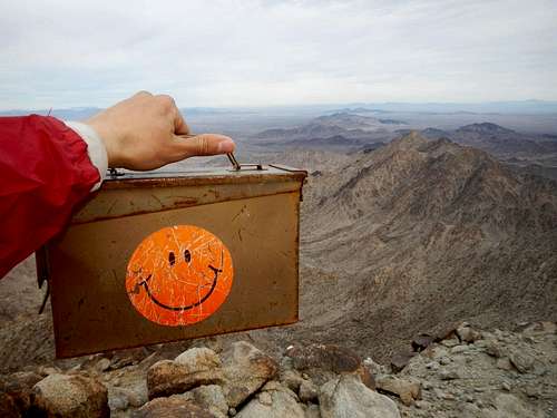
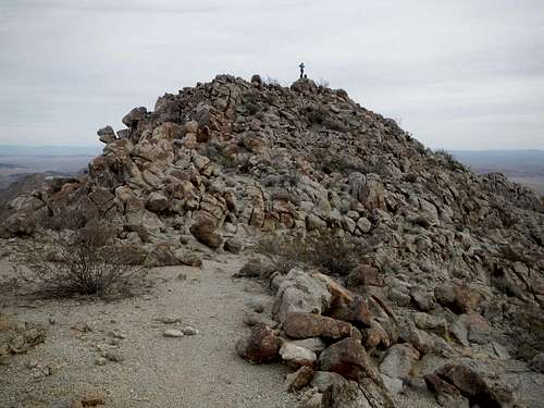
Happy Summit Register
Finally, don’t be startled by the sound of explosions nearby and don’t venture south of the Bradshaw Trail access road that you drove in on. Everything down south is part of a military aerial bombing range.
Interactive Route Map
This GPX file can be downloaded in the link near the top of the page.Standard Route
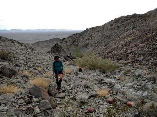
In The Gully
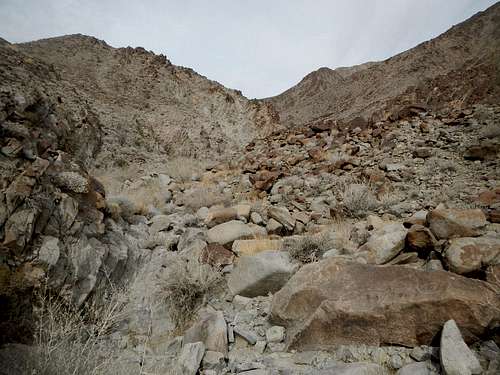
Boulder Choked Gully
Continue up to reach the west shoulder just below the summit and follow the ridge to the top.
Near The Top
Beware of some loose footing in the rocks on the final open slopes below the top.
![Chuckwalla Summit]()
Chuckwalla Summit
The route is 3 miles round-trip with 1650 feet of gain.
![Granite and Palen]()
Granite and Palen Ranges To The North
Continue southeast for nearly another 2 miles and watch for a junction on your right. Turn right (south) onto Gas Line Road and continue another 7.9 miles to an intersection. Turn left onto Bradshaw Trail Road and continue east by southeast for another 21.6 miles (if coming from the Black Butte access road it’s just 14.6 miles).
21.6 miles from the Gas Line Road, the road forks. Keep left onto Niland Road and continue for another 0.3 miles, turning left (northwest) onto a well defined dirt track (33.426064, -115.167636). Continue for another 1.5 miles to the parking area (33.441876,-115.180082).
![Coxcomb Mountains]()
Coxcomb Mountains To The Northwest
Note: An alternate driving approach comes over Graham Pass, however most people do not drive that way, so it could be more sandy or potentially washed out. If you explore it, please report what you find in the comments section.
Chuckwalla Summit
The route is 3 miles round-trip with 1650 feet of gain.
Driving Directions
Follow Interstate 10 either 9 miles east from Chirico summit or 9.5 miles west from Desert Center. Get off at exit 182 and go to the south side of the freeway. Proceed nearly 3 miles southeast on one of two roads, depending on which side of the freeway you exited on. These roads join together to form Red Cloud Mine Road.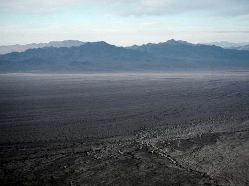
Granite and Palen Ranges To The North
Continue southeast for nearly another 2 miles and watch for a junction on your right. Turn right (south) onto Gas Line Road and continue another 7.9 miles to an intersection. Turn left onto Bradshaw Trail Road and continue east by southeast for another 21.6 miles (if coming from the Black Butte access road it’s just 14.6 miles).
21.6 miles from the Gas Line Road, the road forks. Keep left onto Niland Road and continue for another 0.3 miles, turning left (northwest) onto a well defined dirt track (33.426064, -115.167636). Continue for another 1.5 miles to the parking area (33.441876,-115.180082).
Coxcomb Mountains To The Northwest
Note: An alternate driving approach comes over Graham Pass, however most people do not drive that way, so it could be more sandy or potentially washed out. If you explore it, please report what you find in the comments section.