
|
|
Mountain/Rock |
|---|---|
|
|
33.50040°N / 111.64063°W |
|
|
Maricopa |
|
|
Hiking |
|
|
Spring, Fall, Winter |
|
|
2972 ft / 906 m |
|
|
Overview
The Usery Benchmark (labeled "Usery" on topographic maps) is one of the more accessible summits on the east side of Phoenix. It is closest to Mesa, which is on the west side of the mountain.
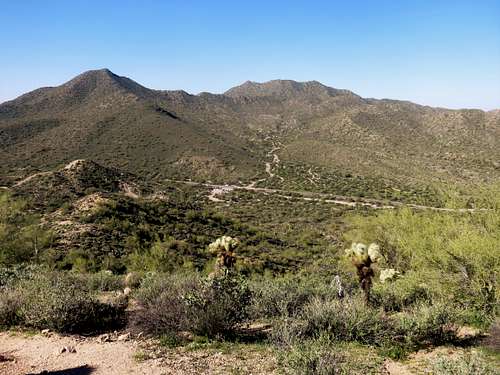 Phoenix Mountain (left) and Usery Benchmark (center) seen from EJ Peak
It isn’t the most popular hike in the area around Usery Pass. That title would go to Pass Mountain 3,312'. However, hiking to Usery Benchmark is a reasonably short trip that can be done in about an hour and a half; with a trail all the way to the summit. Given that the round trip hiking distance is only about 3 ½ miles, it can be combined with its neighbor, EJ Peak (Lone Mountain) 2,809’. Both area accessed from the same trailhead, albeit in separate directions.
The views are excellent, with the Goldfield mountains in the background, and desert peaks as far as the eye can see. There is an unencumbered view of Phoenix and many of the population centers in the region.
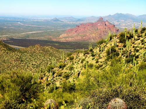 View towards McDowell Mountain (aka Red Mountain) from the summit
As with most lower elevation Arizona mountains, the best time to hike here is between November and March; in order to avoid the heat and the critters.
Getting There
From Phoenix take Hwy 60 to Ellsworth Road. Turn north on Ellsworth Road which turns into Usery Pass Road. From further north you can take the 202 to McKellips Road. From North Scottsdale, take Shea to 87 and then take the Bush Highway.
Once on Usery Pass Road, the trailhead is about 3 miles north of the junction with McDowell Road. Park at the Bulldog Canyon Off Highway Area parking. There is space for about 20-25 cars. The starting point is directly across Usery Pass Road.
Route
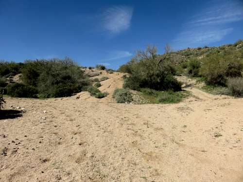
Cross Usery Pass Road and hike up the sandy road. Stay on the wide open sandy road as it continues gradually upwards towards the peak. After about 0.4 miles a trail rises to the right. You can take that, or just continue another tenth of a mile and you reach a junction leading up to the same trail. There is a cairn at the base. The trail to the summit starts here, in the middle, up the hill.
 Head up the hill in the middle to reach the trail
Continue up the trail for another mile or so. You will reach the base of the summit. A steep summit trail heads straight up to the top of the ridge. I fixed up the cairn to make it obvious that this is the right trail with a "UB" and an arrow. From here, it is about a third of a mile to the summit, gaining nearly 300’. To get to the actual summit, take a left once on top of the ridge.
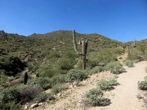 View towards the summit from the trail
The summit is reached after about 1.75 miles from the parking area, gaining a little under 950’. On the descent, you can stay on the ridge and head north and it will loop around back to the original summit trail. That is a 4 1/4 mile loop, and is well worth the extra distance.
Red Tape
There is no red tape and no fees to hike Usery Benchmark. Just park at the trailhead, cross the road, and start walking.