
-
 5580 Hits
-
 88.09% Score
-
 26 Votes
|
|
Mountain/Rock |
|---|---|
|
|
44.08490°N / 114.5758°W |
|
|
Custer |
|
|
Mountaineering |
|
|
Summer, Fall |
|
|
11202 ft / 3414 m |
|
|
Overview
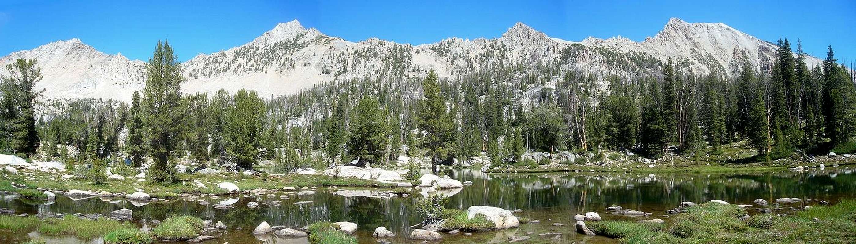
Cardiac Peak is located in the heart of central Idaho’s White Cloud Mountains. This huge mountain forms the highpoint of a ridge that separates two of the most popular alpine lake basins in the White Clouds. With the Big Boulder Lakes to the north, and the Boulder Chain of Lakes to the south. It’s an impressive peak when viewed from any direction. With an elevation of 11202’, Cardiac Peak is ranked number 85 amongst Idaho’s Highest Peaks, and is listed as the eighth tallest on the White Cloud Peak List.
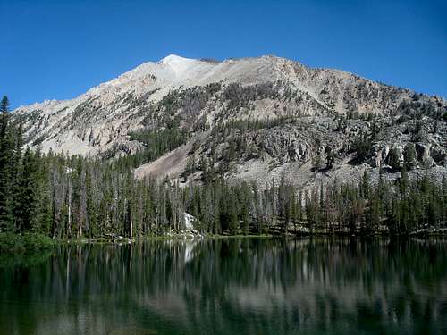
Cardiac Peak
Mountain climbing in the White Clouds is generally known for great ridge-walks and fun straightforward scrambles. But there are a few summits that are pretty challenging to reach. Cardiac is one of those challenging summits. There are a couple routes by which to climb this White Cloud giant, but there’s no way to avoid class IV terrain and loose crumbly rock. The most common ascent route is the southeast ridge, starting from Shelf Lake in the lower Boulder Chain. It’s a long approach, followed by some tedious talus slopes. But the crux is an exposed knife-edge section not far below the summit. This leaves the summit objective in doubt right up until the end.
 Lonesome Lake |  Cardiac Peak |  Big Boulder Lakes |  Scoop Lake |
The unofficially name “Cardiac Peak” was applied by the legendary Idaho peak bagger Rick Baugher, who made the first recorded ascent on September 7, 1998. The name “Granite Peak” has also been used. Climbing this peak will certainly get your blood pumping, but no known cardiac arrests have been officially documented. Because of the long approach and challenging finish, this peak is seldom climbed by anyone other than mountain goats.
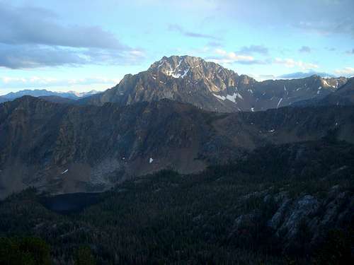
Summit Views
Because of its central location and lofty elevation, Cardiac Peak offers up some excellent summit views. To the east are expansive views of Mount Borah and the Lost River Range in the distance. Railroad Ridge dominates the view to the north. The northern White Clouds are visible to the east, with the Big Boulder Lakes below them. And finally, the view to the south is dominated by the ever-present Castle Peak.
Castle from Cardiac
Getting There
The most likely starting point for a climb of Cardiac Peak is at the Little Boulder Creek trailhead, on the East Fork Salmon River. At 6200’, this is one of the lowest elevation trailheads in the White Clouds, and provides the shortest (but still long) approach to the lower Boulder Chain Lakes. Because of the low elevation, the trail starts off in sagebrush country, with little shade early in the hike.
Another option for reaching Cardiac Peak is to do a multi-day backpacking trip into the Boulder Chain Lakes starting at either the Fourth of July Creek trailhead on the west side of the range, or the Livingston Mill trailhead on the East Fork of the Salmon River. However, the descriptions below only apply to the Little Boulder Creek approach.
The Drive
To reach the Little Boulder Creek trailhead, follow Highway 75 to the East Fork Salmon River Road. This is about 37 miles east from Stanley, or 20 miles south from Challis. Once leaving the highway, follow the East Fork Road almost 20 miles to the Little Boulder Creek Campground. Drive time is about 4 hours from Boise. The road is paved most of the way, with the last few miles on gravel. The trailhead is accessible with a passenger car. The actual trailhead is another half mile up the road, but there’s no room there for parking.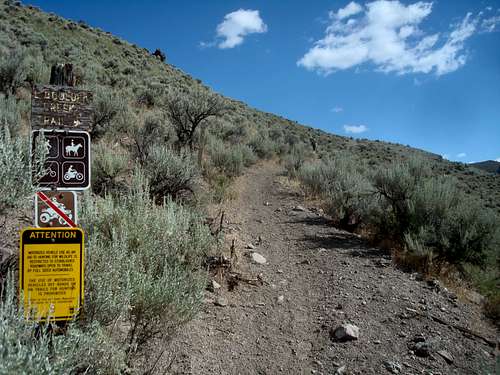
Little Boulder Creek Trail
Route
A climb of Cardiac Peak allows you to pass through numerous vegetation zones. The start is down low in sagebrush country with an undulating trail that doesn’t provide much shade. It’s also just outside of the wilderness area and is open to motorbikes. The trail isn’t highly scenic the first few miles, but it’s easy to follow and you can cover ground quickly. Further up, the forest begins and soon enough the iconic east side view of Castle Peak and Merriam Peak comes into sight. After 6+ miles, hang a right toward the Boulder Chain Lakes, finally entering the wilderness area at Willow Lake.
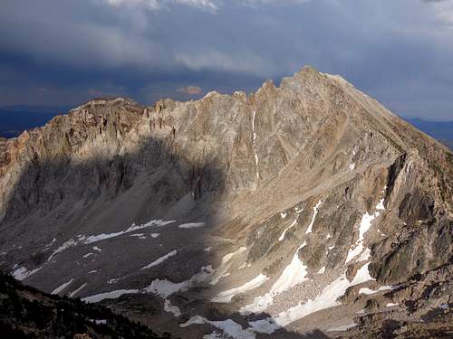
Leave the trail at Shelf Lake and head toward Pt 9530’. From there make your way up the steep southern slopes of Cardiac Peak until you gain the southeast ridge at about 10,600’ elevation. The ridge is straightforward class
2 for a while with exceptional views. But as you near the summit, the exposure increases.
 Cardiac Crux |  Cardiac Crux |  Cardiac Summit |
The crux of the climb is only few hundred feet below the summit, a very exposed knife-edge section with cracked and crumbly rock. This is legit class 4, so a slip here would lead to big trouble a long way from home. Not to be taken lightly!
Trip Stats:
22 Miles Round Trip
5000’ Elevation Gain
Alternatively, Cardiac Peak has also been climbed via the west ridge, accessed from the Goat Lake drainage to the north. This is another adventurous class 4 route.
North Ridge
Red Tape
Cardiac Peak is located in the White Clouds Wilderness, so standard wilderness rules apply. Other than that, no permits, parking passes, or other red tape to worry about. Please tread lightly and respect the fragile nature of the local ecosystem.
When to Climb

Cardiac Peak
The summer climbing season in the White Clouds is typically from July until the snow flies in October. Climbing Cardiac Peak earlier in the year may be feasible some years. The best time for a visit is probably late July and early August after the snow has melted and when the wildflowers are most abundant.
Camping
Camping is possible at Little Boulder Creek Campground near the trailhead. This campground is located next to the East Fork Salmon River and offers an outhouse and picnic tables.
If you enjoy backpacking, then campsite options are plentiful on the approach to Cardiac Peak. There are good campsites at any of the lakes in the Boulder Chain, with several at Hatchet Lake in particular.
  |
Mountain Conditions
- Sawtooth National Forest - NF Current Conditions.
- NOAA Pinpoint Forecast – Weather.
- Idaho Outdoors Forum – Message board monitored by many local climbers.
Guidebooks
Cardiac Peak is seldom visited, so beta is pretty limited,but here are some guidebooks with details on the approach to the peak, and theWhite Clouds in general.
 | Idaho: A Climbing Guide by Tom Lopez – This is far and away the premier mountaineering text for the state, with an entire section devoted to the White Clouds, including details on Cardiac Peak. |
 | Trails of the Sawtooth and White Cloud Mountains by Margaret Fuller – Detailed descriptions of hikes in the White Clouds and neighboring Sawtooths. Includes approach information on how to get to the Boulder Chain Lakes and other nearby destinations. |
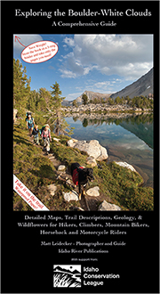 | Exploring the Boulder White Clouds by Matt Leidecker – Easy to see that a tremendous amount of TLC went into this guide, which includes excellent maps as well as history, geology, etc. |
External Links
Here are a few links with details about Cardiac Peak: