|
|
Mountain/Rock |
|---|---|
|
|
44.00130°N / 113.5356°W |
|
|
11308 ft / 3447 m |
|
|
Overview

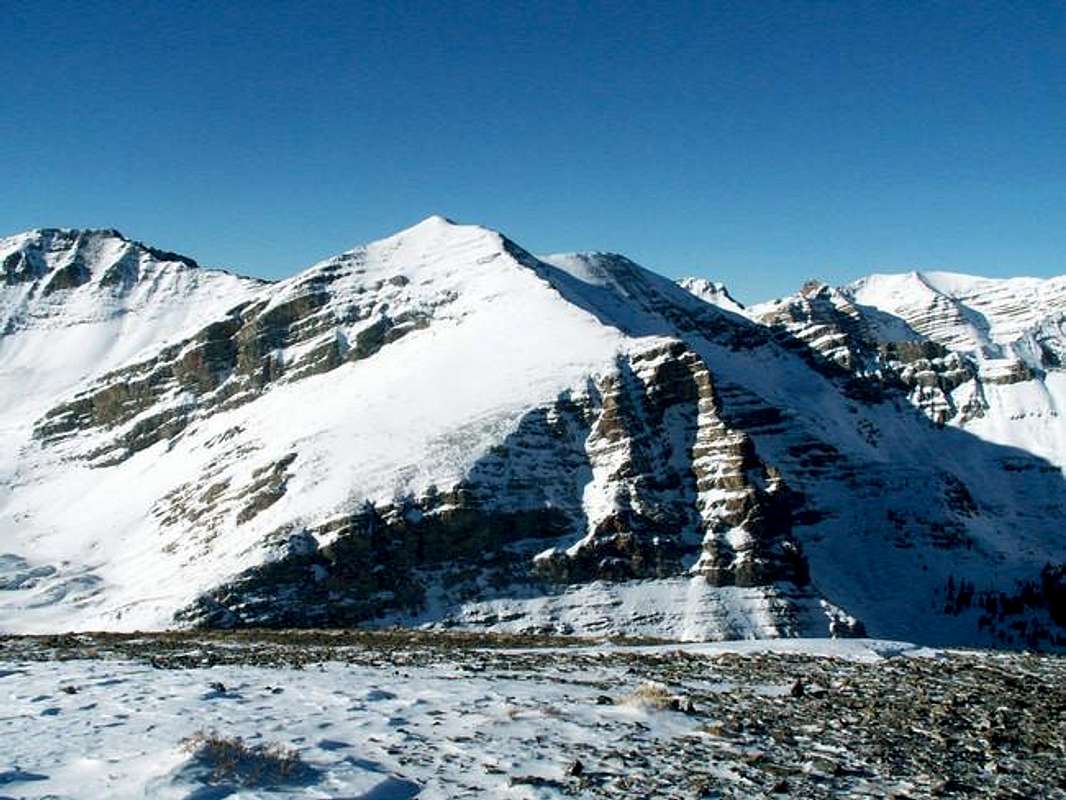
Hidden Peak is another peak nicknamed by famous Idaho Mountaineer R. Baugher. This impressive mountain sits deep in the heart of the range and is difficult to view from anywhere on the valley floor, therefore making it hidden. However, if one takes the time to travel cross country into the remote, high and rugged basins below Hidden Peak, a reward awaits as this summit towers over several drainages in the area.
Hidden Peak, along with most of the terrain in the area, is a complex mountain. Its east and north faces are relatively gently sloped while its northeast and west faces are a rugged mix of banded cliffs and rotten rock towers.
Hidden Peak is somewhere around the 62nd highest mountain in the state of Idaho. It is one of Idaho's 123 known 11ers and while no one has ever climbed all of them, R. Baugher has come the closest and climbed more than 100. Even though it is an 11er, Hidden Peak is climbed very rarely.
There was a summit register at the summit in 1991 but some one has since taken it and destroyed the summit cairn. This is just one of many Lost River summit cairns and registers that has been destroyed by some one in recent years.
The easiest route climbs the broad east face on Class II-III terrain and requires a few miles approac as well as cross-country travel through rotten terrain.
Getting There
Access is not easy for most to the central Lost River Range. The nearest major airport in Hailey is more than two hours away.
Directions from Arco to the Hidden Peak Standard Route
Drive north on Highway 93 for 18 miles until reaching the Pass Creek Summit Road turnoff on the northeast side of the highway.
Take this improved gravel road 8.7 miles to an unnmarked turnoff for Bear Creek Road and Bear Creek. Take this narrow and somewhat rough road 1.5 miles to the trailhead parking area.
Red Tape
No permits required. Some motorized vehicle use is allowed on a few of the local trails but be sure to check ahead.
All local access roads including the summit area of Pass Creek is closed during winter and spring.
When To Climb
The mountain is usually climbed during the summer months.
During winter, access complications and avalanche danger would make a snow ascent difficult but not impossible.
Camping
Camping is allowed in the area but the rugged nature of the terrain is not condusive for tent-camping.
The trailhead areas are small and it is recommended that camping take place in the two nearby campgrounds. Loristica and Bear Creek Campgrounds are both located near the trailhead areas for Hidden Peak.
Mountain Conditions
Hidden Peak is isolated and remote. There is only one weather station nearby. It is a SNOTEL site nearby and is the only existing station of such in the Lost River Range. Hilts Creek SNOTEL at 8,000' provides recent temperatures and precipitation for the lower elevations in the area.
The following links can also provide good current conditions.


