-
 9650 Hits
-
 82.83% Score
-
 16 Votes
|
|
Mountain/Rock |
|---|---|
|
|
61.52610°N / 7.90278°E |
|
|
Mountaineering, Scrambling, Skiing |
|
|
Spring, Summer |
|
|
6644 ft / 2025 m |
|
|
Overview
Geographical classification: The Scandes > Jotunheimen > Steindalsnosi
Steindalsnosi 2025 m
The Hurrungane Massif, located within the Jotunheimen National Park, is one of the finest mountain area in Norway. This mountain range belongs to the municipalities Luster and Årdal in Vestland county and it's the westernmost chain in the larger Jotunheimen range. Sharp peaks and towering mountains project their high vertical walls above broad crevassed glaciers. The Hurrungane Massif can be divided into two main groups, showing quite different features. The most spectacular group is located in the South-Western sector, including the most challenging 2000ers in the Scandes chain, as Store Skagastølstind. In this sector we see spectacular mountains falling down with steep walls. In the North-Eastern sector of the massif Hurrungane it's instead situated a smaller group, the nice Fannaråken group, including some beautiful mountains with gentler profiles, as Fannaråken 2068 m, one of the most famous summit in Norway. Steindalsnosi 2025 m is another fine peak of this subgroup, located between Hurrungane and Smørstabbtindane and very close to the most known Fannaråken. This latter attracts a greater number of climbers and the result is that Steindalsnosis is less visited. Both the mountains are located just East of Sognefjellvegen (Sognefjells road, Highway 55), the high mountain road connecting the Sognefjord with the town of Lom, at the Northern end of Jotunheimen. Steindalsnosi standard route along the West Ridge is also a classic ski mountaineering ascent.
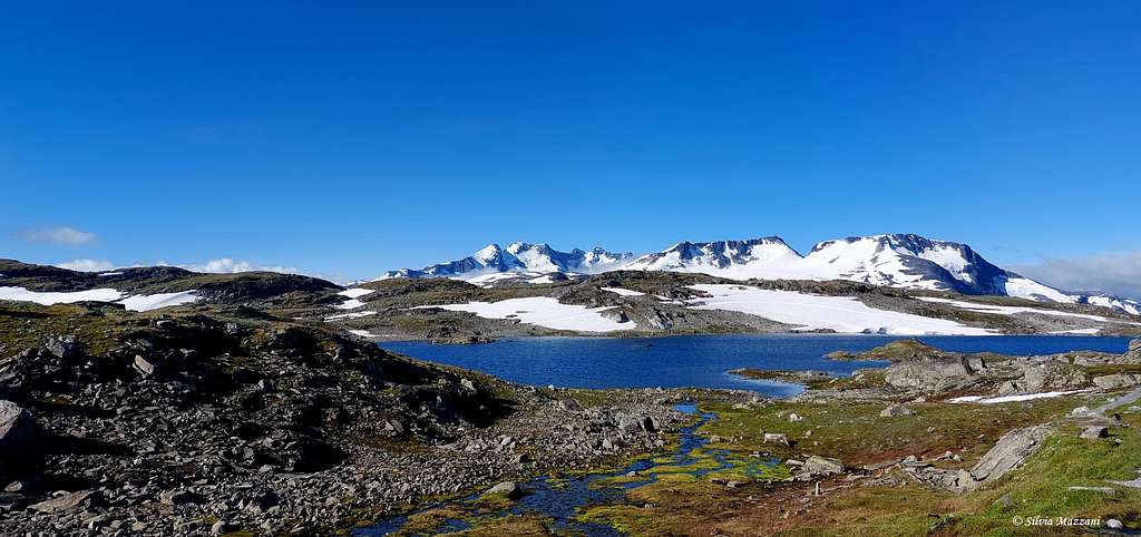
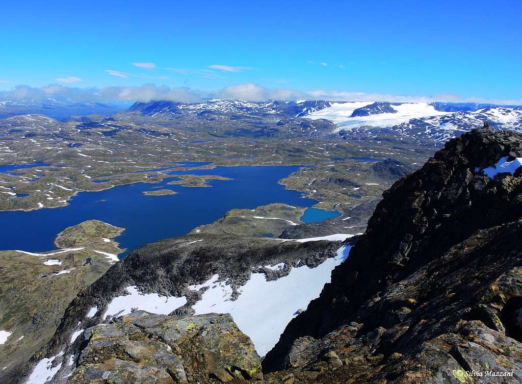
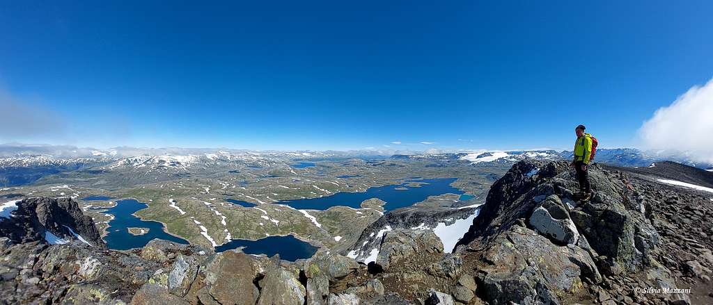
The view from the summit is exceptionally wide towards all directions: Breheimen, Jostedalsbreen, Sognefjellet and Smørstabbrean. There are different ascents and descents from Steindalsnosi. The most traveled and easiest is to reach the top from Sognefjellsvegen in the West, from the 1300 meter marker along the road "Sognefjellvegen". This is the standard route, a walk up with some steep scrambling taking about 2.5 hours one way. Steindalsnosi standard route along the West Ridge is also a classic ski mountaineering ascent.
Getting There
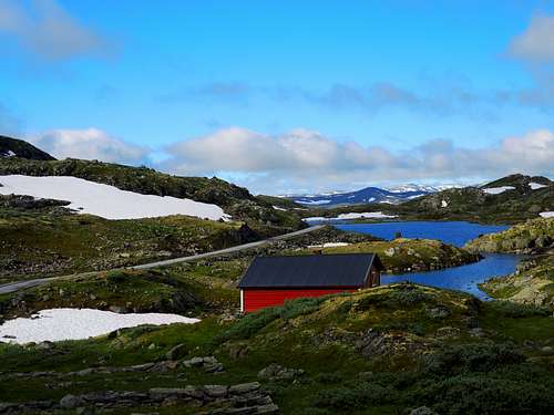
The starting point to climb Steindalsnosi is the highest point along the Sognefjellsveien Road (Highway 55) joining Turtagro and Lom at about 8 km from Turtagrø, just passed the Galgeberghytta. Obviously it can be reached both from Turtagrø, closest, and Lom. There is no international airports in this part of Norway, so getting here from Oslo is as good as any options.
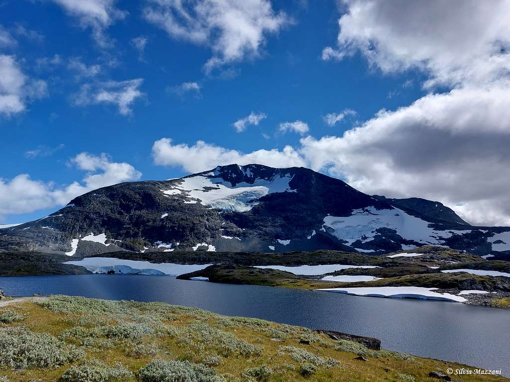
The fastest possibility is to drive from Gardermoen airport against Lillehammer and then follow Gudbrandsdalen valley ontop the little town "Otta". Then take left and follow the road against the town Lom. After Lom the road will get higher and higher before it crosses the wild "Sognefjellet" Mountain pass which at 1440 meters is the highest driveable mountainpass in Norway. Just after the highest point the mountains Steindalsnosi and Fannaråken will be visible to the left across a big glacier, the Fannaråkbreen. Fannaråken is to the left, Steindalsnosi to the right. The whole trip takes about 5-6 hours from Oslo.
Another slightly longer but much nicer drive is to drive the Begnadalen valley from the city Hønefoss just outside Oslo. The valley is at first a little boring but after a couple of hours you will reach the town Fagernes. Here you can take the road 51 along the valley which is one of the most beautiful in Norway.
Another possibility is to follow the E16 and at the crossing "Tyinkrysset" take right steeply up the mountain to the lake Tyin. The road continues to the left of Tyin with an incredible view to the mountain Uranostinden among others. From a height of about 1100 meters the road falls almost directly into Årdal which is an extremely ugly industrial resort. At Årdal drive through the centre of the town and continue on the narrow toll-road towards Turtagrø. It is fully driveable if you got some sense of humour and a not too big car. From Turtagrø take right and look for the 1300 meter marker. It will take about 6-7 hours from Oslo. Drive a little downwards from the pass and park at one of the small parking lots close to the 1300 meter marker.
Route
Normal route report
Summit altitude: 2025 m
Difficulty: Alpine F
Vertical gain: 750 m
Exposure: North
Starting point: Sognefjellsvegen, a hundred meters beyond the Galgeberghytta if coming from Turtagro
A worthwhile route for a great day enjoying breatktaking views all around over Jotunheimen and Hurrungane chains. There is no marking and the itinerary has an alpine character, anyway it's easy, without airy passages. The route has a steeper section of about 100 meters in height, more than 30 degrees steep. At 1,900 meters the last stretch towards the top eases out. The view is absolutely phenomenal: endless planes of mountains, glaciers, lakes open up below you like a gigantic geographic map.
Route report
The mountain is clearly visible when you drive over Sognefjellsvegen, where it lies next to Fannaråki. Park the car just near the high point of the road and can start the walk at 1,300 meters just below Galgeberget at the end of the Northwest ridge. The correct starting point is just a little further the Galgeberghytta, when coming from Turtagrø. The parking lot pass the cabin is small, but you can find more space at Galgeberghytta.
From the parking lot cross the road in the correspondence of some stone cairns and start walking steeply uphill the vegetated slope towards the broad dark ridge visible in front of you. There is only a barely visible trace here and only rare cairns, but at about 1480 m the trace levels off near the first big cairns. Head to the right and pass a small lake on the right side, then go straight uphill.
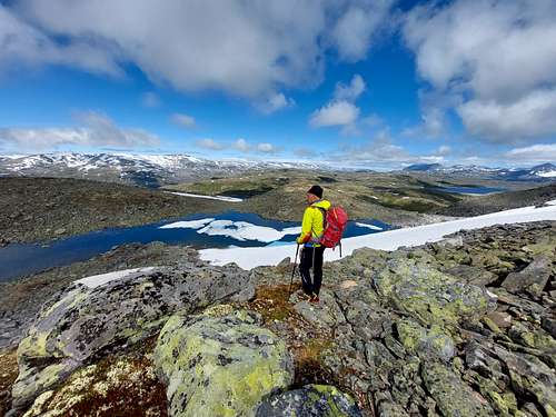
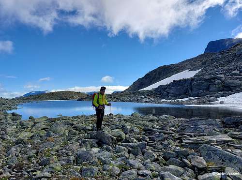
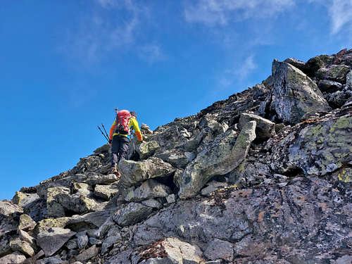
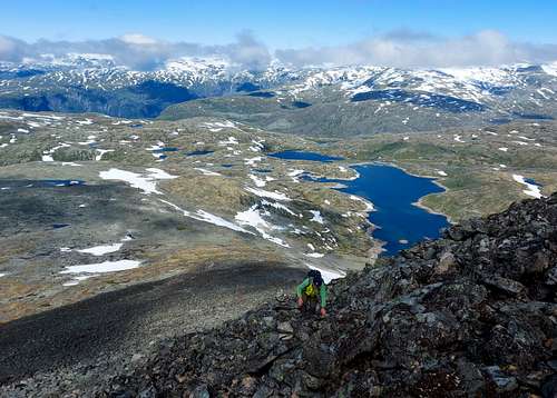
Cross on horizontal stony ground, pass some characteristic stone columns and walk up to get a rocky buttress with a big cairn well visible from afar. From the cairn descend briefly to another small lake which you circle to the right and continue on progressively steeper rocky terrain, aiming for some cairns on the edge of a spur.
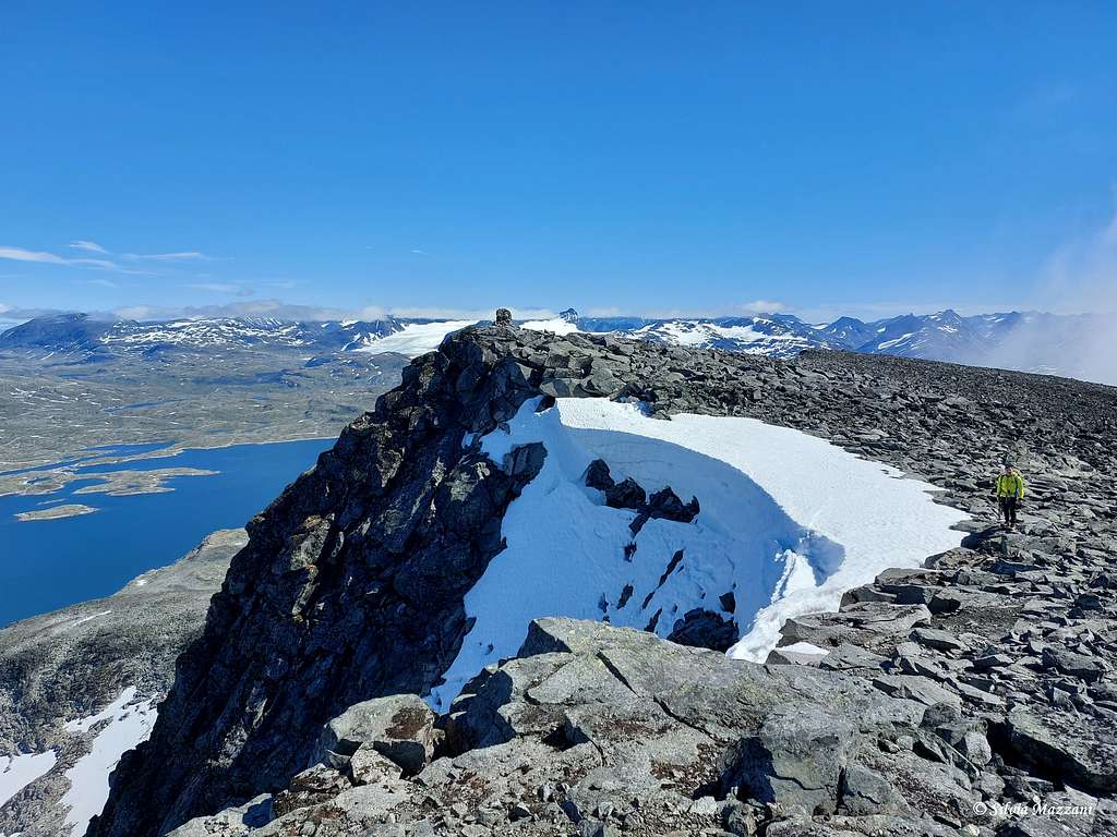
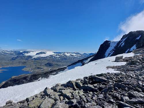
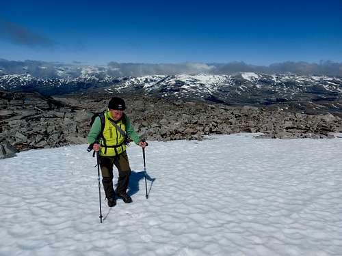
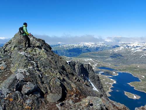
Continue on very steep stone block terrain (cairns) reaching the steepest section of the climb, about a hundred meters high. Then exit onto the inclined rocky summit plateau, covered by some snow fields, which you follow first to the left, then to the right, aiming towards a slightly exposed rocky ridge which forms the true summit, while further on a large cairn marks a lightly lower panoramic point. The view is quite sensational.
Descent: reversing the same route
Essential gear
Usual mountain gear for walk and scramble with hiking poles and sturdy boots, warm clothes
Red Tape

No particulary restrictions. Steindalsnosi is situated inside the superb Jotunheimen National Park, established in 1980, covering an area of 1150 square kms and including the 27 highest peaks in Norway. Jotunheimen is located between Oppland and Vestland counties and it's bordered by the great lake called Vågåvatnet, the valleys of Bøverdalen and Leirdalen and the road No. 55 (the mytical Sognefjellveg) to the N and NW, by the Road 51 to the East, by Bygdin, Tyin and Årdal to the South and by the mountain road between Årdal and Turtagrø to the West.
More info: Visit Jotunheimen.
Nature and climate
Jotunheimen is a wild area of majestic icecapped mountains, glaciers and wonderful lakes. Norway highest peak, Galdhøpiggen, lies within the National Park, together with the icecapped Glittertind, only a few metres lower. There are also several large lakes, amongst those the largest one is Gjende. Rapid weather changes can occur, lots of snow in winter due both to the latitude and the high altitude, nice summer with over up to 25 degrees Celsius with sunny weather. Be aware that at the highest altitudes deep snow can remain until mid summer. Mountaineering and hiking season varies, but usually they start in late June, being July and August the best months. In this area we can find the highest plants growing in Norway. The beautiful Glacier Crowfoot is the highest growing flowering plant, thriving at 2.370 metres on Glittertind, only 100 metres below the summit. Purple Saxifrage and Rose-root or Midsummer men also grow as high as 2.300 metres. Within Jotunheimen National Park we can find a rich variety of lime-loving plants, such as the Mountain Avens and other species, such as Hairy Stonecrop and Red Alpine Catchfly.
When To Climb
Mountaineering: middle June to middle September is the best
Ski-mountaineering: Spring
Accomodation
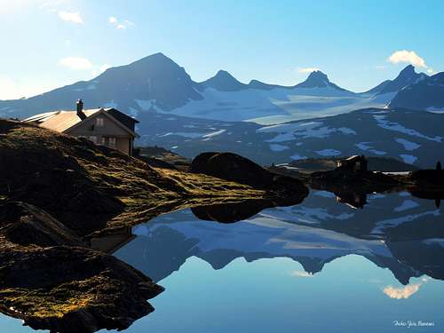
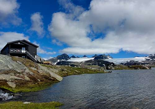
Camping is allowed. Several huts are managed in summer season. There is several good places to camp near the road. In general the Jotunheimen area is tent-able up to about 1400 meters. Higher up there will be just rocks and glaciers, and also difficult to find running water in most areas.
- Sognefjellshytta Lodge
Situation: Sognefjellsveien Road (Highway 55), joining Turtagro and Lom
Open: Easter until mid-September
Phone: +47 61 21 29 34
E-mail: post@sognefjellet.no
Meteo
Guidebooks and maps
"Opptur Jotunheimen" Finn Loftesnes - 125 selected itinerary on Jotunheimen - Selja Forlag 2009
- Maps
Jotunheimen Vest Turkart 2505" Scale 1:50.000
External links
Visit Jotunheimen
Scandinavian Mountains
Norwegian Mountains
Jotunheimen
D.N.T. Den Norske Turistforening

