-
 7358 Hits
-
 82.48% Score
-
 15 Votes
|
|
Mountain/Rock |
|---|---|
|
|
46.67540°N / 12.61220°E |
|
|
7591 ft / 2314 m |
|
|
Overview
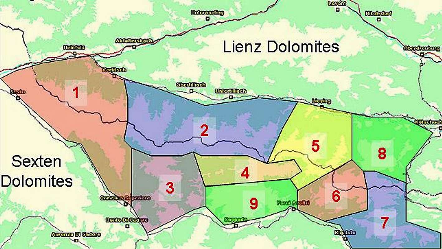
Geographical Classification : Eastern Alps > Carnic Alps > Carnic Alps Main Ridge (West) > Spitzköfele

The Carnic Alps Main Ridge runs from west to east for 130km between the villages of Sexten (Sesto) and Thörl-Maglern. It is a complex ridge, which often winds away from the straight line. The summits on the ridge are very diverse in terms of rock composition, which is due to the geological history, which put the mountain range at the centre of the Alps build-up ages ago.
From this ridge quite a number of side ridges run to the north into the Lesachtal Valley (the valley of the river Gail). The mountains on most of these ridges are rather easy to get to, there are some notable exceptions like Zwölferspitz, which can be climbed only over an UIAA grade II grass climb, dangerous in wet conditions). All of these summits, however, are great lookout peaks - very close to the Carnic Alps Main Ridge with great views of the neighbouring mountains, but at the same time high enough to offer good views of the Sexten and Lienz Dolomites. Speaking of altitudes - though easy to reach, it takes a long day tour to get there and back so you certainly should not underestimate any of them.
Spitzköfele is a case in point. It is located on the ridge between Obertillacher Tal and Rollertal. There are two beautiful ascent routes through the two valleys, which can be combined to do a loop. Starting point is Obertillach, though you can go deep into Obertillacher Tal by car. This, however, will rob you of the opportunity to do the loop. The mountain is located close to Porze (Cima Palombino) and Crode dei Longerin, two of the best known climbing summits of the Carnic Alps.
Both ascent routes to Spitzköfele touch upon Karnischer Höhenweg, the multi day trekking trail, which runs along the old World War I paths over the whole 130km of the Main Ridge. The final ascent from the trekking trail to the summit is rather steep and in places exposed. The summit cross, like on so many summits in the Alps is placed on a false summit to the north of the real one (in order to be seen from the valley floor). In this case the difference in altitude is minimal, just about 5m.
The Spitzköfele summit itself is composed of black volcanic rock which peeps out of beautiful meadows with lots of flowers. to the eastern side it is rather smooth whereas on the western side it shows vertical drops of up to 150m. Spitzköfele, however, is no climbing summit. The black rock is far too lose and fragile for any serious route.
The 360° Summit Panorama
Decide for yourself, if the summit is worthwhile.....
Getting There


