Toggle navigation
Mountains
Routes
Images
Trip Reports
Forum
What's New
People
Areas & Ranges
Articles
Trailheads
Canyons
Huts & Campgrounds
Albums
Logistical Centers
Fact Sheets
Lists
Custom Objects
Gear
Plans & Partners
WELCOME TO SUMMITPOST
SIGN IN
REGISTER
Sundance Mountain
Additional Parents
Image
This is a map from Rocky...
View High-Resolution Image
This is a map from Rocky...
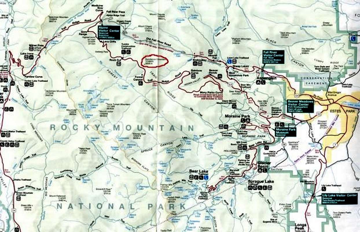
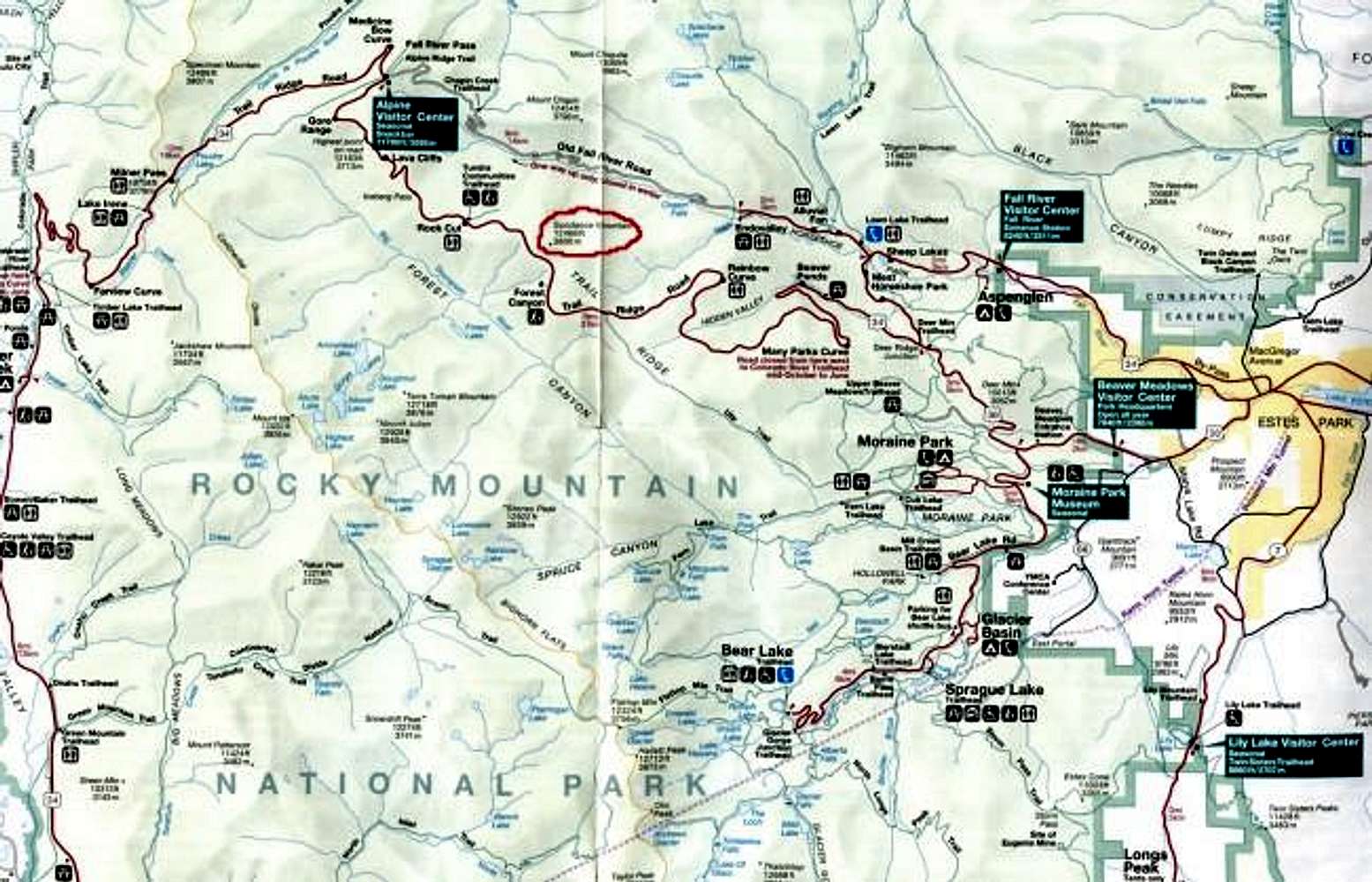
This is a map from Rocky Mountain National Park. Sundance Mountain is circled in red and you can see it's position in relationship to the Trail Ridge and Fall River Roads as well as Estes Park. June 2004
« PREV
NEXT »
mtwashingtonmonroe
on
Jun 16, 2004 10:46 am
Comments & voting
Other parents
Lat/Lon:
40.40800°N / 105.71°W
Image ID:
57138
4292 Hits
74.92
% Score
5
Votes
Log in to vote
Comments
No comments posted yet.
to post!
Don't have an account?
Sundance Mountain
(Mountain/Rock)
« PREV
Viewing
#9 of 85
GALLERY
NEXT »
mtwashingtonmonroe's Image Gallery
« PREV
Viewing
#125 of 1185
GALLERY
NEXT »
×
You need to login in order to vote!
User Name
Password
Remember me
Forgot your password?
Log me out when I close my browser.
Keep me logged in all the time.
sign in as a user
Don't have an account?
Register now for FREE
Rating available
Suggested routes for you
People who climb the same things as you
Comments Available
Create Albums
Register Here


