Viewing: 1-1 of 1
mpbro - Apr 21, 2002 8:27 pm - Hasn't voted
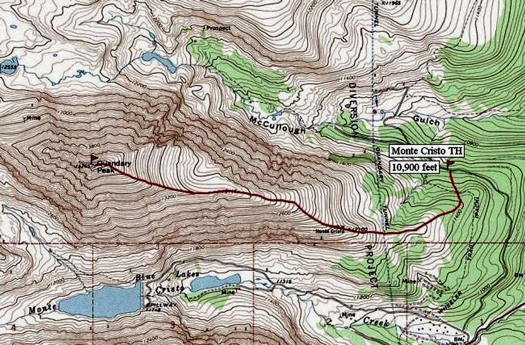
Map shows all main approaches to Quandary PeakHighway 9 is the red line in the lower right hand corner of the map. The trailhead for the standard (East slopes) route is marked on this map. To access routes to the north (Inwood Arete, Quandary Couloir II), continue down the road (Summit County 851) to a locked gate and park your car.
The West Ridge route is accessed via Blue Lakes. Park in the open dirt lot just below the spillway. The trail is marked on the map. After it "ends", just follow the small creek and climb the headwall at its source to reach the Fletcher/Quandary Col, access point for climbs of Quandary's West Ridge and Fletcher's southeast slopes.
Viewing: 1-1 of 1


Comments
Post a Comment