
-
 11063 Hits
-
 75.8% Score
-
 6 Votes
|
|
Mountain/Rock |
|---|---|
|
|
49.43705°N / 124.90425°W |
|
|
Hiking |
|
|
Spring, Summer, Fall, Winter |
|
|
4849 ft / 1478 m |
|
|
Overview
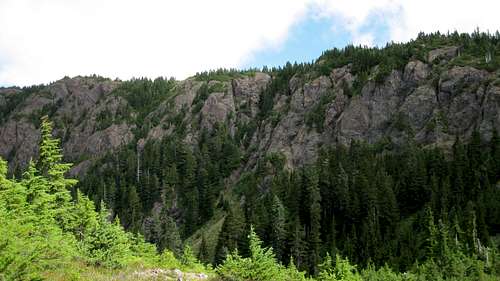
Mt Curran W Aspect
Situated in the south of the range, Mt Curran is the easterly member of the trio of peaks around the head of the valley of Roaring Creek – the others being Mt Joan and The Squarehead – that can all be connected and which offer excellent possibilities for single or multi-day trips.
Like most mountains of the Beaufort Range, Mt Curran is named for a local personality from years gone by. Fred and Mary Curran, residents of Mud Bay on the east coast, also owned a farm on Rosewall Creek and assisted the original surveyors while they were mapping the area in 1943.
Getting There
Vancouver Island can be reached by air from eg Toronto, Vancouver, Seattle, Calgary or San Francisco to Victoria, Nanaimo, Comox or Campbell River and by ferry from Port Angeles to Victoria on The Coho and on BC Ferries from Vancouver to Victoria or Nanaimo. Public transport on the Island is notoriously poor and anyone arriving by air would be advised to rent a car.There is some gravel road involved in getting to the Joan/Squarehead/Curran access spur but, generally, a normal 2WD sedan is fine. Progress up the access spur is for high clearance 4WD vehicles.
Most visitors will approach the area from the Inland Island Highway 19. From the north or south turn west on Cook Creek Road. This is the second traffic light after the Island Highway becomes freeway travelling north from Parksville or the first if coming south from Courtenay. The turn is also signed for Rosewall Creek Provincial Park. Set your odometer to 0 as you leave the highway.
The pavement ends after 200 metres as the road turns left. Keep right at a prominent junction after 2-3 km. This is a forest service road and is well signed with yellow kilometre markers. Just after marker 14 cross Rosewall Creek – there is a small camping area by the creek below you - over a second creek and finally, 15.6 km from Highway 19 reach the logging spur that gives access to the Roaring Creek mountains. There is a prominent sign nailed to a tree announcing that access to Mts Joan and Curran lies this way. If you cross a third bridge – over Roaring Creek – you’ve gone too far.
Drive 200 metres up the spur to a nice flat parking/camping area right by Roaring Creek. Elevation at this point is about 350 metres.
Approach
The method of progress beyond the parking area varies. Following recent (2013) logging, the road is clear of deadfall and can be driven to an elevation of ~750 metres with a high clearance 4WD vehicle. The old "tank trap” ditch that defeated many an unwary driver is long gone but there are still many water bars to cross. The route, however, is straightforward. Don't take the first left uphill turn. Instead keep right/straight here and follow the road around to where it heads uphill on its original pre-logging course. The driveable section of the road ends at a semi-flat area with a turn round spot and a yellow sign for Mts Joan and Curran. Park here.If the spur is impassable or you don’t have a 4WD vehicle, it takes about an hour to walk up to this point from the lower parking area off Cook Creek FSR.
As of May 2016, access off Cook Creek Road is closed. Leave sufficient time and energy therefore for the walk up to what was the upper parking area. I will try to keep any developments on this issue as current as possible.
Continue northwest on good trail, emerging from the last of the forest at about 10 U 363104 5476719 (NAD83) and into an old burn area. The trail becomes indistinct and/or braided as it climbs through the minor bluffs in this area – just keep heading northwest and up and all will soon become obvious.
Eventually the trail swings round to a more westerly course before arriving at an obvious plateau with several tarns about 1 km travel from the old burn. Turn right (north) here and follow good trail to the flat summit about 500 m map distance from the tarns.
Either retrace your steps to you vehicle or complete the Roaring Creek loop as follows.
Although travelled frequently enough according to the summit logs on Curran and Squarehead, navigation between the two isn’t completely straightforward and neither is there always obvious trail or flagging to follow. Be aware of this fact before you go.
From the summit of Mt Curran return to the area of tarns and look to the right for a route heading southwest. There are some flags to follow at this point and these bring you to the top of some steep bluffs. Pick your way down the bluffs aiming for the flat area below. Cross the saddle and continue up southwest and then in a more southerly direction along the ridge edge. The route continues in the same direction over a couple more bumps before arriving at the bottom of the summit block of the Squarehead. Climb this on the right with a little scrambling near the top.
Descend the Squarehead to the Joan/Squarehead col as described on that page and either climb Joan from there or descend the route to the sub alpine tarns and out to your car from there.
Route Details from the upper parking area:
Mt Curran return: ~10 km, ~ 900 m total elevation, ~ 5-6 hours
Curran/Squarehead loop (not including Joan): ~ 14 km, ~1,200 m elevation gain, ~ 8-9 hours
As always a Mapsource/Garmin tracklog is available. Just send me an email or PM.
As always, make sure that you have left a detailed trip plan with someone responsible. The RCMP and the appropriate SAR agency will respond in an emergency but it is up to you to have the mechanism in place that will initiate the call-out process if it becomes necessary.
The Roaring Creek mountains are sufficiently close to major east coast centres that cellular reception is frequently available. Don't absolutely rely on it however.
The parking area just off Cook Creek Road makes a good spot to car camp if you want an early start on a day trip up the nearby peaks. Although the upper parking area has no obvious flat spots, with a little creativity it's possible to position your vehicle such that you can sleep inside. I have done this and it does make a great place to get an early start from. There's certainly no water though, so haul a barrel in with you.
For precise directions get hold of a copy of Backroad Mapbook. Volume 7: Vancouver Island
For winter trips consult Vancouver Island Avalanche Conditions

Routes
From the upper parking spot walk up the remains of the road – one area has sloughed off preventing driving – to a yellow trail sign at a junction for Mt Joan to the left and Mt Curran to the right. Altitude here is about 850 metres.Take the right hand turn. The route continues on old road bed gaining height slowly before petering out into trail after about 1.5 km at 1,000 metres elevation.Continue northwest on good trail, emerging from the last of the forest at about 10 U 363104 5476719 (NAD83) and into an old burn area. The trail becomes indistinct and/or braided as it climbs through the minor bluffs in this area – just keep heading northwest and up and all will soon become obvious.
Eventually the trail swings round to a more westerly course before arriving at an obvious plateau with several tarns about 1 km travel from the old burn. Turn right (north) here and follow good trail to the flat summit about 500 m map distance from the tarns.
Either retrace your steps to you vehicle or complete the Roaring Creek loop as follows.
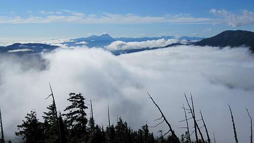 Mt Arrowsmith | 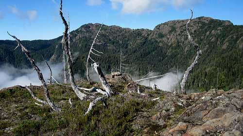 Mt Joan and The Squarehead | 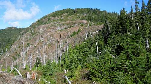 Old Burn Area | 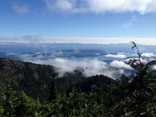 Denman & Hornby Islands | 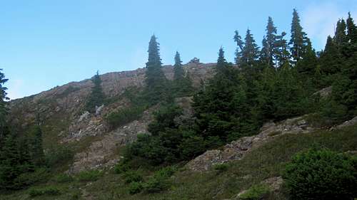 Mt Curran Summit |
Loop Route
Although travelled frequently enough according to the summit logs on Curran and Squarehead, navigation between the two isn’t completely straightforward and neither is there always obvious trail or flagging to follow. Be aware of this fact before you go.
From the summit of Mt Curran return to the area of tarns and look to the right for a route heading southwest. There are some flags to follow at this point and these bring you to the top of some steep bluffs. Pick your way down the bluffs aiming for the flat area below. Cross the saddle and continue up southwest and then in a more southerly direction along the ridge edge. The route continues in the same direction over a couple more bumps before arriving at the bottom of the summit block of the Squarehead. Climb this on the right with a little scrambling near the top.
Descend the Squarehead to the Joan/Squarehead col as described on that page and either climb Joan from there or descend the route to the sub alpine tarns and out to your car from there.
Route Details from the upper parking area:
Mt Curran return: ~10 km, ~ 900 m total elevation, ~ 5-6 hours
Curran/Squarehead loop (not including Joan): ~ 14 km, ~1,200 m elevation gain, ~ 8-9 hours
Red Tape/Safety Considerations
None.As always, make sure that you have left a detailed trip plan with someone responsible. The RCMP and the appropriate SAR agency will respond in an emergency but it is up to you to have the mechanism in place that will initiate the call-out process if it becomes necessary.
The Roaring Creek mountains are sufficiently close to major east coast centres that cellular reception is frequently available. Don't absolutely rely on it however.
Camping
Mt Curran is generally considered a day trip but if you wish to camp en route, there are no restrictions other than the availability of water and a flat spot for your tent. Fires are, however, strictly prohibited, so you must pack a stove. Giardia is well documented throughout Vancouver Island, so boil or treat all water.The parking area just off Cook Creek Road makes a good spot to car camp if you want an early start on a day trip up the nearby peaks. Although the upper parking area has no obvious flat spots, with a little creativity it's possible to position your vehicle such that you can sleep inside. I have done this and it does make a great place to get an early start from. There's certainly no water though, so haul a barrel in with you.
Useful Links
For route information refer to Island Alpine – A Guide to The Mountains of Strathcona Park and Vancouver Island, Philip Stone, Wild Isle Publications, 2003, ISBN 0-9680766-5-3For precise directions get hold of a copy of Backroad Mapbook. Volume 7: Vancouver Island
Weather
Port Alberni weather will likely reflect the most accurate forecast for Mt Curran.For winter trips consult Vancouver Island Avalanche Conditions