-
 767 Hits
-
 75.81% Score
-
 6 Votes
|
|
Mountain/Rock |
|---|---|
|
|
39.14600°N / 120.33013°W |
|
|
Download GPX » View Route on Map |
|
|
Placer |
|
|
Hiking, Mountaineering |
|
|
Spring, Summer, Fall |
|
|
8398 ft / 2560 m |
|
|
Overview
Of the 63 Tahoe Oguls, Mt. Mildred is the one with the fewest ascents registered on Peakbagger. Yes, even compared to Reynolds Peak, Black Butte, and Tells Peak. This has given it a fairly obscure reputation throughout northern Sierra mountaineering and peakbagging. Its relatively remote location (so far as Tahoe-area peaks go) and significant elevation loss upon approach don't help. It is also not the most prominent mountain along its namesake ridge; Picayune Peak to the north is over 100 feet higher.
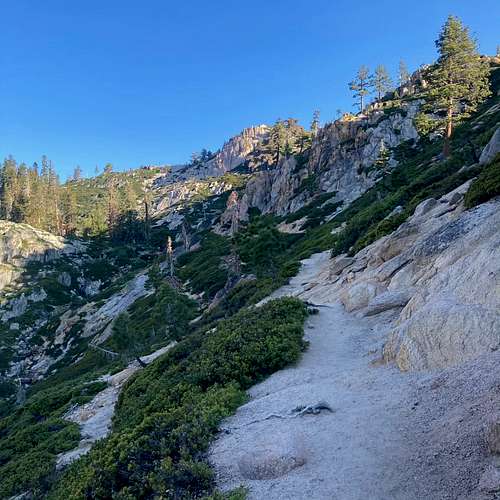
This all being said, Mt. Mildred can a pretty interesting time for the sights and sounds along the way. The east ridge approach from Alpine Meadows is long but takes you past the granite slabs of Alpine Meadows, the froggy Five Lakes, the historic Whisky Creek Camp, and the basaltic monuments that dot the south and east subpeaks. If you are interested in mountains quite literally off the beaten path, then this is a good one for some adventure!

Getting There
Mt. Mildred may be accessed from the east or the west. The most common approach is from the east. Simply head south on CA89 from Truckee or north on CA89 from Tahoe City, then turn west onto Alpine Meadows Road (which is approximately two miles south of Olympic Valley Road). Drive approximately three miles and park at the Five Lakes Trailhead. There is some parking at the trailhead itself and plenty along the side of the road. The usual "don't be a dick" rule applies.
Please note that there is substantail private property here, and Alpine Meadows is a lot less "touristy" than Olympic Valley.
The approach from the west occurs via French Meadows Reservoir through El Dorado National Forest. While a much shorter hike, it's also an extremely long drive and not recommended; just come from the Tahoe side unless you're already in that area.
Route
This route describes the east ridge/slope approach from Five Lakes Trailhead in Alpine Meadows. Per GPX files uploaded to Peakbagger, this is by far the most common ascent route. The out-and-back distance is approximately 17 miles with ~4600 feet of elevation gain. (Although Mt. Mildred is less than 2000 feet higher than the trailhead, this is belied by one major point of 1000+ feet elevation loss and several minor sections of loss).

- Take the Five Lakes Trail west past the Five Lakes recreation area through a thicket of trees. (This area can hold some snow due to the shade.)
- Merge onto the PCT for approximately one mile. Continue west.
- When the PCT splits off and heads north, continue west on the "Historic Western States Trail" (16E10) toward Whisky Creek Camp. You will lose approximately 1000 feet of elevation from Five Lakes to Whisky Creek Camp.
- After passing the ruins (which are cool!), continue heading west. From here, the trail occasionally becomes harder to follow.
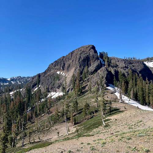
- Ascend 800 feet and continue west for a couple miles until you see one of the great basaltic features around the Mildred Range. Here, the trial pretty much peters out. You can either continue on the sandy ridge to the north, or you can descend around 200-300 feet as you approach the cliff. From here, the trail has returned to the gods.
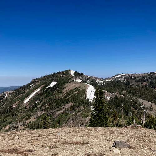
- Head south around the cliff, then walk steeply up between two of more prominent monoliths. Hike west on somewhat unstable metamorphic rock, or gain the ridge to walk up Peak 8109. Mt. Mildred is now visible due west.
- Descend approximately 300 feet to the saddle, then ascend another 600 feet in about half a mile to reach the top of Mt. Mildred.
- Take in the views of more basaltic monuments to the south (i.e. Johnson Monument) and the Heavens Gate feature at Mt. Mildred's col with Picayune Peak.
From here, you can either continue north to grab Picayune Peak as well, or you can retrace your steps east and return to the Five Lakes Trailhead.
The significant cross-country travel and occasional steepness over ungood volcanic terrain/scree provides an estimated Scrambler Rating of 2.1 (YDS 2).
Red Tape
No permits are required to enter the Granite Chief Wilderness. You must obtain a campfire permit if you plan to use any flame source (e.g. campfire, portable stove).
When to Climb

Mt. Mildred is most often climbed after the northern Sierra melts out by mid-Spring. Its relatively low elevation and treeless ridge provides ample opportunities for the summit proper to melt out. That being said, the basaltic eastern face of Peak 8109 generally catches and keeps snow late into the spring, which can be problematic given it is the steepest section of the approach.
Like other northern Sierra peaks, Mt. Mildred is in the realm of "you could climb it in winter".
External Links
USFS Granite Chief Wilderness: link.

