
-
 1284 Hits
-
 78.27% Score
-
 9 Votes
|
|
Mountain/Rock |
|---|---|
|
|
45.74878°N / 15.70675°E |
|
|
Hiking, Sport Climbing |
|
|
Spring, Summer, Fall, Winter |
|
|
1637 ft / 499 m |
|
|
Introduction
Its name is written in Croatian language Okić and is pronounced "Okich". By one explanation, the origin of name is Latin - "Mons acutus" means "Sharp peak" which perfectly matches tke look of our mountain.
Well, it's hardly a mountain. More a rocky, sharp cone hill. But its historical importance for the Croatian mountaineering is considerable and despite its short ascent it's very worth of visiting. The view on Okić from the distance is very nice and also the view from its summit is fine.
Overview
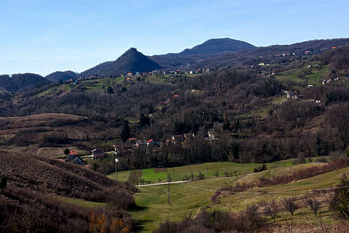
Okić is one of the summits of the Plešivica massif (a part of the NE or Inner Dinaric Belt), 780 m, rising on the very east of it. It's sharp, partially rocky, but rising above a gentle hilly landscape, which is partially forested, partially cultivated with orchards and vineyards. The hill has a shape of a 3-edge pyramid, but its ridges are not very distinct. The W ridge goes towards the mountain hut. Even if the hill is forested, there are many limestone crags. The most rocky side is the southern one.
Okić is interesting first of all for hikers. In addition to the routes climbing on its summit, there are also many other hikes, connecting nearby and more distant destinations. Rock climbing is also popular in the crags of Okić - some short climbs are nicely bolted. The remaining outdoor activities are also popular in the area (not on Okić itself), for example biking, paragliding and others.
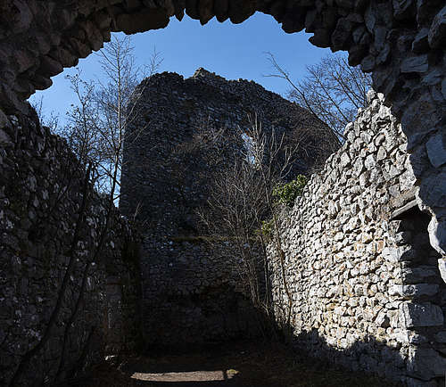
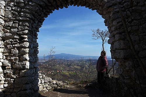
On the summit, there are enough cleared places to enable some nice views around. Especially, if you climb on the castle ruins. Fine is the view towards Zagreb (eastwards) and also towards the south.
Getting There
You can reach the mountain hut by a narrow, asphalted road. The parking lot at the end is free of charge (2023), but for the popularity of Okić quite small. So if you find it occupied, you have to park along the road before.
Parking: 45.74914915350147, 15.702964102252565
Routes overview
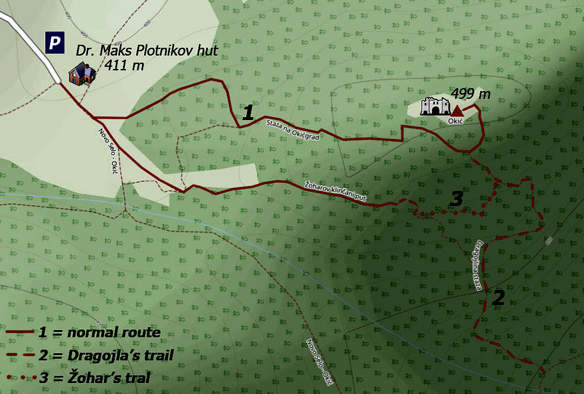
There are three main routes on the summit of Okić. They can be combined in round tours and connection paths, seen on the sketch, are also available.
1. Normal hiking route
("Staza na Okićgrad). It's a quite easy hike up, from the hut taking you only some 20 minutes (90 m of altitude gain). On the Swiss Hiking Scale it would be graded T2, only some stretches are reaching the upper border of this grade, requiring some more careful walk. From the hut you go towards the SE only a few meters, there on the branching go left. Through the woods you gain altitude in the E direction, in higher regions just S of the W ridge. Then you enter the fortification complex, overcome some more narrow passages and enter the main castle yard from the SE side. It's worth climbing also on the castle walls.

2. Žohar's trail
(Žoharjev klinčani put). It's a short, amusing ferrata of grade C on the international ferrata scale. So, it's not just trivial, bul also of only medium difficulty. On some places it's exposed and requires some abilities to pull up. Security devices (cables, hooks and pegs) are in good condition. On the branching a few meters SE of the mountain hut you continue to the right. A good, easy path traverses forested slopes, on the next branching you continue straight (left up goes the connection trail to #1). The S slopes of the hill get steep, then some ropes help you descend safely to the ferrata entry. The first ferrata stretch is the steepest one, it goes vertically up and to the right, gaining soon a rocky edge. On the other side there's another steep section, then from the right the Dragojla's trail joins and you are already below the castle ruins.
3. Dragojla's trail
(Dragojlina staza). It's not starting at the mountain hut, but coming up rather from the valley on the south, being part of a longer trail around the Okić hill. It's difficulty is somewhere between the normal route and Žohar's trail. So, it's steep, in the upper part overcoming also rocks, protected on some places. It's still a hiking route with some elements of easy, protected climbing.
Other paths in the area, either marked or long-distance trails are coming into the area (mostly to the mountain hut) from the neighbouring villages and from places further away.
Two historical notes
|
|
Mountain huts
Planinski dom dr. Maks Plotnikov, 411 m. It has 14 places to sleep and is regularly open on Friday, Saturdays and Sundays. Find more info on the web.