Volendo variare il percorso a cavallo tra il Secondo ed il Terzo giorno, conviene dal Comune di Quart (
da Châtillon/Saint Vincent) s'abbandona momentaneamente la Strada Statale n° 26 e svoltando verso Sud sul grande ponte sopra la Dora Baltea in località Villefranche
. Si lascia momentaneamente la Strada Regionale lungo il corso della Baltea salendo invece a Mezzogiorno in direzione del Comune di Grand Brissogne e, giunti ad una rotonda, si scartano a sinistra (Sudest) la deviazione per il vicino Comune di Saint Marcel ed a destra (Ovest) quella che si indirizza verso il Comune di Pollein.
). Una breve e
discesa tramite una Stradina Municipale riporta sulla Regionale per il Comune di Pollein, passando dal Villaggio di les Ayettes
). Continuando ad Ovest si oltrepassano i Villaggi di Grand Pollein (
). Breve divagazione a Sudovest permette di raggiungere la Frazione di Chenaux (
), all'imbocco della Gorgia del Dard, mentre una stradina di collegamento permette di raggiungere, passando il Torrent de Comboé, quelli di Roulaz ed Alto Félinaz (
), ormai in Charvensod.
From Pollein Municipality or area of the "Envers" (Southern, but less sun as covered by mountains), there are two possibilities to visit the zone of the "Adret".
1)- to return to Quart with the opposite direction (
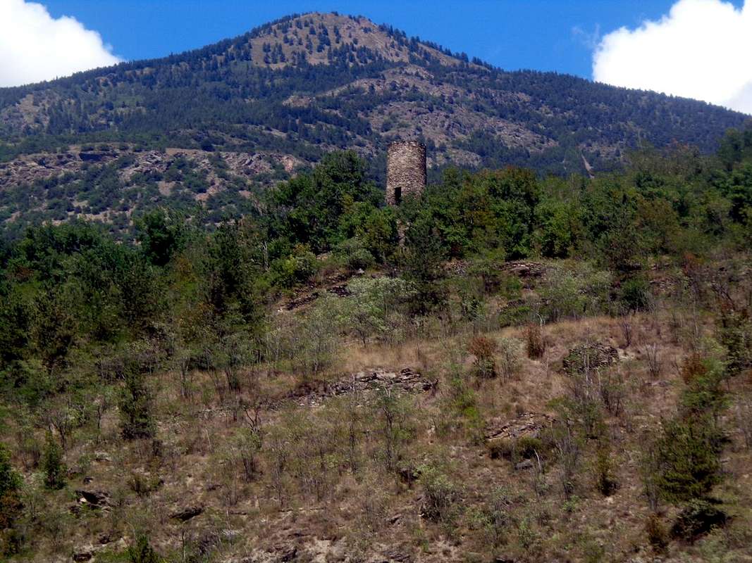
Tour de Chétoz above Quart, Villefranche locality, and clearly visible from the bridge over the Dora Baltea;
Sant'Eusebio Church, between Carné Prebenda small Villages) to the one carried out this far and starting from Quart Municipality on Regional Road with a detour (2 Km. further to West; brown sign), with a detour to the North to that of Etollin (
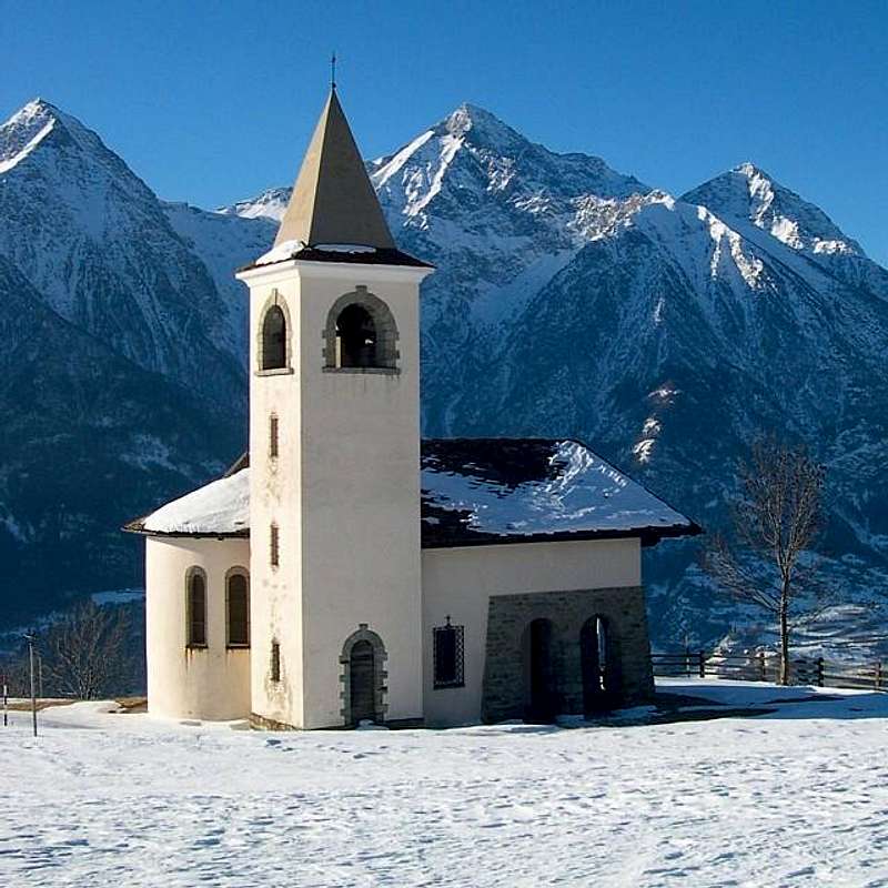
Church with Romanesque Bell Tower) to reach the above Villair de Quart Fraction (
627/64m; Church of Saints Fabiano, Sebastiano and Rocco) and continuing in a short time you get to the
Château de Quart and Church of St. Nicholas (774m); wanting a short trip to the Northeast with small trail reported
n° 7 leads to the above
Hermitage of St. Emeric (
1130m; Little votive Chapel and Altar with Cross, 1h'15/1h'30), under the same name
"Bois". Returning and proceeding with an alternative Regional Road, higher than the State, you reach the Municipality of Saint Christophe (
584/619m; Churches Santa Anna San Cristofero) with overlying Fractions Sorreley (
790; Church of St. Gottardo) and West of Senin (
766/805 m; Church of St.s Barbara and Michael). The descent reaches Aosta passing near the
Castles of "Passerin d'Entrèves" and "Duca degli Abruzzi" or Jocteau and home to
"Alpine Military School of Aosta", dedicated not long to General Alpine Troops Antonio Cantore. Here, near the Busseyaz Village
(664m), we find an old and round
"Mound Celtic", currently under exploration (
Tomb of an ancient burial of a Salassian Prince?). This on the hill just before the entrance to the city and in a meadow just upstream of the Alpine Military School of Aosta.
2)- : Wanting to discard the first hypothesis, from Pollein Commune through the new bridge on the Dora Baltea can quickly get to the National Road No. 26 and this in a moment to the Municipality of Saint Christophe, now at the gates of Aosta City. After reaching a roundabout with a monument dedicated to the
"Local Cuisine", you will soon reach the Chief town (
619m; Church of San Cristoforo). Left to right deviation
"Mountagne", which leads to the small Village of Prevot (
584m; Church of Santa Anna; secondary connections with the fraction of Villair de Quart), however, continue to the left (West) with a long diagonal, passing the Fractions and Chabloz Fontanalle, reaches next round with a monument to the
"Popular Sports" (tsan, rebatta and fiollet) near a small
Votive Chapel dedicated to a Partisan shot by the Nazis in 1944. The road splits:
a)- a branch up to the right (Northeast) to the important Fractions Sorreley and Veynes (
790m, 805m; Churches of San Gottardo San Rocco; wanting to continue on the hill you will reach the Villages Cretallaz, Jeanceyaz (
1087m; Church of San Leonardo) and Morgonaz at entrance to the Combe de Sénevé and beautiful routes to the Castle of Villair de Quart. Or with a fork from Lumian small Village
(1025m) Northwest to the Villages Parléaz or Parleyaz and Blavy (
1274m, 1467m, Church of S.S. Margaret Bernard and Napoleonic fireplace, Church of St. Bernard), at the foot of Becca's Viou
(2856m), as well as the emblem of the Commons of Saint Christophe and Aosta-Northeast. In this case, however, it is limited somewhat the next time to visit the city.
b)- From the second roundabout (
junction 692 metres nearby the
"Castello" St. Christophe or Passerin d'Entrèves, you continue left (Northwest) reaching the Hamlet of Senin (
766/805m; Church of S.S. Barbara and Michael).
b)- : playing field for Traditional Sports over the
"Area Tsatelet" with Quota BP or Baden Powell). From the Castle of St. Christophe the Regional Road falls in the Southwest, and surpassed the
Castle of the Alpine Military School, soon reached the city at
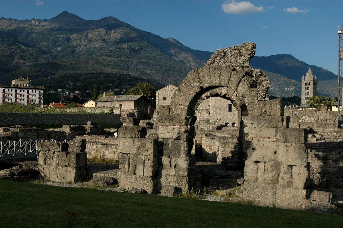
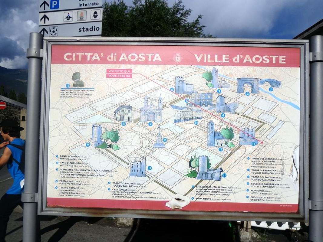
Roman Bridge, Arch Augustus's. From here, going to the West, in an equally short time (
500 metres about) you reach the entrance to the city and the triple
Porte Praetoriane (Pretorian Doors of "Augusta Praetoria Salassorum"). Downright you are now inside the ancient Urbs.
![]()
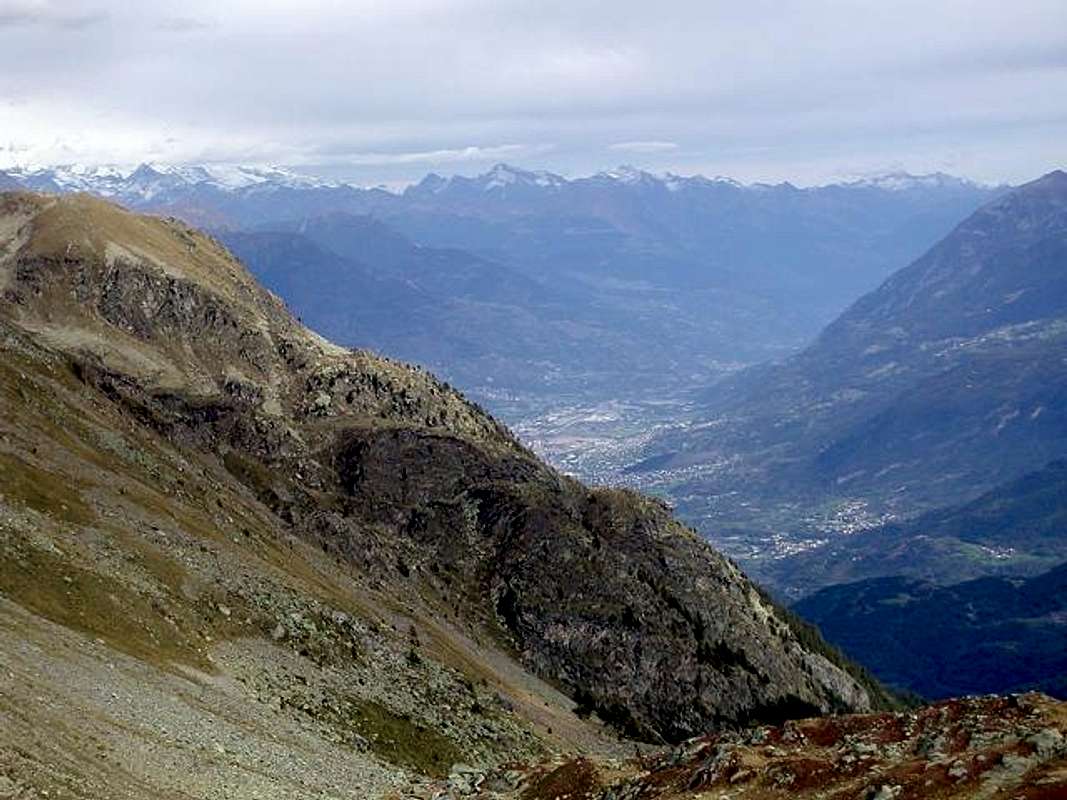
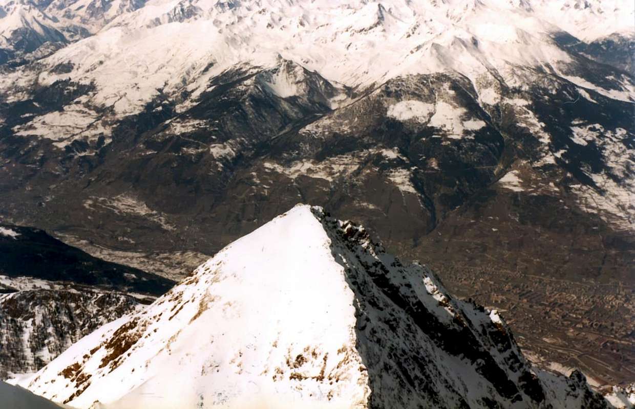
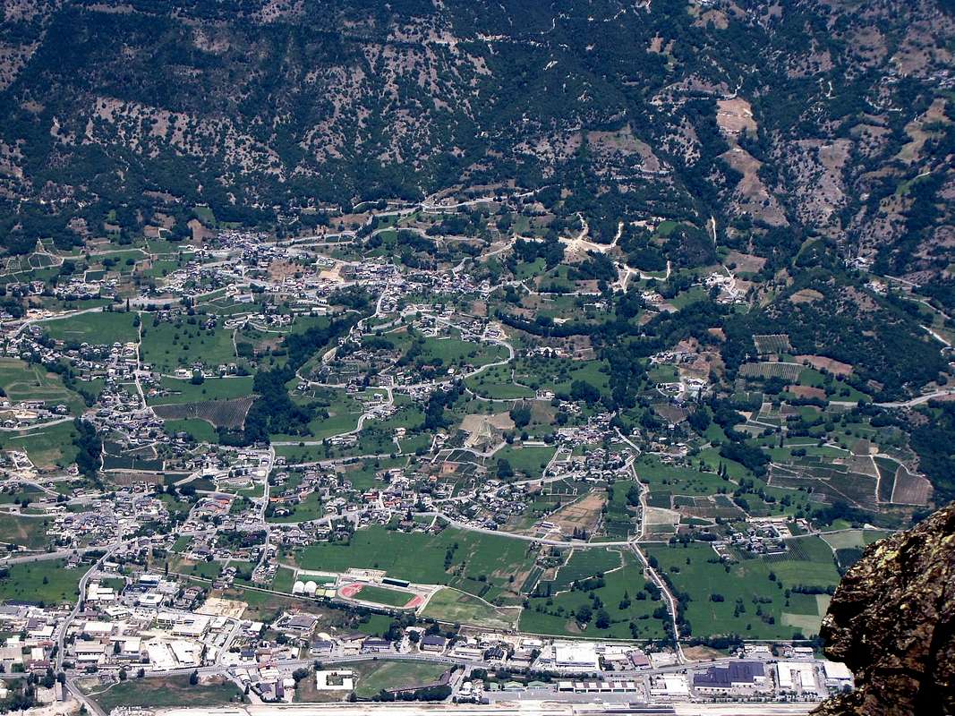
Saint Christophe and Aosta East from Becca di Nona Summit,
by Antonio
Da Pollein o zona dell'"Envers" (a Meridione, ma la meno esposta al sole poiché coperta dalle montagne) esistono due possibilità per andare a visitare l'"Adret".
1)- : rientrare a Quart con il percorso inverso a quello fino a qui effettuato (
Tour de Chétoz sopra Quart in località Villefranche e ben visibile dal ponte sulla Dora Baltea;
Chiesa di Sant'Eusebio, subito più avanti ad Ovest tra i Villaggetti di Carné e Prebenda) e partendo da questi sulla Strada Regionale, con una deviazione (2 Km. oltre verso Ovest con segnalazione color marron) a Nord per quello di Etollin (
Chiesa con Campanile Romanico), si raggiunge il soprastante Villair (
627/64 m; Chiesa dei S.S. Fabiano, Sebastiano e Rocco) e proseguendo in breve tempo si arriva al
Château de Quart e Chiesa di San Nicola (774 m). Volendo una breve escursione a Nordest con sentierino segnalato come
n° 7 conduce all'
Eremo di San Emerico (
1130 m; Cappelletta votiva ed Altare all'aperto con Croce;
1h'15/1h'30), sotto l'omonimo
"Bois". Ritornando e procedendo con un'alternativa Strada Regionale, più in alto rispetto alla Statale, si raggiunge il Comune di Saint Christophe (
584/619 m; Chiese di Santa Anna e San Cristofero) con le soprastanti Frazioni di Sorreley (
790 m; Chiesa di San Gottardo) ed a Ovest di Senin (
766/805 m; Chiesa dei S.S Barbara e Michele). La successiva discesa raggiunge Aosta passando dai
Castelli dei Passerin d'Entrèves e Duca degli Abruzzi o Jocteau "Scuola Militare Alpina di Aosta", dedicata da non molto al Generale Antonio Cantore. Appena prima del Villaggio di Busseyaz
664 m), troviamo un antico tondeggiante
"Tumulo Celtico", attualmente ancora in fase d'esplorazione (
Tomba d'un antica sepoltura d'un Principe Salasso?). Questo sulla collina appena prima dello ingresso alla città ed in un prato subito a monte della Scuola Militare Alpina.
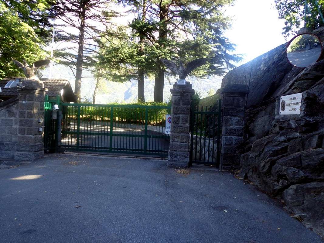
![]() Entrance of Alpine Military School of Aosta in North by Aosta,
Entrance of Alpine Military School of Aosta in North by Aosta,
by Osw2)- : volendo scartare la prima ipotesi, da Pollein il nuovo ponte sulla Dora Baltea permette d'arrivare rapidamente alla Strada Statale n° 26 e da questa in un attimo al Comune di St. Christophe, ormai alle porte d'Aosta. Raggiunta una rotonda con monumento dedicato alla
"Cucina locale", in breve si raggiunge il Capoluogo (
Chiesa di San Cristoforo. Lasciata a destra la deviazione
"Montagne", che conduce al Villaggio di Prevot (
584 m; Chiesa di Sant'Anna; collegamenti secondari col Villair di Quart), si prosegue invece a sinistra (Ovest) con un lungo diagonale che, passando le Frazioni di Chabloz e Fontanalle, raggiunge una successiva rotonda con monumento agli
"Sports Popolari" (tsan, rebatta e fiollet) vicino ad una
Cappelletta Votiva dedicata ad un Partigiano fucilato dai nazisti nel 1944. Qui la strada si sdoppia:
a)- un ramo sale a destra (Nordest) verso le importante Frazioni di Sorreley e Veynes (
790 m, 805 m; Chiese di San Gottardo e San Rocco). Volendo continuare sulla collina si raggiungono i Villaggi di Cretallaz, Jeanceyaz (
1087 m; Chiesa di San Leonardo) e Morgonaz, all'ingresso della Comba di Senevé e con bella strada di collegamento col Castello del Villair de Quart. Oppure con un bivio da Lumian
(1025 m) a Nordovest verso i Villaggi di Parléaz o Parleyaz e Blavy (
1274 m, 1467 m; Chiesa dei S.S. Margherita e Bernardo e camino Napoleonico, Chiesa di San Bernardo), alle falde della Becca di Viou
(2856 m), emblema del Comune di St. Christophe e di Aosta-Nordest. In questo caso però si limita alquanto il tempo successivo per la visita della Città.
b)- Dalla seconda rotonda (bivio
692 metri), appena sopra il
Castello di St. Christophe o Passerin d'Entrèves, si continua a sinistra (Nordovest) raggiungendo la Frazione Senin (
766/805 m; Chiesa dei S.S. Barbara e Michele; campo da gioco per gli Sports Tradizionali sopra l'
Area Tsatelet con Quota BP o Baden Powell). Dal Castello di St. Christophe la Regionale scende a Sudovest e, sorpassato il
Castello della Scuola Militare Alpina, in breve raggiunge la Città presso
Ponte Romano ed Arco d'Augusto. Da qui, andando ad Ovest, si raggiungono l'ingresso alla Città e le antiche triplici
Porte Praetoriane. Siete ormai dentro l'antica Urbs.
![]()
Arch Augustus's Triumph 23 BC at the entrance in Aosta City,
by Osw