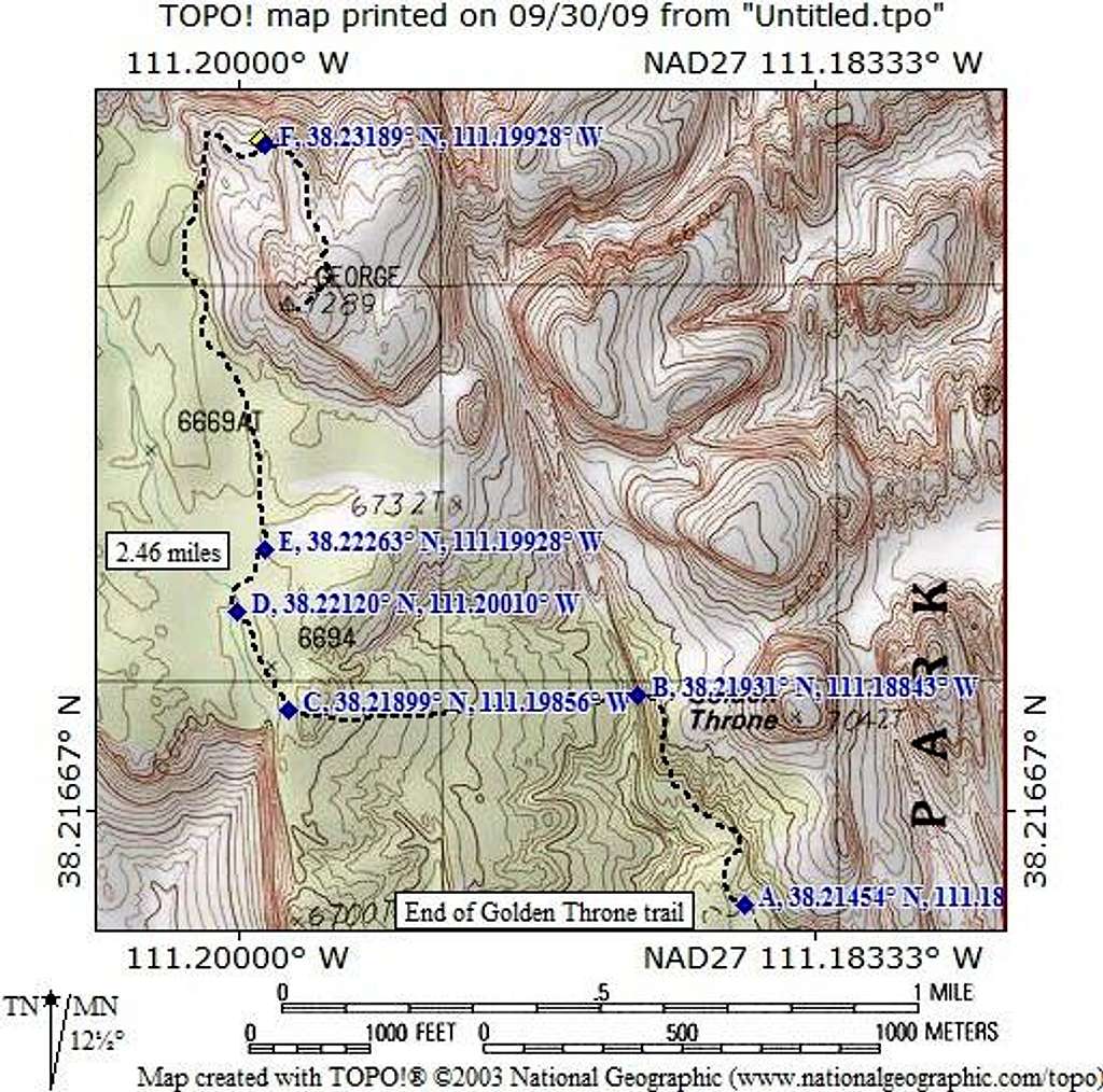
The trailhead is at the end of the graded dirt road found in Capitol Wash and the trail starts on the north side of the parking area. Just before the view point, we left the trail near GPS waypoint A. Waypoint B was where we turned to head up to the left of the rock formation (WP C). A confluence of two washes come together at WP D. Leave the larger of the two and head up the narrower wash (head for WP E). Stay in the winding wash as long as you can and head for a gap which will allow you to reach WP F and the crux of the hike. Waypoints are lat/long nad 27
Note: This
pic was taken between Waypoint A & B.


Comments
Post a Comment