Product Description
(From Microsoft)
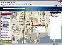
The Virtual Earth Platform is an integrated set of services that combines unique bird’s-eye, aerial, and satellite imagery with best-of-breed mapping, location and search functionality. It enables business to deliver innovative solutions and breakthrough customer experiences.
With the Virtual Earth platform, companies can create an immersive experience that enables consumers to easily discover, search, and visualize business location data and locally relevant information. Take your websites and applications to the next level by integrating the Virtual Earth Platform to deliver the highly visual and locally relevant information consumers care about most.
Note
Microsoft developed Virtual Earth to compete with Google Earth.
Features
Bird’s-Eye Imagery. Get unique views of the real world locations, providing real insight into "what it’s like there."
Aerial and Satellite Imagery. Enjoy high-resolution aerial and satellite images from the best of breed imagery providers.
Dynamic Maps. Easy to read, accurate maps and hybrid imagery make finding locations and following directions easier than ever.
Intuitive User Experience. Utilizing AJAX technology, drag and pan the map, zoom in and out with the scroll wheel and interact with the application like a rich client.
Specialty Static Maps. Customize applications with over 30 specialty road map styles that are dynamically generated via the Web Service, such as line-drive maps or night-time driving maps.
Localization. Expand your audience by localizing maps and driving directions into 13 languages (Available through the MapPoint Web Service API only).
Geocoding. Get the most accurate locations around the world with the highest quality geo-coders, such as Group1 GeoStan geocoding engine in the U.S.
Driving Directions. Provide optimized driving directions with step-by-step instructions. Travel long distances with worldwide city-to-city routing.
Proximity Search. Return a list of POI based on the proximity to a selected location. Flexible ways to search for additional POI along a specified route.
Flexible, Standard APIs. Utilize services-oriented architecture (SOA) best practices with multiple platform support through our SOAP and JScript interfaces.
Customer Services Site. Manage your applications, store and batch process your data and generate flexible reports that can be combined with business intelligence applications. Download
Virtual Earth is free and can be downloaded Here. Images

redsplashman23 - Mar 8, 2007 2:14 pm - Hasn't voted
Virtual Earth