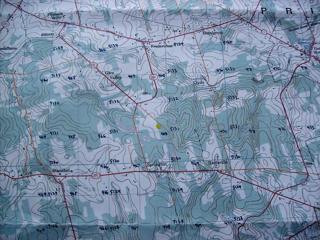
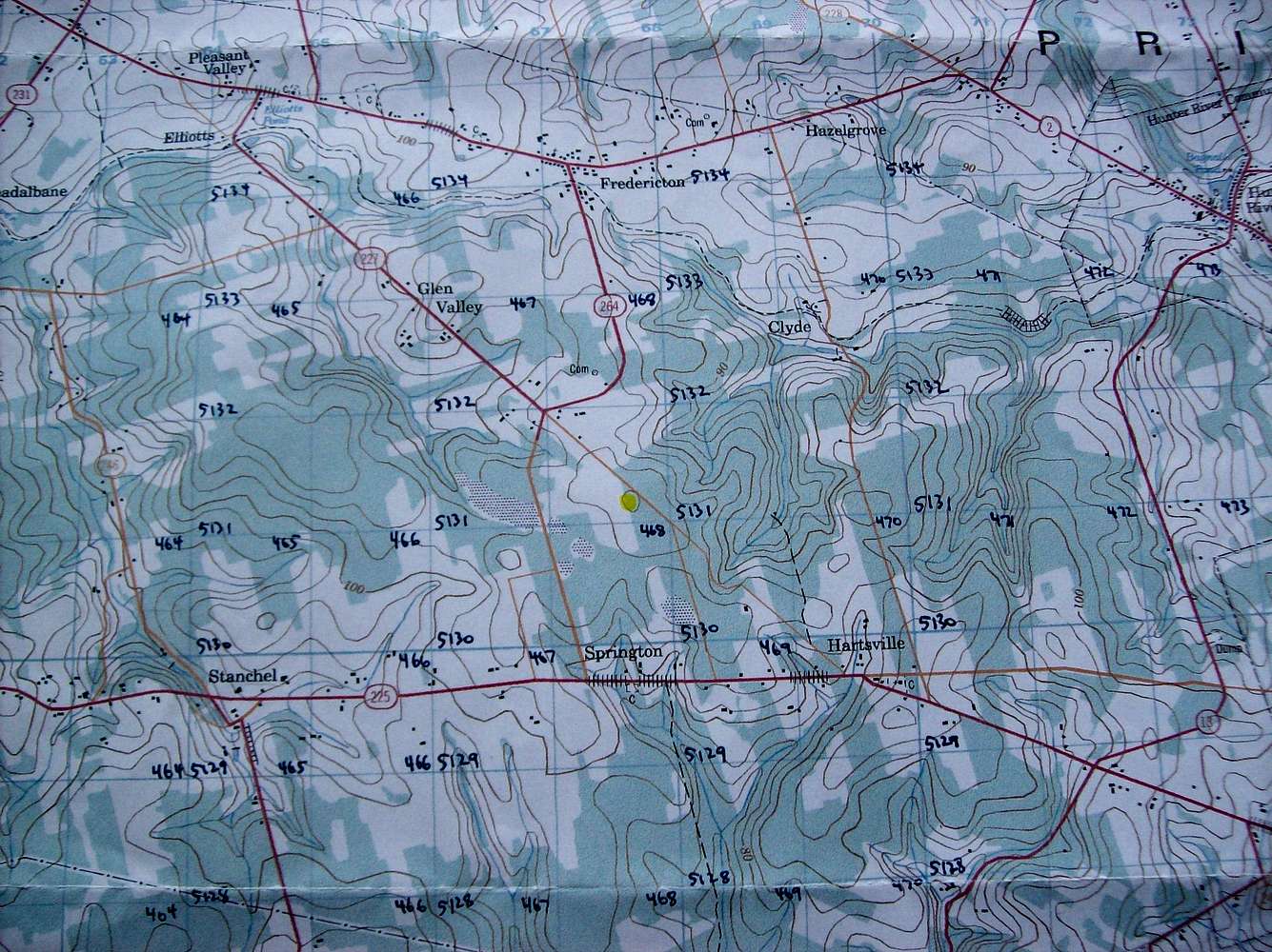
This is a picture of the NTS 1:50,000 topo map I used when hiking to the Prince Edward Island High Point. I labeled the UTM grid by hand. The 140m closed contour is highlighted in yellow. The mailbox marking the high point turned out to be south of the closed contour at UTM 467758 5130922. Look below the yellow closed contour for the number 468. Just on the lower left of the four is the high point.


