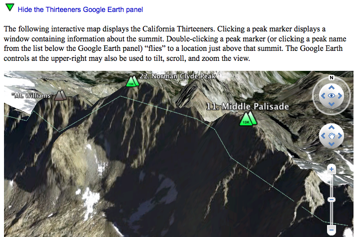
I've just completed a significant update to my VRMC California Thirteeners site. I'm now using the Google Earth plugin to display interactive 3-D maps of the peaks on this and other peak lists. Here's a picture of what this support looks like in your browser after installing the plugin:
========================================================

========================================================
Although this post is certainly a shameless act of self-promotion, I am finding the new Google Earth panel quite useful for showing my wife and others where I've been, conducting future trip planning, etc. I hope that at least some of you will try my site out and that you will find it useful as well.
A few additional features of interest:
* In addition to the California Thirteeners, I also have pages listing the California Fourteeners, 50 Highest, 100 Highest, 4000-Meter Peaks, and 150 Highest.
* Climbers can register a user name & password to begin keeping track of their own progress toward completing the list(s).
* Info balloons and detail pages link back to peak pages here at SummitPost.org.
* Each detail page includes an interactive 2-D Google Map that can display TerraServer USGS topographic images (and other map types).
* KML files can also be downloaded to view peak lists within the separate Google Earth application.
* Registered climbers can employ their own criteria for which peaks are considered passing, marginal, or failing (e.g., the Fourteeners using interpolated contours for key saddle heights includes Mt. Muir).
Enjoy,
- Schmed

