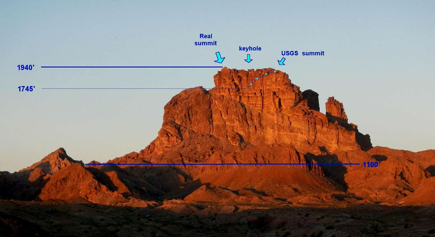
Picacho as seen from the east (north at right). There are substantial errors in the
USGS map. Elevations for contours were undoubtedly obtained by photogrammetry, and were not checked.
The right arrow points to the "summit" identified by the USGS map (~1920'). The actual summit (location of the register) is indicated by the arrow at left, and is roughly 500' farther south. The region of the true summit is given an elevation of ~1745' by the USGS map, and the dash-dot line shows the approximate shape suggested by the USGS contour map. GPS measurements put the true summit at ~1940 +/- 15'. The keyhole is under the false summit, which one most pass over (or under, through the keyhole) to reach the true summit.


