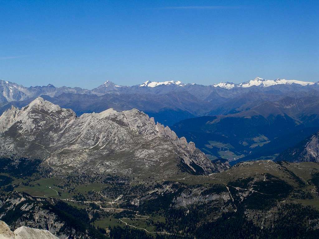
Pico di Vallandro/Dürrenstein Route Overview
The route to the summit of the Pico di Vallandro (Dürrenstein, high summit in foreground at left) can be clearly seen rising from the Pratopiazza (Plätzwiese, green area at bottom left). The following description is easier to follow if you click on the image to enlarge it.
The route follows a zig-zag track that takes approximately 3 hours return from the Hotel Hohe Gaisl (just off screen to the left where the track straightens out below the peak), or 4 hours return from the marvellous Rifugio Vallandro (seen clearly at the right hand end of the Pratopiazza, just above the road winding down to Val Landro, bottom centre).
Another interesting and more scenic route follows the ridge directly up from Monte Specie (Strüdelkopf, low, grassy summit at bottom right), involves some scrambling.
The summit has terrific views of the Croda Rossa (Hohe Gaisl) to the west, the Sexten (Sextner) Dolomites (including the famous Tre Cime di Lavaredo/Drei Zinnen) to the east, Monte Cristallo to the south and Val Pusteria/Austrian Alps to the north. Taken from Forcella Staunies, with Val Pusteria mid-ground and the glaciated Austrian Alps on the horizon (September 2006).


