


FlatheadNative - Aug 12, 2010 9:33 pm - Hasn't voted
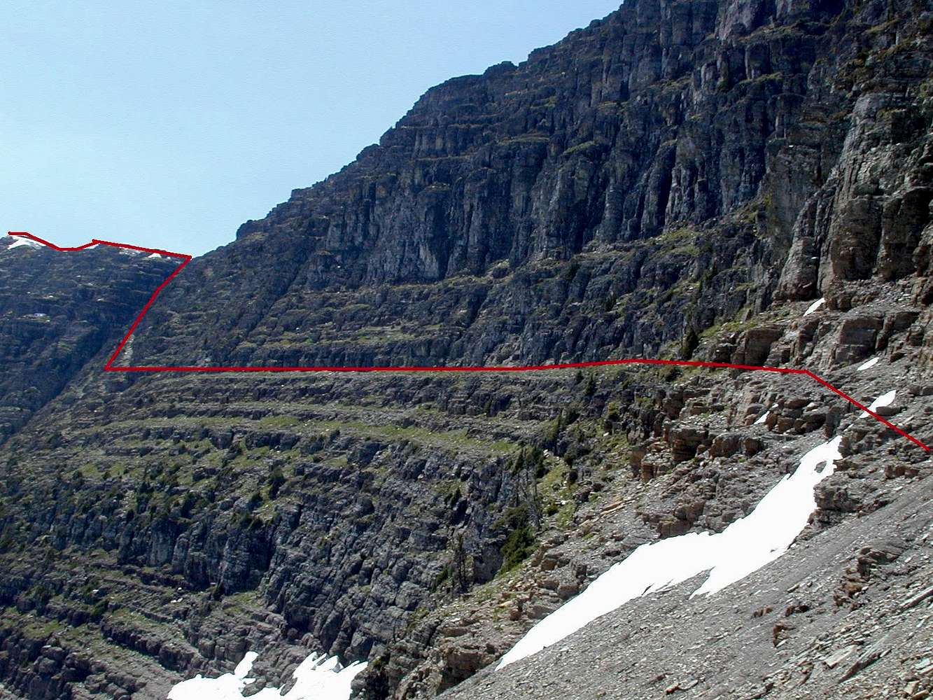
Too HighThe goat trail across this slope is actually the wide green ledge below the red line in this photo.

jimegan - Aug 17, 2010 12:15 am - Hasn't voted
Re: Too Highforgive my failing eyesight. The correct ledge is well marked with ducks and should be apparent as you begin your traverse.
FlatheadNative - Aug 17, 2010 2:32 pm - Hasn't voted
Re: Too HighIts all good, Jim. i just thought it important for readers to know that the trail is lower. Are you having a good summer climbing?
jimegan - Aug 17, 2010 2:41 pm - Hasn't voted
Re: Too HighI agree...thanks for your input. It would be nice to have the elevation for the best ledge, but in my description I note that it is about 100' below the saddle which along with the ducks should help folks find it.
Just returned from Great Basin Nat'l Park where I climbed 3 new peaks. It was a nice escape from the Vegas heat. Next week I am heading to Alaska for a couple of weeks with several small peaks on my wish list!
FlatheadNative - Aug 17, 2010 2:51 pm - Hasn't voted
Re: Too HighSounds great! I have done 23 up at the park this year. doing Pollock (again) and Bishops Cap tomorrow. Will be doing Clements/Cannon and Grinnell next week. The following week we are doing Iceberg and Ahern. The weather has been poor here and there was a lot of snow on routes that we normally could do in July. Take care and stay in touch.


Comments
Post a Comment