Toggle navigation
Mountains
Routes
Images
Trip Reports
Forum
What's New
People
Areas & Ranges
Articles
Trailheads
Canyons
Huts & Campgrounds
Albums
Logistical Centers
Fact Sheets
Lists
Custom Objects
Gear
Plans & Partners
WELCOME TO SUMMITPOST
SIGN IN
REGISTER
Mount Harrington
Additional Parents
Image
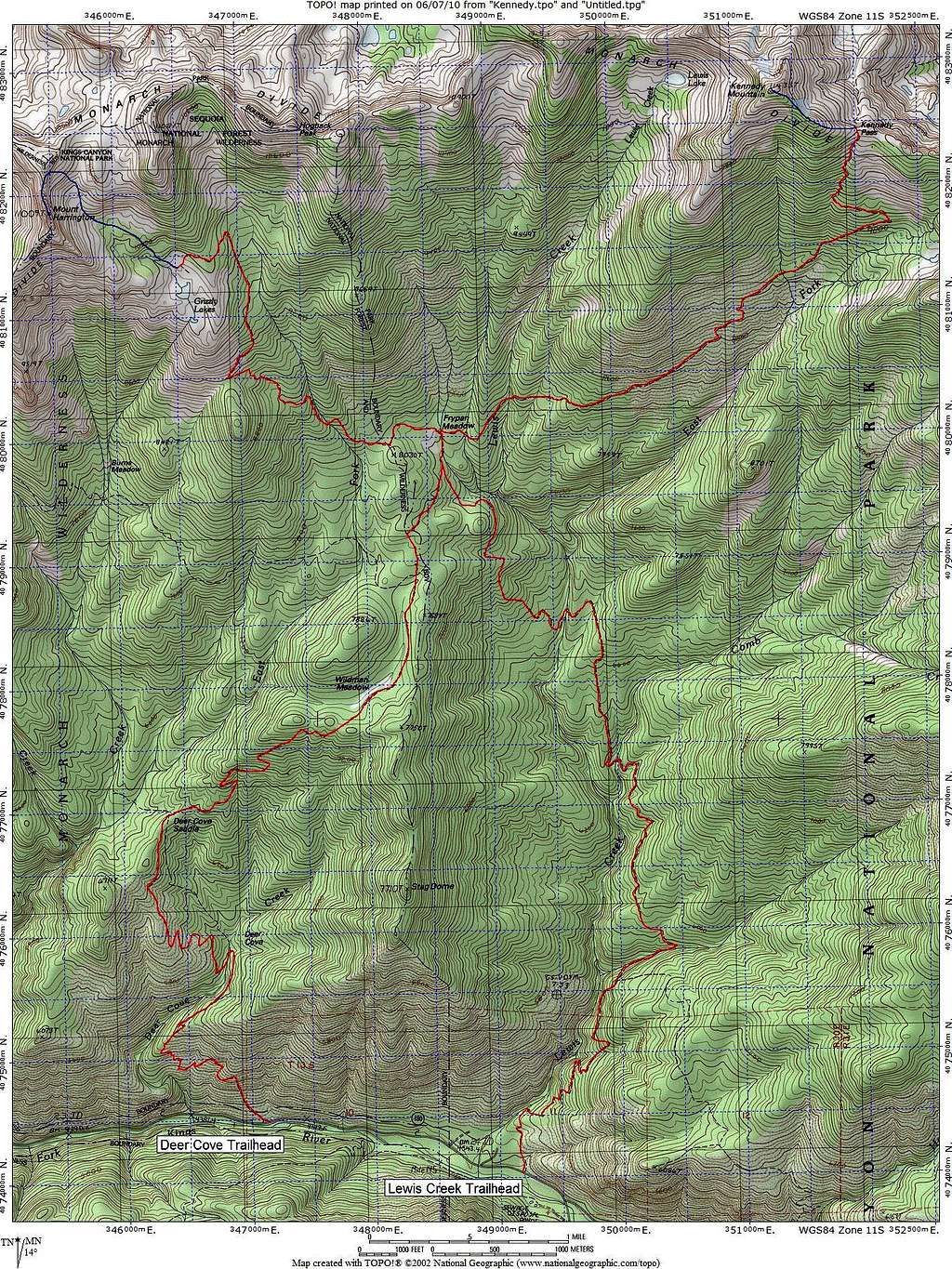
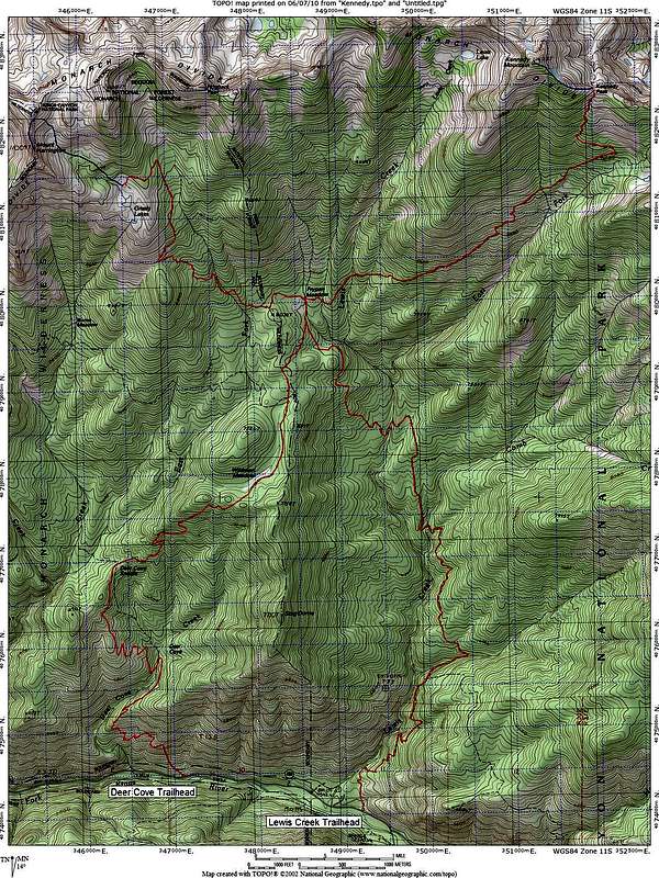
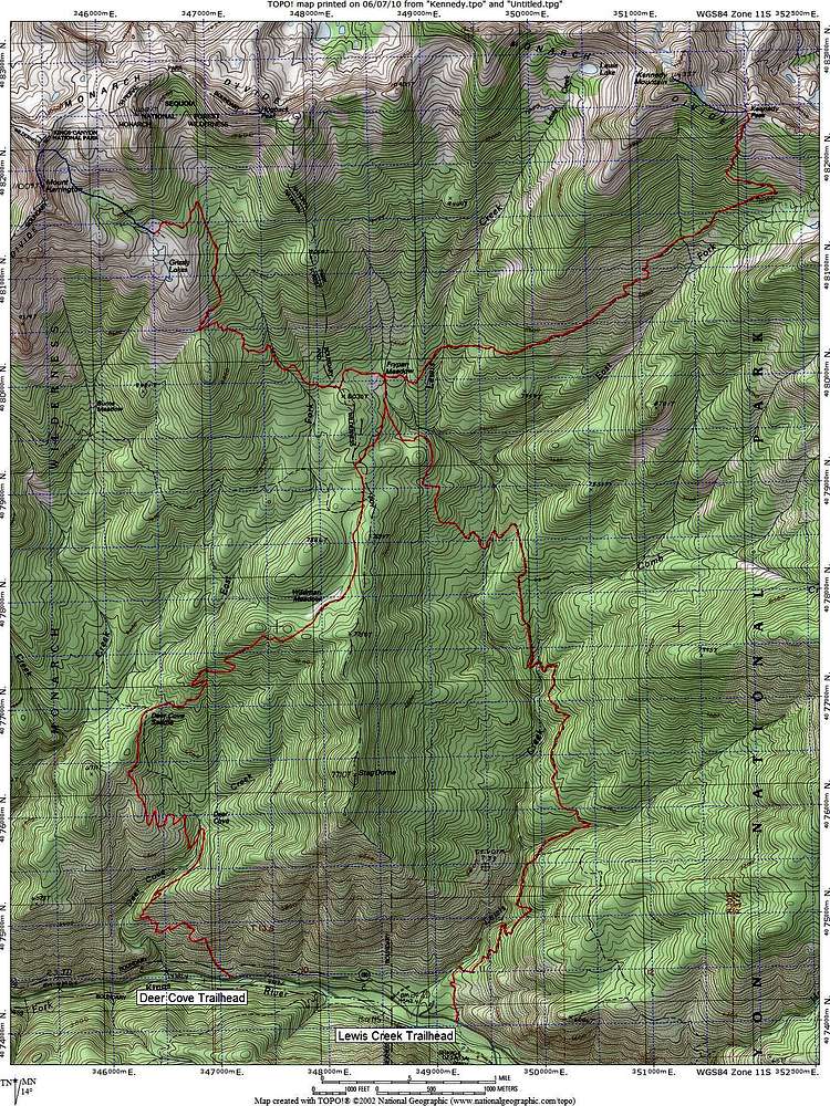
Route Map for Kennedy Mountain and Mount Harrington
View High-Resolution Image
Route Map for Kennedy Mountain and Mount Harrington
Routes from the Deer Cove and Lewis Creek Trailheads to Kennedy Mountain and Mount Harrington, with cross-country portions shown in blue.
« PREV
NEXT »
mrchad9
on
Jun 15, 2010 12:24 am
Comments & voting
Other parents
Lat/Lon:
36.88000°N / 118.67°W
Image Type(s):
Topo/Diagram
Image ID:
629649
4785 Hits
82.48
% Score
15
Votes
Log in to vote
Comments
No comments posted yet.
to post!
Don't have an account?
Mount Harrington
(Mountain/Rock)
You are at
the First
Image
Viewing
#1 of 17
GALLERY
NEXT »
mrchad9's Image Gallery
« PREV
Viewing
#241 of 636
GALLERY
NEXT »
Kennedy Mountain
(Mountain/Rock)
Loading....
×
You need to login in order to vote!
User Name
Password
Remember me
Forgot your password?
Log me out when I close my browser.
Keep me logged in all the time.
sign in as a user
Don't have an account?
Register now for FREE
Rating available
Suggested routes for you
People who climb the same things as you
Comments Available
Create Albums
Register Here


