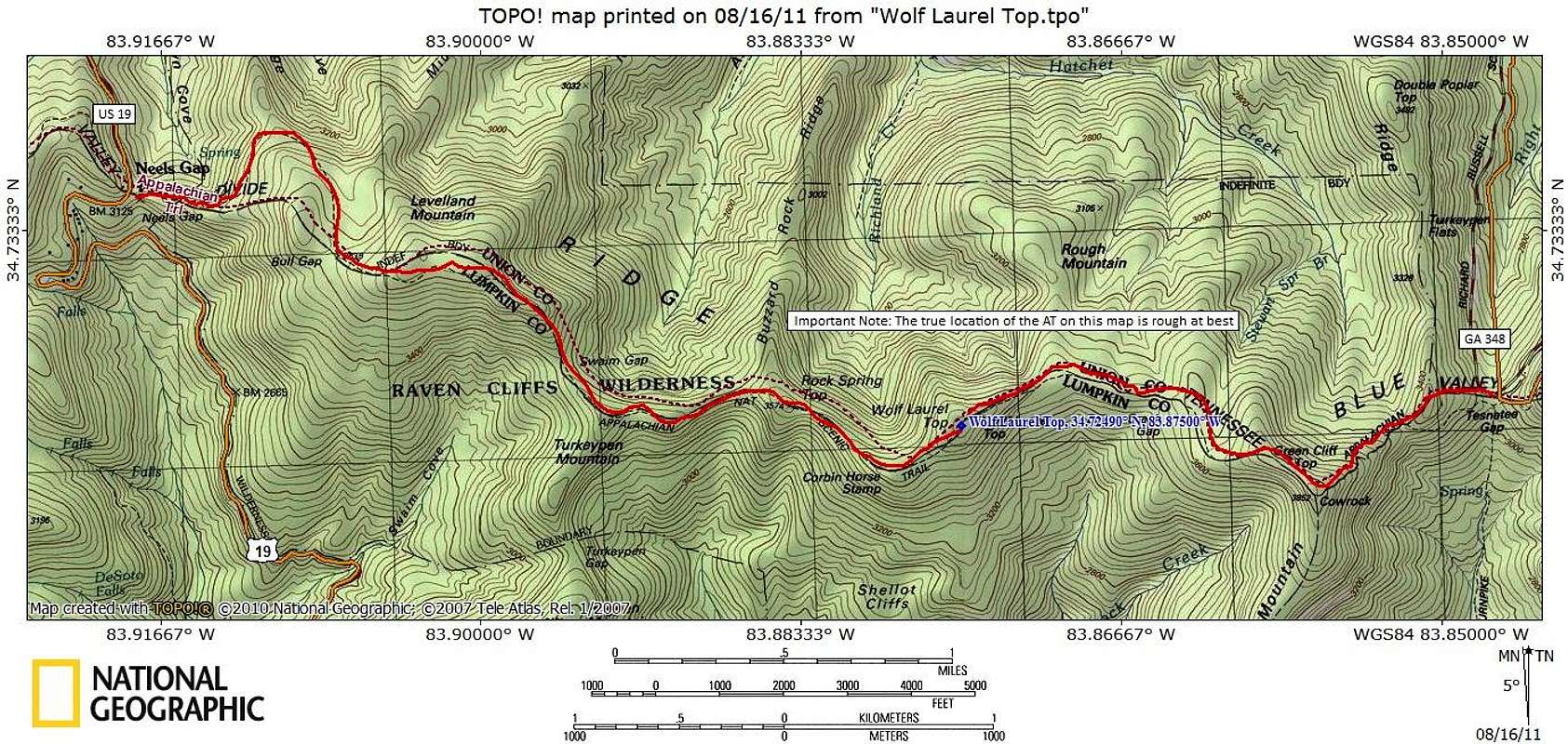
The AT crosses very near summit of Wolf Laurel Top, though nothing I found indicated the highpoint had been reached (such as a cairn or other marker). As with many mountains in this region, the highpoint is rather indistinct.
From the west: The peak can be accessed from the west via Neels Gap (elevation 3,109 feet) for an undulating, approximately 6.5 mile roundtrip outing. To reach Neels Gap from Dahlanega (about 60 miles north of Atlanta), follow U.S. 129/19 roughly 22 miles north.
From the east: For a shorter but steep outing, park where the AT intersects GA 348 (Richard B. Russell Scenic Highway) at Tesneete Gap (3,138 feet) for an undulating approximately 4.5 mile roundtrip, including an ascent of Cow Rock Mountain both ways.
Map designed August 2011


