Toggle navigation
Mountains
Routes
Images
Trip Reports
Forum
What's New
People
Areas & Ranges
Articles
Trailheads
Canyons
Huts & Campgrounds
Albums
Logistical Centers
Fact Sheets
Lists
Custom Objects
Gear
Plans & Partners
WELCOME TO SUMMITPOST
SIGN IN
REGISTER
Adams, Mount
Additional Parents
Southeast Face
Image
Route on Mount Adams
View High-Resolution Image
Route on Mount Adams
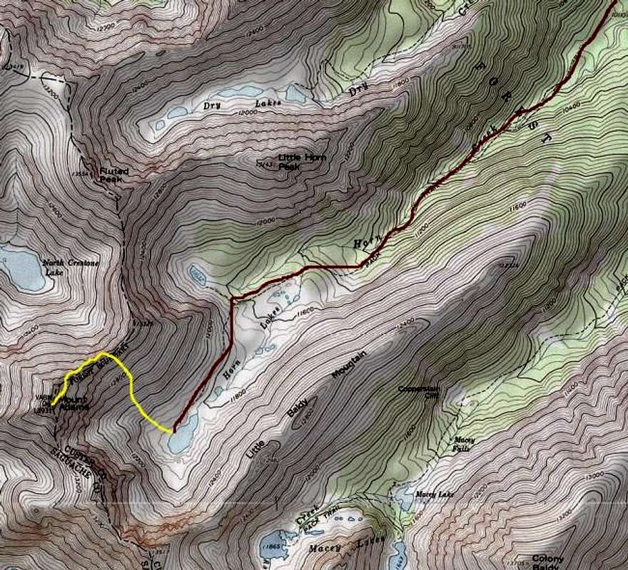
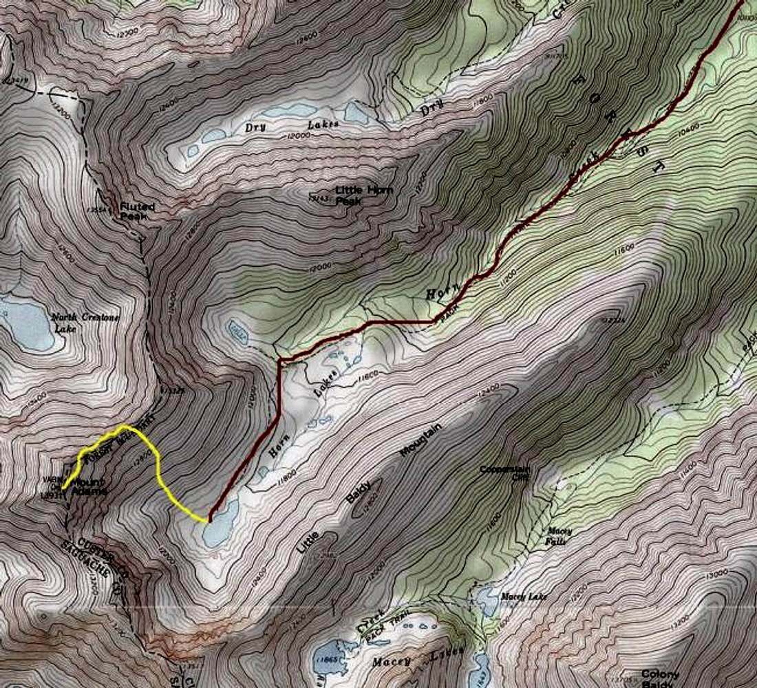
The southeast face route breaks down into three phases: 5-mile hike to the lake on the Horn Creek Trail; three creek crossings. (In red.) 1500-foot climb up the southeast face to gain the ridge. 1/4-mile scramble to the summit.
« PREV
NEXT »
Larry V
on
Oct 15, 2006 3:43 am
Comments & voting
Other parents
Lat/Lon:
38.00600°N / 105.593°W
Image Type(s):
Topo/Diagram
Image ID:
235212
4425 Hits
71.06
% Score
1
Votes
Log in to vote
Comments
No comments posted yet.
to post!
Don't have an account?
Adams, Mount
(Mountain/Rock)
You are at
the First
Image
Viewing
#1 of 1
GALLERY
You are at
the Last
Image
Larry V's Image Gallery
« PREV
Viewing
#444 of 488
GALLERY
NEXT »
Southeast Face
(Route)
Loading....
×
You need to login in order to vote!
User Name
Password
Remember me
Forgot your password?
Log me out when I close my browser.
Keep me logged in all the time.
sign in as a user
Don't have an account?
Register now for FREE
Rating available
Suggested routes for you
People who climb the same things as you
Comments Available
Create Albums
Register Here


