Toggle navigation
Mountains
Routes
Images
Trip Reports
Forum
What's New
People
Areas & Ranges
Articles
Trailheads
Canyons
Huts & Campgrounds
Albums
Logistical Centers
Fact Sheets
Lists
Custom Objects
Gear
Plans & Partners
WELCOME TO SUMMITPOST
SIGN IN
REGISTER
Blodgett Creek Trailhead
Additional Parents
Image
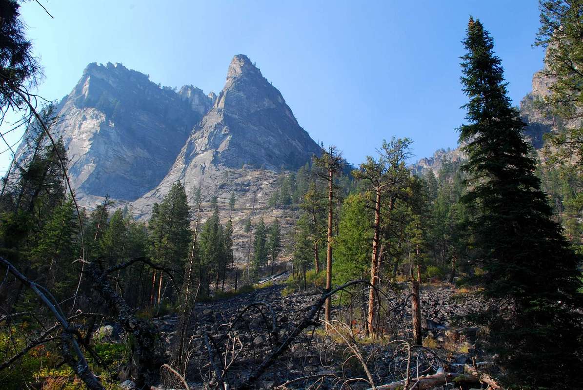
Route Past The Prow
View High-Resolution Image
Route Past The Prow
The avalanche chute route to the summit of Mill Point is just to the right
(east)
of The Prow. Notice the talus at the base of the chute. That mostly stable rock continues almost all the way to the top. © Mike Hoyt, 11sep07.
« PREV
NEXT »
Michael Hoyt
on
Sep 16, 2007 4:05 pm
Comments & voting
Other parents
Lat/Lon:
46.29173°N / 114.29375°W
Image Type(s):
Alpine Climbing
,
Scenery
,
Panorama
Image ID:
337557
3623 Hits
78.27
% Score
9
Votes
Log in to vote
Comments
No comments posted yet.
to post!
Don't have an account?
Blodgett Creek Trailhead
(Trailhead)
« PREV
Viewing
#3 of 8
GALLERY
NEXT »
Michael Hoyt's Image Gallery
« PREV
Viewing
#266 of 1801
GALLERY
NEXT »
Point 8650 - Mill Point West
(Mountain/Rock)
Loading....
The Prow Chute
(Route)
Loading....
×
You need to login in order to vote!
User Name
Password
Remember me
Forgot your password?
Log me out when I close my browser.
Keep me logged in all the time.
sign in as a user
Don't have an account?
Register now for FREE
Rating available
Suggested routes for you
People who climb the same things as you
Comments Available
Create Albums
Register Here


